The grand marshal of the Thunder Valley Lawn Mower Races, Maine. Image credit: Mark Haskell, Courier-Gazette
Apologies for the bad pun in the title, but I wanted to let you know that you truly haven’t lived until you’ve witnessed this phenomenon. Lawn mower races happen all across America, from Idaho to Maine. I received my first taste in late summer when I meandered into Cotton, a small town in northern Minnesota.
Grown men (and in other places, women) clamber aboard riding lawn mowers that they have modified for racing. In Cotton, the circular racing track was an actual lawn situated behind what used to be the town’s high school but is now a community center.
The races are a cultural highlight of the season. Families gather to sit on the grass or on haybales to watch the festivities. Kids eat cotton candy. Some folks even back their jacked-up pickup trucks along the track. Sitting in folding lawn chairs in the cargo bed, they have a prime, elevated view.
Engines rev. The starting gun cracks, and they’re off! The machines tilt as they round the corners, wheels lifting off the ground. The drivers likewise tilt, leaning into the movement. Around and around they buzz, neck and neck. After a few turns around the track, one man’s mower putters out and he pulls into the center, defeated.
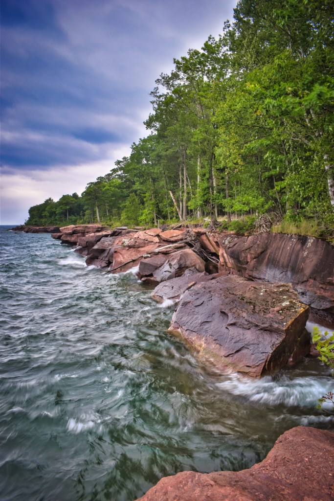
Cotton, MN, lawn mower racers lean into the turn.
According to the U.S. Lawn Mower Racing Association, this quirky form of racing began in the early 1970s – touted as a perfect way to use a machine that many people already have, and to let off steam. It became official when the makers of a fuel stabilizer came up with the idea of using a lawn mower race to promote their product on April Fools’ Day in 1992.
I had no idea this pastime had been around for so long! There’s even such a thing as lawn mower ice racing in winter.
With a wave of a checkered flag, the race ends. The crowd applauds. The winners strut over to claim their prizes and pose for the local newspaper photographer.
In Cotton, racers competed in two events, “modified” and “stock.” I felt culturally enriched for having watched these events. But it all seemed like such a waste. You see, the racing mowers don’t have their blades engaged. All that noise and hype, and in the end, the grass on the track is just as long as before. 🙂
The “Going Coastal” anthology sporting its snazzy Northeastern MN Book Awards seal.
Hi – this Saturday (10/16) I’ll be selling books at the Twin Cities Book Festival from noon-2 p.m. Look for me at the Metropolitan Library Service Agency table. I’ll have copies of “Going Coastal” (a Lake Superior short story anthology written by Lake Superior locals, including me) and “Plover Landing,” my eco-mytic-romance novel.
My creepy short story, “A Night in the Tower-Soudan Mine,” was published on the Twin Ports Terror website. You can access it for free by clicking on the linked text above. Eventually, it will be published in their printed book, which is distributed for free around the Twin Ports of Duluth and Superior.
The storyline was inspired by several trips I’ve taken into the mine, a half-mile underground on Minnesota’s Iron Range, since I was a youngster. My latest trip was just a few weeks ago, taken to refresh my memory. The sections about the mine tour are factual (other than the character getting knocked out thing), but the latter parts about the safety tunnel are figments of my imagination, informed by research.
Iron ore, which is used to make steel.
I began writing the story as part of a fiction workshop by the indomitable and inspirational Felicia Schneiderhan, where she challenged us to write two short stories that follow the same “rules” and feature the same random object in them. If you read the story, I’d be interested in hearing what you think is the random object.
The second story I wrote for the workshop is part of a collection for which I’m currently trying to find an agent. So far, I’m striking out, but I just received some good tips, so we’ll see if they are helpful.
One of the tranquil views from the Prairie Overlook Trail in William O’Brien State Park.
Russ and I meandered south a couple of hours to camp along the St. Croix River in William O’Brien State Park. We chose the park mainly for the location – we wanted to visit the river towns of Stillwater and Afton, both of which are not far south – but we plan to return again someday because of the great accommodations and the views – oh, the views!
Visitor can choose from two campgrounds at the park. We chose the Riverway Campground because it was closest to the river, and we are water people. After setting up camp our first night, we visited Stillwater and took advantage of its foodie options. We ate at the Marx Fusion Bistro – excellent food and drinks – much better than camp food. That was a treat for us — who usually camp in the middle of nowhere.
Back at our trailer, we enjoyed a fire and a visit from three fat racoons who quickly checked our site for food. Finding none, they waddled off to the next site.
The next morning, we walked the 1.6-mile Riverside Loop Trail near the campground. The trail passes through old white pines along the river and then turns inland a bit, meandering by Lake Alice, which is named after the daughter of William O’Brien, a lumberman who used to own the land that’s now the park. Two bald eagles graced us with their presence, performing aerial acrobatics.
Later, we took a nine-mile (round-trip) bike ride to the small town of Marine on St. Croix. We explored its short main street and stopped to visit an old lumber mill site featuring a short trail and interpretive signs. The mercantile in town looked like it could accommodate any forgotten food needs, plus there’s a coffee shop that touts its cold-press coffee as “best in the valley.”
We sipped our coffee while sitting in the town’s gazebo/band stand in a small park just across the street from the shop. The town was so quaint and picturesque, I felt like I was in a gosh darn Hallmark Channel movie.
A view of the St. Croix River from the Riverside Trail. I call this one, “X Marks the Spot.”
After supper, we revisited the Riverside Trail and made good use of one of its benches to watch the moon rise above the clouds lining the river. Barred owls hooted their “who cooks for you?” calls and Canada geese honked as they flew to their nightly roosting waters.
As we fell asleep back inside our trailer, the quiet of the night was interrupted by a pack of coyotes who yipped to each other.
On our final morning in the park, we drove a few miles to hike the Prairie Overlook trail through a restored oak savanna. The trail loops around a small lake. As I hope my photos attest, everywhere we looked was a feast for the eye. Seas of sumac had turned red and lined the trail.
The day was overcast, and the rain conveniently waited until we reached our car to begin. The drops came down, steady and persistent, so once back at the campground, we packed up and headed home.
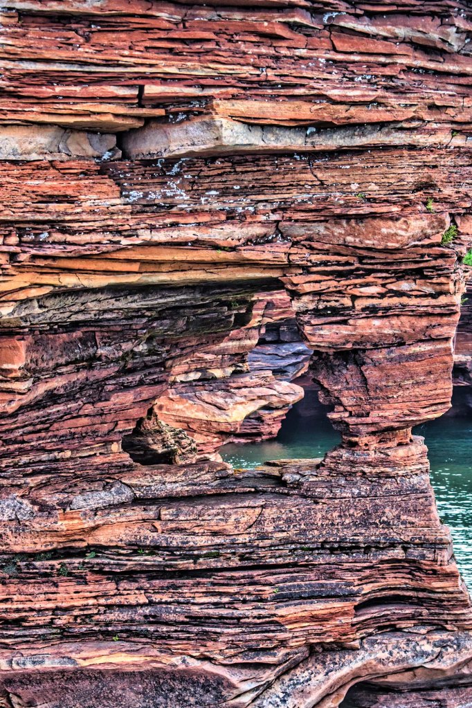
Once upon a time on Outer Island in Lake Superior, a lumber company cut much of the remaining old growth hemlocks and other trees to make baby furniture. The lumberjacks lived in a camp near sandstone ledges on the shore. They used a railroad built by previous loggers through the middle of the island to haul the heavy logs to a dock for shipping to shore. Eventually, the crew built an air strip so they could go home on weekends.
The company that used the wood was Lullabye Furniture of Steven’s Point, Wisconsin. By the 1960s, logging on the island cost too much, so the men left their camp. They also left behind the buildings, old trucks, a stove, a water tank.
Slowly, the forest took its revenge. Snow knocked down the buildings, the trucks rusted, animals carried away seat cushion stuffing for their nests. The forest regrew, swallowing the lumber camp and reclaiming the land as its own.
Last month, I meandered out to the most remote spot in Wisconsin: Outer Island in the Apostle Islands National Lakeshore in Lake Superior. Now, the folks on Washington Island off the Door County Peninsula in Lake Michigan might argue that they live in the state’s most remote spot. I guess it’s all in how you define “remote.”
The Milwaukee Journal gives Outer Island this distinction. However, the rest of the internet says it’s Washington Island.
To check on which place is really the remotest, I consulted with the Wisconsin State Cartographer’s Office. Jim Lacey, associate state cartographer, said he has not tried to define such a spot in the state yet. Is it defined as the farthest outpost of civilization that a person can easily reach, or is it the place farthest from any roads and the hardest to reach?
We went back and forth a couple of times about a worthy definition. Lacey agreed that it wasn’t very hard to get to Washington Island – all a person needed to do is pay for a ferry, drive their car onto it, and they’re set.
The spiral staircase that leads up to the top of the tower.
Outer Island, on the other hand, is twenty-eight miles from the port of Bayfield, Wisconsin, has no ferry and no roads. To get there, a person either needs to have their own boat, spend a couple days paddling a kayak, or pay a small fortune for a water taxi. A water taxi is basically a private motorboat ride. That’s how I traveled to the island last month.
Lacey said, “To sum it up, I’m afraid I don’t have a very satisfying answer for you! I think this is one of those situations where a deceptively simple question gets very complicated, very quickly.”
But, to my way of thinking, the difficulty of access and the lack of civilized conveniences makes Outer Island the “winner” for the remote spot title.
Anyway – I had a great time camping on the island. Visiting the place again reminded me of a research project, which never quite worked at the lighthouse, in part, due to the island’s remoteness.
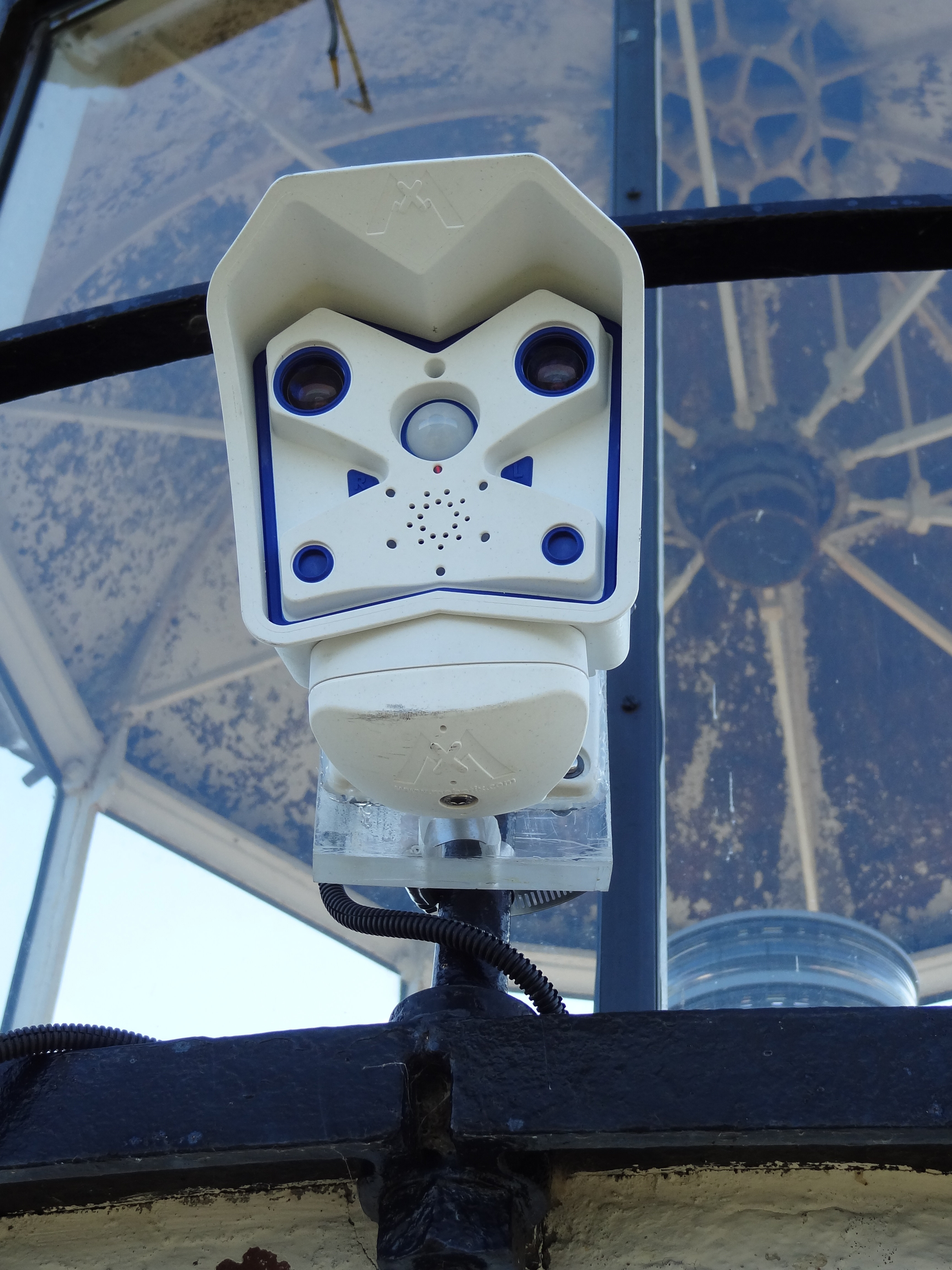
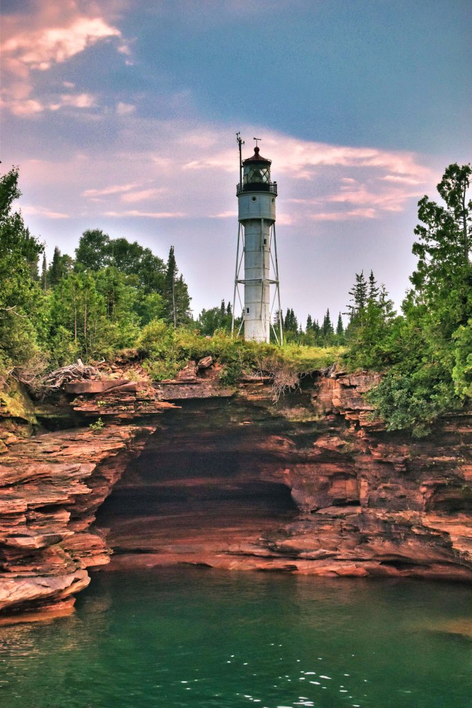
Nine years ago as part of my job with Wisconsin Sea Grant, I accompanied Chin Wu, a researcher from the University of Wisconsin-Madison, to Outer Island. His goal was to install a webcam atop the lighthouse to track the development of rogue waves and wave patterns off the island’s coast.
Hooking the webcam up to the solar power grid on the lighthouse.
The National Park Service was cooperating with the project, so they drove our small research team out to the island for the installation. Once at the island, the park service staffer let us into the lighthouse and led us to the top of the tower.
We installed the camera and plugged it into the solar power system atop the lighthouse. Thankfully, the day was calm and warm, so hanging around outside ninety feet in the air wasn’t too scary.
I took some great photos, but they were never published because the project didn’t pan out. Why? The webcam needed a cell phone signal in order to transmit the photos. Back then, the cell phone system wasn’t powerful enough on the island for this to work.
The doomed webcam.
Even smart people need to learn things the hard way, sometimes, I guess. It just goes to show that science doesn’t always work out despite the best of intentions. But these photos are too cool to waste, so here you go. Mr. Wu has since gone onto conduct other projects in the Apostle Islands, which were much more successful, such as this WISC-Watch website, which provides tons of info about wave and wind conditions.
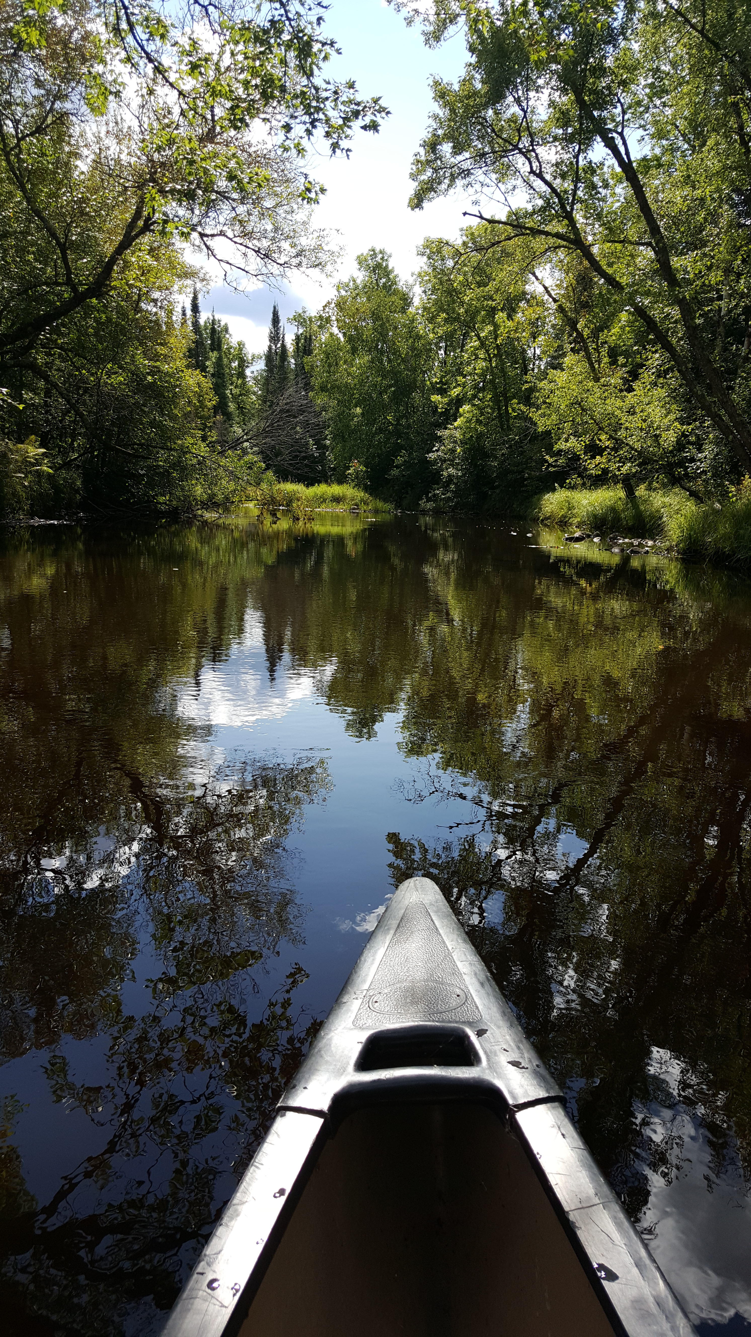
A story that began as a post on this very blog was recently published by “Northern Wilds” magazine. It details an adventure Russ and I had canoeing down the Whiteface River in northern Minnesota. As I began writing it, I quickly realized its magazine potential. So, I didn’t post it here.
…I marveled that a trip that takes about five minutes by car could take three hours by canoe. But in a car, we would not have had the wonder of the white birds, a mermaid, and a lightning-blasted pine. Now, we have a mental map of the liquid emerald that flows beyond the screen of trees bordering the road.
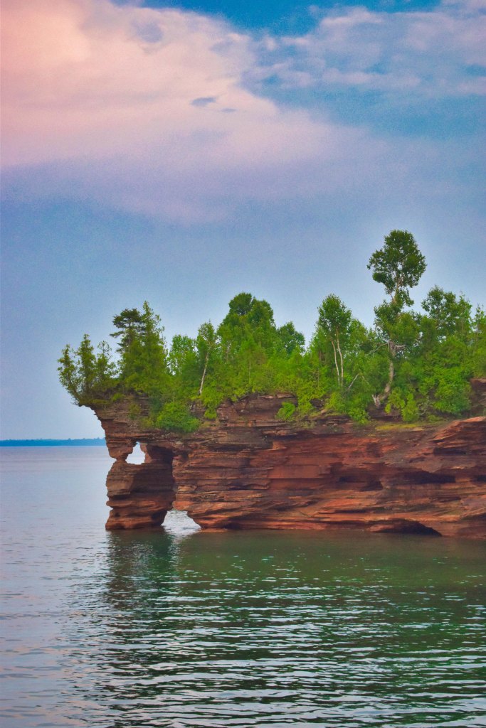
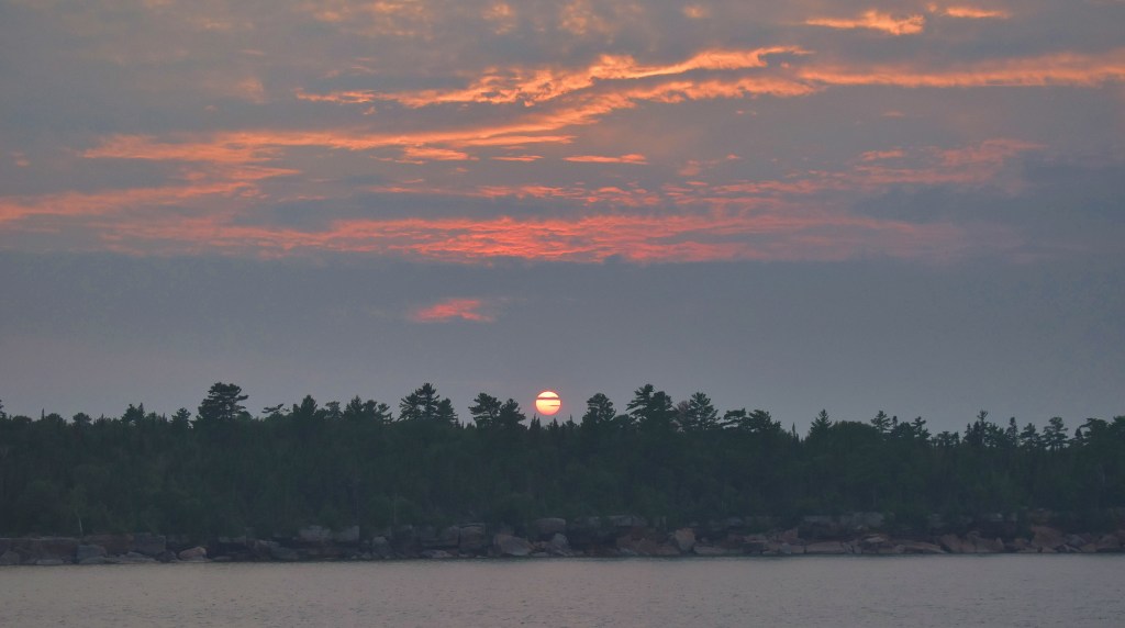
Russ and I meandered to the Apostle Islands National Lakeshore last month. We had the privilege of camping on Outer Island for two glorious, warm nights. Lake Superior was so calm, we could hear ore boat engines quietly throbbing even though they were dozens of miles away as they passed the island.
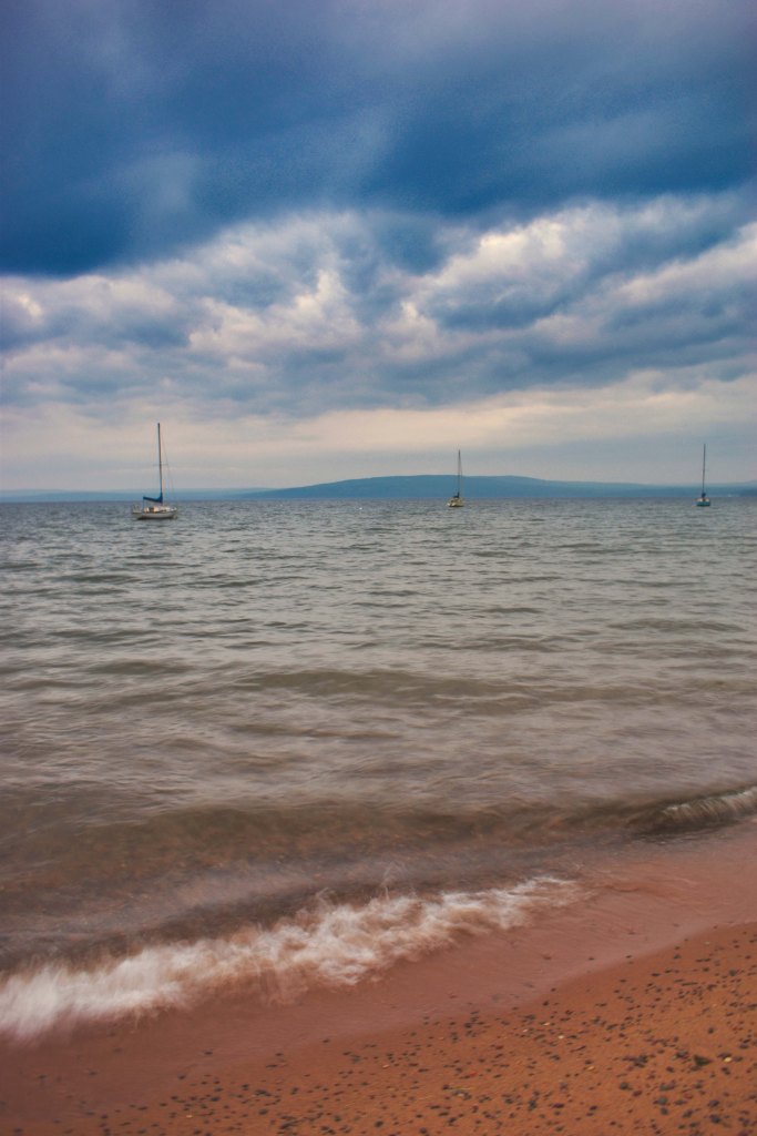
I took this shot from the beach near the lighthouse. You can just see the lighthouse over the tops of the trees by the dock. A wave-worn rock provided a perfect foreground. Can you feel the peace?
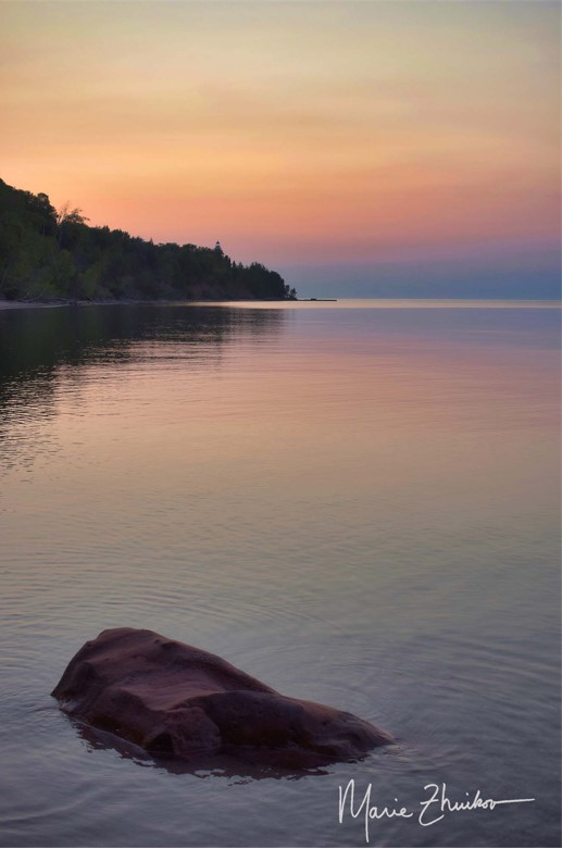
I’ve never had time to just hang out somewhere and take photos for a week. That’s what I was able to do (thanks to my awesome workplace) earlier this month. I took a landscape photography class at the Madeline Island School for the Arts.
Madeline Island lies off the Bayfield peninsula in northern Wisconsin. It’s adjacent to (but not part of) the Apostle Islands National Lakeshore.
The class focused on sunrise and sunset photography. This made for long days, but it was worth it. The class was life-changing and life-affirming. I knew I had a good eye — I told my fellow students I learned photography “by osmosis” from my mother — but I’ve never had any formal training in it. An F-stop? ISO? What are those? I got a crash course and affirmative feedback, but am still learning.
I’d like to share some of my favorites from the week with you. Locations include Joni’s Beach, Grant’s Point, Big Bay State Park, Black Shanty Road wetlands, the art school grounds, and Devil’s Island.
As always, feel free to use my images, but please give me (Marie Zhuikov) credit.
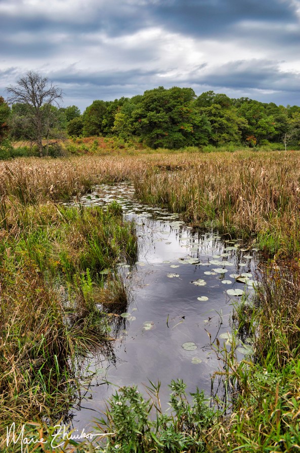
Our water toys await launch into Jeanette Lake in the Superior National Forest.
If someone ever wanted to successfully torture me for information, all they would need to do is stick me in a dark room full of mosquitoes. Between the incessant buzzing and the blood-sucking, I would divulge anything anyone wanted to know. I’d even make up stuff if it would get me out of that hellhole faster.
I was reminded of effective torture methods during our inaugural night at Jeanette Lake Campground in northern Minnesota’s Superior National Forest. Russ and I arrive late on a Friday night with our Scamp trailer. The site we had reserved months before was the only one available in the government system for the dates we desired. It was situated in dense woods near a wetland along the lake. Mosquitoes love wetlands. They also love the dark. And, they apparently love my ankles.
We set up camp between mosquito slaps, amazed that so many bugs were still alive when our summer has been so dry. I’d expect swarms like this earlier in the season, not in mid-July, but I guess this year has been a good one for them.
Somebody (and I’m not naming names) left our camper door open too long. By the time we were ready to sleep, our trailer was filled with mosquitoes. We spent a good forty-five minutes trying to kill every last one before we went to bed.
But you know that ONE mosquito always survives. They will hunt you down during the night, buzzing insistently around your pillow as you try to sleep.
After a few belated kills, we were serenaded by the mosquitoes that had collected outside on our window screens. Such a lovely way to drift off into dream land!
In the morning, I was loath to leave the trailer. Still demoralized from the night, I envisioned cutting our weekend camping trip short due to the bugs. Russ was awake and out before me. I noticed he stayed outside for a long time. Wasn’t he getting eaten alive?
Thankfully, it turned out he wasn’t. As I took my first cautious steps outdoors, he sat, smiling, at the picnic table, coffee in hand. The mosquitoes were nowhere near as numerous as the night before. Maybe our camping trip wouldn’t be a bust, after all.
I first learned of Jeanette Lake over thirty years ago when I spent a summer as a photojournalist volunteer for the LaCroix Ranger District in the Superior National Forest. I’d driven past and through the campground a few times on my way to other places. With its islands and white pines, the glacier-carved lake looked like one that should be in the Boundary Waters Canoe Area Wilderness. The thought of being able to drive to it and camp appealed to me, but I never had the chance until now.
We ate our breakfasts and took a walking tour of the campground, which offers about a dozen sites. Two are walk-in. Backcountry sites are scattered around the lake and on the islands for those who want to work harder (by paddling or boating) for their camping experience.
A few of the non-reservable sites were empty, including a picturesque one right on the lakeshore. I noticed it had perfect access to the water for kayaks or paddleboards, both of which we brought with us. A nice breeze off the lake would keep mosquitoes at bay.
After we returned to our site and got talking, Russ said he had paid for our site at the pay station that morning while I was sleeping. My brain was beginning to work by that time, and I remembered that I had paid for our site when I made our reservation.
So, we had paid for two sites. Why not move to the better one? The Forest Service might frown upon such practices, but it seemed like a good idea to us, so we packed up and moved out of the wetlands and to the lakeshore. Later, we told several people who were looking for campsites about the free one they could have that was under our name, but nobody took us up on it. Gee, do you think that might have had something to do with MOSQUITOES?
Our non-mosquitoey campsite.
We spent our Saturday paddling the lake, resting on a tiny island covered in jack pines and blueberry bushes (the berries were ripe). We also hiked on the Astrid Lake Trail, which can be accessed from the campground near the walk-in sites. After the trail crosses the road (the Echo Trail), it wanders through a black spruce bog. If you look closely, you’ll see rare pitcher plants. Farther on, glacial erratic rocks — huge boulders dropped by glaciers as they retreated and melted 10,000 years ago — dot the sides of the trail in the forest.
We spent the evening around a campfire, admiring the red orb that served as a sunset in skies hazy from northern wildfires. As the sun disappeared, the mosquitoes reappeared, but in more manageable numbers.
Ferns growing on an ancient glacial erratic boulder along the Astrid Lake Trail.
Sunday morning, we mountain-biked on the Echo Trail, which is the gravel road that provides access to this part of the land. After a quick dip in the lake, it was time to pack up and head home. Along the way, we made a lunch stop at the Montana Café in Cook, Minnesota, the town where I was stationed during my volunteer stint. The café was another one of my old haunts and I was glad to see it was still in business. They have great malts and burgers.
Despite the best efforts of the mosquitoes, we were able to salvage this trip down memory lane. If you’re interested in a touch of wilderness with easy access, don’t be put off by all my whining about mosquitoes; put gorgeous Jeanette Lake on your list.
Two shed skins from a garter snake that lived near our site. We also had a camp chipmunk and cottontail rabbit.