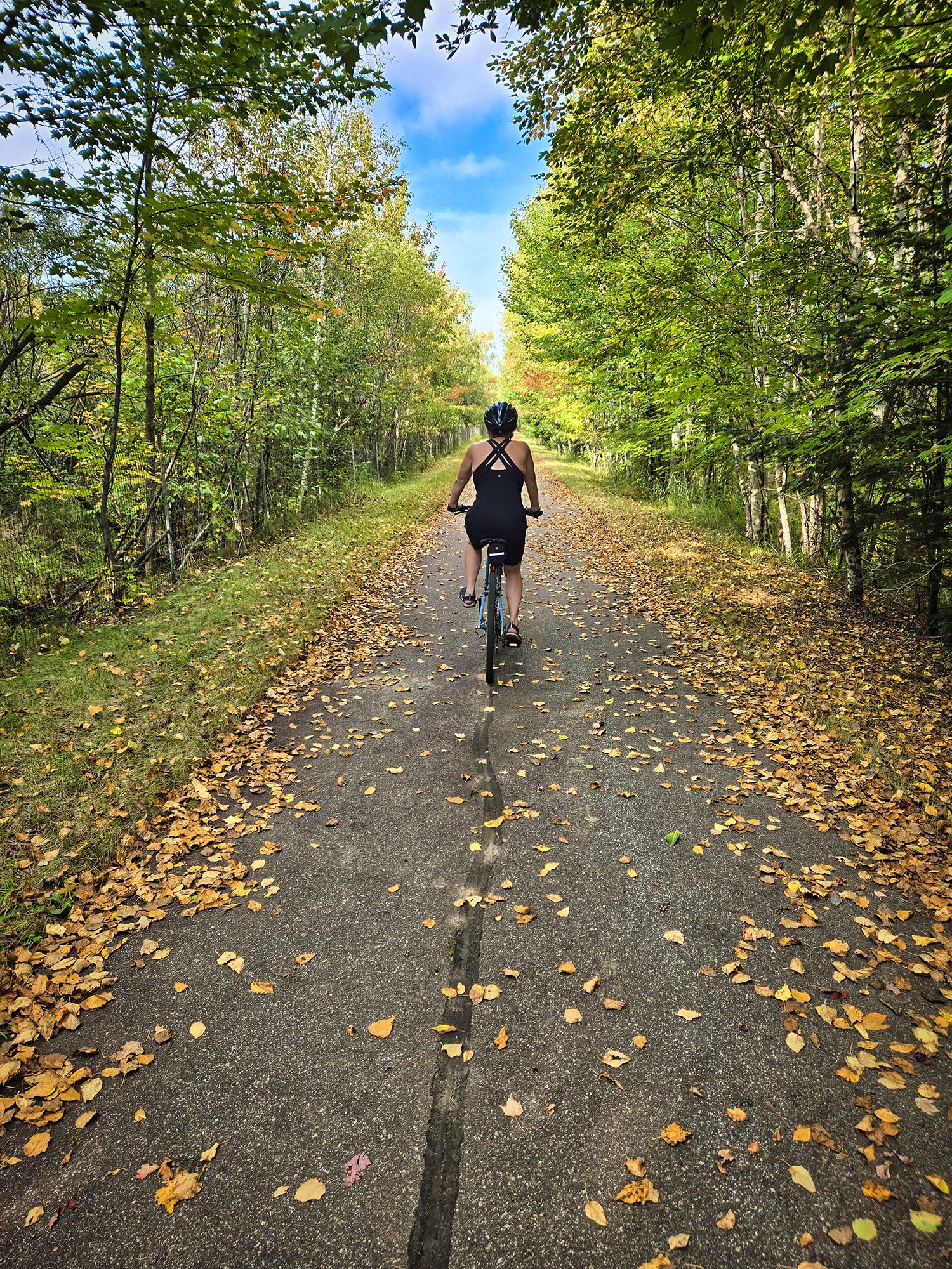
Last month, Russ and I continued our quest to cycle different sections of the Mesabi Trail, which crosses northern Minnesota’s Iron Range. Amid the crunch of fallen leaves and the brilliant red of sumac, we biked from Nashwuak to Calumet with a side trip to Pengilly.
A warm breeze offered one of those final temperate days between summer and fall. The trail began in Nashwauk at a nondescript parking lot near a closed restaurant with the suggestive name of Big O’s Chef House. (Maybe that’s why it went out of business?) Except for a few frost heaves, the mostly flat trail was in good condition. It parallels the highway ,so the distant noise of cars is ever-present.
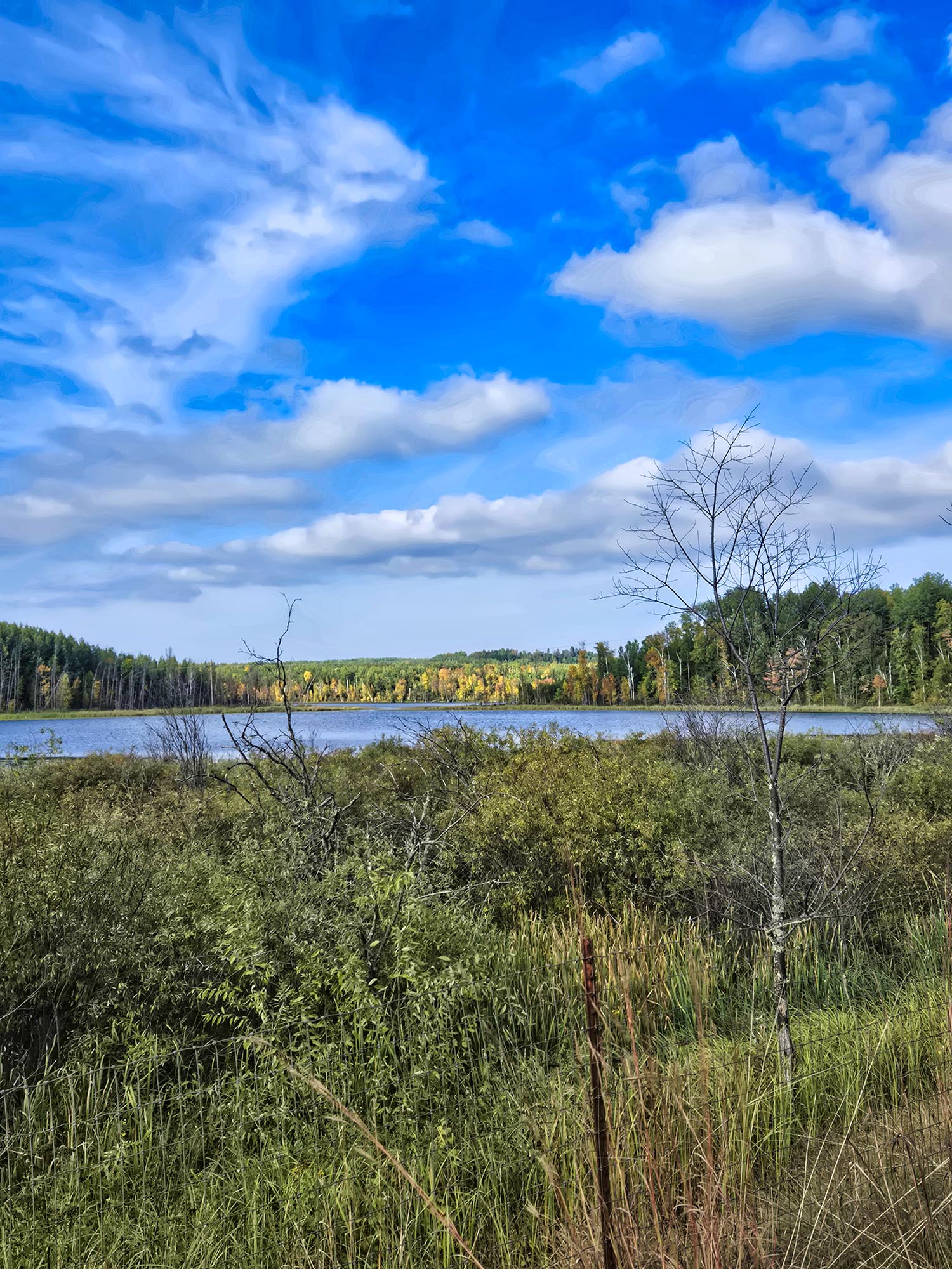
Much of the land surrounding the trail is owned by Mesabi Metallics Co., an iron ore and taconite mining company. We passed huge piles of mine tailing waste and overgrown past mining roads as a few vultures circled overhead.
In the sleepy Sunday town of Calumet, we rested at a public picnic shelter. The only evidence of life was a man throwing a ball for his black lab. Then we turned around and made our way back to Nashwauk. Along the way, we took a short spur trail to the town of Pengilly just for a change of scenery.
Scenery along the trail.
Once, a pair of teenagers on an ATV surprised us (they’re not supposed to go on the trail). Several times, we had to dodge Halloween-colored (black and orange) woolly bear caterpillars inching their way across the trail. Folklore says they can predict how harsh the winter will be by the width of the colored bands on their bodies: more black equals a harsher winter. We were trying too hard not to squish these fuzzy forecasters, so we didn’t notice their band patterns.
Apparently, science has not confirmed the caterpillars’ weather-forecasting abilities. Even so, the woolly bear remains a symbol of autumn. Its presence offered us a gentle reminder that the season is turning, and nature is preparing for the quiet, cold months ahead. This will probably be our last long ride of the season.
Total distance: 14 miles. For more information about other sections of the trail, please see these previous posts:
The Hawkins Mine Pit in Nashwauk. We heard peregrine falcons on the cliffs to the right.
Russ and I have been biking short sections of the 150+ mile-long Mesabi Trail in northeastern Minnesota. Stretching from the Mississippi River to the Boundary Waters Canoe Area Wilderness, the trail will be complete in the next year or two. At that point, it will be 165 miles long, making it one of the longest paved trails in the country.
We’ve biked the trail twice this summer (and many times in the past – a list of other posts included at the end). Those recent trips weren’t very noteworthy, so I didn’t blog about them.
This section of the trail took us between two iron ore mining towns. We began in Keewatin, which was formed during the iron ore mining boom in the early 20th century. The town’s name comes from the Ojibwe word for “north” or “north wind,” and the soil is a rusty red from all the iron it contains.
The 11-mile round trip seemed like a gradual climb both ways to me. I’m not sure how that worked! Only one short, steep hill gave me pause, otherwise it was smooth cycling. The first part out of Keewatin follows an old highway/road that’s no longer in use.
We passed several lakes and mine pits, namely O’Brien Reservoir, Hawkins Mine Pit, and LaRue Pit Lake. A cold rain shower caught us about halfway to Nashwauk. I had to stop and clean off my sunglasses. Sometimes I think they need little windshield wipers! The rain didn’t last long, so we kept on going and the breeze dried our clothes.
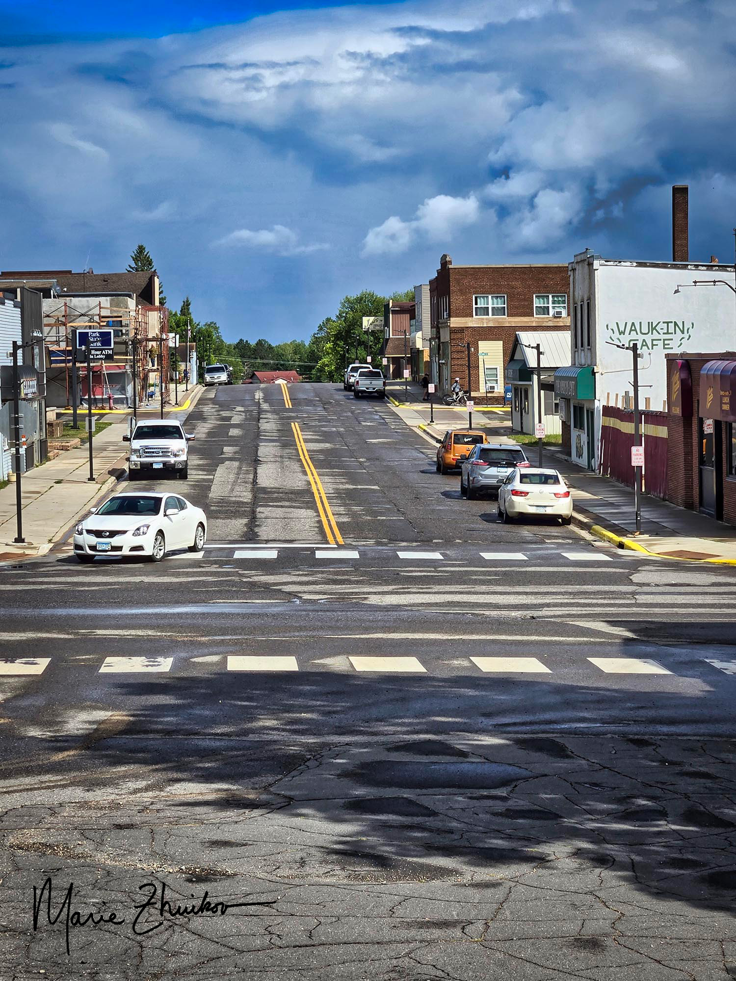
Downtown Nashwauk, MN
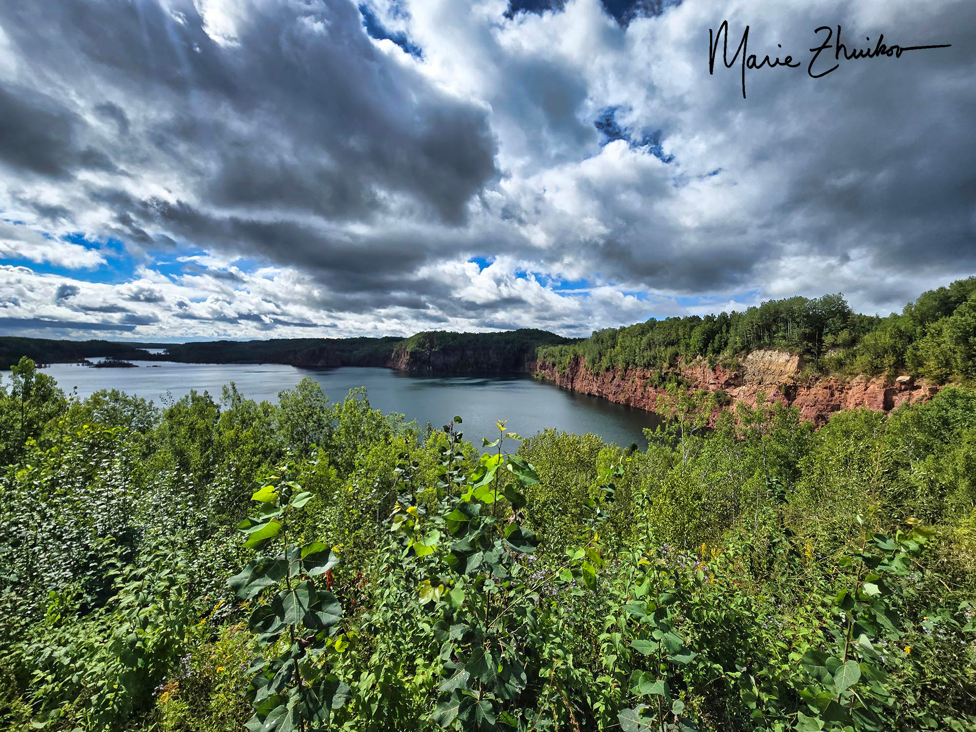
When we reached Nashwauk, we stopped at an overlook at the Hawkins Mine Pit. It used to be an open pit iron ore mine but is now unused and filled with water. Steep red and tan cliffs topped with green trees line the “lake.” As we admired the view, we heard some squawking that sounded suspiciously like peregrine falcons. I’ve heard that they sometimes nest on the mine pit ledges, so perhaps there was a nest at the Hawkins Pit?
It’s believed that Nashwauk was named after a river in New Brunswick, Canada. The word is said to be from the Algonquin language and means “land between.”
As we turned around and headed back to Keewatin, we noticed a spur trail with a sign about the LaRue Pit Lake. The sign said the area features a boat landing, fishing pier, and is a tourist attraction. We decided to check it out.
Our bikes needed a rest at the LaRue Pit lake. We were fine, of course.
The spur trail came out on a paved road. Unsure which way to go, we chose to turn right, which ended up being the correct direction. The road took us down a steep hill to a picturesque lake. It looked like the “tourist attraction” was still under construction – no grass, just bare dirt that was being graded. An angler floated offshore in his boat, trying his luck with the fish. The LaRue Pit began as an underground mine in 1903-1905. The park looks like it will be a nice place, once finished.
The LaRue Pit lake near Nashwauk.
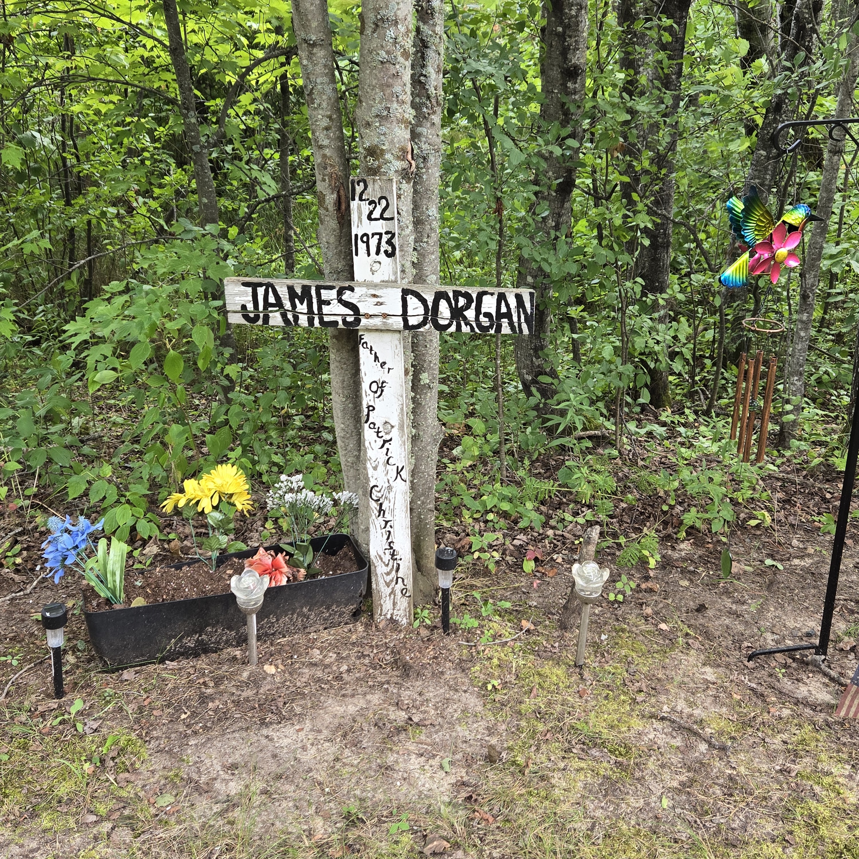
Then we biked back UP the road and rejoined the trail. Not far from the spur, we stopped at a memorial we had passed earlier. The name on the weathered white wooden cross was James Dorgan and it was dated 12/22/1973. The memorial looked in such good shape, we weren’t sure if that was the day he died or the day he was born. Once back home, I did a bit of sleuthing and discovered that it was his death date. James was a former Keewatin resident living in St. Paul who died in a car accident when he stopped to help his ex-wife, whose car was stalled. Another driver apparently hit him.
We were impressed by how well the memorial has been kept up for fifty-two years. Colorful plastic flowers decorated a flower box, and a wind chime hung from a post nearby. Solar lights illuminate the memorial at night.
We mostly had the trail to ourselves. Saw a few squirrels hightailing it across the pavement. Saw a few walkers. We passed a couple of other cyclists in town. Heard some ATVs but didn’t see any.
From rainstorms to pit lakes to falcons to ghosts, this is a good stretch to ride to get a feel for how important mining is to this part of the country.
Wishing everyone a good Labor Day Weekend!
For more information on other sections of the Mesabi Trail, check out my previous posts:
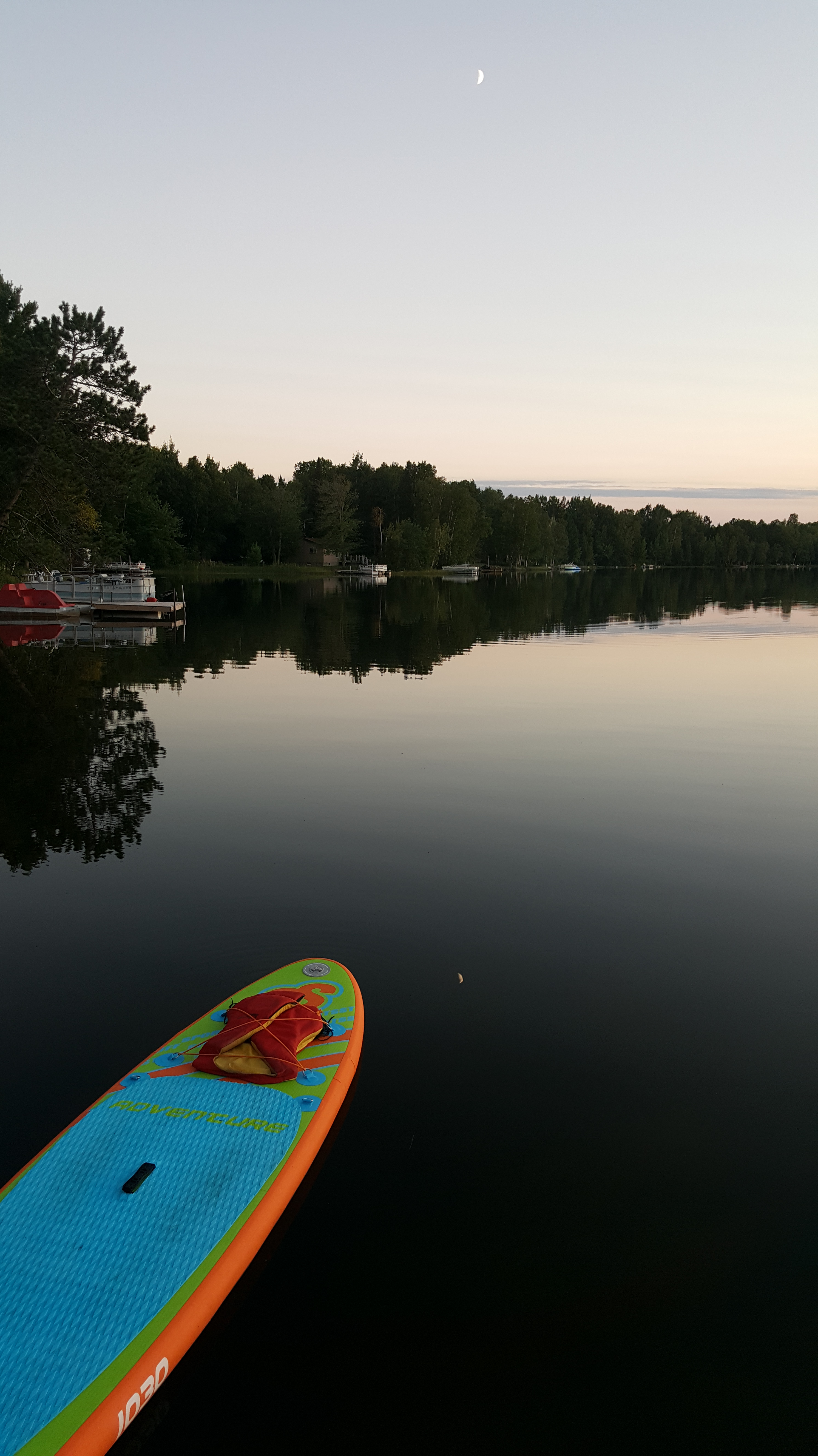
One of my paddleboards and a sliver of the moon reflected in the water.
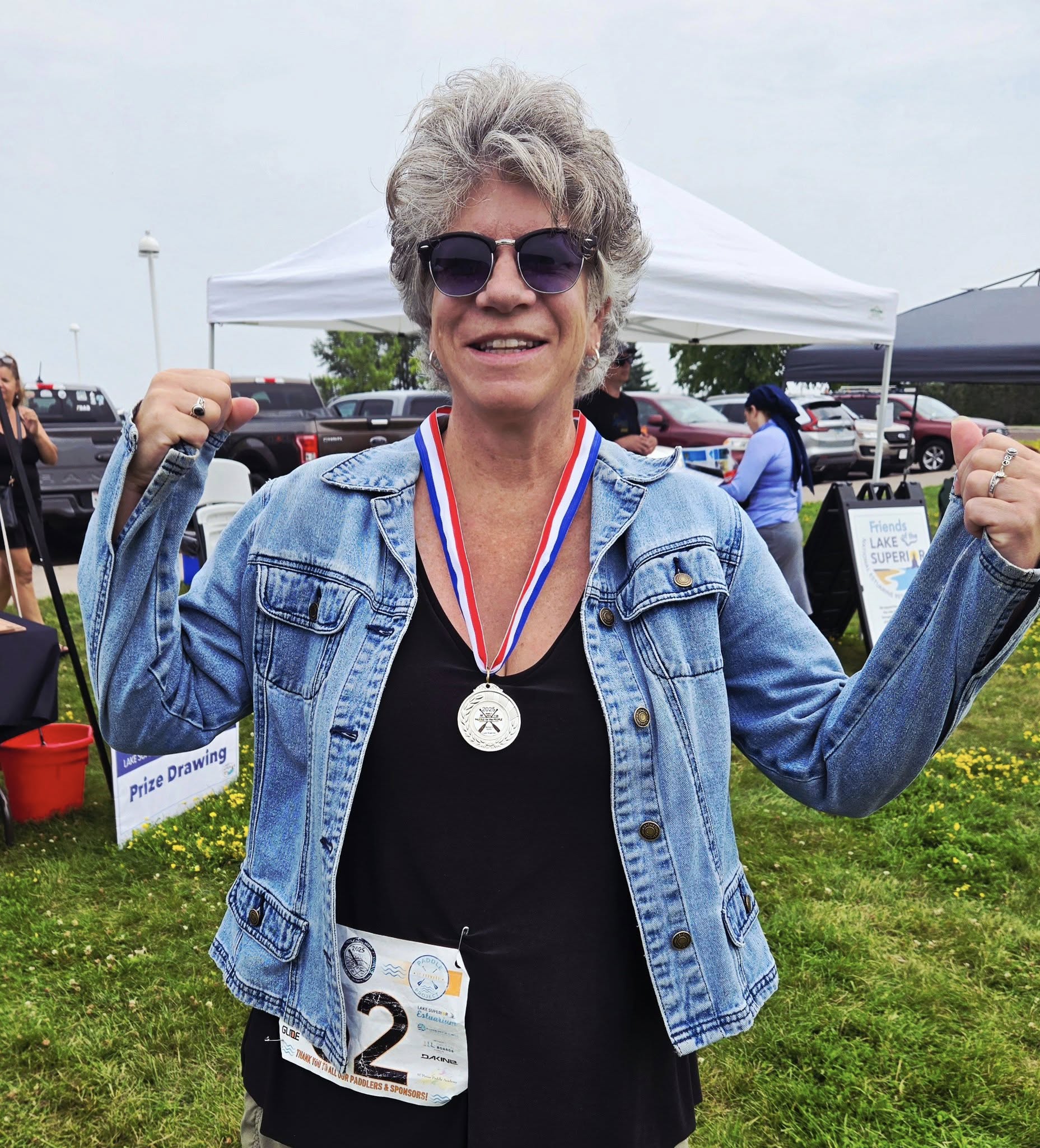
For more years than I care to count, I’ve staffed a booth for work at Lake Superior Day, which falls annually on the third Sunday in July. When I wasn’t informing people about water quality issues and research, I was gazing wistfully at the groups of paddlers gathered for a race held in conjunction with the event.
The “Paddle for the People” competition welcomes paddleboarders, canoeists, and kayakers. The 4 K race takes them around Barker’s Island in the bay just offshore from the city of Superior.
Last year, a gray-haired woman won the event. She inspired me. I decided that in 2025, since I’d be retired and not staffing a booth anymore, I was going to enter the race.
This spring I sent in my entry. Once the ice went out on our cabin lake, I began training. Having never raced on a paddleboard before, I watched online videos for tips. Russ helped me figure out that two-and-a-half times around our lake equaled the race distance. Around and around our lake I went.
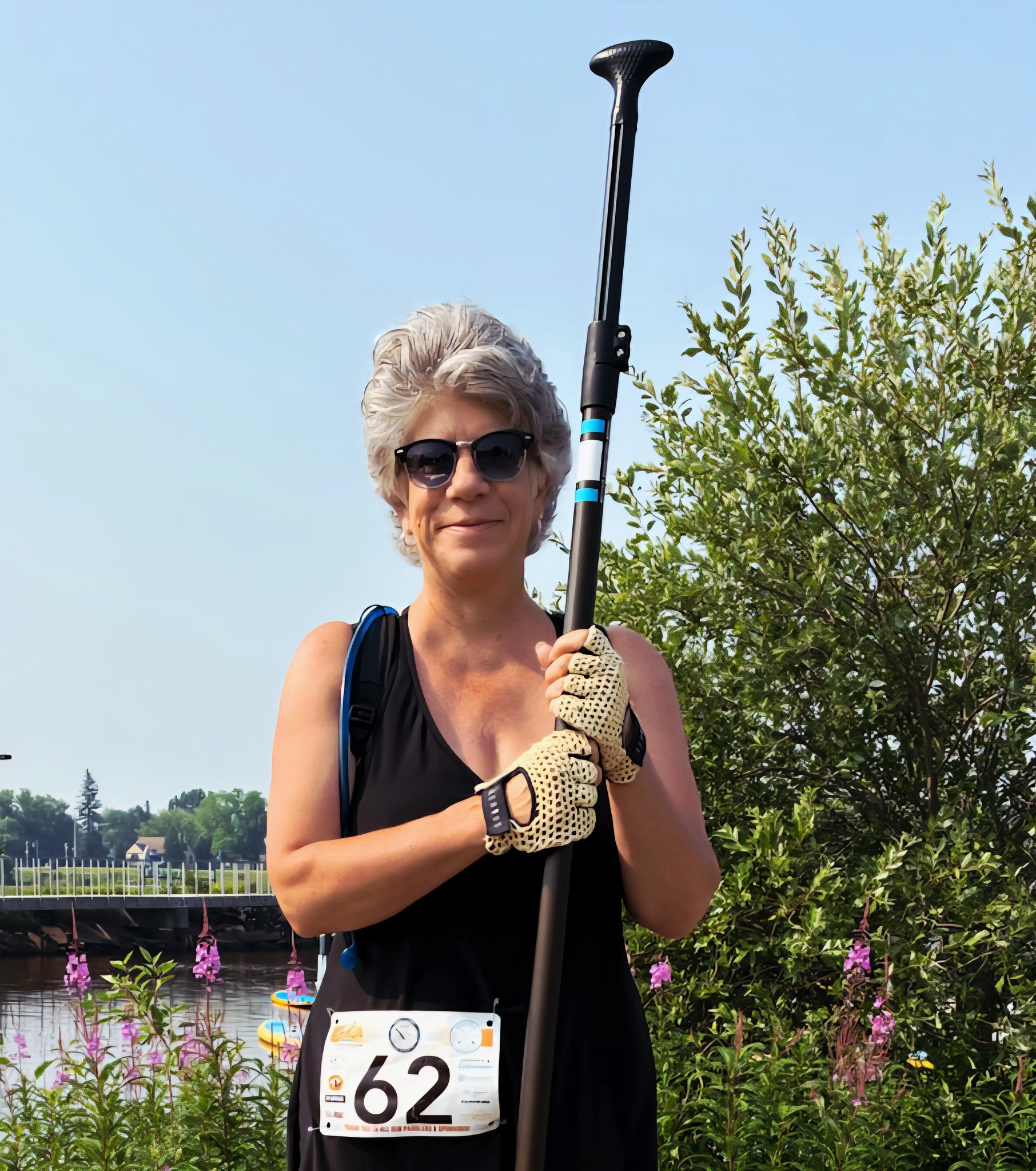
Me, ready to paddle!
I’d circled Barker’s Island on my board a couple times in the past just for fun, but I did it one more time before the race to assess any hazards and to build my confidence.
Come race day, I awoke a couple hours earlier than usual (ouch) to make it to the start of the race on time. I felt good but had no illusions about winning. The weather cooperated: warm and sunny with little wind. The only problem was poor air quality from wildfire that had drifted from Canada, but it didn’t seem to bother me.
About thirty of us lined up in the bay on our various crafts behind an imaginary starting line. When the bullhorn blew, we were off! I got a good start, paddling with quick, short and powerful strokes and I didn’t crash into anybody. Soon, we paddled around one end of the island and were out on the unprotected side, but conditions stayed optimal.
I was about halfway around the island when an older lady who I’d spied before the race slowly passed me. I wondered if she was in the same “old lady” race category as I was. She was about a foot taller than me. Her technique wasn’t that good, but she was propelled by long-armed strokes. I decided to try and stay with her and pass her if I could in case she was my competition.
At one point, she slowed to (unsuccessfully) try and pick up a can floating in the water. Although I was impressed by her environmental concern, I thought this was my chance to pass her. Try as I might, I couldn’t catch her. I still felt like I was paddling strong when I watched in dismay as a couple of young people with small dogs on their boards passed me. Then came two overweight people who were sitting too far to the front of their boards. They virtually plowed through the water paddling with kayak paddles and also passed me.
I shrugged off my dismay and just dug in. The “other old lady” crossed the finish line twenty-five seconds ahead of me. At the end, I felt good about the effort I expended and the fact that I wasn’t last.
The race organizers held a short awards ceremony afterward and sure enough, I came in second in my category to the woman I had been chasing. I received a silver medal for my efforts.
Now I know what the race is about. But I don’t think I’ll do it again. Waking up early and then paddling hard for 45 minutes isn’t my idea of fun. But I’m glad I stayed true to my self-promise and participated instead of gazing at the racers wistfully from shore. What dreams have you pursued this summer?
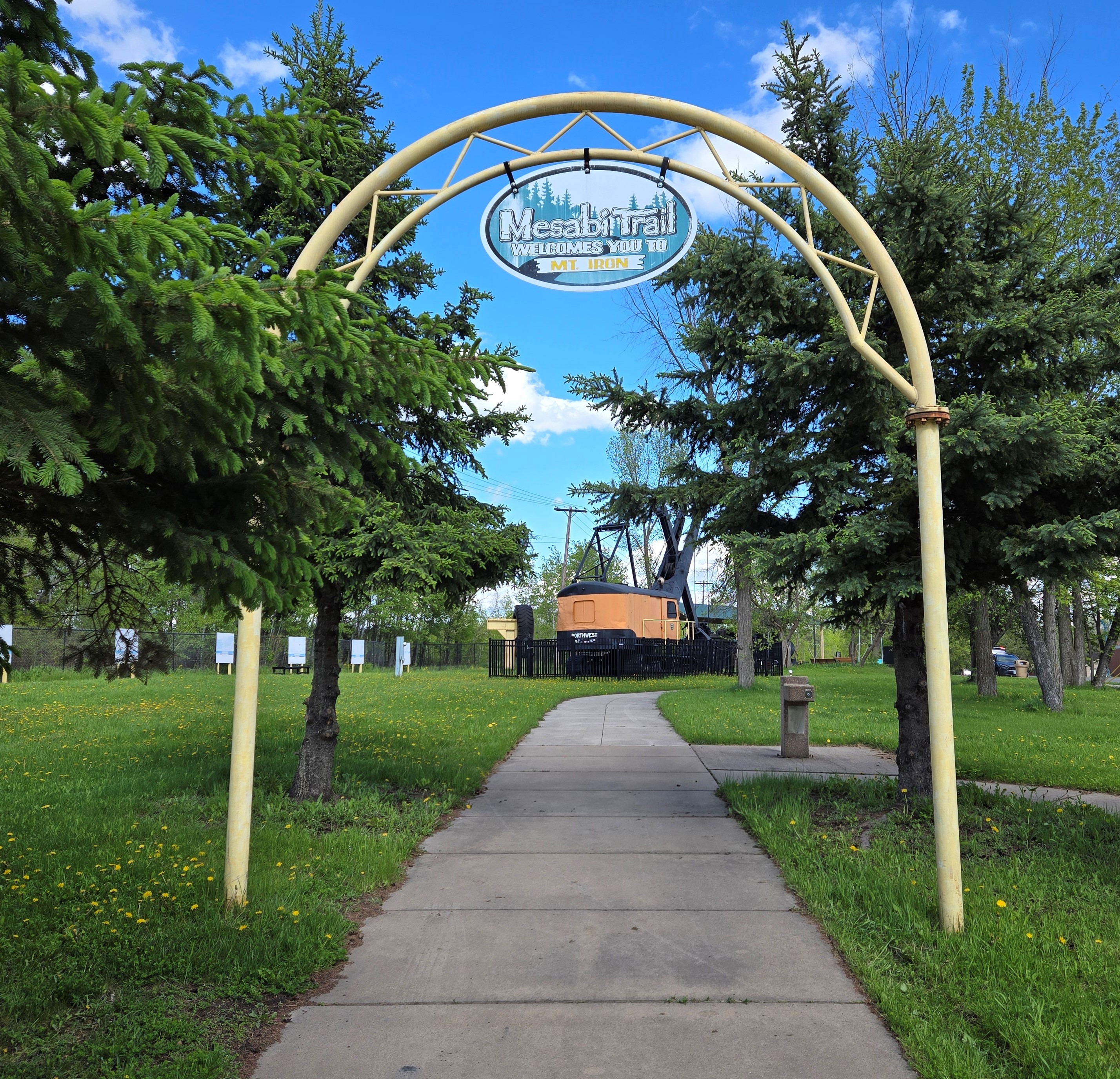
The beginning of the Mesabi Trail in Mountain Iron.
In our continuing quest to bike different sections of the Mesabi Trail in northern Minnesota, Russ and I meandered over to the small mining town of Mountain Iron last weekend. We planned to pedal a 6.5-mile stretch between there and the neighboring town of Kinney. (Round-trip, the distance is a little over 13 miles.)
Mountain Iron is known as “The Taconite Capitol of the World.” It’s the site where iron ore was first discovered on Minnesota’s Iron Range. The mine is no longer in operation, but during the 30 years it was open, 52 million tons of iron ore were shipped to various steel mills in places like Michigan and Illinois.
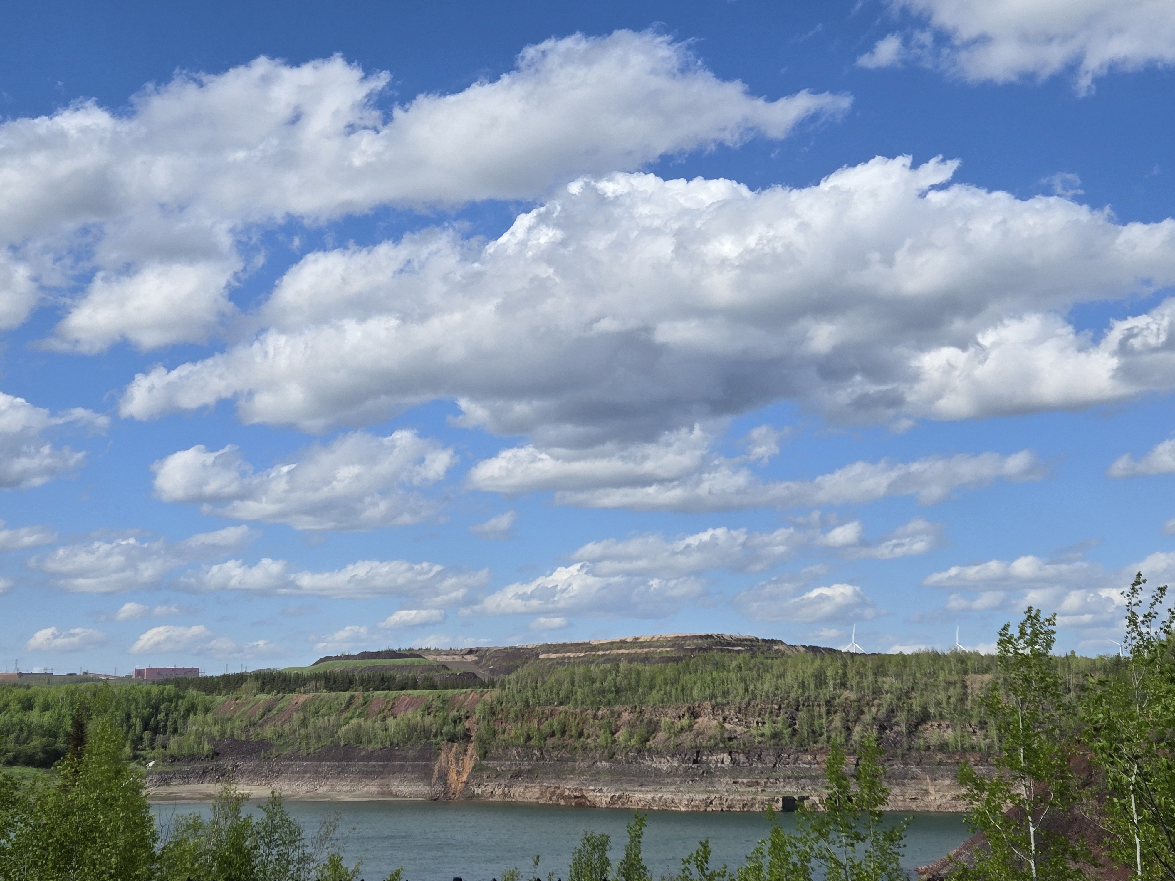
The landscape and town bear the scars of this industry. A huge mine pit filled with turquoise water is visible from the small city park where the trail begins. As we biked toward Kinney, we passed ghostly remnants of homes and businesses that had been moved to make room for mining operations. Cement house pads and neglected lilacs provided testament to the abandoned homesteads.
The open pit mine in Mountain Iron. You can almost make out the wind turbines on the hill to the right.
These days, instead of iron ore, Mountain Iron is known for wind energy. Several turbines spin on far hills. They are part of the Taconite Ridge Wind Energy Center – the first commercial wind center in northeastern Minnesota. An interpretive sign in the park says, “In ideal wind conditions, 10 turbines can collectively capture the wind and convert it into 25 megawatts of electricity – enough to power 8,000 homes on an annual basis.”
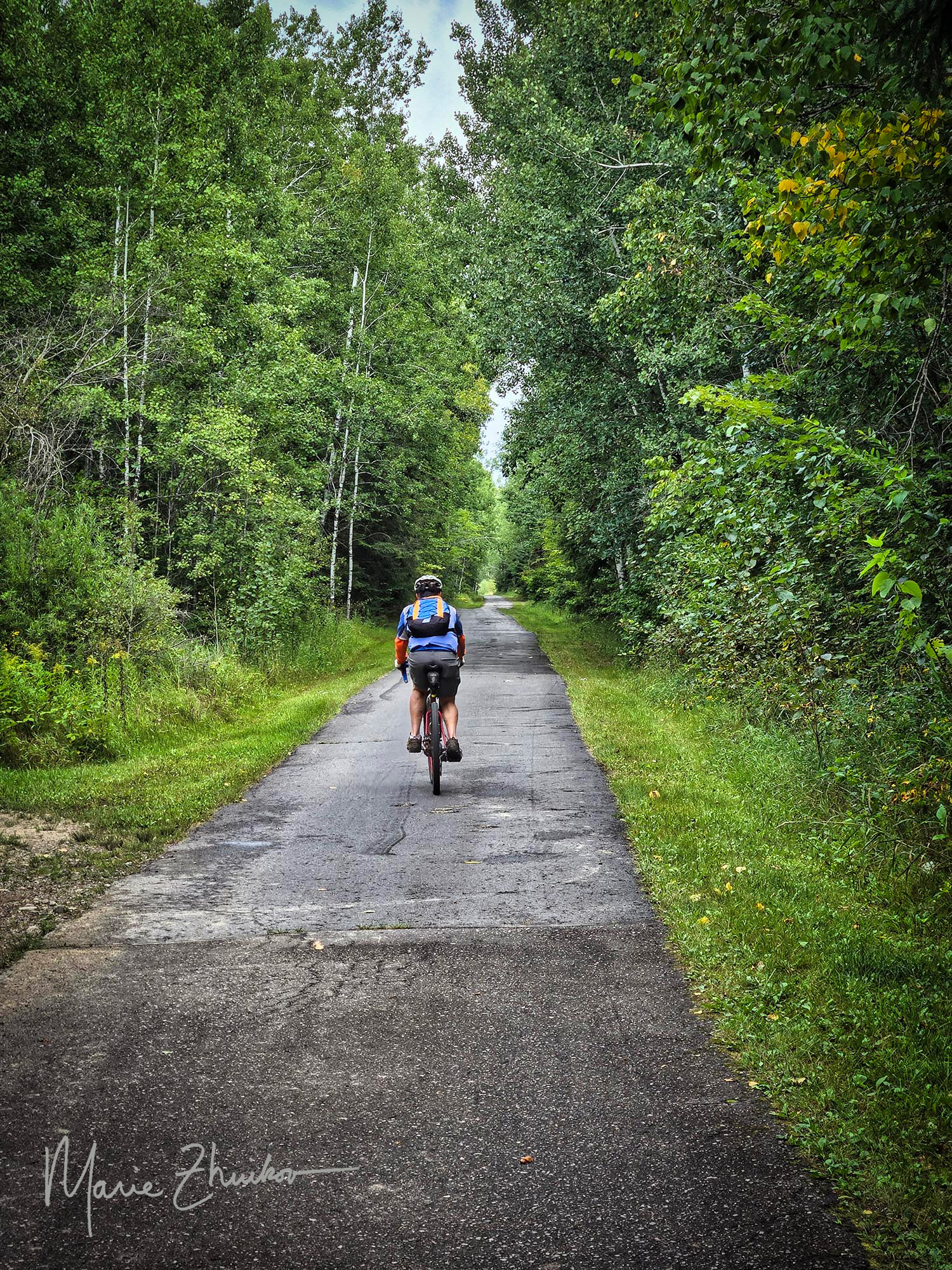
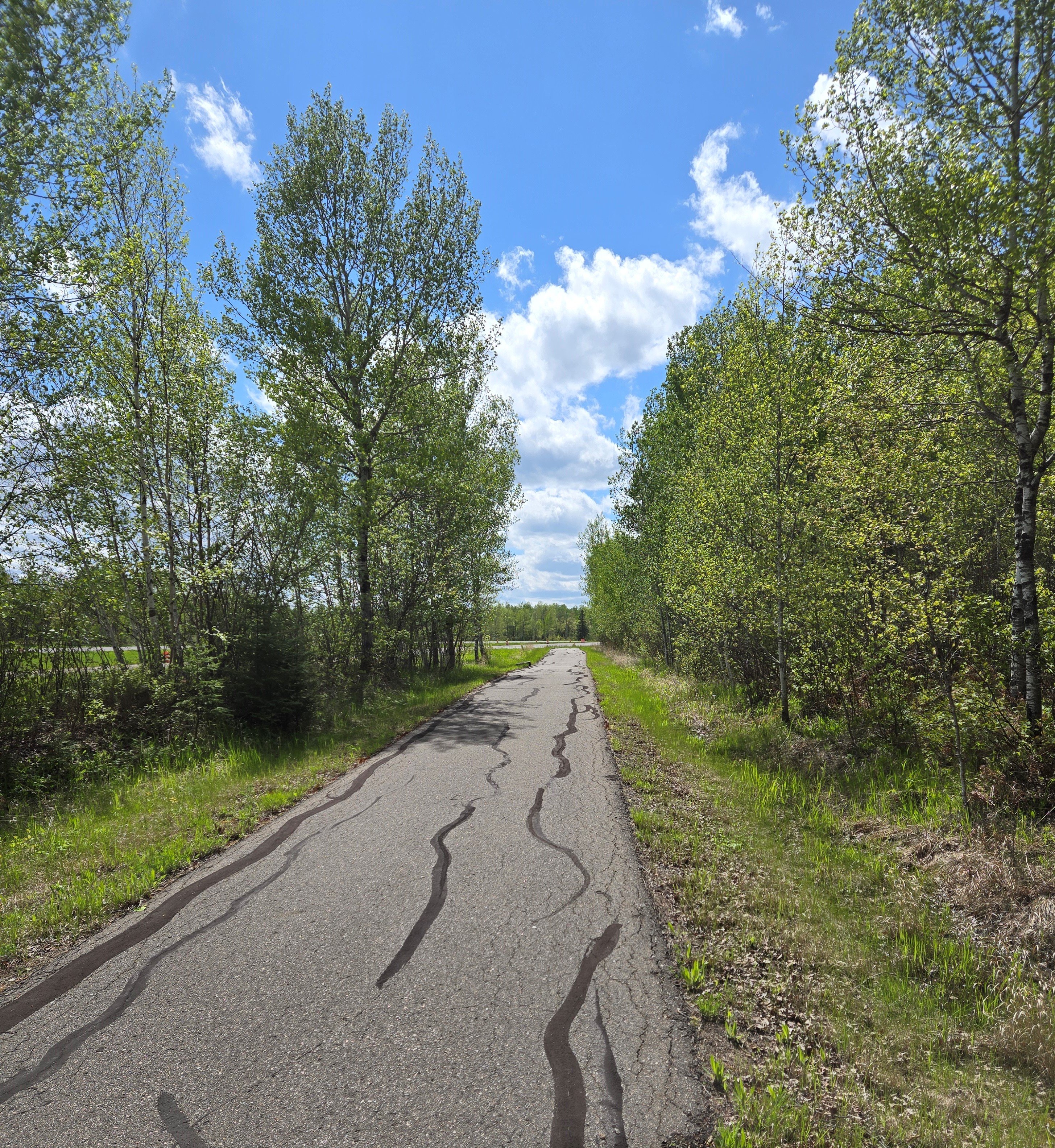
A typical section of the Mesabi Trail.
Compared to other sections of the trail we’ve biked, this was more civilized. Once we passed the abandoned neighborhood, a few occupied homes lay along the trail. Huge grassy piles of mining tailings lined the horizon. Although a sign along the way says that tailings are not a health hazard, I don’t believe it! We saw a lined basin where it seemed like water was being pumped from the base of the piles. I couldn’t find any info about that online, but I am hoping it’s so the water can be collected and treated before being released into the environment. For much of the way, the trail parallels a highway, although it’s often hidden from view by trees.
A couple of hills dot this section of trail, but nothing too onerous. When you first near the highway, there is a hill with a curve at the bottom. Bikers coming the other way also have a downhill before the curve, so beware of that. Two downhills lead over small bridges with culverts underneath them. The culverts each form a bump. I almost caught air on one of them!
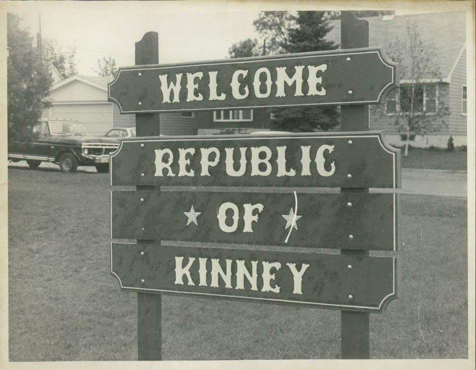
We saw one bicycling family and a few other small groups. When we reached the turn off to Kinney, we did not feel the need to explore. But now, after reading more about the town, I wish we would have. Kinney once voted to secede from the United States and become a foreign country. This bold yet tongue-in-cheek action was taken to draw attention to the small city’s dire water system situation.
According to an account on the Mesabi Trail website (linked above via “Kinney”), the system was “failing so badly that the fire department had to watch buildings burn to the ground due to lack of water pressure. That year the term ‘The Kinney Brown Shirts’ was coined because all clothing washed with detergent that included bleach turned brown because of mineral deposits in the water.
“Replacing the water system far exceeded the budget of the small town, so the city exhaustively searched locally and nationally for assistance. The resulting volume of paperwork led to the city’s motto of ‘File in Triplicate.’ The city attorney commented that it would be easier to get money if the city seceded, waged war with the union, quickly lost, and then asked for foreign aid. The joke took root, and the council voted unanimously to secede on July 13, 1977, and a certified letter was sent to U.S. Secretary of State Cyrus Vance.”
A sign with the new name of the town of Kinney after it seceded from the USA and declared itself a foreign republic. Image courtesy of the Mesabi Trail website.
The secession gained international publicity and from that, the city eventually received grants to replace their water system.
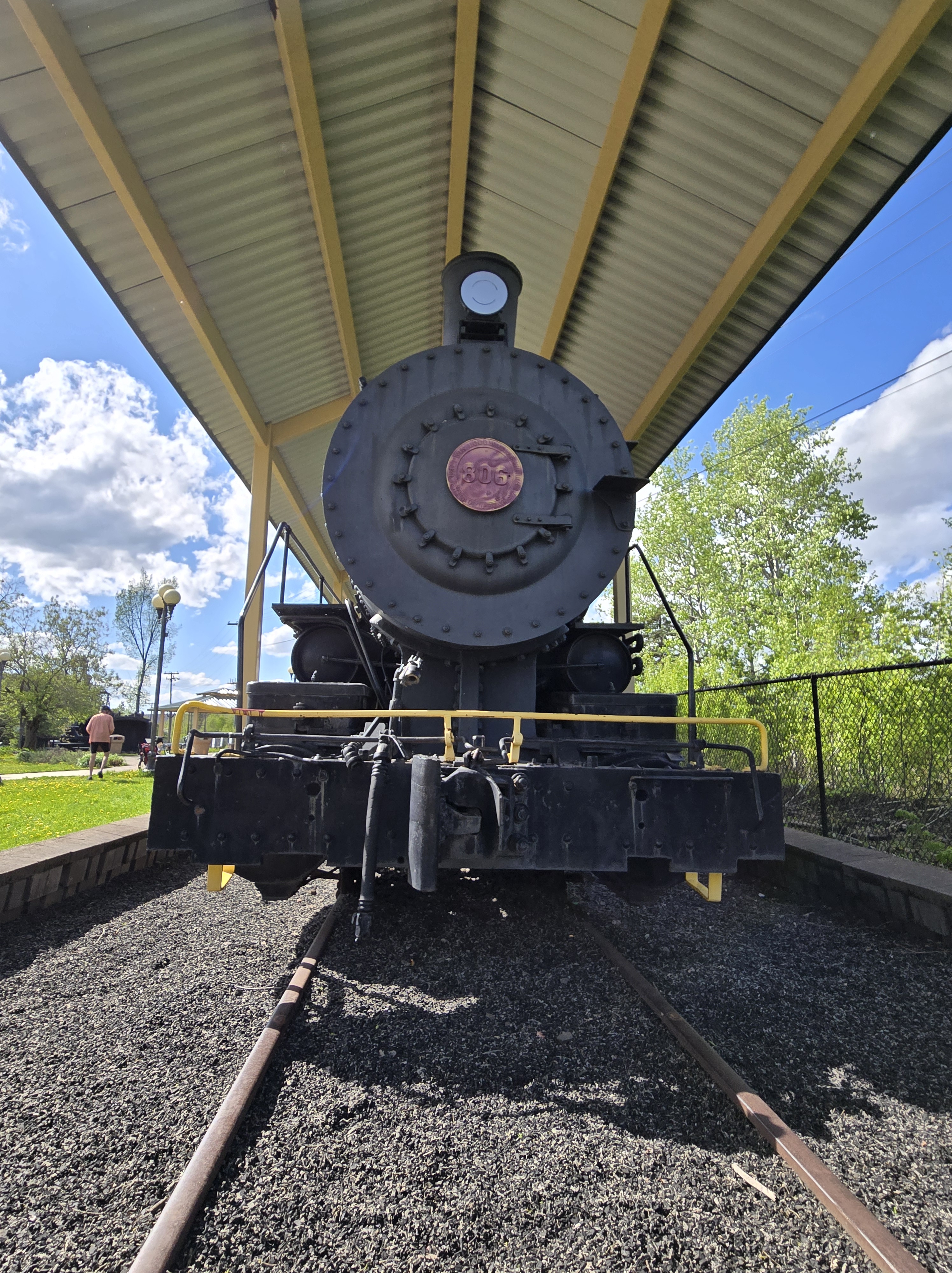
Our way back to Mountain Iron seemed easier than the ride out. I’m not sure if that was from the tailwind or the topography, but biking back was a breeze. Ride over, we spent time exploring the various pieces of mining equipment in the park. This included an old locomotive, which, no doubt, used to haul taconite to ships waiting for it on Lake Superior’s shore. Another group of bikers that we passed on the trail arrived and we chatted a bit. They were from St. Paul and were biking the entire trail, staying in hotels overnight.
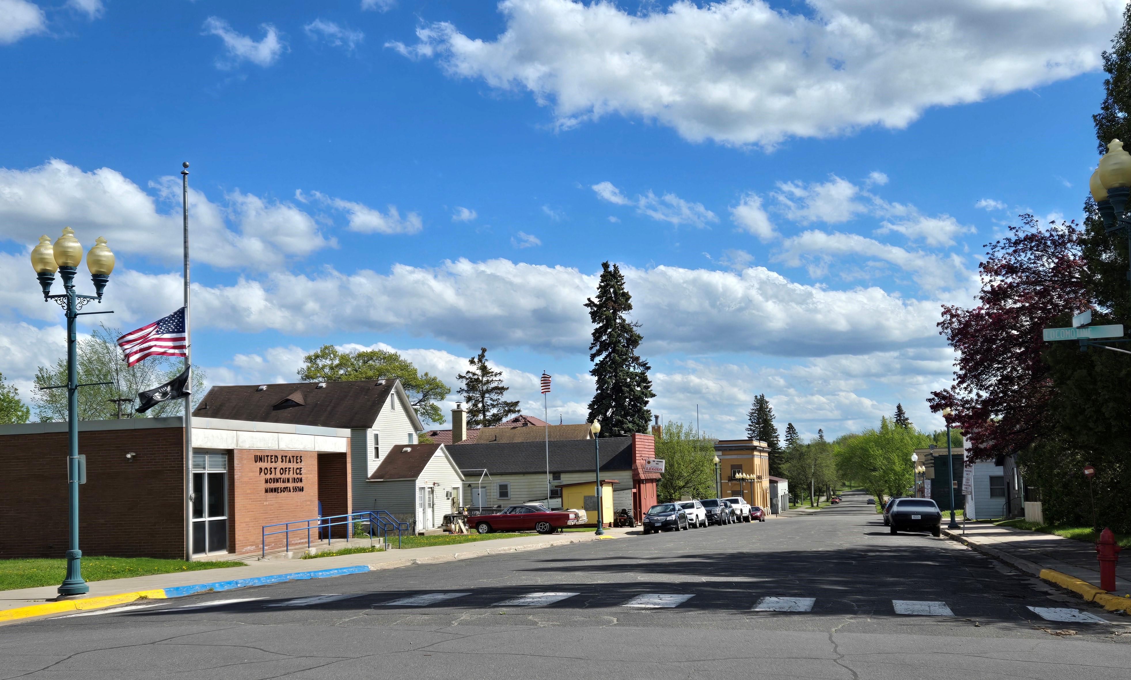
Downtown Mountain Iron.
That’s it for our experience with this section of the Mesabi Trail. Maybe next time, we’ll start from Kinney to experience this plucky little burg.
The locomotive engine in the Mountain Iron city park where the bike trail begins.
Update: 8/31/25
Well, it took a while, but we did start cycling from Kinney. This hardscrabble town is composed mostly of trailer homes. Not that there’s anything wrong with trailer homes. I’m just not used to seeing so many of them near the center of town.
We biked from Kinney to Buhl, which is only 4K. From there we rode toward Chisholm, a section we’ve ridden in the past, but I don’t think I blogged about it. The most scenic spot was the Stubler Mine Pit Beach, which looked like a good spot for swimming. A bunch of folks were doing just that during our Labor Day Weekend ride.
The beginning of the trail was wooded, but then much of it follows an abandoned roadway. The most scenic part of the section past Buhl was the City of Chisholm sewage plant. Thus, this addendum and not an entire blog post.
The online entry for the part of the Gitchi-Gami State Trail from Gooseberry Falls State Park to Split Rock State Park along Lake Superior said, This trail segment has steep hills and curves that can be particularly arduous for recreational use.
The warning was in italics and demanded attention. Russ and I looked at each other and shrugged. “Meh. How hard can it be?”
Will we never learn?! Spoiler alert: Actually, it wasn’t that bad, but a few of the uphills toward the end of our round-trip tour did defeat me, and I walked them. Just a reminder that I am 60 years old, so you gotta cut me some slack.
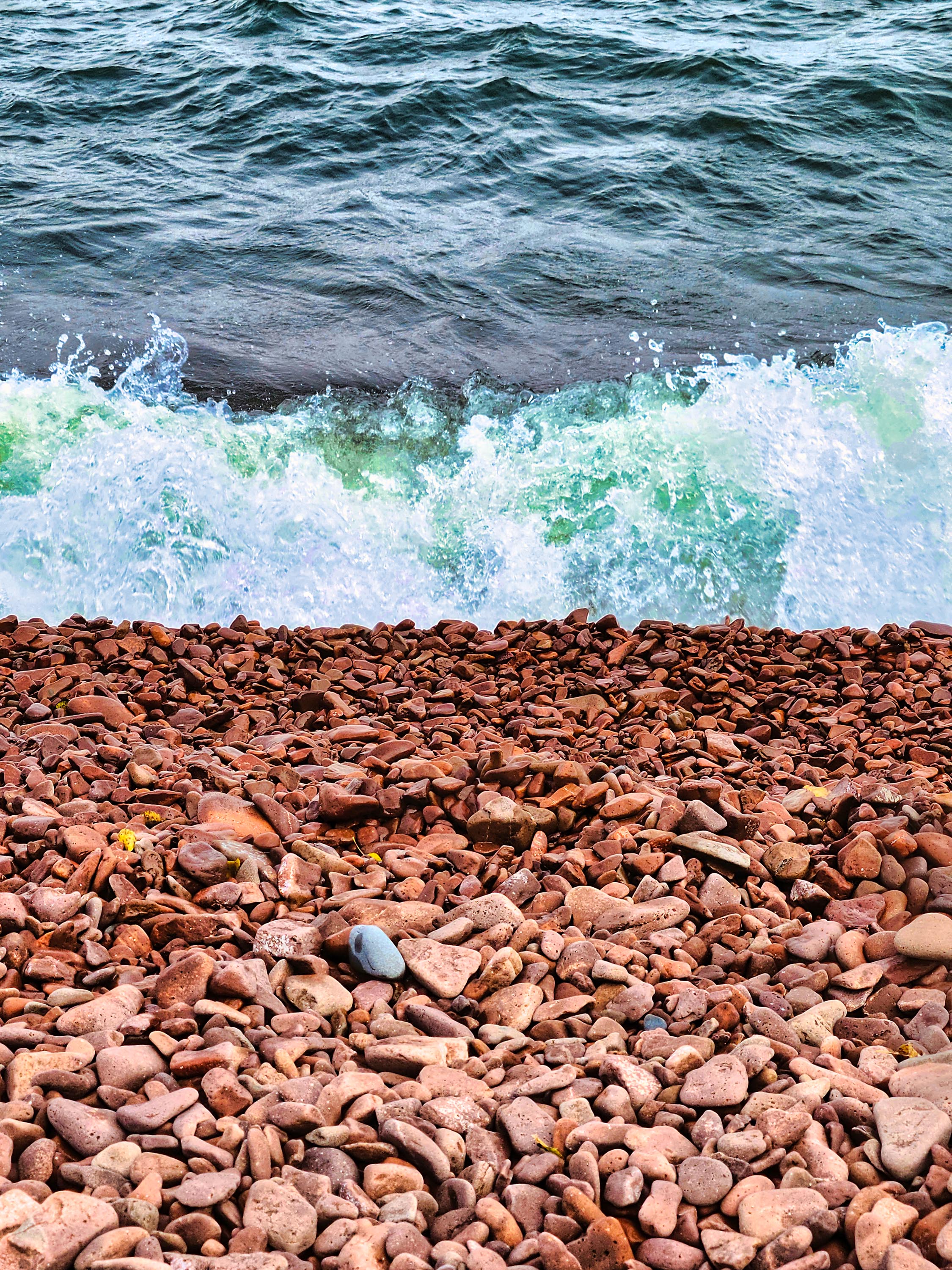
But the arduosity was worth it to bike a new (to us) segment of this trail on the North Shore and to see Iona’s Beach – a fabled shore littered with pink stones.
The Gitchi-Gami trail is composed of several paved segments totaling 33 miles. Eventually, it will span 86 miles from Two Harbors, MN, to Grand Marais, MN. I’d been on a segment north of the Gooseberry-Split Rock previously and enjoyed gliding through the birch and aspen forests and crossing river bridges.
The Gooseberry River before the falls on a foggy day.
After buying our MN state park pass at Gooseberry, we made our way to the trailhead, which is near the picnic area. The trail begins by taking bicyclists in the wrong direction – you travel south for a bit, but once you get near the park entrance it turns north. Cyclists get a spectacular view of the head of the Gooseberry River falls. In about 3 miles the trail winds into Twin Points Safe Harbor and Iona’s Beach Scientific and Natural Area. Fog from the lake rolled in and out along the way.
Iona’s Beach
We stopped and explored Iona’s Beach. Probably because of the mist, it wasn’t very crowded, but that was okay with us.
As you can see from the photos, the beach really is composed of pink stones. The stones have eroded from waves and frost from a nearby cliff (made of rhyolite) and are kept in place by dark basalt rock headlands on either side.
We sat by the water to see if we could hear the beach “sing.” When waves recede from the cobblestones, the stones come to rest with a tinkling sound unique to this beach. Waves were plentiful during our visit – the sound was subtle, but I do think we heard the beach sing!
The beach is named after Iona Lind, whose family bought the area and ran a resort there for more than 50 years. Iona ended up protecting the lakeshore she loved permanently by donating it to the state.
We continued on our way, gaining a close view of the rhyolite cliff from a bridge. A small waterfall cascaded down its face. The Split Rock River was another inspiring site. We made it a few miles into the park before my legs begged me to turn around, so we headed back to Gooseberry Falls. We did not make it all the way to the famed Split Rock Lighthouse.
All total, our trip was 15 miles. We were famished by the end of it. We wanted to eat at Betty’s Pies outside of Two Harbors, but it was so crowded that we opted for Blackwoods in Two Harbors. A mushroom and swiss burger never tasted so good!
The rhyolite cliffs that formed Iona’s Beach
FYI – Minnesota also has a black beach farther up the Shore in Silver Bay. It’s not natural, however. It’s created from discarded taconite tailings from iron ore mining activities. According to media reports and info from friends, it’s not that healthy to regularly play around on a beach made from industrial pollution, but a visit or two is just fine. The beach has been cleaned up in the past, but I would still be cautious if you have young children or have immune issues. Maybe opt for a natural pink beach instead.
Miners Dry Building at the Pioneer Mine Museum, tour headquartersin Ely.
Russ and I meandered farther north in Minnesota earlier this summer to bicycle in the Great River Energy Mesabi Trail Tour. Although we’ve biked on this trail in several different locations, this was the first time we’d travelled this new stretch of it and participated in the official annual tour. Note: this is not a race, it’s a recreational tour.
Bikers can sign up for several different distances: 12, 30, or 50 miles. Russ is such a bicycling animal he’d normally sign up for 50 miles. But some of us still have day jobs and can’t spend all our waking hours biking (😊), so he indulged me and we both signed up for the 12-mile tour.
The Mesabi Trail is paved and, once totally built, will stretch 165 miles from Grand Rapids to Ely, Minnesota. It’s almost all complete. The Ely part is the newest section, so we were eager to traverse it.
The tour began at the gritty, post-industrial Pioneer Mine Museum, which features photos and artifacts from an underground iron ore mine that closed in 1967.
The trail wound past a lake, through a few blocks of town, and then we were in the woods, along with 400 other people who were on the tour. There was no official start time, so people began biking in drips and drabs, which made for a less crowded experience.
Russ signed us up, so he had the tour map and I was fairly clueless about our route and where our turnaround point was. Also, the turnaround points were not marked on the actual trail (note to trail organizers, this might be a good idea!)
The spot on the trail by the raspberry patch where we finally turned around. (Note, the cyclists are not us. They are just some other people who didn’t stop for the raspberries.)
We passed one rest stop, which only felt about 3 miles out to me, but it was actually 6 miles and was our turnaround point. Because we were clueless and in good form, we kept going another couple miles, past a huge scenic meadow and lovely white pines until Russ found a patch of raspberries. Russ never met a wild raspberry he didn’t like, so we stopped so he could forage.
Once he was done eating, Russ thought to look at his exercise ap and discovered that we had gone over our mileage. So, we turned back, completing 16 miles instead of 12. No big deal, plus I probably needed the extra exercise, anyway.
Back at the museum, a little lunch was waiting for us, along with musical entertainment. We also ran into a few people we knew at lunch and met some new people on the trail. Much more fun than biking alone!
For information about other sections of the trail, please read:
This does not look like a dead butt to me. Photo by Oleg Melevych on Pexels.com
I recently learned there’s such a thing as “gluteal amnesia.” Have you ever heard of that? I hadn’t.
It’s a condition caused by our society’s sedentary lifestyle – literally by sitting on your butt too much. Also known as “dead butt syndrome,” gluteal amnesia happens when your gluteus maximus muscles (the major muscles that make up your butt) lose their ability to contract naturally. There are different theories about why being sedentary causes this to happen, but it does seem to happen to some unfortunate individuals.
Having a dead butt can cause lower back problems and sometimes pain that resembles sciatica. Also, it can give you a saggy butt. Oh no!
To compensate, a person can do exercises, among them squats, hip thrusts, and bridges. Experts say that with proper treatment and exercise, there is hope for resurrecting dead butts.
According to Self Magazine and Healthline, the condition can even impact people who exercise regularly if they sit a lot when they don’t exercise. Suggestions for preventing it include breaking up time sitting with walks and stair climbing.
Rest assured, my butt is just fine, thank you, especially since I began kick boxing workouts. But now you can say you learned something today.
The Rouchleau Mine Pit as seen from Minnesota’s tallest bridge.
Russ and I explored a new (to us) section of the Mesabi Bike Trail in Minnesota’s Iron Range this weekend. The section we targeted took us across the state’s tallest bridge, the Thomas Rukavina Memorial Bridge, near Virginia, Minnesota. We driven over the 204-foot-tall structure plenty of times but always looked longingly at the walking/biking/ATV trails right next to the freeway, and today was the day to make our dream come true!
The Thomas Rukavina Memorial Bridge outside of Virginia, Minnesota.
We meandered to bike trailhead in the town of Gilbert at the Sherwood Forest Campground. Biking toward Virginia, we promptly lost the paved trail as it merged into the city roads for several blocks. I think in the past, trail directions had been painted on the road, but those have been lost to the weathering of snow and traffic.
A veterans’ memorial mural we biked past in Virginia.
We had a general idea of where to go, however. We just followed our noses for a few blocks and the trail reappeared, taking us past a restaurant and across Highway 37. Then we headed into the woods. I love these forested sections of trail with their lines of aspen and birch. Pink fireweed is beginning to bloom, which added pops of color to the route. One impressive stretch took us on a skinny peninsula high above a gravel pit and a wetlands area.
What the bike trail looks like across the bridge.
The topography is gradual and unchallenging. The only part my legs complained about was the gradual incline once we returned from the bridge, but I get ahead of myself.
Eventually, we reached the bridge. One side of the trail is for walkers and bikers. The other side of the painted line is for ATVs. A low concrete barrier separates the trails from the freeway. A high railing on the outside provides protection from dropping 200 feet but still provides a view of the Rouchleau Mine Pit below. This mini Grand Canyon was created by iron ore mining activities and now provides drinking water for the city of Virginia.
Wind likes to whip around the bridge, but the weather was fair for us. The bridge was built because mining companies wanted to dig where Highway 53 used to be. They gave the transportation dept. plenty of notice, but, as you can imagine, moving a highway is no small feat. This was the most economical route. Even so, the project cost $220 million! And the bridge was constructed as part of it.
The Oldtown-Finntown Overlook.
Thomas Rukavina, its namesake, was an Iron Range lawmaker born in Virginia. He was a staunch advocate for the Iron Range and its people. He’s also memorialized in a park about a half-mile farther down the trail from the bridge. Bridge View Park offers a good vista of the structure and some interpretive signs and benches.
Once we biked to the outskirts of Virginia, we stopped to investigate a rather overgrown overlook of the mine pit that features a 50-foot caged safety bridge out to the pit’s edge. It’s named the Oldtown-Finntown Overlook.
From there, we passed the historic downtown district with its quaint old streetlights and American flags flying. The trail took us to Lake Virginia. We decided this would be a good turnaround spot. We biked around the small lake, disturbing a gaggle of Canada geese, which hissed at us, and then headed back to Gilbert.
The total trip was 13.5 miles. Although the bridge was our main goal, it was fun seeing the other, unexpected attractions along the way and becoming familiar with a new route.
The town of Lanesboro, MN, as viewed from the hill in town.
Russ and I meandered with our Scamp trailer to Lanesboro, Minnesota, a small town not far from the Iowa border. I almost lived in Lanesboro, once, back when I was working for Mayo Clinic, which is a bit north of it. (But then Duluth and the call of Lake Superior won out and my family stayed in Duluth.)
Lanesboro is set in a limestone valley cut by the Root River. It hosts live theater, art galleries, and museums — as if all the creative people from the surrounding flat farmland tumbled into the valley and decided to stay. Had I lived there, I’m sure I would have felt at home. As it is, at least I get to visit it occasionally.
What attracted us weren’t the numerous bed and breakfast inns (Lanesboro is known as Minnesota’s Bed and Breakfast Capitol) or the rhubarb (also known as Minnesota’s Rhubarb Capitol), but Lanesboro’s bike trail.
The Root River Bike Trail runs right through the community. The forty-two-mile-long trail saved this little town from becoming a ghost of itself over thirty years ago when the trail was built by the state on an abandoned railroad bed.
We Scamped just outside of town at the Eagle Cliff Campground. As we drove to the campground in the evening, fireflies were out in full force, lighting up the roadside ditches and the forest edges. When we arrived, the campground hosts moved us to an upgraded site (pull-through with full hook-ups to water/electric/sewer) at no extra cost because a family reunion was going on in the site next to the one we originally signed up for. With that, we could already tell it was a well-run facility and the rest of our trip confirmed that good first impression.
That first night, we ate a quick and simple meal of scrambled eggs and Spam. In case you’re not aware, the home of Spam (a ground pork canned meat product) is not far away from Lanesboro, in Austin, Minnesota. We like to use it when camping because it’s tasty and easy. Since we were so close to its birthplace, we had to make sure we brought it along on this particular trip. Someday, I’d love to go to the Spam Museum, but we didn’t have time on this trip.
We stayed at the campground for four nights. Our first day, we bicycled from the town of Whalen to Peterson. Access to the Root River trail in Whalen was available via a short bike ride through the campground and down the quiet local highway. It was twenty miles from the campground to Peterson and back.
The Root River Bike Trail
One thing I love about the Root River Trail is that it’s well shaded. Trees line most of it, providing welcome relief, especially when temps were in the 80s like they were for us. The trail is also in good shape. Hardly any potholes or tree root bumps were to be found. The trail follows the river and is relatively flat. Quaint farms and cornfields line the parts that aren’t forested. Yet another thing I like is that the trail is free to use, unlike some of the trails Russ and I bike up north.
A variety of birds flitted across in front of us or called from the trees. We saw orioles and cardinals, heard catbirds, cowbirds and house wrens. At our campground, a pair of eagles were nesting nearby, and we watched black vultures circle around the bluffs that surround the valley. We also heard a rooster or two as we biked past farmsteads.
The area must have had a good amount of rain this season – everything was green and smelled verdant – like a newly mowed lawn.
A barn seen along the trail.
A note of caution: wild parsnip plants line the trail – you don’t want to come in contact with those. I also found out the hard way that stinging nettles can be found along the trail. My legs got a brief dose while I was taking the photo of the barn found in this post. Dedicated photographer that I am, I stood in them just long enough to get the photo. My legs stung, but not for long. The movement of biking and the fact that I wasn’t in the nettles long helped, I think. I just gritted my teeth and ignored the pain!
When we reached Peterson, we rested at a picnic table set up for bikers in town. We took the requisite tourist photos next to the town’s large welcome sign gnome. As we rehydrated, we were treated to the sight of a man driving a motorcycle with his German shepherd in the sidecar. They drove past us twice before we decided it was time to bike back to our campground.
Tubers on the Root River
The temperatures climbed into the 90s the next two days, so we opted for cooler forms of entertainment. One day, we visited Niagara Cave in Harmony, Minnesota, about fifteen miles south of Lanesboro. I’ll write more about that in a separate post. The next day we went tubing down the river. The campground offered a shuttle service and tubes at a reasonable cost. They drove us to a drop-off spot, and it took us about two hours to tube back to the campground. We just hopped out of the river at the campground landing and brought our tubes back to the office. It worked out pretty slick. The only thing that gave me pause is the lack of instruction by the shuttle driver. He just made some joke about hoping we all had our wills updated and then dropped us off. (!!)
There’s really not much to tubing other than avoiding strainers (trees that lean into the river – you can get stuck in them) and to wear sunscreen. I was so hot and sweaty when I applied my sunscreen, it must not have worked. I looked like a lobster the next day and am in the delightful peeling process now.
The river was murky but cool and refreshing. I enjoyed getting to know the river better. I saw three fish jump, lots of red-winged blackbirds and vultures, and we passed a Canada goose nesting area complete with goose families.
The final morning of our trip, the temps dropped into the 80s again, so we hit the bike trail. We drove into Lanesboro and began from the trailhead near the bass pond. We pedaled west toward the town of Fountain, turning back at the trail junction (where it joins the Harmony-Preston Trail). On our return, we stopped at the Old Barn Resort for lunch – an interesting historical site connected to the Allis Chalmers Machinery Company. Lots of cliff swallows nest under the barn’s eves.
The shrimp mango rice bowl from Pedal Pushers Cafe in Lanesboro.
Another great place to eat is Pedal Pushers Café in Lanesboro. We stopped there on one of the hot days after hitting the gift shops and walking around the town. The food at the café is locally sourced and very good!
If you’re ever looking for a quaint Minnesota getaway, put the Lanesboro area on your list. You’ll be glad you did. We came home refreshed and sunburnt, but happy.
A bridge on the trail between Lanesboro and Fountain.
I’m not sure what got into me last week. I saw an ad on Facebook and signed up for a free kickboxing lesson at a gym within walking distance of my house.
Well, I do sort of know what got into me. At the beginning of this year, I grew aghast at the post-menopausal weight that had crept upon my thighs (and butt!) with little pig’s feet, so, I signed up for Noom, an app that helps you track your food intake, exercise, steps taken, and thought processes around food.
The program has been very helpful and effective. I’ve lost eighteen pounds so far and still have a few more to go. I can tighten my belt three or four more notches than before. Pretty soon I’ll need to buy smaller jeans!
I noticed the gym when it opened a few years ago and joked with my girlfriends that we should try it, but in my mind, I figured the sport was for people younger than those in their late (ahem) fifties. But since losing weight, I’ve been feeling a bit feisty and ready to try something new. Plus, the more weight that comes off, the harder it is to lose because your body becomes more efficient using calories. One of the things Noom suggests to counteract this is to up the intensity of your workouts. Kickboxing would certainly be more intense than walking, biking, and elliptical striding, which is what I’ve been doing.
My main goal with this lesson was not to get broken. Having fun would be a plus.
I just returned from my lesson and I *think* I’m still intact (I’ll know better tomorrow after the stiffness sets in). And, it was FUN. I enjoyed punching the crap out of something without any social consequences. I must have subterranean anger that needs an outlet! Plus, the music was good.
Here’s how it works: The instructor interviews you about your fitness goals, motivations and any injuries you may have. Then it’s time to get moving. There are nine stations. You exercise alone at a station for three minutes. Then there’s a thirty-second interlude where the staff call out different exercises for everyone to do, like holding a plank position or doing mountain-climbers. Then everyone moves to the next station. Instructions for what to do are written on placards at each station. Time is kept by a lighted box on the wall.
Station exercises include sit-ups, kicking a heavy bag, doing uppercut punches on a wrecking ball-type heavy bag, and practicing traditional punches on a speed bag. The exercise I failed miserably at was jump roping. Apparently, jumping is not in my adult repertoire of activities. The activity I was surprised I could do fairly well were sit-ups while holding a medicine ball.
I like that, even though you work out at a station alone, you’re with other people who are working out in the same room. It’s rather like weight-lifting that way. But on the thirty-second interludes between stations, everyone works together doing whatever torture, er… exercise the instructors call out.
At the end, the instructor had me step on a machine that calibrates body composition. It basically said what I already knew – I’m doing pretty good for my age but could lose a few more pounds.
Then, the instructor outlined the three monthly exercise plan options they offer. I chose the cheapest one (because I’m cheap) and was issued my VERY OWN boxing gloves (I chose pink and black), wrapping tape, and heart monitor. I was also able to choose my own boxing superhero name, which will be shown on the public monitor display in the workout room. I chose “Magma” because it starts with M like Marie, plus cuz I’m so hot.
I may regret all this tomorrow when I can’t get out of bed, but for now, I’m feeling pretty darn good, and for a Minnesotan, that’s saying a lot.