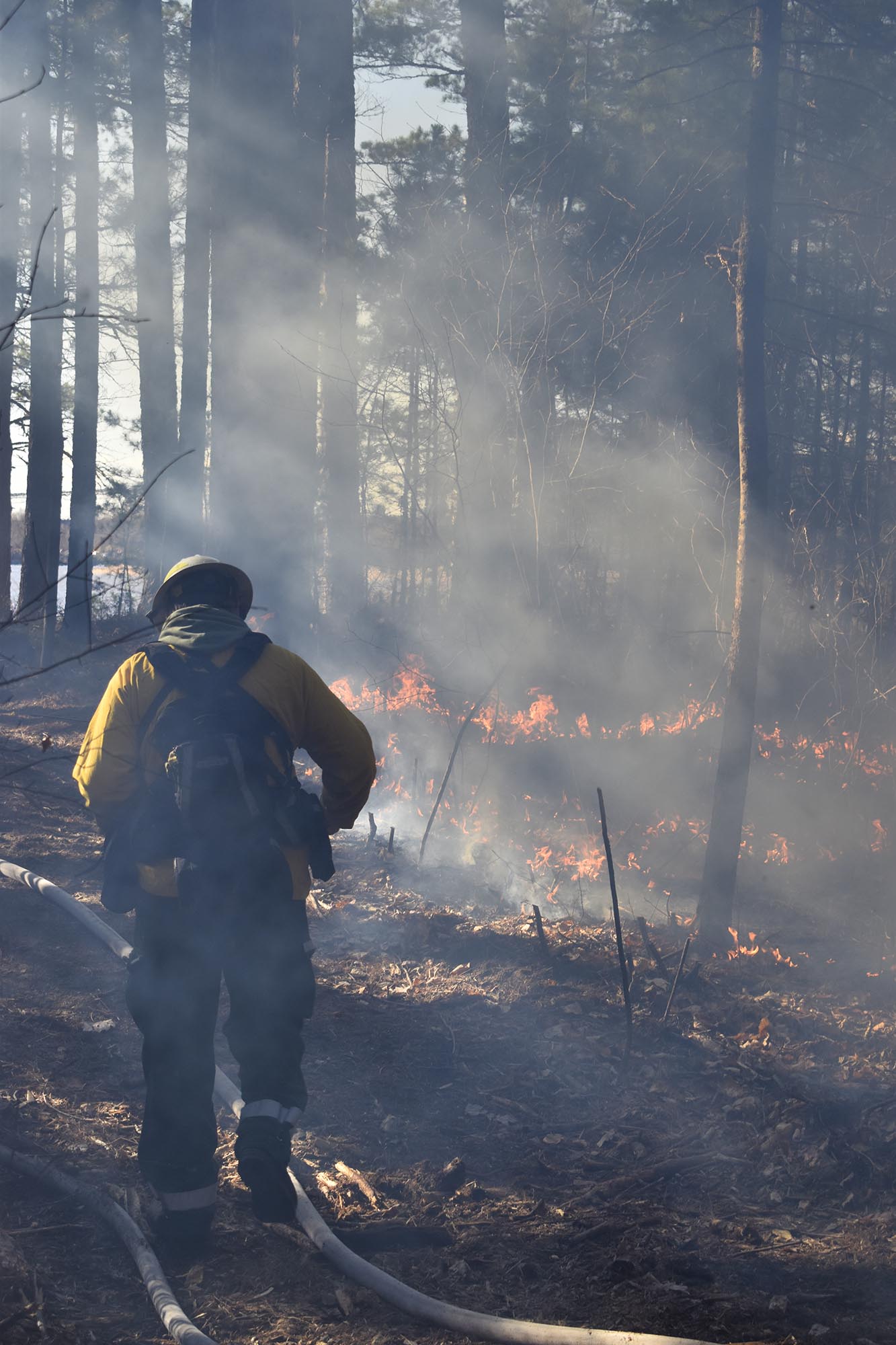
A fire crew member monitors the Nov 2025 cultural prescribed burn on Wisconsin Point.
A story of mine appeared in the April/May 2026 issue of Lake Superior Magazine. It covers a project I’m involved with that’s designed to bring back the Ojibwe tradition of prescribed burning on Wisconsin Point, a long sandspit on Lake Superior. The Ojibwe once lived in the red and white pine woods there until they were moved to reservations in the mid-1800s. Before then, they would set small, controlled fires to keep brush down, encourage plants like blueberries, and help red pines sprout. They call these fires “Ishkode,” or good fire.
I first heard about this practice a few years ago while I was still working as a science communicator for Wisconsin Sea Grant. The organization funded research that studied tree rings and fire scars on Wisconsin Point and its neighboring sandspit, Minnesota Point. I reported on the project by writing articles, news releases, and producing a podcast.
Last year, a few months before I retired, I heard that the Ishkode group was looking for help with communications. I immediately volunteered, and you can read about the results in my article. I’m happy to say that last fall, Ishkode successfully returned to the point for the first time in 159 years. And nobody got hurt! More patchwork burns are planned in the future.
As a result, I was approached by a different group that’s working to bring Ojibwe fire practices back to Minnesota Point. Although the two points are separated by a short span of water, they are different politically and socially. Not only are they in different states, but Wisconsin Point is uninhabited, whereas more than 100 homes line Minnesota Point, many of which are beachfront mansions. Wisconsin Point is owned by the City of Superior and the Fond du Lac Tribe. Minnesota Point is a mix of private, city, and state Department of Natural Resources property. There’s even an airport near the end of it.
Both fire projects are led by Fond du Lac tribal members. Except for those folks and me, most of the rest of the people involved in each project are different. Because of its complexity, the Minnesota Point group is much larger (about 40 people). I began helping them this winter and finally have everyone’s names and affiliations down.
Our goal is to conduct a prescribed burn on Minnesota Point this spring. It will be the first time in 180 years that a burn has occurred there. Things are falling into place nicely, and so far, public reception has been good.
I’m happy to have a hand in returning a missing piece of the ecosystem to the shores of Lake Superior. As one of our group members said, the burns will help the choked forests breathe again. These points aren’t the only places where the Ojibwe used to burn. Evidence can be found all around the lake.
For more information, check out my article in the print version of the magazine, or check the Wisconsin Point Ishkode webpage.
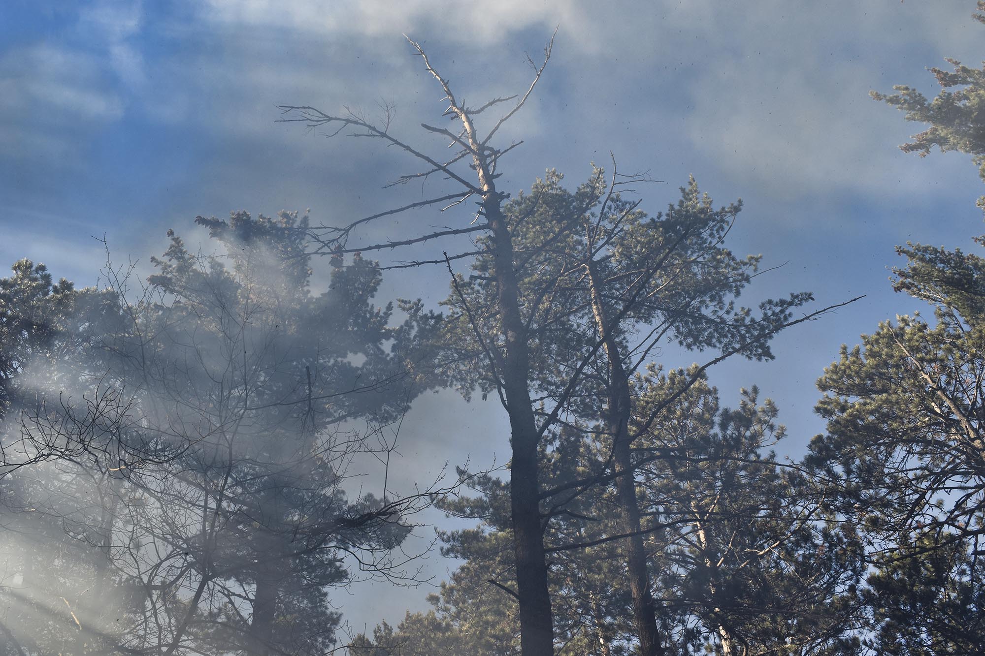
Smoke from the prescribed fire drifts through the pines on Wisconsin Point. The fire will help the beleaguered red pine population regenerate.
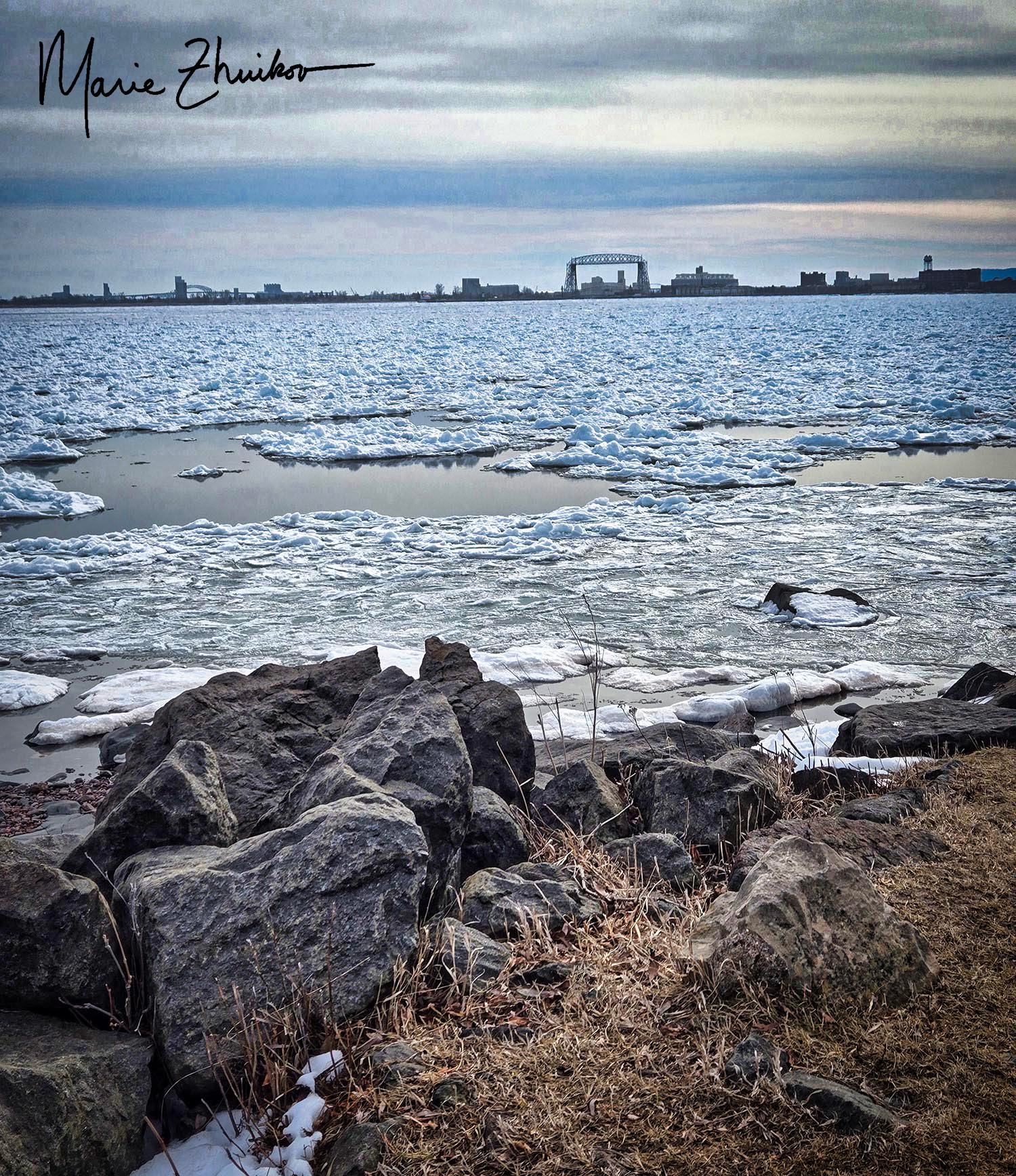
Each of these ice pancakes is about three feet across.
Winter is loosening its cold, hard grip on Lake Superior. One sure sign of spring is pancake ice. Sorry for the misleading title—these pancakes are not edible. But I suppose they are, if you like chewing ice.
Pancake ice on Lake Superior with Duluth’s iconic aerial lift bridge in the distance.
Pancake ice can form in early winter, too, but in spring it occurs when the ice begins to melt and waves or wind blow the ice chunks around. The wind whistles over the lake, carrying the crisp scent of melting ice and the freshness of open water. The ice chunks slap against each other like bumper cars at a fairground. The pancakes form circles with ridges along the sides, their surfaces glistening under the pale, watery sunlight. Pancake ice can also form on open water when it gets cold and ice crystals freeze and then break up and are blown around. This phenomenon can also occur on rivers and in the ocean.
Sometimes the rotating, colliding ice makes sounds, but I didn’t hear any during Russ’s and my walk along Lake Superior’s shore the other day when I took these photos. Instead, there was only the whisper of our boots on the asphalt trail, and the restless sigh of the breeze—sharp enough to sting cheeks and make eyes water.
This year, Lake Superior experienced 27% ice cover. The last time the lake came close to being completely frozen was 2019. The long-term average is 61.5% ice cover, and I assume that average is going down as the climate changes.
During our walk, other signs of warming weather in Duluth were the white legs of everyone who wore shorts for the first time since October. Mind you, it was only 44 degrees F with a cold northeast breeze, but people are so desperate for spring that shorts seemed like a good idea! I even saw a bare-chested man wearing shorts, his skin turning pink in the biting wind. I was not so inclined. In fact, I had to raise the hood on my jacket and cinch it tightly around my face, feeling the rough fabric press against my cheeks as I tried to shield myself from the breeze once we turned around and headed back to our car.
But the pancakes and white legs are here on Lake Superior. Spring can’t be far behind.
Ice off of Minnesota Point in Duluth. Each of those slabs in the foreground is the size of a person lying down. The ridge behind it is about fifteen feet tall.(I popped a squat to obtain this viewpoint.)
On the Dunes By Sara Teasdale
If there is any life when death is over, These tawny beaches will know much of me, I shall come back, as constant and changeful As the unchanging, many-colored sea.
If life was small, if it has made me scornful, Forgive me; I shall straighten like a flame In the great calm of death, and if you want me Stand on the sea-ward dunes and call my name.
I recently stumbled upon this poem while leafing through a stack of old, yellowed pages—poems I had once painstakingly typed on a clattering Underwood typewriter during my high school days. Back then, before the convenience of photocopiers, I’d wander the library aisles, selecting poetry books that called to me. I would borrow them, then sit for hours, as I copied lines that stirred my soul. I imagined that I’d refer to these pages often, though, they have gathered more dust than fingerprints. Now, rereading them, I’m flooded with nostalgia, peering through a window into what once moved my younger heart.
Poet Sara Teasdale lived from 1884 to 1933. She is characterized as “neurotically intense,” and it’s said she moved in the company of poets like a “recessive flame.” She had a tempestuous affair with poet Vachel Lindsay. Later, she married a businessman but then divorced him, retired to seclusion, and in the end, died from an overdose of sleeping pills.
Her poem struck me because I’d just meandered to the beach in Duluth with Russ. If you’re not familiar, we are blessed with a long sandbar at the mouth of Lake Superior. Of course, the beach was snow-covered. The lake’s power was on full display in the form of huge piles of ice piled high about ten yards offshore. I had my phone with me and was tempted to brave the ice to take some photos, but I hesitated, not knowing if the ice was safe. I am well acquainted with the vagaries and dangers of this Great Lake.
However, two other people walked out to an ice ridge in front of me. They survived, so I figured I’d be okay if I followed in their footsteps. I ventured out, and these photos are the result. I was glad I braved the ice to share them with you! Russ wisely remained onshore. I’m also glad that the little adventure didn’t hasten my death so that Russ would need to stand on the dunes and call my name when he wants me. 😊
My fair city of Duluth, Minnesota, has donned a silvery veil these past few days—a haunting fog that drapes the world in mystery. I don’t know about you, but I adore the hush and wonder of fog; here, I am home. Each morning, the temperatures bite, and the fog cloaks every branch and rooftop in crystalline frost and shimmering ice.
Restless for movement, I ventured out, camera in hand, into my transformed neighborhood. The roads glittered treacherously beneath a thin armor of ice, so I strapped on my boot’s iron claws. Each step crunched with possibility. The world was both dazzling and dangerous.
As the sun coaxed the temperature upward, ice shards crashed from trembling trees and sagging power lines. Splintered branches, felled by the weight of winter, littered yards and tangled themselves in lines above. Once, a cascade of ice from a power line narrowly missed me, which sent my heart pounding. But I pressed on, determined to witness the spectacle to its end.
Who knew a simple walk around the neighborhood could be so exciting?
I have two writing things to impart. The first is a review of my new poetry book, High Fire Danger by Rebecca Swanson, a fellow member of the Wisconsin Writers Association. She kindly says they are “some of the finest nature poems” you will ever read, and that every page is filled with “warmth, wit, vigor, and beautifully crafted poetry.” My book costs $15 and is available from Amazon.
The other is my new Facebook author/photography page. I used to have pages for each of my novels. Even though my first novel’s page (Eye of the Wolf) had 2,500 followers, it was so out of date that, after notifying my followers to switch to my new page, I held my breath and sacrificed it. If you follow my new page, you’ll get notifications of my writing events, see my favorite new photos, and get links to my latest blog posts. My page is slowly growing with 77 followers; I could use a few more.
Image by Sharon Moen
I also have an Instagram account, but am less active there. My profile photo shows my arms hugging a tree. Because, you know, that’s what I do.
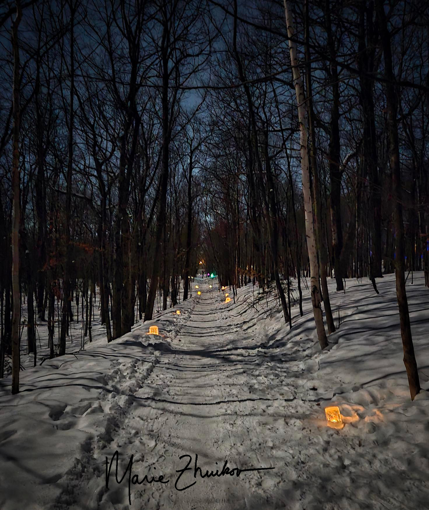
Inside our mailbox was an invitation on a slim, hand-cut piece of paper: Luminary Walk. It contained a date, time, and location, which was a short woodland trail in our neighborhood. On the bottom were the words: light, warmth, hope, welcome, neighbors.
How could we resist? We waited until dark and ventured out into the calm night. An almost-full moon watched our progress, casting shadows on the snow. That was all the light we needed. We didn’t even consider bringing a flashlight.
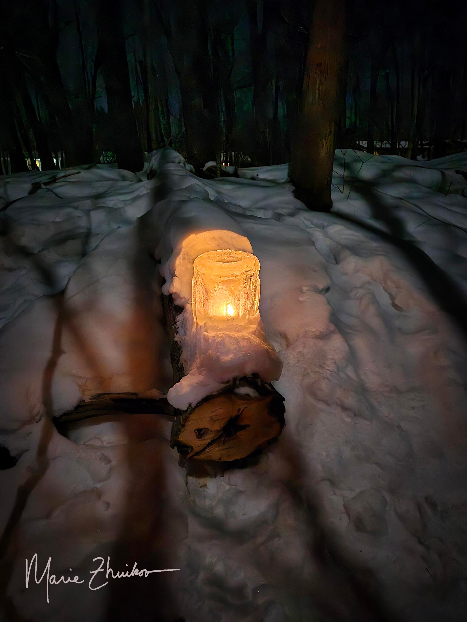
When we arrived at the trailhead, an alternating path of ice luminaries glowed softly down the length of the trail. As we walked, we noticed some were lit with candles and some with LED lights. Most glimmered with soft, natural light. Others swirled with a riot of color. There were round and rectangular clear ice luminaries, colored square ones, and huge raindrop-shaped ones.
We weren’t sure who was responsible for creating this magic, but it must have been several families, given all the work involved. Halfway down the trail, we met other neighbors enjoying the scene with their dogs. We greeted each other and marveled over the view.
One display looked like a snowy rose: a raindrop luminary in the middle, surrounded with icy petals and lit with a string of white lights. Orange slices, cranberries, and pine needles were embedded in another. Most lay on the snow. One was perched on a log.
We left the trail and walked back home with these words echoing in our heads: light, warmth, hope, welcome, neighbors.
I came upon this scene at our cabin. The grouse must have hit the window on our garage, even though it’s on the second story. I’ll have to do something about that — close the curtain, perhaps? At least the bird had a soft landing in new snow. It looked so peaceful, I was moved to take a photo. We left it where it fell. Some fox has probably already made quick work of it — returning its energy to the world.
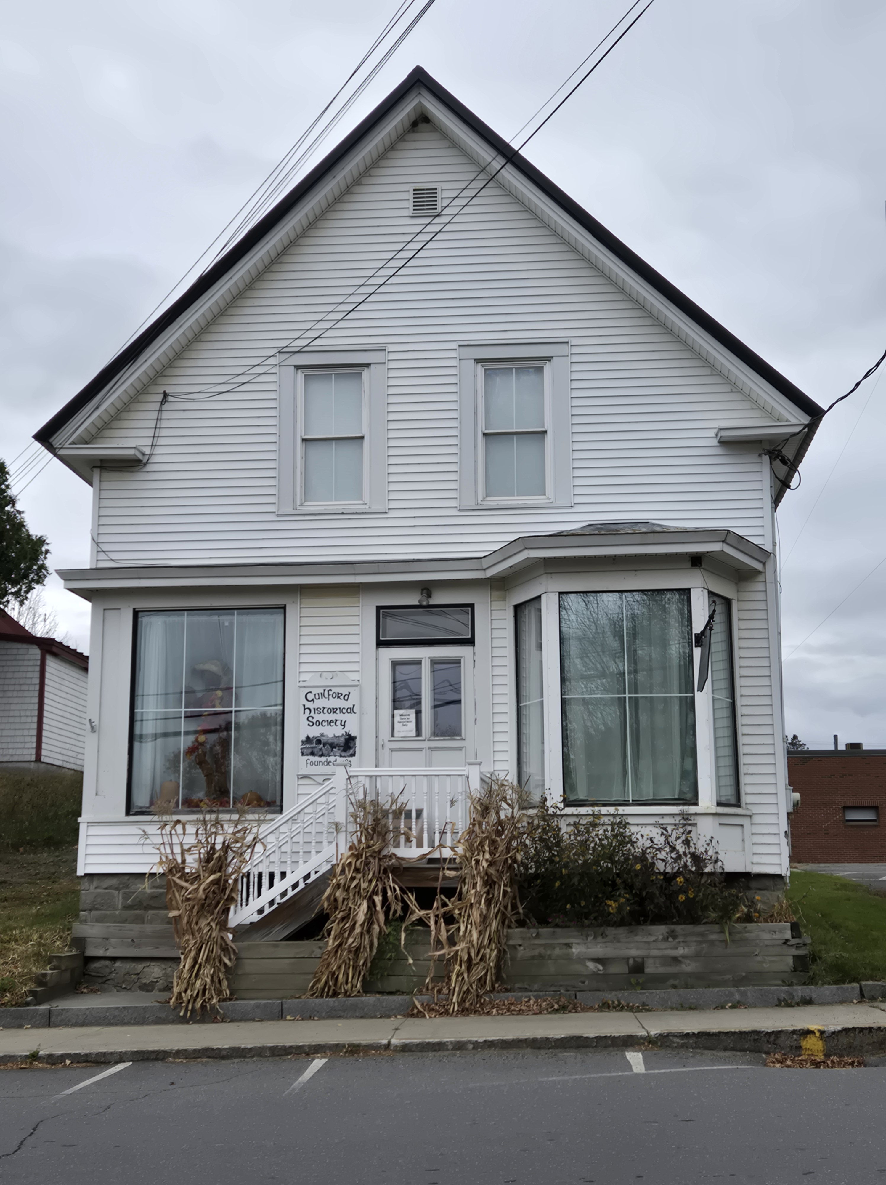
As you may recall, for our epic New England Road Trip, in October Russ and I flew from our home in Duluth, Minnesota, to New York to visit Russ’s family members there and in Connecticut, and then drove north, exploring sites connected with my mother’s ancestors. Guilford, in the Maine Highlands, was the culmination of our trip and was the spot I’d been wanting to visit for over 15 years, ever since I did an internet search on my Herring ancestors and discovered that Robert Herring (my great-grandfather to the fifth power on my mother’s side) was one of the founders of Guilford.
As if that weren’t enough, Guilford was the original home of the Burt’s Bees brand of personal care products infused with honey and beeswax. That company has since moved away and changed owners. Now, Guilford is home to a company that makes many of those cotton-tipped nose swabs that we all became too familiar with during the COVID epidemic.
Back when I made my discovery fifteen years ago, I was so excited that I wrote a history about Gilford’s founding and sent it to their historical society. I see that it has since ended up in the University of Maine’s Digital Commons! (“Early Town History: A Tale of Three Roberts.”)
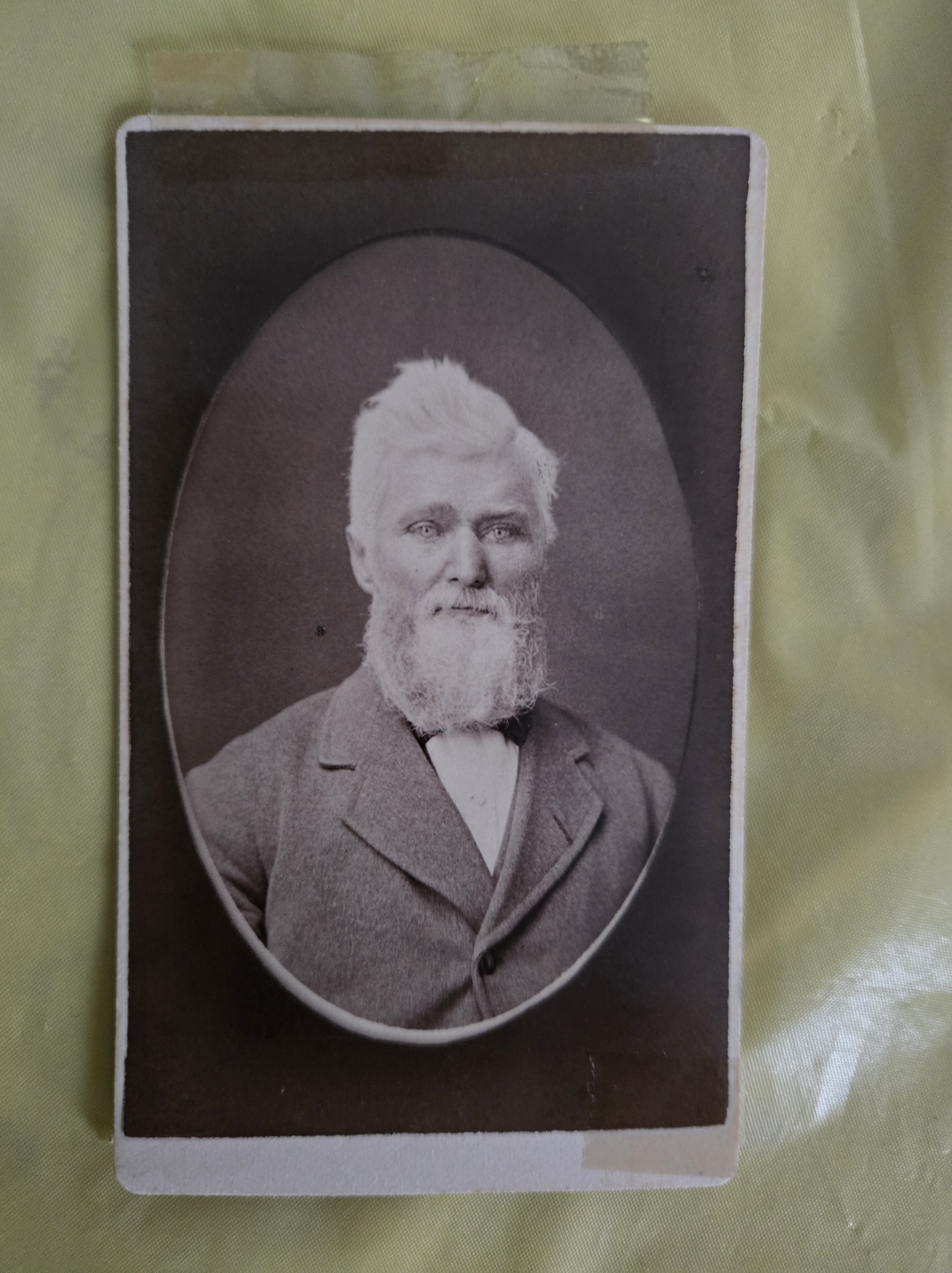
A photo of Robert Herring. On the back, it says “Robert Herring the 1st,” so I assume this is Benjamin Herring’s son Robert, who was the privateer-turned- deacon. The photo was taken in nearby Dover, Maine.(Now known as Dover-Foxcroft.)
Privateers and a Deacon
My mother and her sisters compiled an extensive genealogy for our family before the era of computers. In it, they documented Robert Herring, his father Benjamin Herring, who was born in Gloucester, Massachusetts, in 1727, and his father Robert Herring, who immigrated from England in the early 1700s. But my mother and her sisters didn’t know about the family’s role in founding Guilford.
I found these ancestors interesting because Benjamin Herring was a Revolutionary War privateer who was buried at sea off Cape Sable Island, Nova Scotia. According to info I found on Wiki-Tree, Benjamin was the captain, and his ship’s name was the Princeton. His son Robert was also a privateer, but according to research by one of my California cousins, he gave up that life, became a deacon in the Baptist Church, and headed inland with his cousin Robert Low to found Guilford. Robert Herring’s son, Robert Lowe Herring, and his family followed soon after.
(There’s some question about whether there was an “e” on the end of Robert Low’s name. I’m leaving it off to minimize confusion with Robert Lowe Herring. But I’m pretty sure that RLH is named after his relative Robert Low.)
Brian and Cindy Woodworth.
I let the Guilford Historical Society know about our trip, and their president and treasurer, Brian and Cindy Woodworth, were good enough to notify other Herring relatives and to open the museum for us during our two-day stay.
Before our museum visit, we had a delightful chat with some cousins, who are related to the original Bennett settlers of Guilford and to the Herrings. We met at the Guilford Bed and Breakfast, where we were staying. They gave me copies of helpful information about the Herrings and privateers.
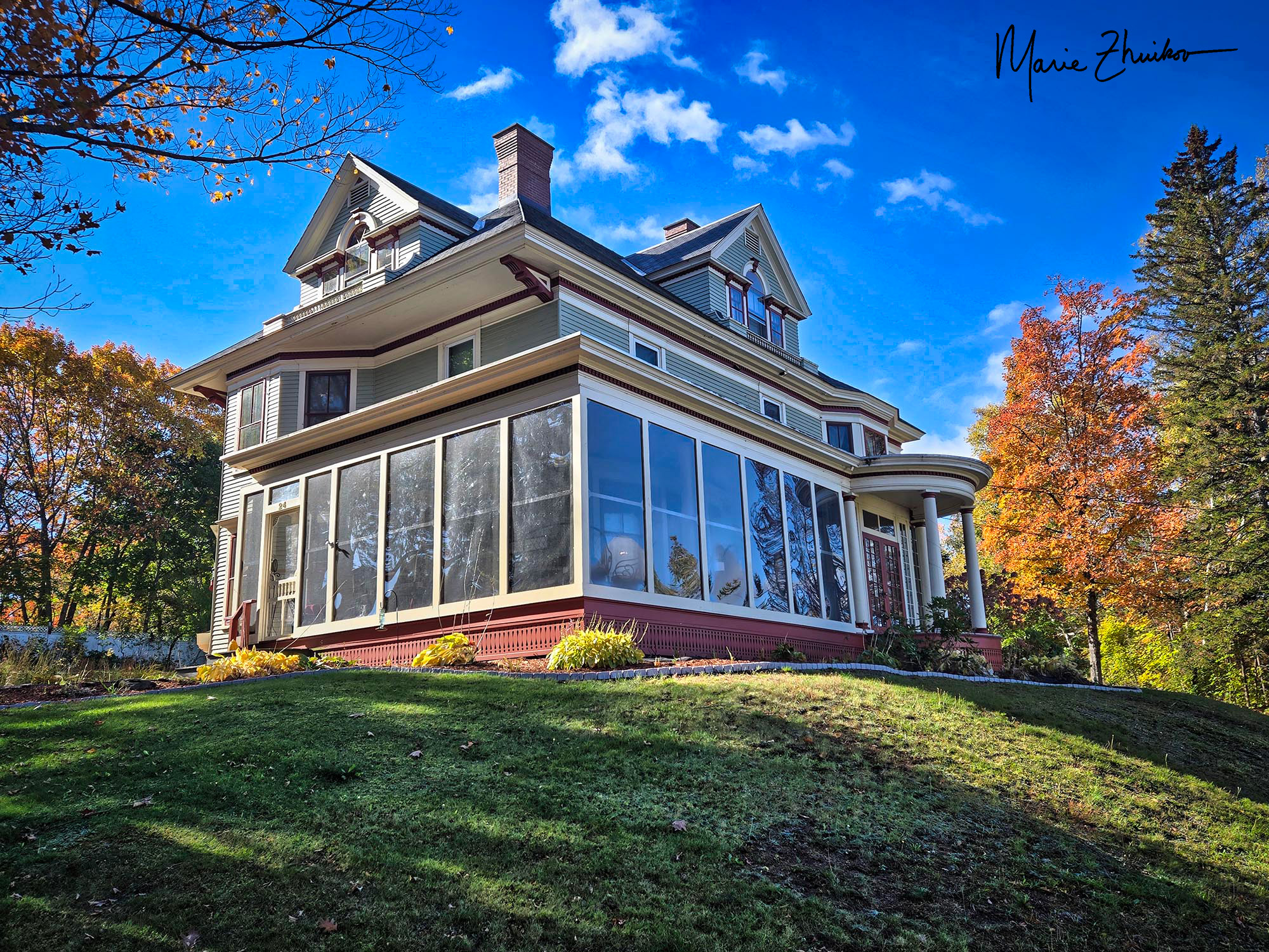
By the way, if you ever stay in Guilford, the Bed and Breakfast is the place to go! The colonial Victorian is run by John and Lisa McNamara, new transplants from Georgia. They’re also active members of the historical society and the community. They spoiled us with homemade gourmet breakfasts made to order. In the evenings, we enjoyed a cocktail in the inn’s Hummingbird Lounge when we weren’t curled up with a book in front of the library fireplace.
The Guilford Bed and Breakfast
We ate other meals at the Red Maple Inn. If you want a taste of “real backwoods Maine” and superb service, that’s the place!
Guilford Historical Society Museum
During our museum visit with Brian and Cindy, we were excited to meet a Herring cousin. She and I compared genealogical charts and figured out how we might be related. We were also happy to see the “mother’s chair” at the museum. When Robert Lowe Herring brought his family from New Gloucester, Maine, to Guilford via ox cart, this was the chair his wife, Mary (Polly) Wagg, sat on for the week-long trip. The chair was then passed down through the family and later donated to the historical society. I got to actually touch this piece of history!
The Herring “Mother’s Chair”
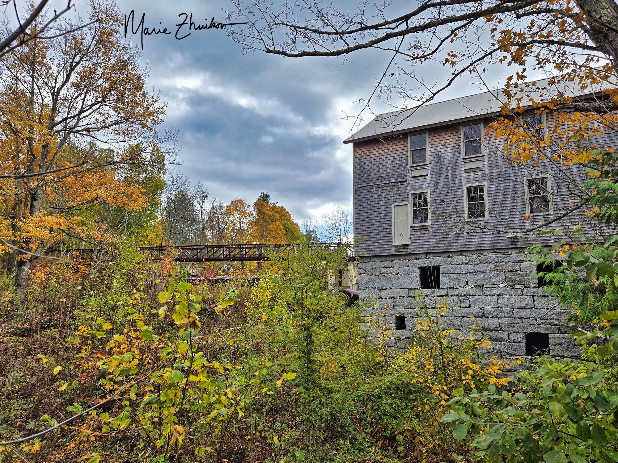
My newfound cousin showed us Herring photos that I had not seen before. Afterward, she drove with us to the cemetery was in town and showed us where some Herring graves were located. Then we parted. Russ and I drove to Guilford Center and toured the cemetery and Baptist church there. This is where the family first settled. We also drove across Lowe’s Bridge, a covered bridge named after Robert Low), and past Herring Brothers Meats store, which the family owns. We even took a walk along the Piscataquis River where Robert Lowe Herring built a sawmill. (I learned the hard way from locals that the river’s name is pronounced pis-CAT-a-qwis not PIS-cat-a-qwis.)
Lowe’s Bridge in Guilford. It’s been rebuilt a time or two due to flooding.
Both Robert Lowe Herring and his father had eleven children each. Robert Lowe Herring died in 1847, about a year after from the heartbreak of seeing his youngest son, Alvin, die in a tree-felling accident.
Historical accounts (Sprague’s Journal of Maine History) say that Robert Lowe Herring was “well-fitted for pioneer work. Robust in mind and body, no combination of obstacles and hard labor changed his course once he determined upon the accomplishment of a certain purpose. He enjoyed overcoming difficulties-the greater they were, the greater his satisfaction when they were surmounted. The sight of suffering, in man or beast, moved him to tears. No one was ever turned from his door unwarmed or unfed. No neighbor in difficulty or distress ever appealed to him in vain for aid.”
I found another good story about Robert Lowe Herring in the History of Piscataquis County. It involves his neighbor, Ephriam Andrews. This poor neighbor was “afflicted with a morbid and partially insane state of mind . . . Although surrounded with good neighbors, he would drive his plow team all day with an axe on his shoulder, fearing that some of them would take his life.” Ephriam was a Revolutionary War veteran, so it could be that his mental health issues stemmed from that experience.
Ephriam’s sons regarded him as dangerous. They “prepared a small cage and shut him in. But he was marvelously ingenious in contriving and making escapes. They would capture him and force him back, and this would aggravate his insanity and rage.”
The breaking point came one spring in 1814 when Ephriam escaped. His sons surrounded him, trying to recage him. “He had armed himself with a small axe, and brandishing it, bade them stand off at their peril. But his youngest son, Samuel, then about fourteen years old, not believing that he would strike, daringly pressed up. The enraged father struck him a full blow in the face with the edge of the axe – nearly a fatal stroke.”
Ephriam was then jailed. His son recovered but carried an ugly scar the rest of his life. After being released from jail, Ephriam’s wife left him. The one person he seemed to trust was Robert Lowe Herring. Ephriam gave him all his property, and Robert let him live with him and his family. The arrangement seemed to work.
“There he had a good home, lived in listless ease, and sought his own entertainments. . . He died suddenly on his ninetieth birthday in Mr. Herring’s house.”
Can you imagine having a would-be axe murderer living in your house?! It says a lot about Robert’s character that Ephriam trusted him and that no more physical harm ensued, even though Ephriam’s “evil spirit would at times return.”
Ancient Family History
One of my Guilford cousins directed me to a book in the museum (Connor Genealogy) that contained information about Herring ancient history. This info was compiled by Menzies Herring, a family genealogist who lived in Massachusetts years ago, and Jerome Campbell Herring. Menzies used to mail questionnaires to Herring relatives across the country and perhaps that’s where he learned the history.
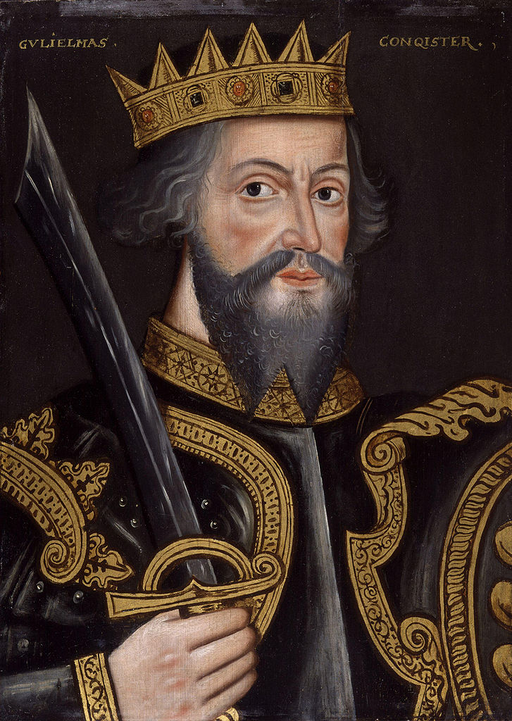
William the Conqueror image courtesy of History on the Net.
The family supposedly originated in Denmark. (My note: possibly in a town with a name that sounds like “herring,” which could either be Herning or Hjørring). They became Viking raiders and eventually settled in Normandy. A Herring ancestor was a “commander” in the Norman Navy under Rollo, the Norman chief who became the first Duke of Normandy. As such, this Herring was given the Norman title of Viscount. Generations later, another Viscount Herring supported William the Conqueror, who sailed from Normandy and overthrew the English King Harold II during the Battle of Hastings in 1066. Viscount Herring then remained in England to help William hold onto his new kingdom. He was then given the English title of Baronet.
That’s where the ancient history stops. It agrees with my genetic testing, which indicates Nordic ancestry in the distant past and then more recent ancestry from France and the British Isles. In recent research, I have found a number of Herrings on the British Peerage website; however, it appears that the records only go back to the early 1600s. These Herrings are associated with Lambeth Palace in London, and one Herring (Thomas Edward) was even the Archbishop of Canterbury (head of the church in England). Looks like I’ll need to do some sleuthing!
The Herrings in Minnesota
Getting back to the Maine Herrings, my branch of them ended up in Minnesota after Robert Lowe Herring’s daughter, Charlotte, married William Weymouth. They migrated with their daughter, Olive, to Ripon, Wisconsin, perhaps for the opportunity of timber or their own farmland. Olive married a Mainer named John Andrew Potter, and they were one of the pioneer founding families of Springfield, Minnesota, where my mother was born a few generations later. The family was known for their Hereford cattle breeding operation, and they owned the Potter Stockyards in Springfield.
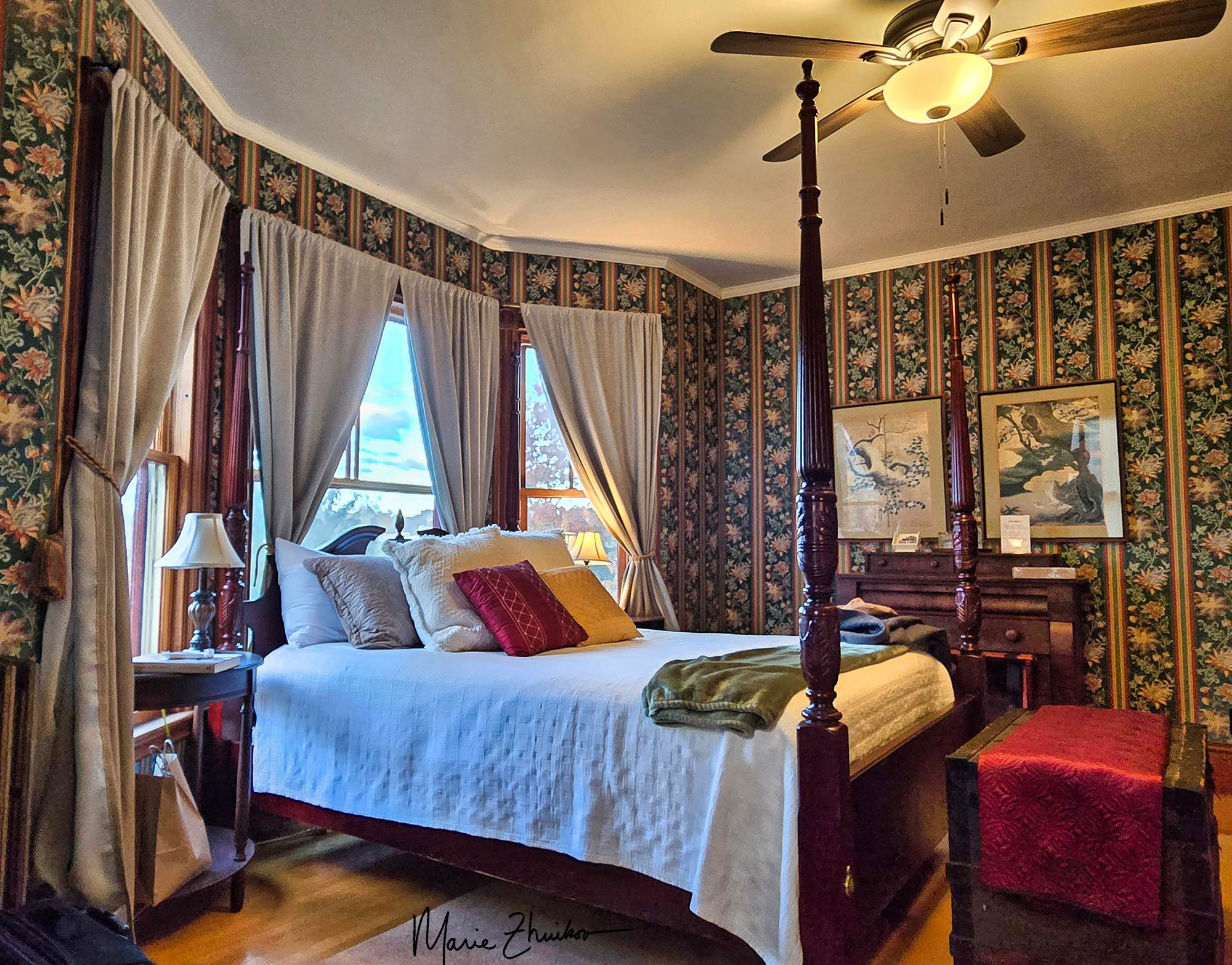
Our bedroom at the Guilford Bed and Breakfast
I don’t know if we’ll ever have the chance to return to Guilford, but I was so thankful for this opportunity to connect more with my family’s history and to meet “new” relatives. After two days in Guilford, we drove to Bangor and then flew home. This eleven-day trip was epic on so many levels, and I’m a different person because of it.
Conclusion
I felt the most “at home” in Maine. That’s probably because the landscape is similar to Minnesota’s. It’s wilder and has more “natural” nature than states like Connecticut or Vermont. The land just “is” and doesn’t seem like it’s been specially preserved as natural. However, Maine and its kind people have a hardscrabble existence. Piscataquis County has the least densely populated area in Maine, just over 17,000 people (only 3.9 people per square mile), although it’s the size of Connecticut. Social challenges like drugs and poverty show in the houses and the people. There’s an underlying feel that the state is more like one portrayed in a Stephen King novel than a cozy seaside mystery novel.
I enjoyed reconnecting with Russ’s relatives and seeing sites related to his family. He feels a bit bad that his family didn’t found a bunch of towns like mine did, but I remind him that my ancestors made it here about a hundred years earlier than his. There were more opportunities to found towns then.
Seeing the sites involved in the beginning of our country has driven home the values that went into the conflicts. I’ve vowed to do what I can to uphold those values and continue the legacies my ancestors began.
This trip also brought a whole new meaning to my traditional holiday dish of pickled herring. (For some strange reason, Russ doesn’t share my delight in this culinary delicacy.) I have an enhanced appreciation for it now that I know more about my Herring ancestors.
That’s it. The trip’s done, finally! But the effects will reverberate for years to come, I’m sure.
Russ and I left Waterbury and meandered through the rest of Vermont and New Hampshire on our way to Maine. Our goal was a small town north of Bangor named Guilford, which my ancestors founded. But on our six-hour road trip, we took a slight jog to Freedom, Maine, to visit The Lost Kitchen, a place featured in one of our favorite cooking shows.
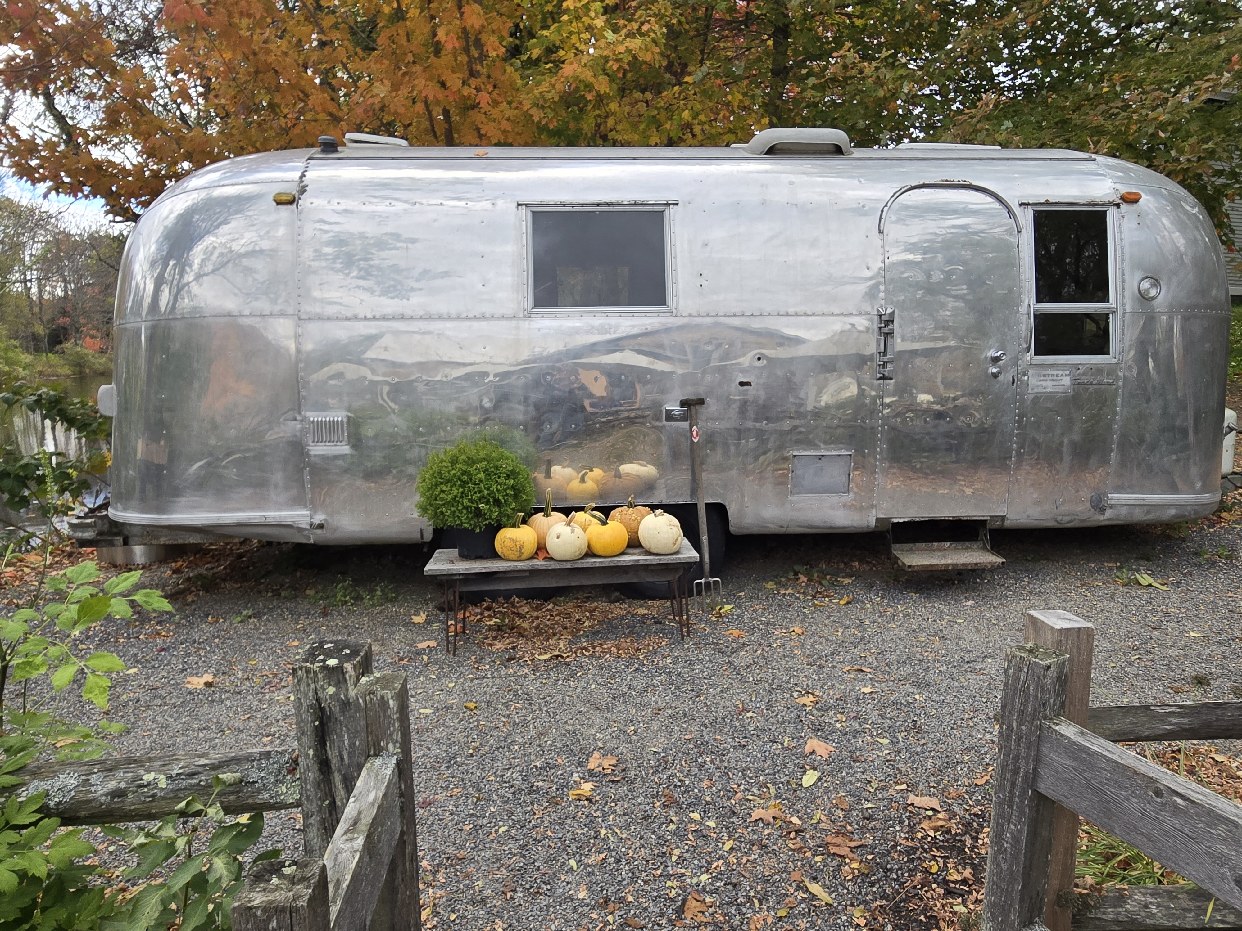
The Kitchen is run by Chef Erin French and her crew and is named after a restaurant she once owned in Belfast, Maine. She lost the restaurant because she had a really mean husband who closed it down and fired everyone while Erin went into treatment for substance abuse. (You can read all about it in her memoir, Finding Freedom.) She also lost custody of her son to the mean husband. But Erin got clean and slowly pulled herself up by her Maine rubber bootstraps. She ditched the husband, regained contact with her son, and began her own mini restaurant in a refurbished Airstream trailer.
She still has her trailer, but along the way, she was able to buy an old mill in her hometown of Freedom. It’s situated on a pond in the middle of town. I’d been to Freedom in the past – once filled up at a gas station there and bought a red T-shirt that featured a moose filling his Model T with gas that said something about Beautiful Downtown Freedom, Maine. I swear, that T-shirt lasted twenty years! I wore it every time I worked out, and it served me well. It is long gone, however.
I was excited to return to the town and visit Erin’s Lost Kitchen site that we’d seen so often on TV. Her show is on the Magnolia Food Network, which is available via streaming through Discovery+. We’d watched all her episodes, which focus on her local farm-to-table foods that she feeds to guests (chosen by a lottery, which we entered last year but did not win). Her restaurant is open for dinner at all times of year, except for winter, when the staff hibernates.
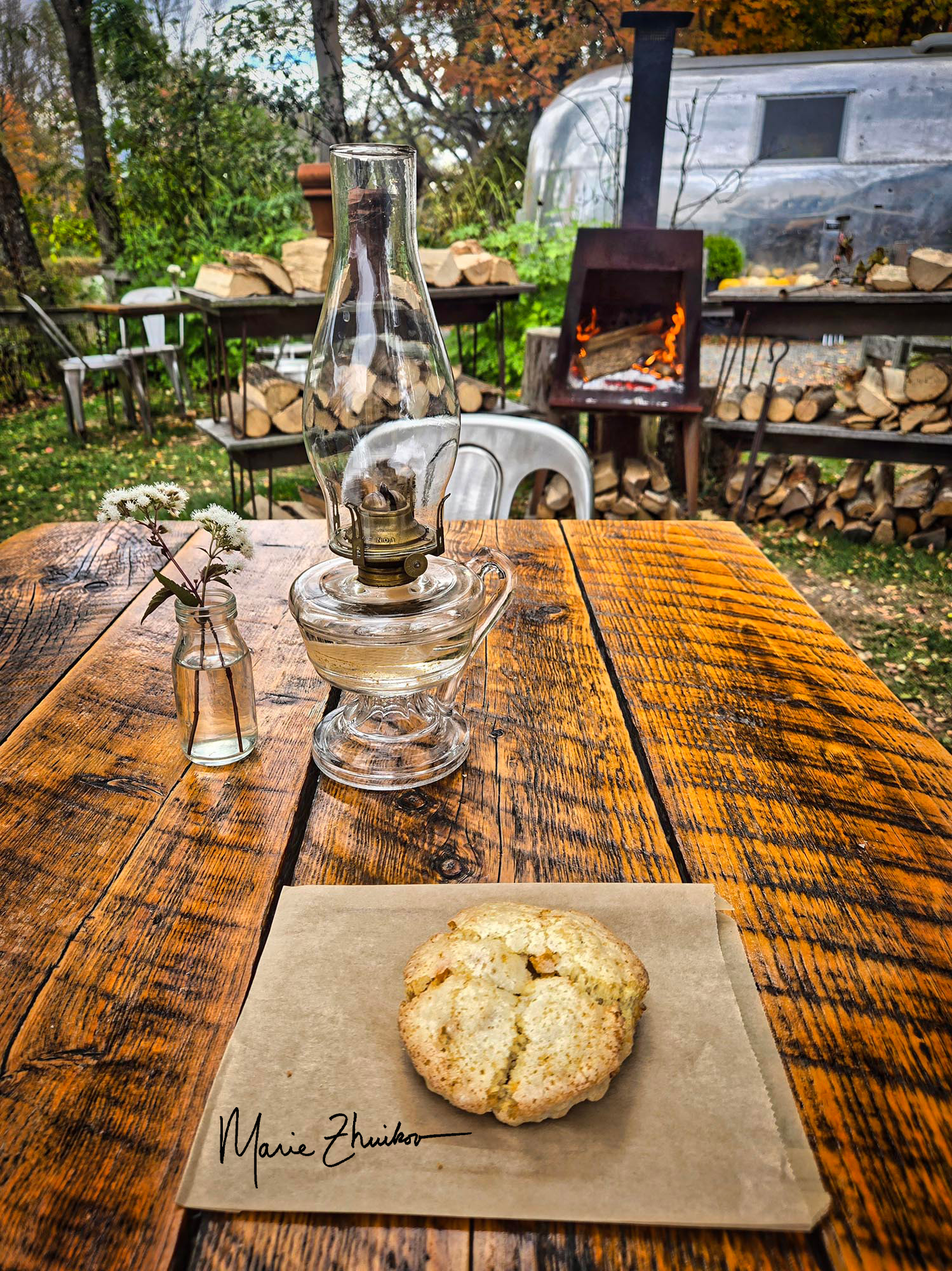
One of the memorable scones that we ate.
Our fall drive through New Hampshire would have been beautiful except for the leaf colors muted by drought and a viewshed clouded by rainy mist. When we arrived at The Lost Kitchen mill, we visited the kitchen’s café, which features fresh-baked goods and other light lunch fare. We ordered a candied apricot and ginger scone. It turned out to be fresh-from-the-oven warm. OMG, so flaky and good!
In addition to the café, Erin also has a cooking store on-site. I bought some candlestick stickum (to make taper candles stick in their holders despite the candles or the holders being off-kilter), a pastry brush (which we needed for our cabin), a sourdough bread-rising bowl, and a gluten-free cookbook that one of the staff members (who we saw on TV!) recommended.
Then we went back outside and wandered around the grounds. We crossed the famous bridge over the mill pond, which is featured in the TV show, and ended up buying yet another scone (not so warm this time) and eating it in the outdoor dining area near Erin’s Airstream.
The Lost Kitchen mill pond.
One thing that struck me is that the mill site looked smaller in real life than it does on TV. But it was still exciting to see it. Also, it’s surrounded by old Maine houses that could use paint jobs. (Which they would never show on TV.) That’s one thing that struck me about our drive through this state. I’ve been to Maine several times over the years, but I don’t recall so many houses that need attention. I fear that the state and its occupants are suffering financially.
We did not glimpse Erin or her new husband, Michael (a media executive who probably helped get her show on TV), but we were still so thankful to spend a bit of time in the reality of this place. Methinks that Erin’s ex is eating his heart out now. (Smile.)
Then we hit the road to Guilford. More on that, next!
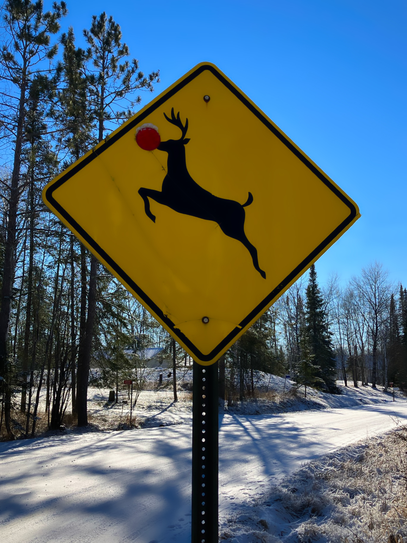
Here’s wishing you a Merry Christmas the Minnesota way! I took this photo near my cabin. It’s a typical rural Minnesota scene, except perhaps for the red reflector on the deer’s nose. I found the sign this way — I did not add the reflector! Rudolph’s red nose has since fallen off, so I’m glad I took the photo before that happened. This sign provided the design for our custom-made Christmas cards this year — the first time I’ve done that and maybe not the last. Because I retired this year, I’ve had time to write cards and pop them in the mail. It’s been fun “going retro” this season.
We hope you have a wonderful, whimsical holiday, and thank you for reading.