One of the tranquil views from the Prairie Overlook Trail in William O’Brien State Park.
Russ and I meandered south a couple of hours to camp along the St. Croix River in William O’Brien State Park. We chose the park mainly for the location – we wanted to visit the river towns of Stillwater and Afton, both of which are not far south – but we plan to return again someday because of the great accommodations and the views – oh, the views!
Visitor can choose from two campgrounds at the park. We chose the Riverway Campground because it was closest to the river, and we are water people. After setting up camp our first night, we visited Stillwater and took advantage of its foodie options. We ate at the Marx Fusion Bistro – excellent food and drinks – much better than camp food. That was a treat for us — who usually camp in the middle of nowhere.
Back at our trailer, we enjoyed a fire and a visit from three fat racoons who quickly checked our site for food. Finding none, they waddled off to the next site.
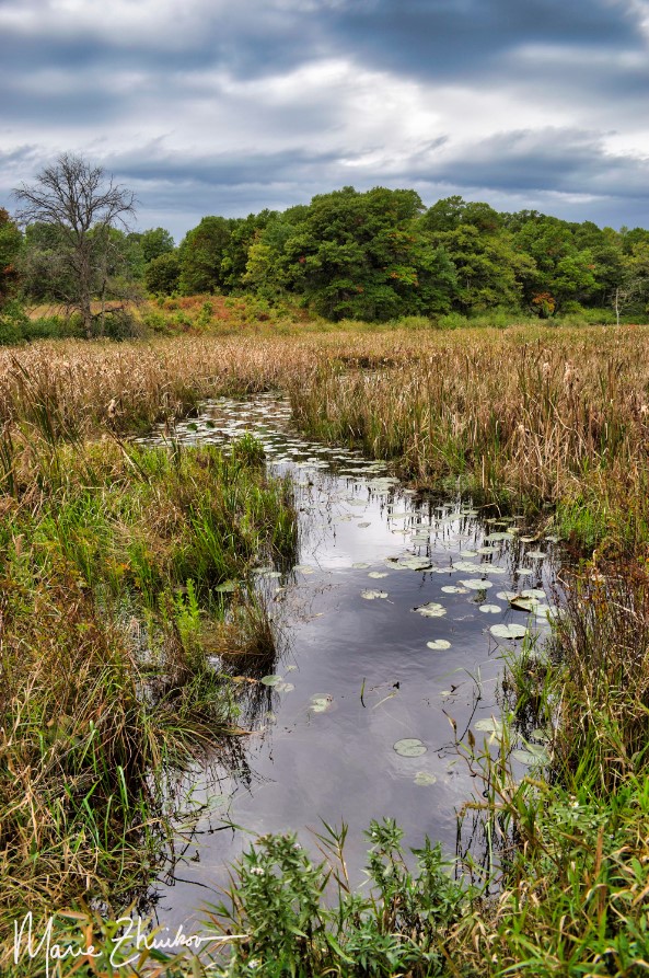
The next morning, we walked the 1.6-mile Riverside Loop Trail near the campground. The trail passes through old white pines along the river and then turns inland a bit, meandering by Lake Alice, which is named after the daughter of William O’Brien, a lumberman who used to own the land that’s now the park. Two bald eagles graced us with their presence, performing aerial acrobatics.
Later, we took a nine-mile (round-trip) bike ride to the small town of Marine on St. Croix. We explored its short main street and stopped to visit an old lumber mill site featuring a short trail and interpretive signs. The mercantile in town looked like it could accommodate any forgotten food needs, plus there’s a coffee shop that touts its cold-press coffee as “best in the valley.”
We sipped our coffee while sitting in the town’s gazebo/band stand in a small park just across the street from the shop. The town was so quaint and picturesque, I felt like I was in a gosh darn Hallmark Channel movie.
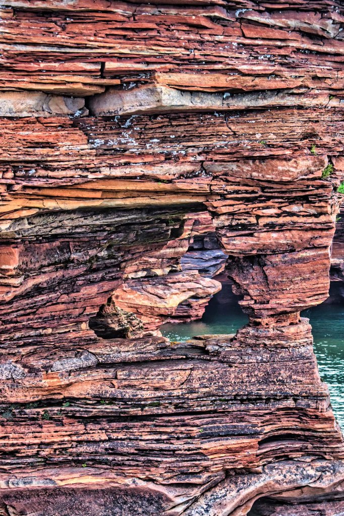
A view of the St. Croix River from the Riverside Trail. I call this one, “X Marks the Spot.”
After supper, we revisited the Riverside Trail and made good use of one of its benches to watch the moon rise above the clouds lining the river. Barred owls hooted their “who cooks for you?” calls and Canada geese honked as they flew to their nightly roosting waters.
As we fell asleep back inside our trailer, the quiet of the night was interrupted by a pack of coyotes who yipped to each other.
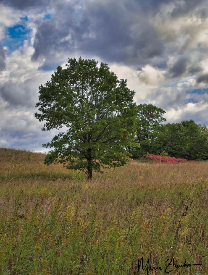
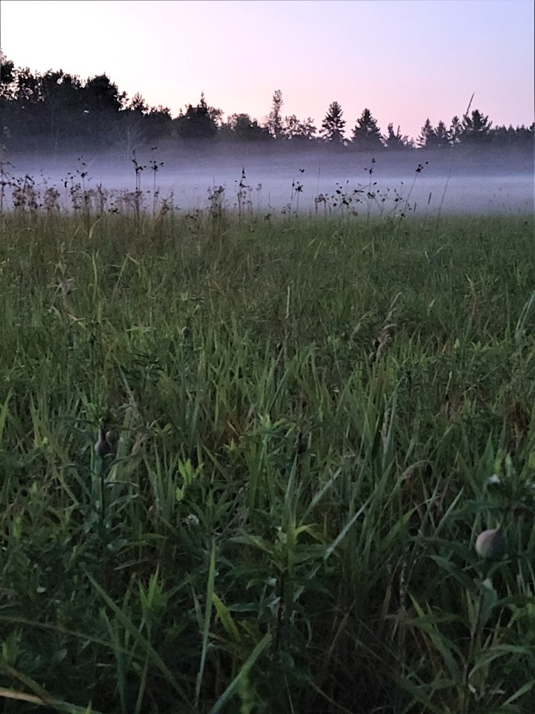
On our final morning in the park, we drove a few miles to hike the Prairie Overlook trail through a restored oak savanna. The trail loops around a small lake. As I hope my photos attest, everywhere we looked was a feast for the eye. Seas of sumac had turned red and lined the trail.
The day was overcast, and the rain conveniently waited until we reached our car to begin. The drops came down, steady and persistent, so once back at the campground, we packed up and headed home.
Once upon a time on Outer Island in Lake Superior, a lumber company cut much of the remaining old growth hemlocks and other trees to make baby furniture. The lumberjacks lived in a camp near sandstone ledges on the shore. They used a railroad built by previous loggers through the middle of the island to haul the heavy logs to a dock for shipping to shore. Eventually, the crew built an air strip so they could go home on weekends.
The company that used the wood was Lullabye Furniture of Steven’s Point, Wisconsin. By the 1960s, logging on the island cost too much, so the men left their camp. They also left behind the buildings, old trucks, a stove, a water tank.
Slowly, the forest took its revenge. Snow knocked down the buildings, the trucks rusted, animals carried away seat cushion stuffing for their nests. The forest regrew, swallowing the lumber camp and reclaiming the land as its own.
Last month, I meandered out to the most remote spot in Wisconsin: Outer Island in the Apostle Islands National Lakeshore in Lake Superior. Now, the folks on Washington Island off the Door County Peninsula in Lake Michigan might argue that they live in the state’s most remote spot. I guess it’s all in how you define “remote.”
The Milwaukee Journal gives Outer Island this distinction. However, the rest of the internet says it’s Washington Island.
To check on which place is really the remotest, I consulted with the Wisconsin State Cartographer’s Office. Jim Lacey, associate state cartographer, said he has not tried to define such a spot in the state yet. Is it defined as the farthest outpost of civilization that a person can easily reach, or is it the place farthest from any roads and the hardest to reach?
We went back and forth a couple of times about a worthy definition. Lacey agreed that it wasn’t very hard to get to Washington Island – all a person needed to do is pay for a ferry, drive their car onto it, and they’re set.
The spiral staircase that leads up to the top of the tower.
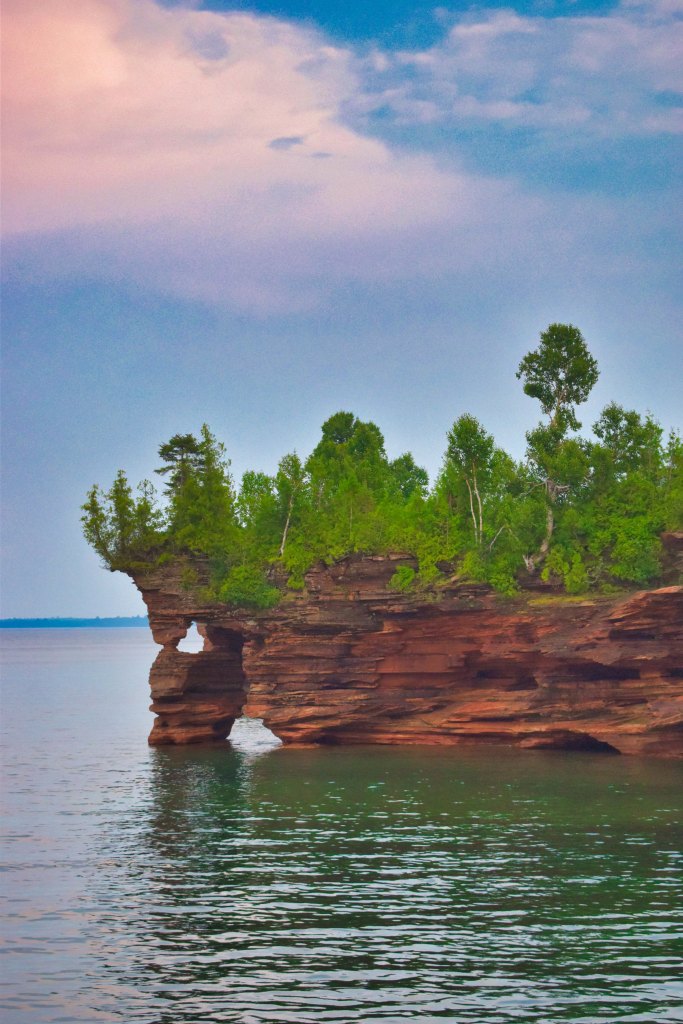
Outer Island, on the other hand, is twenty-eight miles from the port of Bayfield, Wisconsin, has no ferry and no roads. To get there, a person either needs to have their own boat, spend a couple days paddling a kayak, or pay a small fortune for a water taxi. A water taxi is basically a private motorboat ride. That’s how I traveled to the island last month.
Lacey said, “To sum it up, I’m afraid I don’t have a very satisfying answer for you! I think this is one of those situations where a deceptively simple question gets very complicated, very quickly.”
But, to my way of thinking, the difficulty of access and the lack of civilized conveniences makes Outer Island the “winner” for the remote spot title.
Anyway – I had a great time camping on the island. Visiting the place again reminded me of a research project, which never quite worked at the lighthouse, in part, due to the island’s remoteness.
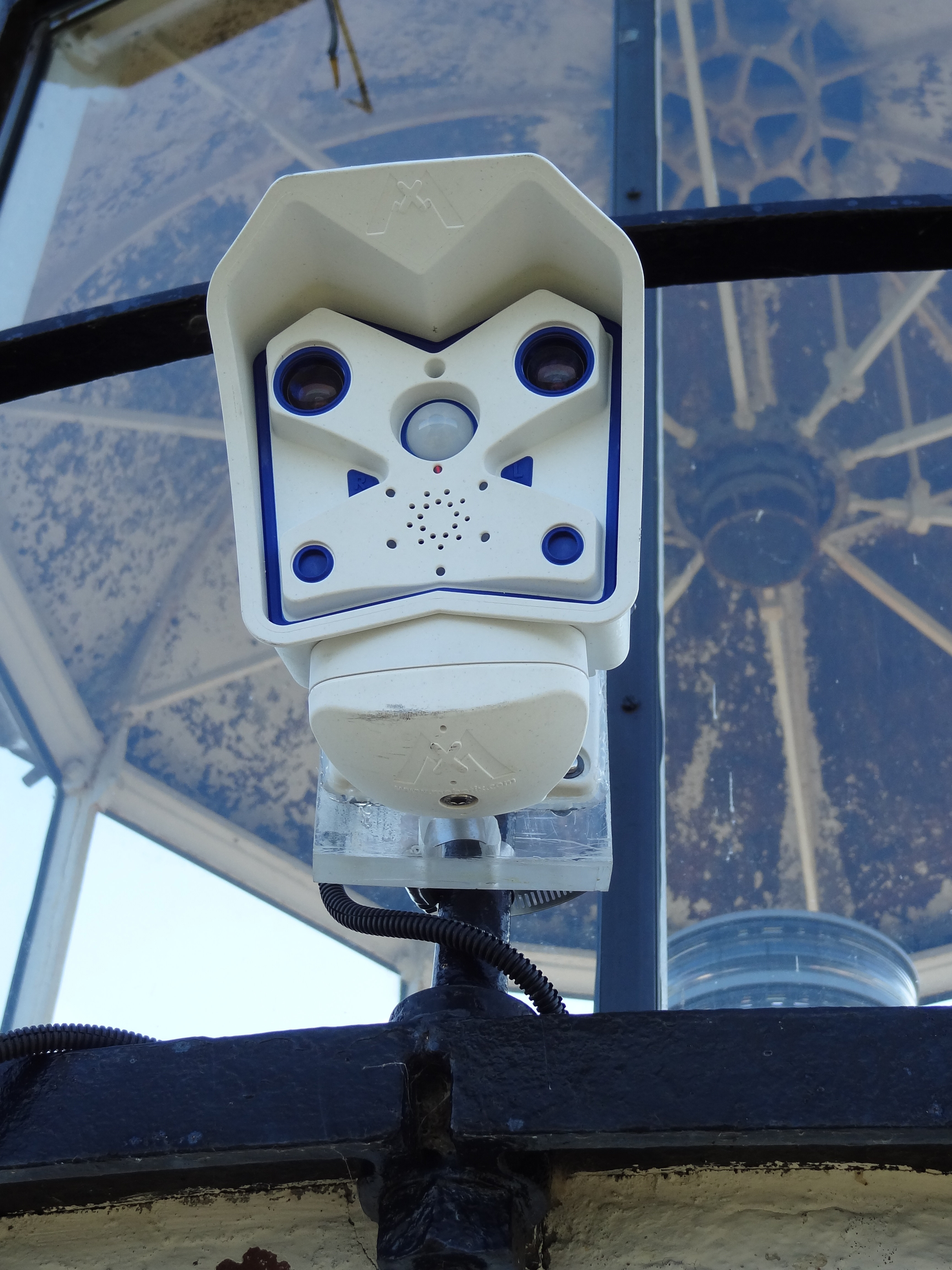
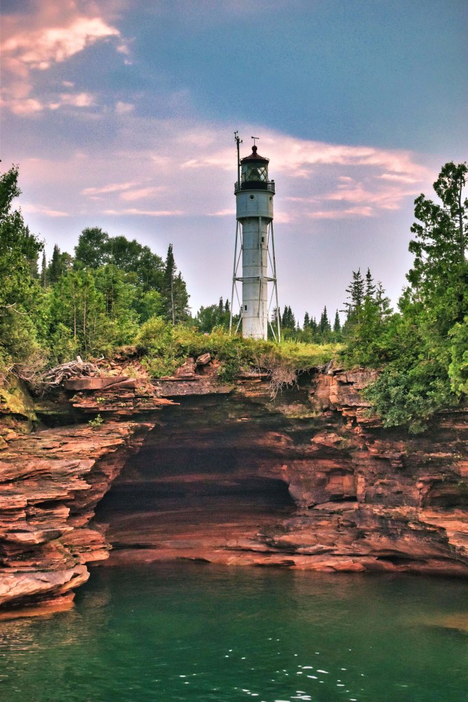
Nine years ago as part of my job with Wisconsin Sea Grant, I accompanied Chin Wu, a researcher from the University of Wisconsin-Madison, to Outer Island. His goal was to install a webcam atop the lighthouse to track the development of rogue waves and wave patterns off the island’s coast.
Hooking the webcam up to the solar power grid on the lighthouse.
The National Park Service was cooperating with the project, so they drove our small research team out to the island for the installation. Once at the island, the park service staffer let us into the lighthouse and led us to the top of the tower.
We installed the camera and plugged it into the solar power system atop the lighthouse. Thankfully, the day was calm and warm, so hanging around outside ninety feet in the air wasn’t too scary.
I took some great photos, but they were never published because the project didn’t pan out. Why? The webcam needed a cell phone signal in order to transmit the photos. Back then, the cell phone system wasn’t powerful enough on the island for this to work.
The doomed webcam.
Even smart people need to learn things the hard way, sometimes, I guess. It just goes to show that science doesn’t always work out despite the best of intentions. But these photos are too cool to waste, so here you go. Mr. Wu has since gone onto conduct other projects in the Apostle Islands, which were much more successful, such as this WISC-Watch website, which provides tons of info about wave and wind conditions.
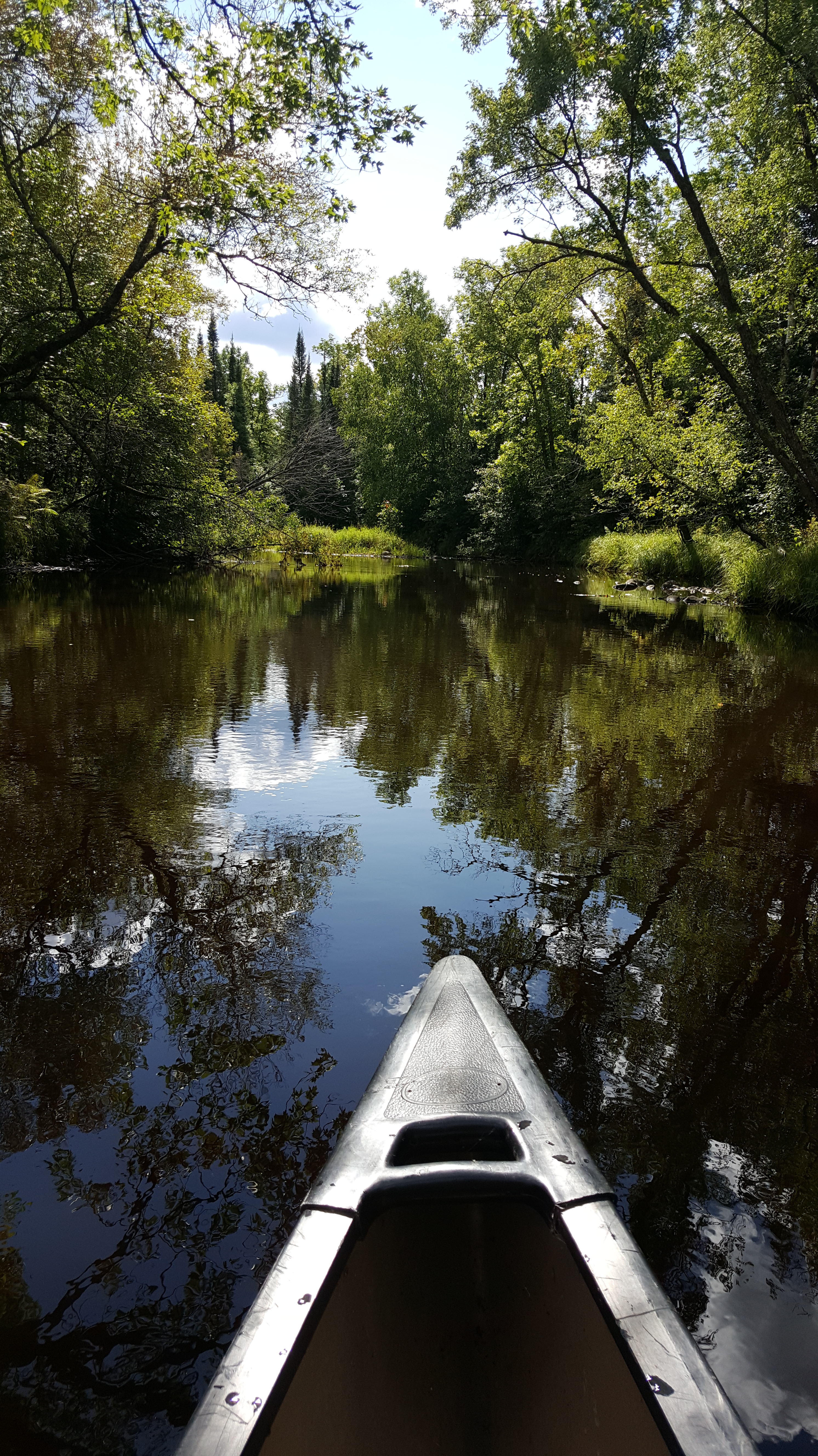
A story that began as a post on this very blog was recently published by “Northern Wilds” magazine. It details an adventure Russ and I had canoeing down the Whiteface River in northern Minnesota. As I began writing it, I quickly realized its magazine potential. So, I didn’t post it here.
…I marveled that a trip that takes about five minutes by car could take three hours by canoe. But in a car, we would not have had the wonder of the white birds, a mermaid, and a lightning-blasted pine. Now, we have a mental map of the liquid emerald that flows beyond the screen of trees bordering the road.
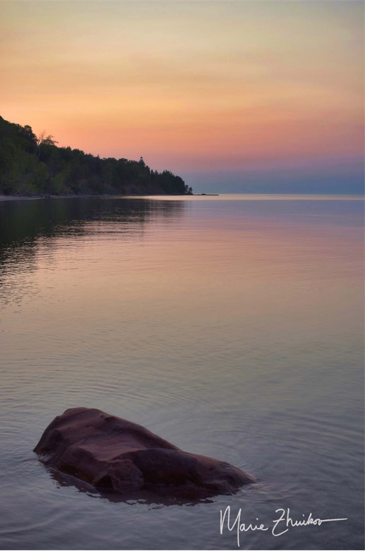
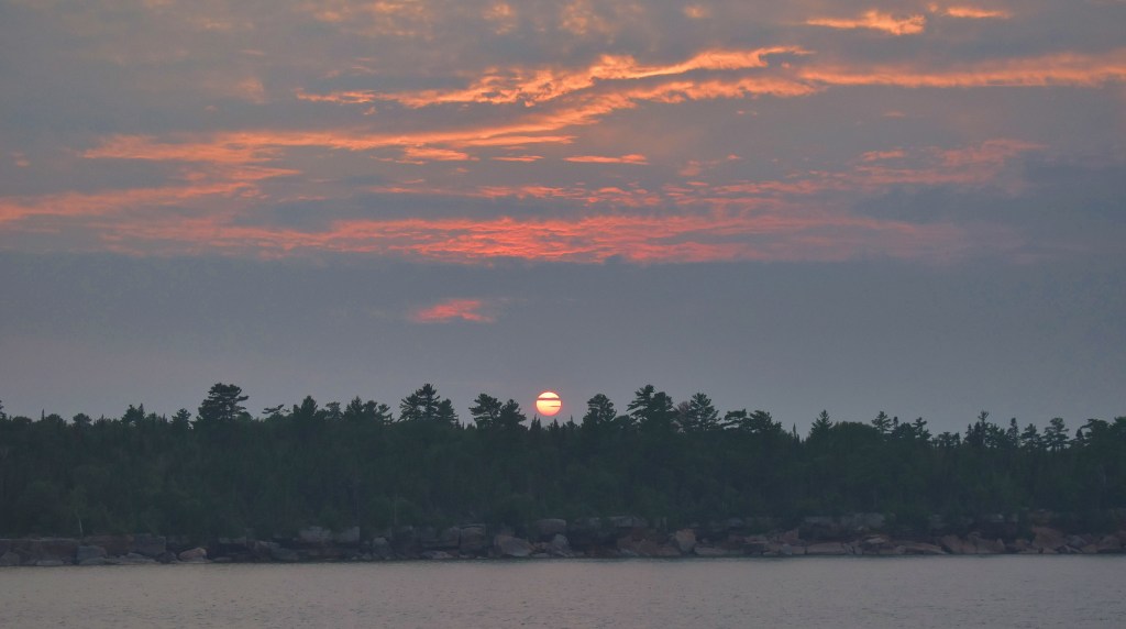
Russ and I meandered to the Apostle Islands National Lakeshore last month. We had the privilege of camping on Outer Island for two glorious, warm nights. Lake Superior was so calm, we could hear ore boat engines quietly throbbing even though they were dozens of miles away as they passed the island.
I took this shot from the beach near the lighthouse. You can just see the lighthouse over the tops of the trees by the dock. A wave-worn rock provided a perfect foreground. Can you feel the peace?
I’ve never had time to just hang out somewhere and take photos for a week. That’s what I was able to do (thanks to my awesome workplace) earlier this month. I took a landscape photography class at the Madeline Island School for the Arts.
Madeline Island lies off the Bayfield peninsula in northern Wisconsin. It’s adjacent to (but not part of) the Apostle Islands National Lakeshore.
The class focused on sunrise and sunset photography. This made for long days, but it was worth it. The class was life-changing and life-affirming. I knew I had a good eye — I told my fellow students I learned photography “by osmosis” from my mother — but I’ve never had any formal training in it. An F-stop? ISO? What are those? I got a crash course and affirmative feedback, but am still learning.
I’d like to share some of my favorites from the week with you. Locations include Joni’s Beach, Grant’s Point, Big Bay State Park, Black Shanty Road wetlands, the art school grounds, and Devil’s Island.
As always, feel free to use my images, but please give me (Marie Zhuikov) credit.
Our water toys await launch into Jeanette Lake in the Superior National Forest.
If someone ever wanted to successfully torture me for information, all they would need to do is stick me in a dark room full of mosquitoes. Between the incessant buzzing and the blood-sucking, I would divulge anything anyone wanted to know. I’d even make up stuff if it would get me out of that hellhole faster.
I was reminded of effective torture methods during our inaugural night at Jeanette Lake Campground in northern Minnesota’s Superior National Forest. Russ and I arrive late on a Friday night with our Scamp trailer. The site we had reserved months before was the only one available in the government system for the dates we desired. It was situated in dense woods near a wetland along the lake. Mosquitoes love wetlands. They also love the dark. And, they apparently love my ankles.
We set up camp between mosquito slaps, amazed that so many bugs were still alive when our summer has been so dry. I’d expect swarms like this earlier in the season, not in mid-July, but I guess this year has been a good one for them.
Somebody (and I’m not naming names) left our camper door open too long. By the time we were ready to sleep, our trailer was filled with mosquitoes. We spent a good forty-five minutes trying to kill every last one before we went to bed.
But you know that ONE mosquito always survives. They will hunt you down during the night, buzzing insistently around your pillow as you try to sleep.
After a few belated kills, we were serenaded by the mosquitoes that had collected outside on our window screens. Such a lovely way to drift off into dream land!
In the morning, I was loath to leave the trailer. Still demoralized from the night, I envisioned cutting our weekend camping trip short due to the bugs. Russ was awake and out before me. I noticed he stayed outside for a long time. Wasn’t he getting eaten alive?
Thankfully, it turned out he wasn’t. As I took my first cautious steps outdoors, he sat, smiling, at the picnic table, coffee in hand. The mosquitoes were nowhere near as numerous as the night before. Maybe our camping trip wouldn’t be a bust, after all.
I first learned of Jeanette Lake over thirty years ago when I spent a summer as a photojournalist volunteer for the LaCroix Ranger District in the Superior National Forest. I’d driven past and through the campground a few times on my way to other places. With its islands and white pines, the glacier-carved lake looked like one that should be in the Boundary Waters Canoe Area Wilderness. The thought of being able to drive to it and camp appealed to me, but I never had the chance until now.
We ate our breakfasts and took a walking tour of the campground, which offers about a dozen sites. Two are walk-in. Backcountry sites are scattered around the lake and on the islands for those who want to work harder (by paddling or boating) for their camping experience.
A few of the non-reservable sites were empty, including a picturesque one right on the lakeshore. I noticed it had perfect access to the water for kayaks or paddleboards, both of which we brought with us. A nice breeze off the lake would keep mosquitoes at bay.
After we returned to our site and got talking, Russ said he had paid for our site at the pay station that morning while I was sleeping. My brain was beginning to work by that time, and I remembered that I had paid for our site when I made our reservation.
So, we had paid for two sites. Why not move to the better one? The Forest Service might frown upon such practices, but it seemed like a good idea to us, so we packed up and moved out of the wetlands and to the lakeshore. Later, we told several people who were looking for campsites about the free one they could have that was under our name, but nobody took us up on it. Gee, do you think that might have had something to do with MOSQUITOES?
Our non-mosquitoey campsite.
We spent our Saturday paddling the lake, resting on a tiny island covered in jack pines and blueberry bushes (the berries were ripe). We also hiked on the Astrid Lake Trail, which can be accessed from the campground near the walk-in sites. After the trail crosses the road (the Echo Trail), it wanders through a black spruce bog. If you look closely, you’ll see rare pitcher plants. Farther on, glacial erratic rocks — huge boulders dropped by glaciers as they retreated and melted 10,000 years ago — dot the sides of the trail in the forest.
We spent the evening around a campfire, admiring the red orb that served as a sunset in skies hazy from northern wildfires. As the sun disappeared, the mosquitoes reappeared, but in more manageable numbers.
Ferns growing on an ancient glacial erratic boulder along the Astrid Lake Trail.
Sunday morning, we mountain-biked on the Echo Trail, which is the gravel road that provides access to this part of the land. After a quick dip in the lake, it was time to pack up and head home. Along the way, we made a lunch stop at the Montana Café in Cook, Minnesota, the town where I was stationed during my volunteer stint. The café was another one of my old haunts and I was glad to see it was still in business. They have great malts and burgers.
Despite the best efforts of the mosquitoes, we were able to salvage this trip down memory lane. If you’re interested in a touch of wilderness with easy access, don’t be put off by all my whining about mosquitoes; put gorgeous Jeanette Lake on your list.
Two shed skins from a garter snake that lived near our site. We also had a camp chipmunk and cottontail rabbit.
I’ve posted several times about the “River of Poems” project on my blog. I’d like to let you know we (as in Wisconsin Sea Grant and the Lake Superior Reserve) finally got around to publishing this book of river poems from poets around the world.
To refresh your memory, in 2020, we sent out a call for river poems for The River Talks speaker series we hold with the Lake Superior National Estuarine Research Reserve. Poets were offered the opportunity to read their poems via Zoom during one of the River Talk monthly presentations.
Poets from across the world responded. With help from a judging committee, we narrowed the pool to a dozen poets, who read their works in March 2021 in conjunction with the St. Louis River Summit. The event was so moving, and the poems so well received, we created a publication to showcase them. “A River of Poems,” is now available as a free download.
In “I Held Us on for 36 Hours After the Levee Broke to Hell,” Heather Dobbins tells the story of a family who spends the night atop a phone pole to escape a raging river.
In “Catching Your Drift,” Lorraine Lamey highlights the subtle humor in natural resource regulations for a river in Montana.
Poet Ron Riekki shares how water can be an antidote for PTSD from war in “It Took a Long Time to Discover.”
A river in Detroit burns in Derold Sligh’s “Rouge River” poem, heralding a cry for environmental and social justice.
Doing a sitting spinal twist yoga pose in the Duluth-Superior Harbor. I’m on the left. Willowy younger person is on the right. (Image courtesy of North Shore SUP.)
You probably already know that I love doing yoga. I also love paddle boarding. Well, I finally had the chance to combine both these pastimes by taking a standup paddleboard yoga class the other day.
The opportunity was offered by North Shore SUP (also known as Duluth SUP even though they are located in Superior). Their business is run out of Barker’s Island in the Duluth-Superior Harbor. Owners Heather and Garrett are great – so enthusiastic about sharing their love of paddle boarding with everyone. I first learned how to paddleboard with their help eight years ago, when I began this blog.
My main fear was that I would fall off the board and make a fool of myself in front of the other students. Because keeping my fear to myself is boring and not blog-worthy, I broadcast it to everyone else by alerting my Facebook friends that I planned to do SUP yoga and then asked how many times they thought I would fall. They had much more faith in me than I had myself. They didn’t think I would fall, or that if I did, the water would be refreshing.
The evening was warm and fairly calm, with a haze of smoke in the air from the wildfires in Canada and northern Minnesota. Two younger women joined me in the class. After some conversation, I discovered it was their first time SUP yoga-ing, too, which made me feel better. The 1-1/2-hour class costs $30, which includes the board rental. I thought that was a good deal. It’s offered every Tuesday and Thursday evening, weather permitting.
We began by paddling our boards around the tip of Barker’s Island to a spot sheltered by trees from prying eyes. That also made me feel better because fewer people would see me fall. We anchored our boards in the shallows with a five-pound weight wrapped around the ankle leashes.
Katie, our instructor, started us off with some basic poses, including tips on techniques to maintain our balance. I would say the poses were Level One difficulty (which equals easy), but when you do them on a floating board, that automatically makes them Level Two. Combined with some boat wakes, the poses reach Level Two-Point-Five.
The other women were taller than I am, with long limbs that looked so elegant with each pose. Then there’s me, with short arms and legs. I looked like a yoga blob (see photo), but at least I didn’t fall!
Actually, I wouldn’t have minded falling. The air temps were hot and cooling off would have been nice. But big chunks of algae were floating in the water, along with dead bugs. It did not look appetizing for swimming. The water quality issues are only temporary, though, so don’t let that turn you off from trying SUP yoga.
My favorite part was the final resting pose, where you lay on your back, looking up to the sky. Although traffic noise from the nearby highway was audible, blissing out was still possible.
Class over, I asked the others what they thought. They all said they enjoyed it and would try it again. I agreed. It was wonderful!
A display in the lobby of the Greyhound Bus Museum.
A former landlady of mine was the first to inform me that the Greyhound Busline had its start in northern Minnesota – Hibbing, to be exact. One of her relatives had a hand in beginning it. Our conversation was years ago. I’m not sure if the Greyhound Bus Museum had been built yet or even why the topic came up, but one thing was sure: she was proud of that heritage.
During one of our recent quests to bike different sections of the Mesabi Trail, Russ and I had the opportunity to visit the bus museum – it was located in the same parking lot as the trailhead for the section that runs between Hibbing and Chisholm.
The first thing we noticed was the air conditioning. After biking seventeen miles in eighty-five-degree heat, it was a godsend. The clerk noticed our biking gear and immediately informed us where we could refill our water bottles (unlimited!) at the drinking fountain.
Festooned with a red, white and blue beaded “tie” necklace in celebration of the fourth of July, the attendant explained how we could tour the museum and access the pushbutton audio and video presentations in the exhibits. Although we were the only visitors at the time, others must have come before us because the attendant bragged that her tie was the “talk of the bike trail” and that other cyclists had encouraged trail acquaintances to at least stop into the museum to see her festive tie. A shiver of patriotic privilege passed through us, or was that the air conditioning?
I would have been happy just spending time in the lobby, as it housed what ended up as my favorite artifact: a black velvet painting of a Greyhound Bus. How classy can you get? It also featured a recreated bus ticket office, complete with a mannequin attendant.
My favorite artifact.
After paying a modest $5 per person, the tour began with explanations of the people and machines that comprised the first bus line, which was developed for iron ore miners who lived a couple of miles away from their work in the small town of Alice, Minnesota (which no longer exists – it was incorporated into Hibbing later). From these humble beginnings in 1914, Greyhound became an international business that’s still running today, although not in northern Minnesota anymore.
While perusing the handmade exhibit panels, it soon became evident that grammar was not the museum founder’s strong suit. Some visitors had taken it upon themselves to correct mistakes on the signs in pen, which you don’t see every day.
A fake bus with seating provided a comfortable place to watch an extended video about the origins of the busline. Since we were tired from our ride, we sat through most of it. The video seemed to have been produced in the 1980s, because the timeline stopped after that point. It was fun to watch as an example of how videos used to be made, back in the day, but also for the history.
From there, we progressed to the attached bus garage, which houses different eras of busses. My favorite was an art deco bus from the 1950s. Its red and yellow streamlined shape was so appealing. A dozen creepy (and sometimes gender-bending) mannequins made up a diorama of how Greyhound aided the war effort in WWII.
The World War II mannequins.
If you look behind the bus that is the focus of the diorama, you’ll see the purgatory where museum managers must store misbehaving mannequins. A sailor mannequin was separated from his hands, and others were in pieces between the bus and the wall.
Another creepy thing is that the museum is located next to a graveyard. The garage area is supposedly haunted, with reports of bus windows and doors opening and closing by themselves, as well as sightings of apparitions, including a young girl. Did she get left on a bus? Or is she visiting from the cemetery, looking for an eternal ride? Although we did not experience any ghostly activity, I sure did get strange vibes from those mannequins!
We thoroughly enjoyed our trip through the museum. It’s a local labor of love that must have taken a lot of time and effort to create. If you’re ever near Hibbing, it’s a must-see.