Pancakes, Anyone?

Each of these ice pancakes is about three feet across.

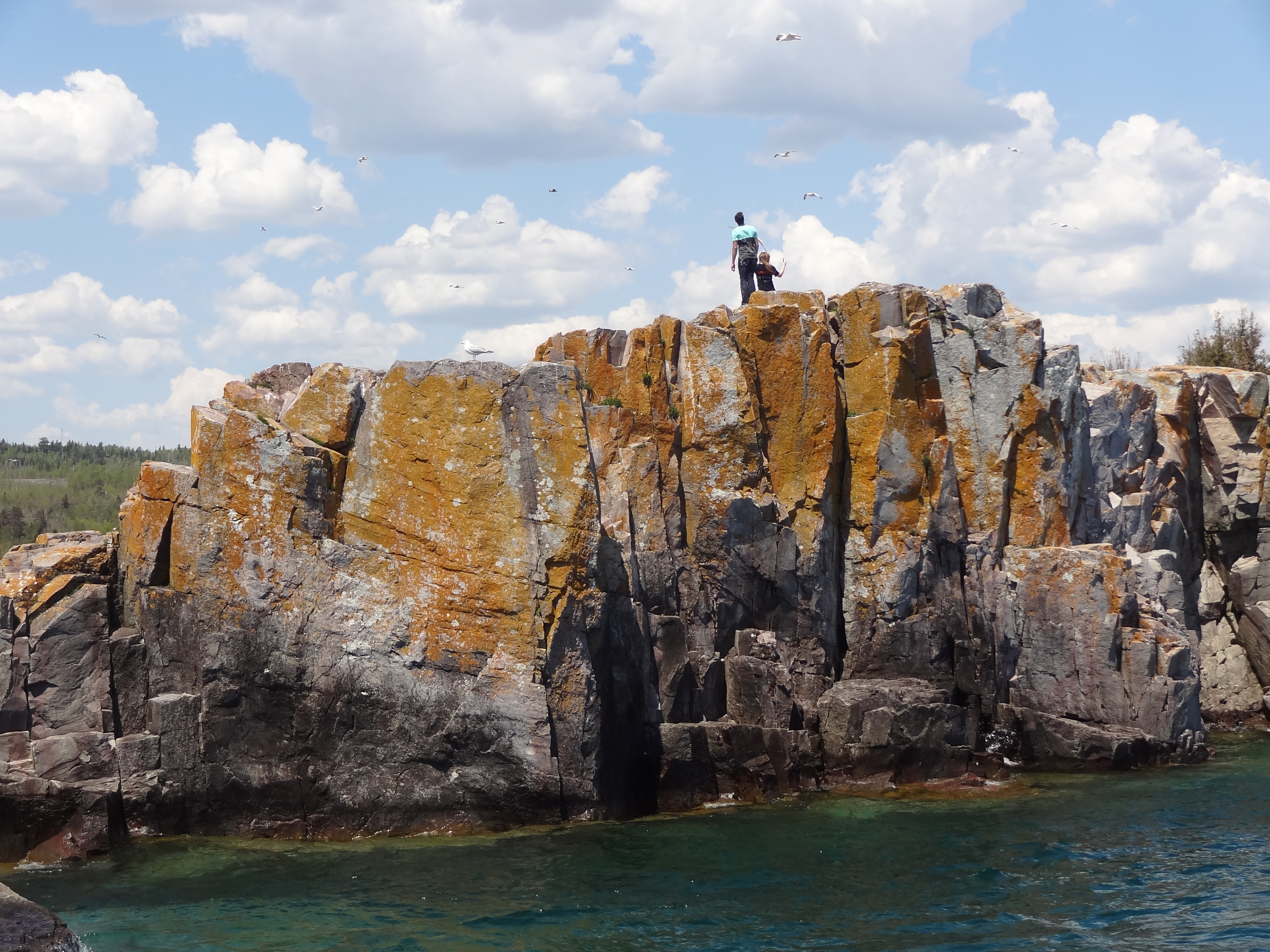
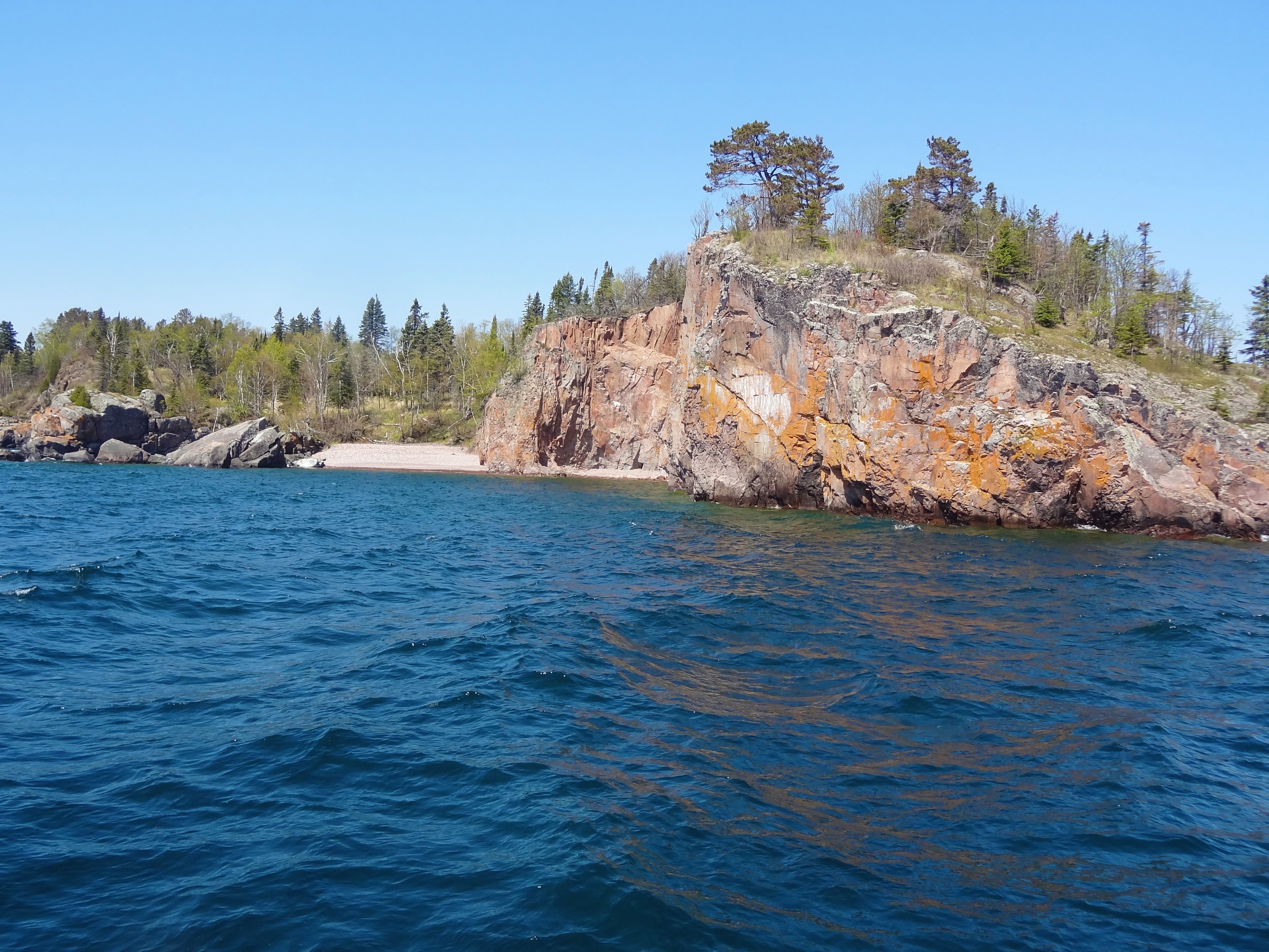
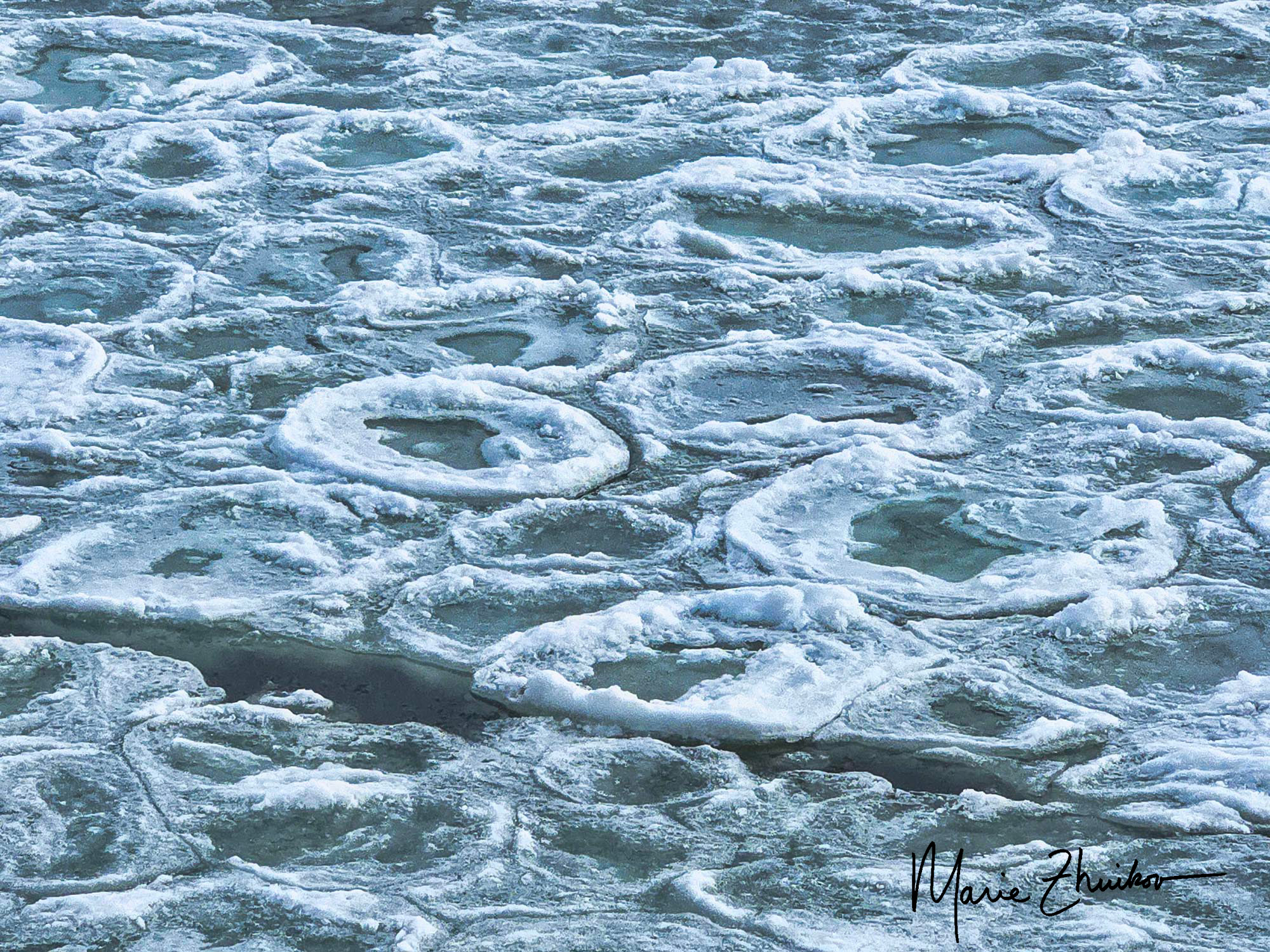
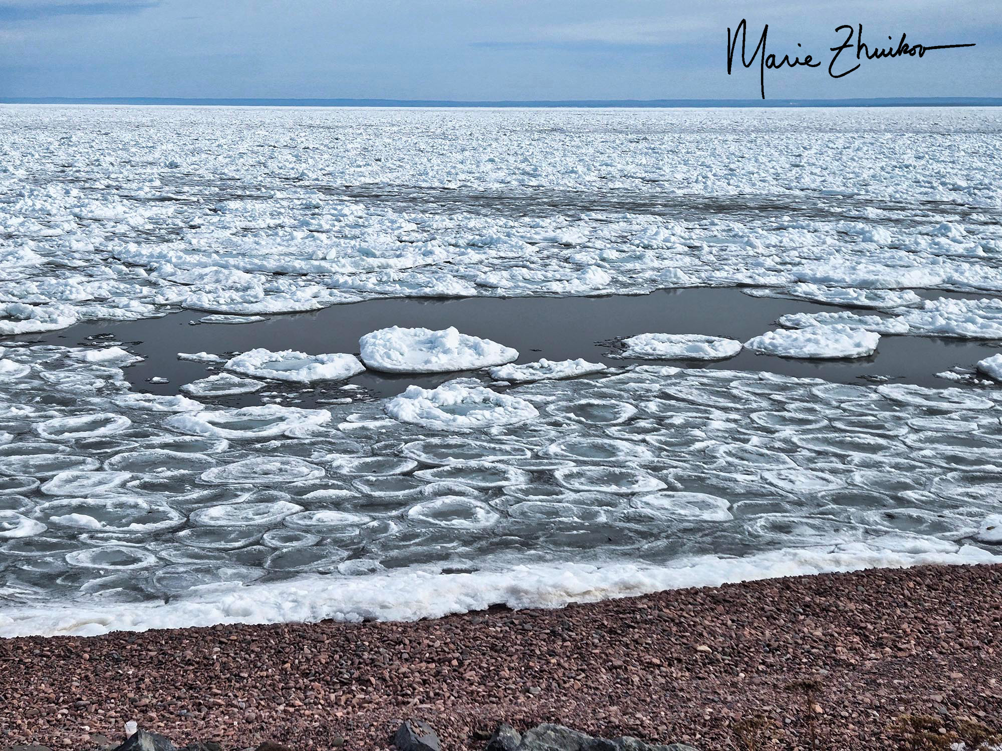
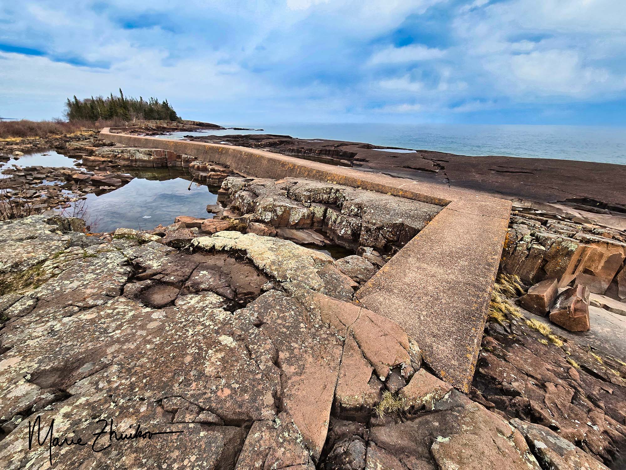
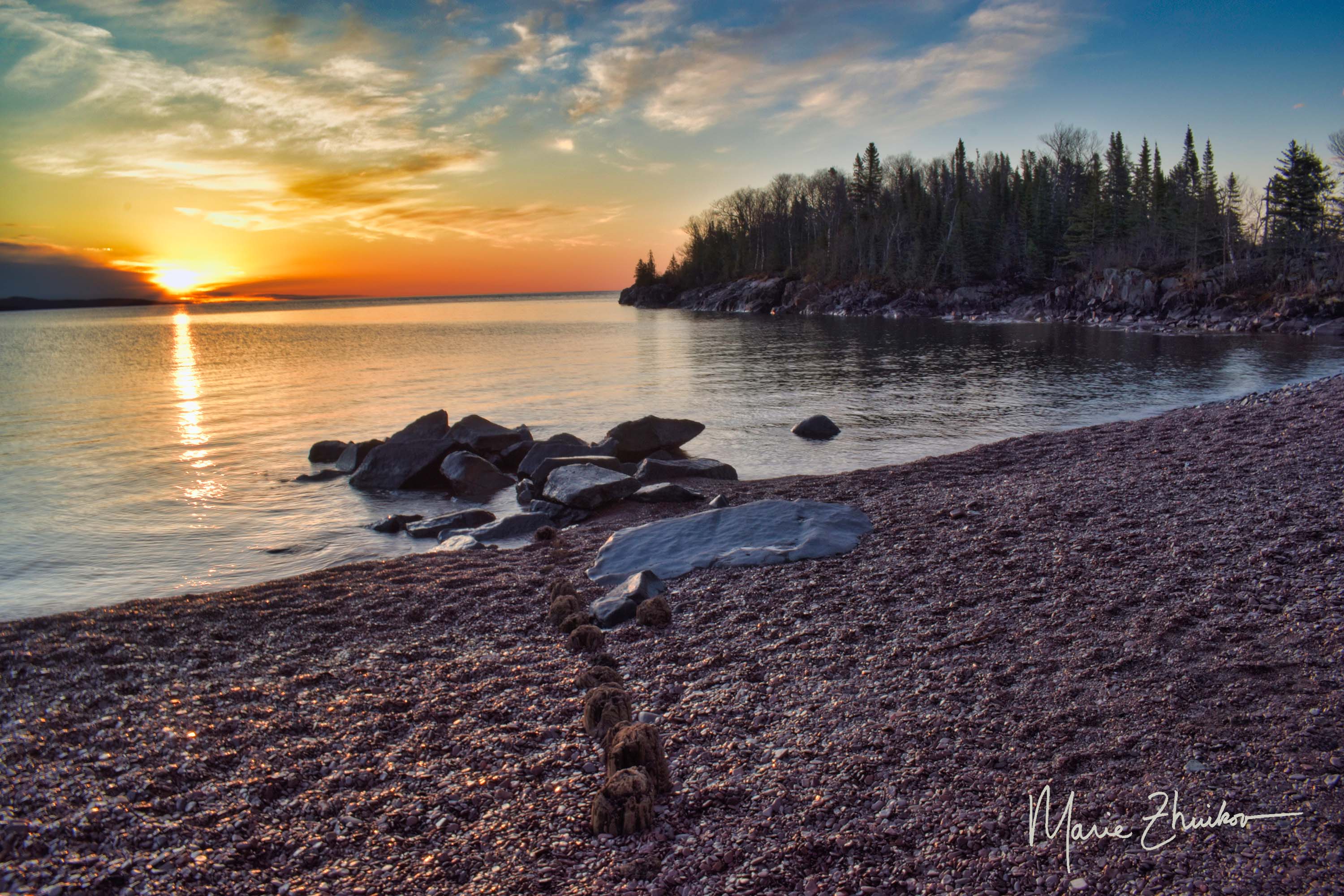
Winter is loosening its cold, hard grip on Lake Superior. One sure sign of spring is pancake ice. Sorry for the misleading title—these pancakes are not edible. But I suppose they are, if you like chewing ice.

Pancake ice on Lake Superior with Duluth’s iconic aerial lift bridge in the distance.

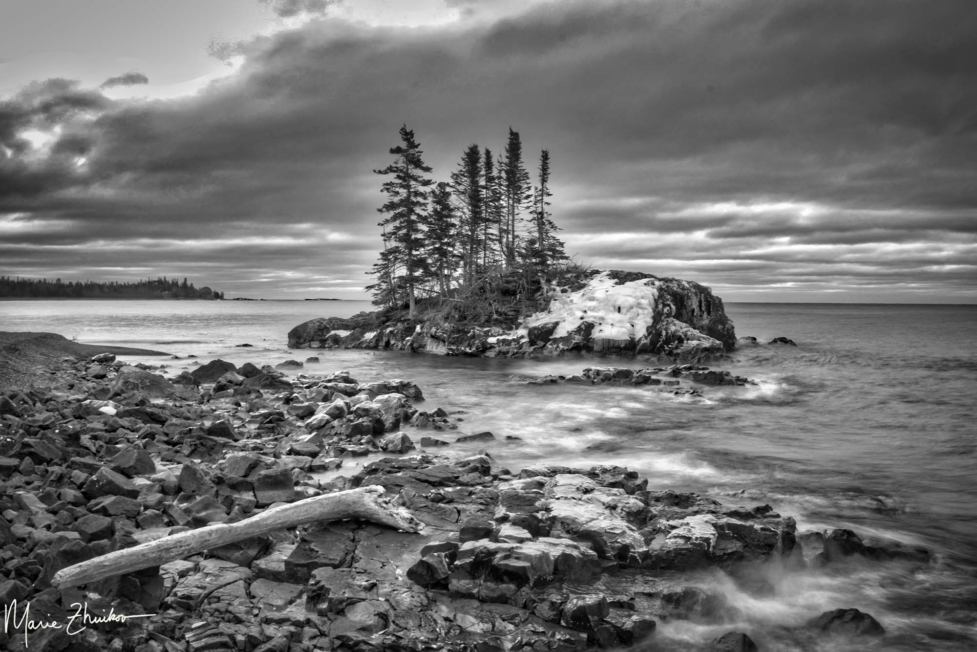
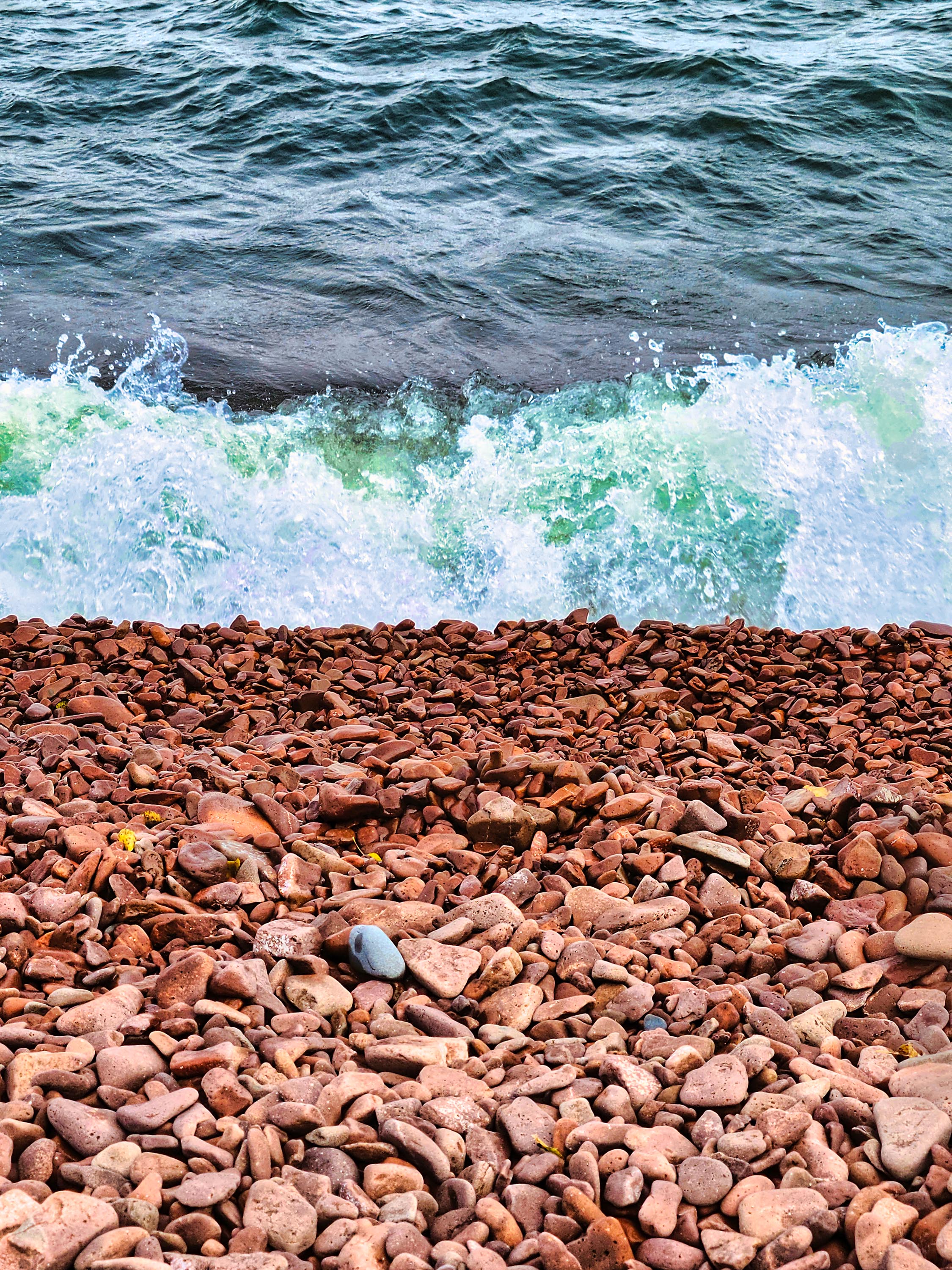
Pancake ice can form in early winter, too, but in spring it occurs when the ice begins to melt and waves or wind blow the ice chunks around. The wind whistles over the lake, carrying the crisp scent of melting ice and the freshness of open water. The ice chunks slap against each other like bumper cars at a fairground. The pancakes form circles with ridges along the sides, their surfaces glistening under the pale, watery sunlight. Pancake ice can also form on open water when it gets cold and ice crystals freeze and then break up and are blown around. This phenomenon can also occur on rivers and in the ocean.

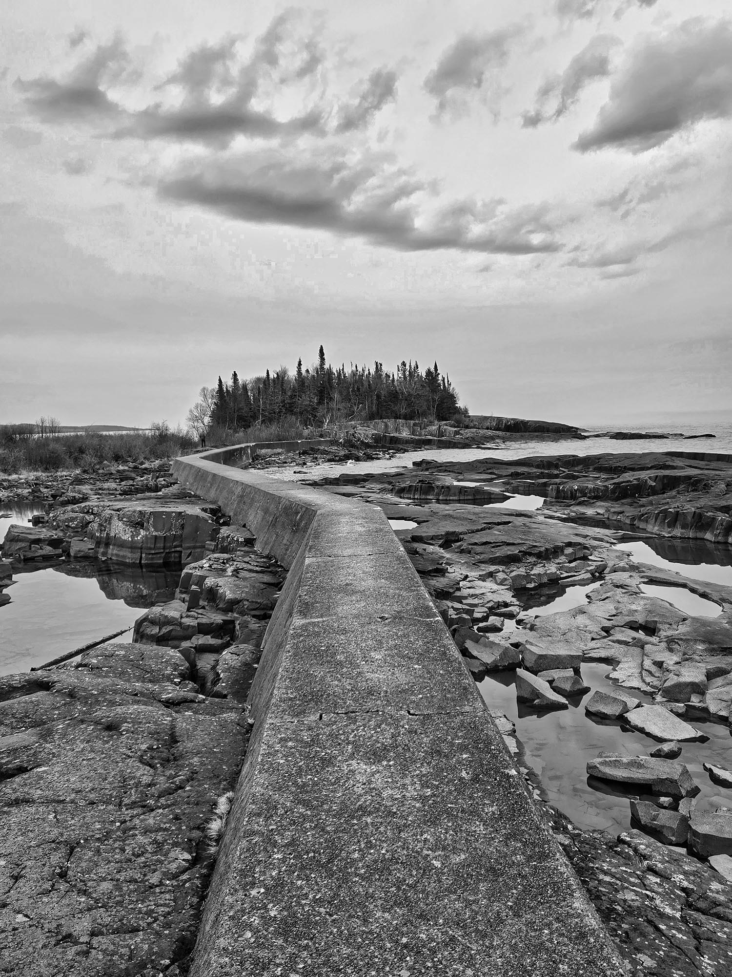
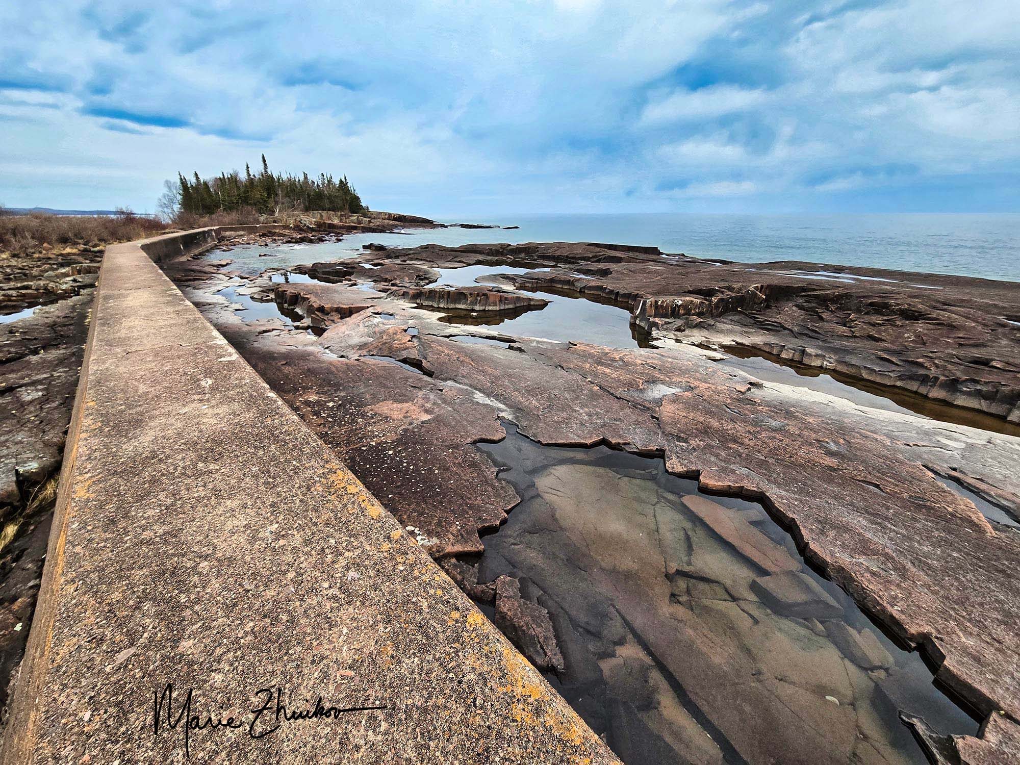
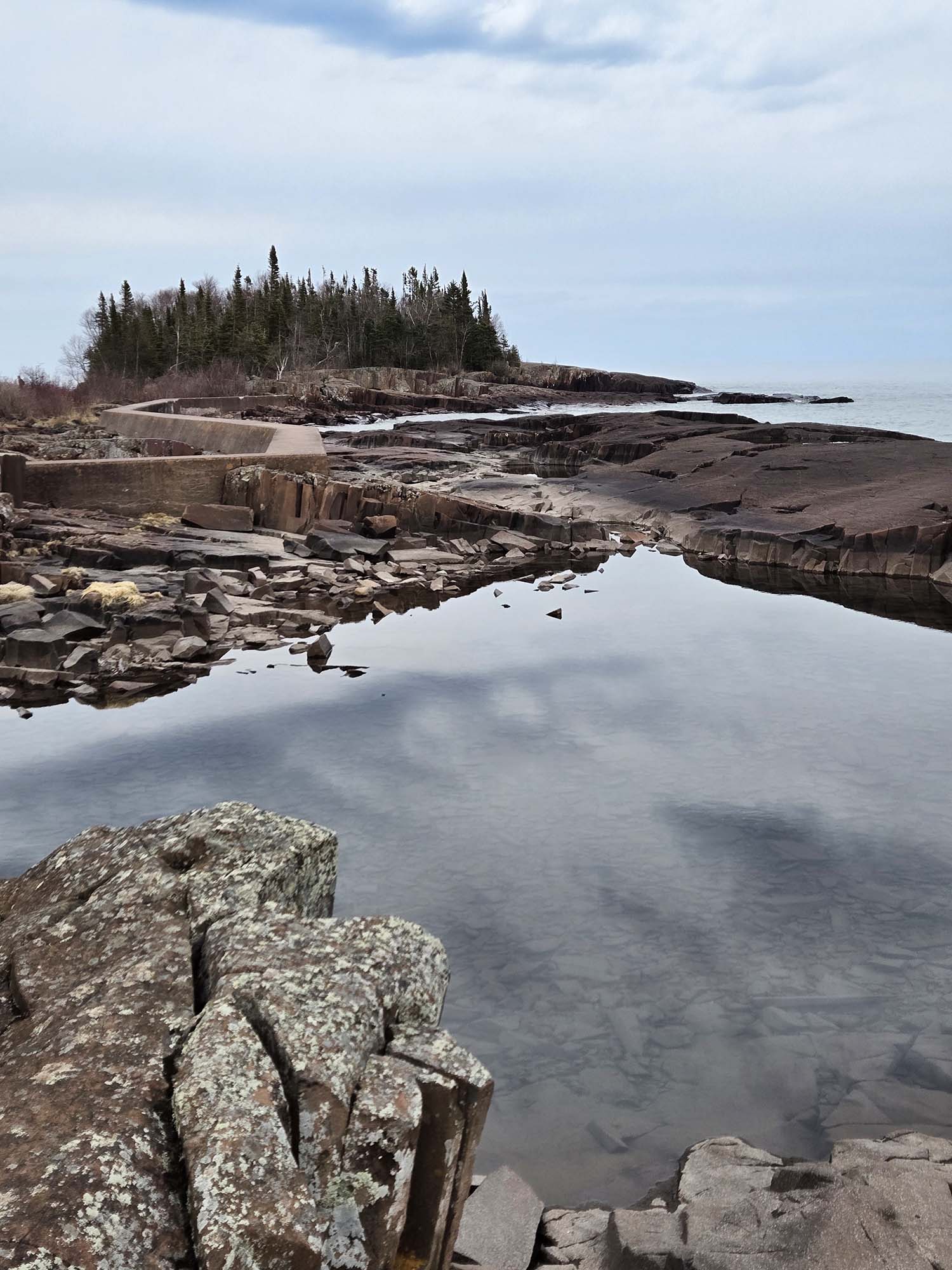
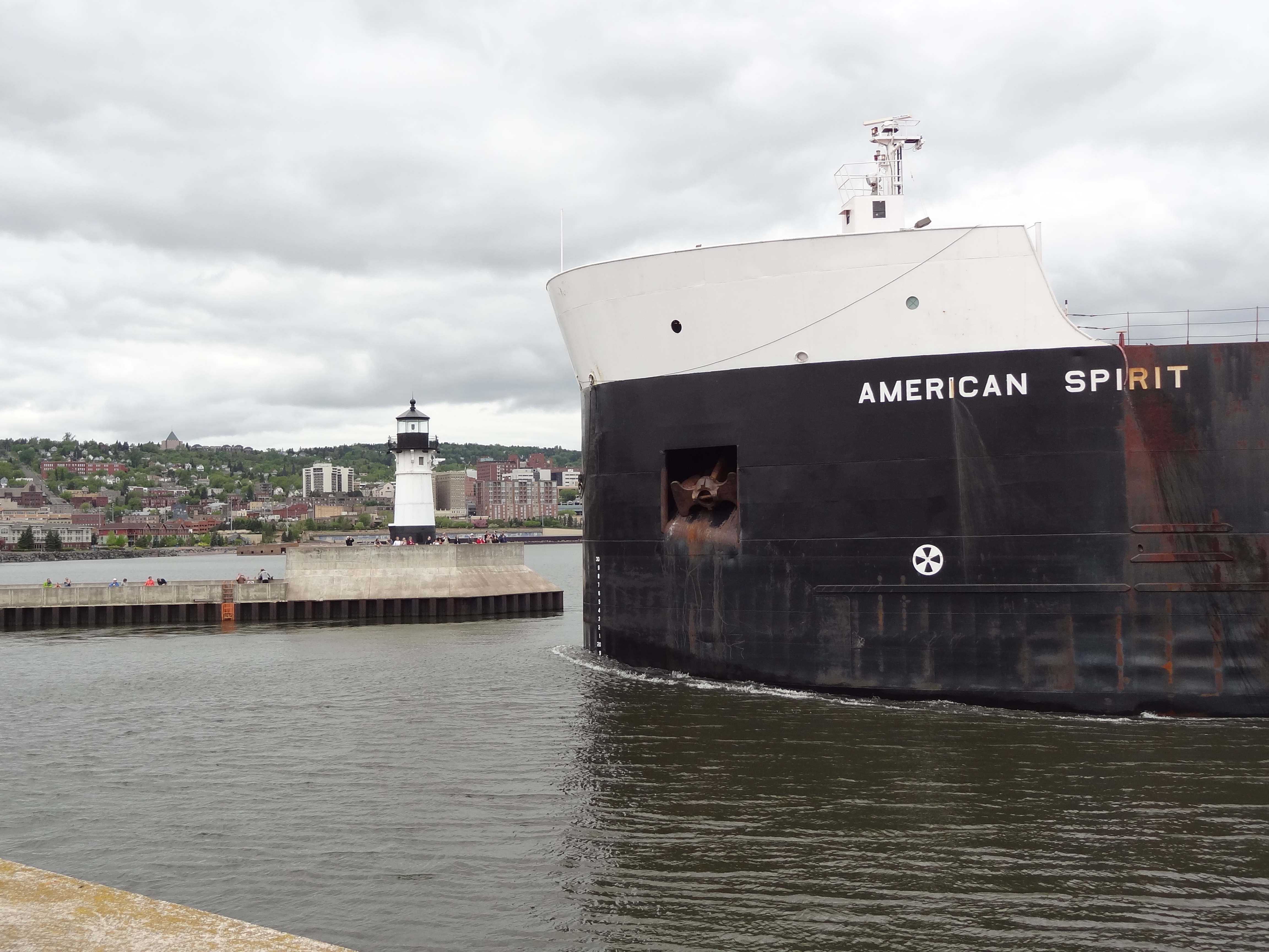
Sometimes the rotating, colliding ice makes sounds, but I didn’t hear any during Russ’s and my walk along Lake Superior’s shore the other day when I took these photos. Instead, there was only the whisper of our boots on the asphalt trail, and the restless sigh of the breeze—sharp enough to sting cheeks and make eyes water.

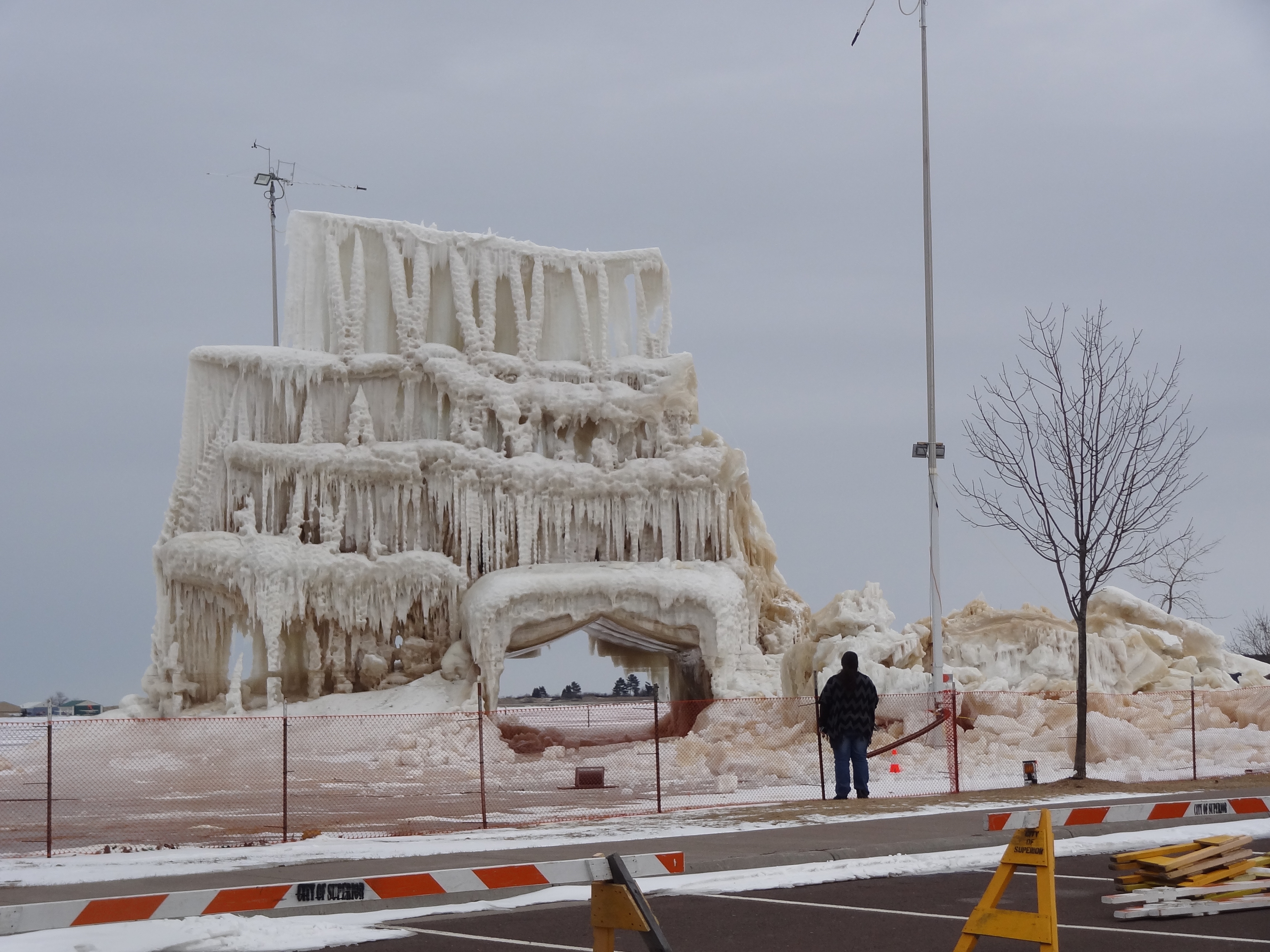
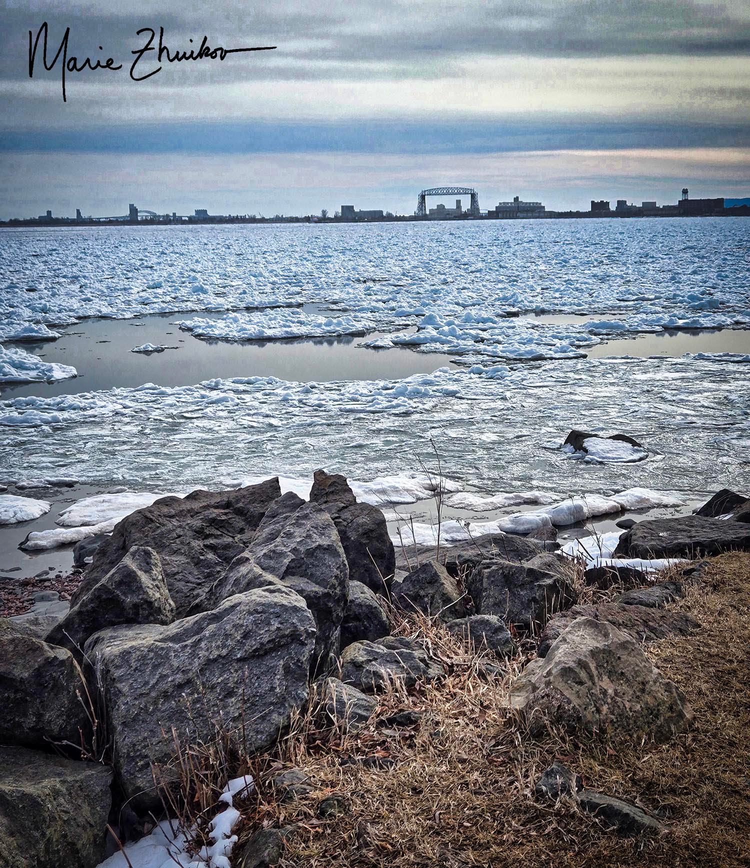
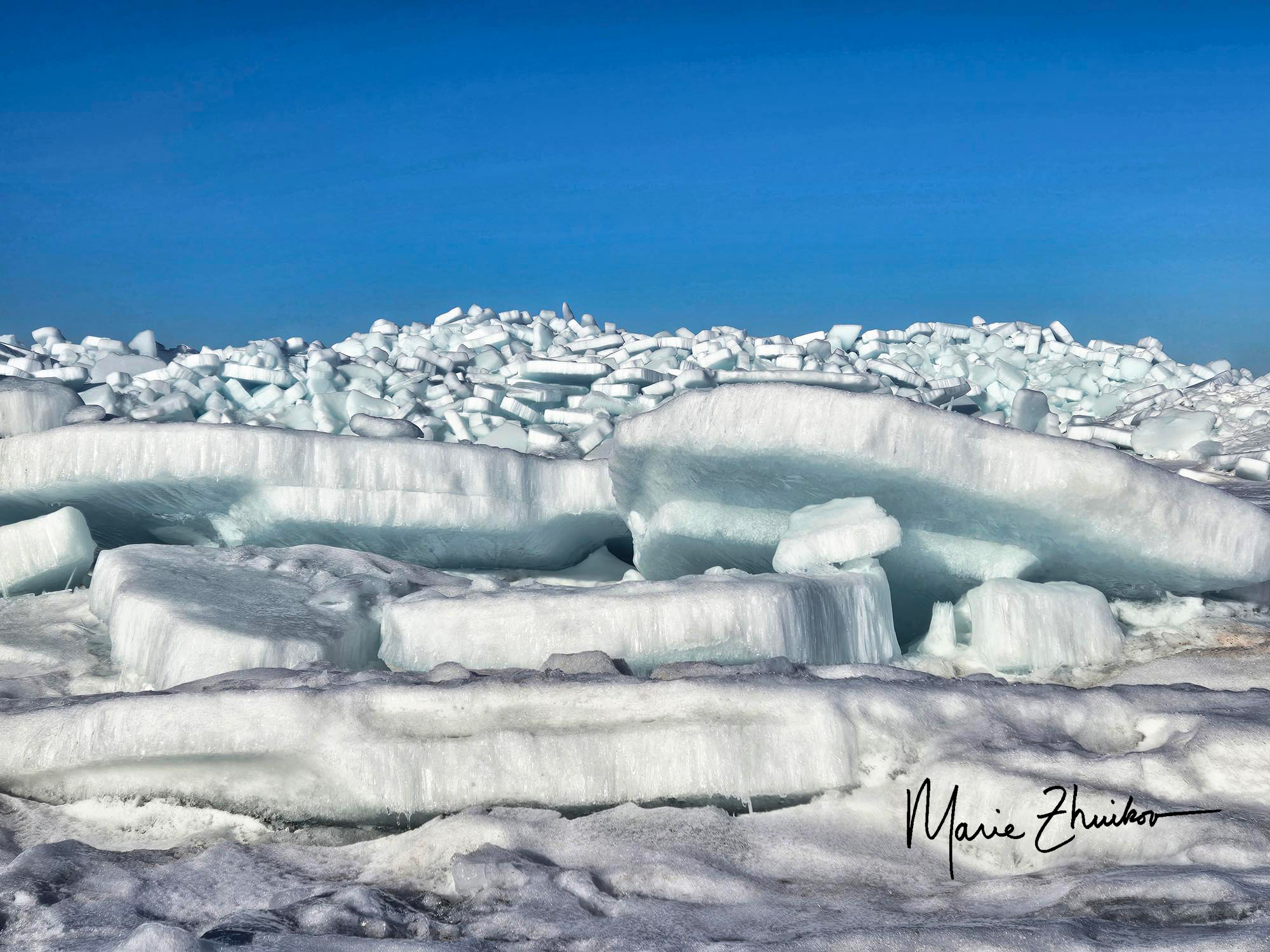
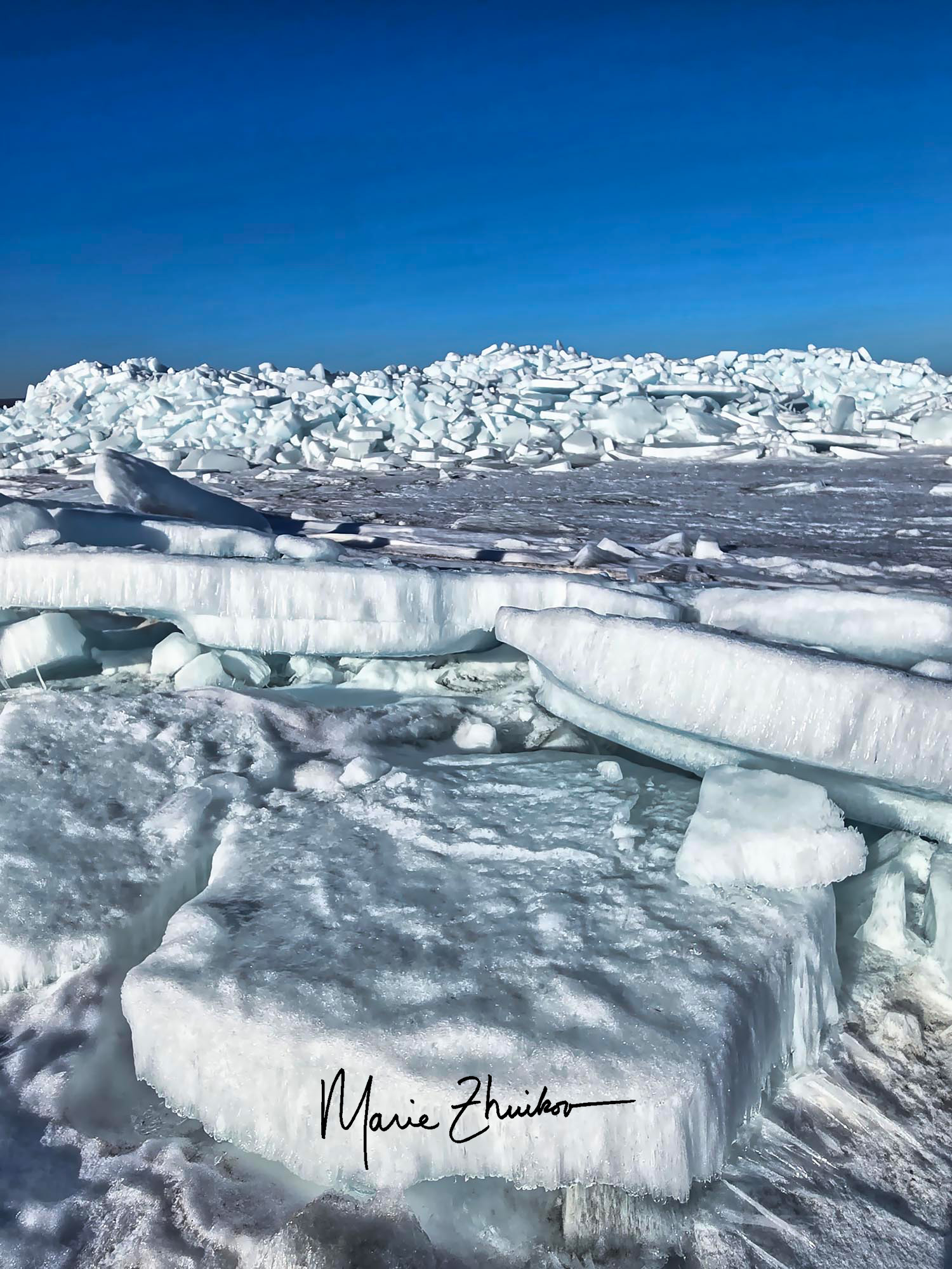
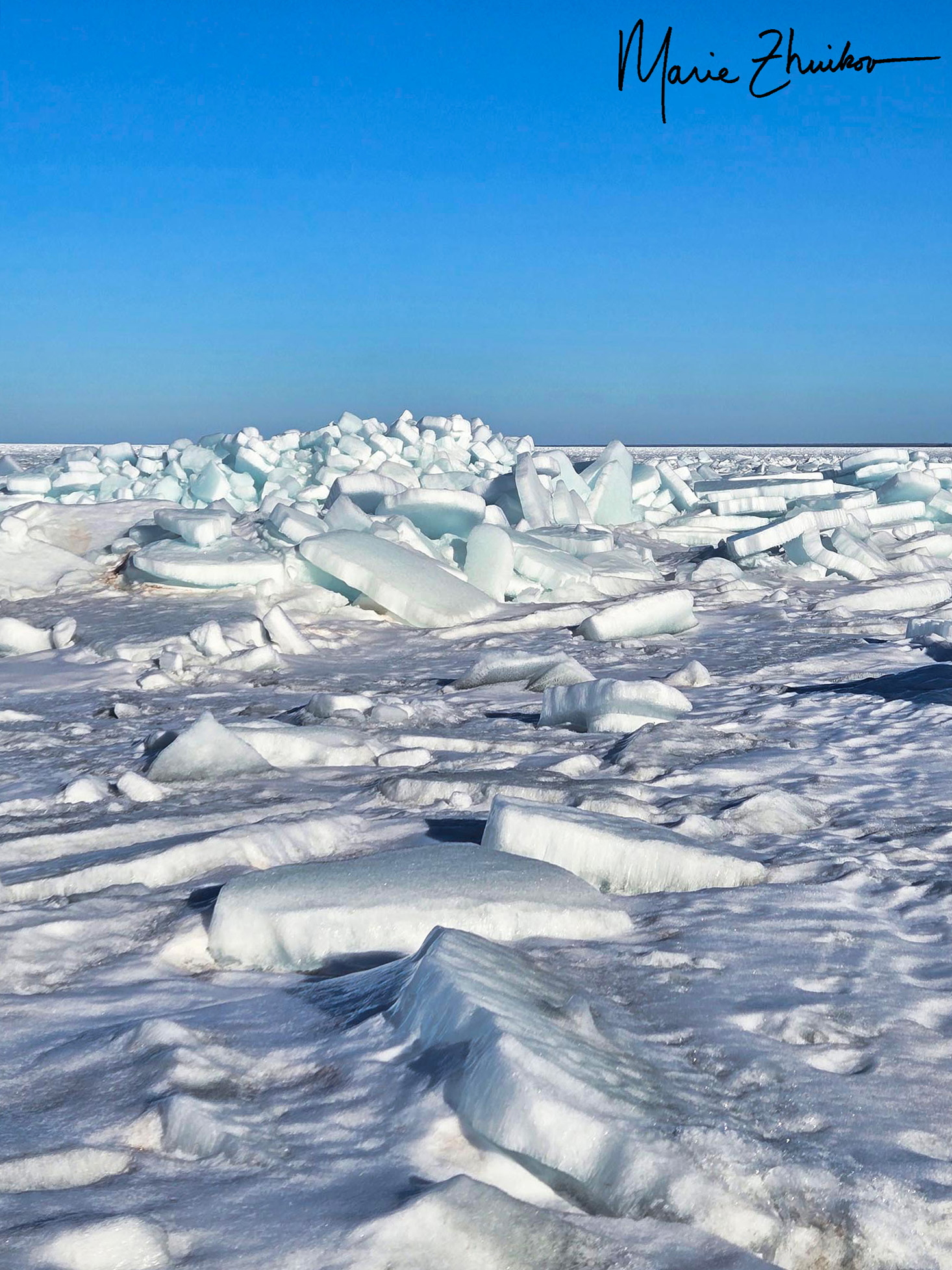
This year, Lake Superior experienced 27% ice cover. The last time the lake came close to being completely frozen was 2019. The long-term average is 61.5% ice cover, and I assume that average is going down as the climate changes.

During our walk, other signs of warming weather in Duluth were the white legs of everyone who wore shorts for the first time since October. Mind you, it was only 44 degrees F with a cold northeast breeze, but people are so desperate for spring that shorts seemed like a good idea! I even saw a bare-chested man wearing shorts, his skin turning pink in the biting wind. I was not so inclined. In fact, I had to raise the hood on my jacket and cinch it tightly around my face, feeling the rough fabric press against my cheeks as I tried to shield myself from the breeze once we turned around and headed back to our car.

But the pancakes and white legs are here on Lake Superior. Spring can’t be far behind.

On the Dunes

Ice off of Minnesota Point in Duluth. Each of those slabs in the foreground is the size of a person lying down. The ridge behind it is about fifteen feet tall. (I popped a squat to obtain this viewpoint.)

On the Dunes
By Sara Teasdale

If there is any life when death is over,
   These tawny beaches will know much of me,
I shall come back, as constant and changeful
   As the unchanging, many-colored sea.

If life was small, if it has made me scornful,
   Forgive me; I shall straighten like a flame
In the great calm of death, and if you want me
   Stand on the sea-ward dunes and call my name.

I recently stumbled upon this poem while leafing through a stack of old, yellowed pages—poems I had once painstakingly typed on a clattering Underwood typewriter during my high school days. Back then, before the convenience of photocopiers, I’d wander the library aisles, selecting poetry books that called to me. I would borrow them, then sit for hours, as I copied lines that stirred my soul. I imagined that I’d refer to these pages often, though, they have gathered more dust than fingerprints. Now, rereading them, I’m flooded with nostalgia, peering through a window into what once moved my younger heart.

Poet Sara Teasdale lived from 1884 to 1933. She is characterized as “neurotically intense,” and it’s said she moved in the company of poets like a “recessive flame.” She had a tempestuous affair with poet Vachel Lindsay. Later, she married a businessman but then divorced him, retired to seclusion, and in the end, died from an overdose of sleeping pills.

Her poem struck me because I’d just meandered to the beach in Duluth with Russ. If you’re not familiar, we are blessed with a long sandbar at the mouth of Lake Superior. Of course, the beach was snow-covered. The lake’s power was on full display in the form of huge piles of ice piled high about ten yards offshore. I had my phone with me and was tempted to brave the ice to take some photos, but I hesitated, not knowing if the ice was safe. I am well acquainted with the vagaries and dangers of this Great Lake.

However, two other people walked out to an ice ridge in front of me. They survived, so I figured I’d be okay if I followed in their footsteps. I ventured out, and these photos are the result. I was glad I braved the ice to share them with you! Russ wisely remained onshore. I’m also glad that the little adventure didn’t hasten my death so that Russ would need to stand on the dunes and call my name when he wants me. 😊

Old Fish in Lake Superior Sparks Controversy

The oldest lake trout yet discovered in Lake Superior, also known as “Mary Catherine.” Image courtesy of the Michigan DNR.

The Michigan Department of Natural Resources (DNR) published a story a few days ago that made many people upset. As someone who has her feet in both natural resources management and public relations/science communication it offers an interesting case study. The DNR was trying to highlight an interesting fact about how fish can reach old ages, but some mistakes got in the way of this message.

The ear bone of one fish they caught in a special survey done in 2023 to study the different forms of lake trout and their reproductive biology was recently analyzed and the DNR discovered that the fish was as old as I am! (62 years) They caught the lake trout on a reef in the southeastern part of Lake Superior (40 miles north of Grand Marais, Michigan) and this lake trout is the oldest one currently on record.

The ear bones of fish show annual rings much like a tree, and that’s how the DNR can tell the age of the fish. It’s the only way they can do this, and they have to kill the fish to extract the ear bone, also called an otolith

Mary Catherine’s otolith shows 62 years of growth. Michigan DNR image.

One mistake the technicians made was naming the fish. They picked the era-specific moniker of Mary Catherine because Mary was one of the most common names in 1961 when the fish was hatched. People who heard news reports were excited that such an old fish was found, and that it even had a name, only to be crushed when they learned later that the fish was killed in the process of discovering its age.

One Facebook commenter said, “Hey we just killed Mary Catherine, but the upside is we now know that she was 62 years young, much like many grandmothers and recently retirees. There’s one less on Social Security now, and that should help keep it solvent.”

Another said, “Sad that they killed a fish who is probably older than the combined ages of some of the researchers, but it is interesting information.” Another commented that the fish might have lived another 20 years if not sacrificed for science.

You might think that such an old fish would be very large, but she wasn’t. Mary Catherine weighed 2.1 kilograms (4.62 pounds) and was 627 millimeters (24.7 inches) long. That’s because Lake Superior doesn’t have much food in it and animals grow slowly. The typical lifespan for a lake trout is 25-30 years.

The story gained wide media coverage, so it was successful that way, but even some of the reporters were dismayed that Mary Catherine was a goner. People already love to hate the DNR, and this well-intentioned science story just gave them another reason.

I’d say the main lesson is not to name your research subjects in newsworthy stories, especially if they’re dead.

The researchers were mum about whether they were inspired by the Saturday Night Live character, Mary Katherine Gallagher.

Artist’s Point, Grand Marais MN

When last we met, Russ and I were in Grand Marais along the shores of Lake Superior for an afternoon photo reception at their local health facility. We decided to stay overnight after the reception and take a little photo expedition the next morning to a scenic spot on the harbor.

As we ate supper at the Gunflint Tavern, I came up with the bright idea to do a reconnaissance mission to the spot to prepare for the next day’s shot. I hadn’t been to Artist’s Point in several years and wanted a refresher. The sun was still up so we’d be able to see okay to walk along the break walls and rocky coast.

I must admit that I had a glass of wine with supper and then for dessert, a brandy old fashioned cocktail. Although the food at the tavern was lovely, that cocktail was truly memorable! A brandy old fashioned is made with muddled (smashed) maraschino cherries and orange slices. (For a photo, see this post.)

I don’t know what kind of cherries the tavern used, but they took the drink to a whole new level! They were dark maroon and tasted divine. I know they weren’t Amaro-soaked cherries because I’ve had those before. I wish I had asked our waitress what they were, but I didn’t.

Thus fortified, and wearing high-heeled boots, I ventured with Russ to the harbor. I didn’t even have my Nikon along (that was back at our inn), only my cell phone.

I clambered up on the break wall, but Russ refused. He’d had a drink with dinner, too, and didn’t trust his balance enough to join me. I, however, found that my dessert made me not really care that I was up on a rocky wall in high heels. Plus, the views! I immediately became inspired and started snapping away on my phone, wandering this way and that for the best views.

What was intended as a simple reconnaissance turned into a photo shoot in its own right. Here’s a gallery of my results.

I clambered off with wall none the worse for wear and we headed to our inn for a rousing card game. We slumbered until Civil Dawn – that time just before the sun rises. In our case, that was 5:30 a.m., much earlier than we usually wake.

We quickly dressed in gear appropriate for temperatures in the mid-40s. I gathered my tripod and camera and we drove down the hill a short way to Artist’s Point. The area is named for its picturesque views. Painters can often be found there.

The sky over Lake Superior began turning a light orange as the sun prepared to make its appearance. Songbirds were singing, mallards quacking. Shorebirds flitted from rock to rock in front of me on the beach. The air was calm.

The sun wasn’t rising close to the island where I hoped it would be, so I set up my tripod on the beach and started taking photos. As the sunrise progressed, I found some large rocks and old wooden pilings that made for an interesting foreground. I crouched for the best angle.

I stepped away from my camera a few times to enjoy the sunrise in its own right, without a viewfinder in front of it.

Then I made my way out to the point and the break wall. Russ stayed back again. By this time, the sun climbed higher, but it was too bright for a good photo against the island. Instead, I focused my efforts in the opposite direction — on the lighthouse in the harbor, which was lit by the reflection of the rising sun. As I shot, a gray fishing boat left for the deeps of the lake with a raucous chorus of gulls following in hopes of sharing the bounty to come.

As I was finishing, I noticed a man off to the side on the harbor shore. Was he a photographer, too? Was he seeing something I wasn’t? (Every photographer’s nightmare!)

Then I noticed he wasn’t holding a camera, but a fishing rod. Just an angler out catching breakfast before work.

My cold fingers told me it was time to stop taking photos, so I clambered off the wall and met up with Russ. We returned to our cozy inn, peaceful, inspired. Happy.

Catching a Wave

Catching a Wave. Image by Marie Zhuikov

You may recall that a few weeks ago I left my “photo babies” at a medical facility in Grand Marais, Minnesota, along the shores of Lake Superior. (For a refresher, read this post.)

Russ and I were able to visit my babies earlier this week at an afternoon reception for the photographers and artists whose works are featured on the walls of the facility. I was excited to visit my images and see where they were hung. They seemed well cared for and happy in their new surroundings. My four large images were together on one wall and the other smaller ones lined a different wall farther down the hallway.

For a while, I stood near my images, a fly on the wall listening to peoples’ comments about my photos. Hearing their compliments and theories was fun. Meeting members of the medical facility board and the other artists was an added benefit.

This was my first reception, so I wasn’t sure what to expect. We struck up conversations with several photographers who proudly took us on hallway tours of their works. There were a couple ladies from Duluth who I hadn’t met before.

When I was in the reception room enjoying snacks and a PowerPoint show of the images, several reception-goers approached me, wanting an explanation of how I took one of my photos. We walked back to where the large images hung and stopped in front of “Catching a Wave.”

Before I told the three ladies how I got the shot of a wave splashing off a rock on Madeline Island in Lake Superior, I wanted to hear their theories. All of them thought I used a tripod and that I took multiple shots.

Surprise crossed their faces when I told them I just sat on a rock with my feet dangling over the water and hand-held my Nikon. I took the image when I was on the island for my first-ever photography class. This image was from a class outing in a park along the lakeshore where we roamed. I thought it would be fun to try and “catch a wave” with my camera.

As I sat on the rock, I pushed the shutter in the moments after a wave hit the rock and sprayed. I only took a couple of shots, not even bothering to look at what I had in the field because it was hard to see my playback viewer in the sunshine. Instead, I hiked down the trail to the next viewshed.

But when I returned to my room after our class outing, I knew something was different with the rock splash photos when I scrolled through them on my camera. “What the heck?” I recall saying to myself. My wonder turned to pleasure after I downloaded the images to my computer and took a closer look. I’d caught the wave perfectly in two of them!

The ladies at the show pointed out a couple things about the photo that I hadn’t noticed before, plus some patterns in my other photos that I had not seen. Then we walked down the hall to view their images and they described the trials and tribulations involved in taking their shots.

Once the reception was over, Russ and I headed out to a local restaurant for supper. We planned to stay overnight and wake at dawn the next morning so that I could have a photo outing at a scenic spot on the town’s harbor before we left for the two-hour drive home. We may have been there for the photo reception, but why not turn it into a photo expedition, too?

As it turns out, that was a capital idea! I’ll share those images in my next post, but here’s a sneak peek:

Artist’s Point Sunrise, Grand Marais, Minnesota. Image by Marie Zhuikov

To see a slide show of the other photos I took during my Madeline Island photography class, please visit this post. If you’re interested in purchasing “Catching a Wave,” it’s available on canvas (24” x 36”) for $150. Since I took the class and that image as part of my day job, profits will be donated to the Wisconsin Sea Grant Program, which provides research and education programs about lakes Superior and Michigan. To see my other work, please visit my photography webpage.

Northern Dreams

This is one of my favorite photos from a recent meander north to Grand Marais, MN. I was hoping for good sunset photos, but the colors weren’t cooperating. After standing outside in the frigid cold for an hour, and with fingers beginning to numb, I snapped this one last photo of Tombolo Island in Lake Superior.

I love the blurry water and the placement of the driftwood. The cynical part of me wonders if some other photographer placed it on the shore for effect. All I know is that I didn’t do it! So I’ll pretend that it just washed up on the rocky beach.

No sunset colors? Turn the photo into a black and white! So moody. I love this lake and hope that shows.

Minnesota’s Pink Beach: Biking the Gitchi-Gami State Trail

Iona’s Beach, Lake Superior

The online entry for the part of the Gitchi-Gami State Trail from Gooseberry Falls State Park to Split Rock State Park along Lake Superior said, This trail segment has steep hills and curves that can be particularly arduous for recreational use.

The warning was in italics and demanded attention. Russ and I looked at each other and shrugged. “Meh. How hard can it be?”

Will we never learn?! Spoiler alert: Actually, it wasn’t that bad, but a few of the uphills toward the end of our round-trip tour did defeat me, and I walked them. Just a reminder that I am 60 years old, so you gotta cut me some slack.

But the arduosity was worth it to bike a new (to us) segment of this trail on the North Shore and to see Iona’s Beach – a fabled shore littered with pink stones.

The Gitchi-Gami trail is composed of several paved segments totaling 33 miles. Eventually, it will span 86 miles from Two Harbors, MN, to Grand Marais, MN. I’d been on a segment north of the Gooseberry-Split Rock previously and enjoyed gliding through the birch and aspen forests and crossing river bridges.

The Gooseberry River before the falls on a foggy day.

After buying our MN state park pass at Gooseberry, we made our way to the trailhead, which is near the picnic area. The trail begins by taking bicyclists in the wrong direction – you travel south for a bit, but once you get near the park entrance it turns north. Cyclists get a spectacular view of the head of the Gooseberry River falls. In about 3 miles the trail winds into Twin Points Safe Harbor and Iona’s Beach Scientific and Natural Area. Fog from the lake rolled in and out along the way.

Iona’s Beach

We stopped and explored Iona’s Beach. Probably because of the mist, it wasn’t very crowded, but that was okay with us.

As you can see from the photos, the beach really is composed of pink stones. The stones have eroded from waves and frost from a nearby cliff (made of rhyolite) and are kept in place by dark basalt rock headlands on either side.

We sat by the water to see if we could hear the beach “sing.” When waves recede from the cobblestones, the stones come to rest with a tinkling sound unique to this beach. Waves were plentiful during our visit – the sound was subtle, but I do think we heard the beach sing!

The beach is named after Iona Lind, whose family bought the area and ran a resort there for more than 50 years. Iona ended up protecting the lakeshore she loved permanently by donating it to the state.

We continued on our way, gaining a close view of the rhyolite cliff from a bridge. A small waterfall cascaded down its face. The Split Rock River was another inspiring site. We made it a few miles into the park before my legs begged me to turn around, so we headed back to Gooseberry Falls. We did not make it all the way to the famed Split Rock Lighthouse.

All total, our trip was 15 miles. We were famished by the end of it. We wanted to eat at Betty’s Pies outside of Two Harbors, but it was so crowded that we opted for Blackwoods in Two Harbors. A mushroom and swiss burger never tasted so good!

The rhyolite cliffs that formed Iona’s Beach

FYI – Minnesota also has a black beach farther up the Shore in Silver Bay. It’s not natural, however. It’s created from discarded taconite tailings from iron ore mining activities. According to media reports and info from friends, it’s not that healthy to regularly play around on a beach made from industrial pollution, but a visit or two is just fine. The beach has been cleaned up in the past, but I would still be cautious if you have young children or have immune issues.  Maybe opt for a natural pink beach instead.

Hangin’ on the South Pier

I had to wait for some work colleagues on a pier on Duluth’s Ship Canal last week. They were late. I had a camera. Enjoy the fruits of my boredom!

ChinWu Wave Pressure Gauge 003

ChinWu Wave Pressure Gauge 008

Duluth’s Aerial Lift Bridge (from a different perspective than usual.)

ChinWu Wave Pressure Gauge 024

A ship, the American Spirit, enters the ship canal. Looks like it’s going to crash, doesn’t it?

ChinWu Wave Pressure Gauge 029

ChinWu Wave Pressure Gauge 039

A friendly little house wren kept me company. It was catching bugs behind the lighthouse on the pier.

ChinWu Wave Pressure Gauge 034

When my colleagues arrived, they installed a wave gauge pressure sensor off the pier that will be used to help detect and predict the presence of rip currents, which can sweep unwary swimmers out into Lake Superior. The local newspaper wrote a (front page!) story about the project. Read it here.

A Lake Superior Cruise

I stopped freelance writing a few years ago, choosing instead to focus on writing fiction and poetry. (And this blog!) I was tired of hiring out my brain for somebody else’s use, since that’s what I do all day at work already. Thankfully, I also no longer had a financialLSMagazineMay16 need to freelance, so I made the conscious decision to stop.

That worked well until about a year ago, when I took a cruise on Lake Superior aboard the Wenonah, the ship that took me on my first trip across the lake.

The cruise dredged up old memories. I considered blogging about them, but once I started writing, I realized I had a story I could sell, dang it!

Alas, I succumbed to freelancing, but at least the story was one I truly wanted to write. I know, poor me. It’s a good problem to have.

My story was recently published in Lake Superior Magazine. It’s a superb magazine — pick up a copy and check it out! (Page 14.)

They also published a couple of my photos. But I have gobs of other photos I took that day, which I thought I would share with you. Please enjoy this virtual cruise along Lake Superior’s North Shore.

DSC02270

The Wenonah at Silver Bay Marina.


DSC02290

The tip of Gold Rock, site of a shipwreck in 1905 that claimed a life.

DSC02298

That turquoise water looks like the Caribbean, doesn’t it? I wouldn’t jump in though. It’s a bit nippy.

DSC02303

Coming around Split Rock Lighthouse. Not many people get to see the lighthouse from a mariner’s view.

DSC02310

A more classic view of the lighthouse.

DSC02322

People frolicing with gulls on an island off Silver Bay.

DSC02327

Piles of taconite pellets waiting to be shipped south to be made into steel.

DSC02333

The taconite plant in Silver Bay, although it looks more like a cloud factory. Perhaps it’s not beautiful, but it’s part of the cultural landscape of this area.

DSC02275

The rugged coastline of Lake Superior’s North Shore.


The ‘Castle’ has Fallen, Spring Must be Coming

Ice Castle 2016 001

The Lake Superior Ice Project formation collapsed near my workplace this week, and that means spring can’t be far behind. The photo above is from a week ago when the right part of it collapsed, and now the whole thing is a pile of ice rubble.

When the collapse in the picture happened, we weren’t sure if it was planned or not. It caused a bit of a stir in the office – especially since last year the structure had a rather spectacular and unintended collapse right in front of a New York Times reporter. But we later heard that the formation’s creator, Roger Hanson, had been working for the past few days on dismantling his ice castle.

It would have been nice if he had alerted the public that he was dismantling the structure. The woman in my photo complained that she would have come to see it earlier had she known. And it could have avoided some surprise and speculation.

I have “castle” in quotes in this posting’s title because the ice never ended up looking like the European-style castle with four towers that Mr. Hanson described in media stories. It looked more like a birthday cake with a door in it to me. I suspect our warm El Nino winter had something to do with that.

The structure also didn’t break any world height records as hoped, but it did serve as a focal point for a community Ice Festival, complete with fireworks.

Orbs 002

Ice orbs during the freezing process.

A related icy project (that I actually helped with instead of snarking about) involved bringing community groups together to create ice orbs in the shape of Lake Superior. The City of Superior’s Environmental Services Division organized this collaborative art project to highlight the importance of fresh water to the community. Different groups pledged to create a certain number of ice orbs so that 365 of them (Get it? One for each day of the year) could be installed near the ice castle for the festival.

The project was called Orb365 and, along with instructions on how to make the orbs, the project included educational messages about how water reacts to freezing and ways water is important.

I pledged 10 orbs, which I created by filling water balloons and sticking them outside in hopes that they would freeze. I started the freezing process four days before the orbs were needed, certain that would be plenty of time, especially in February in northern Wisconsin. However, the weather was so warm, the orbs didn’t completely freeze until the very last night, eliciting some anxiety on my part.

DSCN0051

Lake Superior shaped in ice orbs.

Triumphant, I was able to deliver the orbs the following day to the “orb construction site” where a city worker artistically arranged them into the shape of the lake, and festooned them with lights. She positioned larger orbs to represent major cities around the lake.

Alas, now the orbs are melted along with the castle. The snow is almost gone, and the meatloaf-brown grass of spring is upon us. Although this winter was warmer than usual, I’m not going to complain about it. I’m sure the northern weather gods will make us pay for it next winter.