Last month, Russ and I continued our quest to cycle different sections of the Mesabi Trail, which crosses northern Minnesota’s Iron Range. Amid the crunch of fallen leaves and the brilliant red of sumac, we biked from Nashwuak to Calumet with a side trip to Pengilly.
A warm breeze offered one of those final temperate days between summer and fall. The trail began in Nashwauk at a nondescript parking lot near a closed restaurant with the suggestive name of Big O’s Chef House. (Maybe that’s why it went out of business?) Except for a few frost heaves, the mostly flat trail was in good condition. It parallels the highway ,so the distant noise of cars is ever-present.
Much of the land surrounding the trail is owned by Mesabi Metallics Co., an iron ore and taconite mining company. We passed huge piles of mine tailing waste and overgrown past mining roads as a few vultures circled overhead.
In the sleepy Sunday town of Calumet, we rested at a public picnic shelter. The only evidence of life was a man throwing a ball for his black lab. Then we turned around and made our way back to Nashwauk. Along the way, we took a short spur trail to the town of Pengilly just for a change of scenery.
Scenery along the trail.
Once, a pair of teenagers on an ATV surprised us (they’re not supposed to go on the trail). Several times, we had to dodge Halloween-colored (black and orange) woolly bear caterpillars inching their way across the trail. Folklore says they can predict how harsh the winter will be by the width of the colored bands on their bodies: more black equals a harsher winter. We were trying too hard not to squish these fuzzy forecasters, so we didn’t notice their band patterns.
Apparently, science has not confirmed the caterpillars’ weather-forecasting abilities. Even so, the woolly bear remains a symbol of autumn. Its presence offered us a gentle reminder that the season is turning, and nature is preparing for the quiet, cold months ahead. This will probably be our last long ride of the season.
Total distance: 14 miles. For more information about other sections of the trail, please see these previous posts:
The Hawkins Mine Pit in Nashwauk. We heard peregrine falcons on the cliffs to the right.
Russ and I have been biking short sections of the 150+ mile-long Mesabi Trail in northeastern Minnesota. Stretching from the Mississippi River to the Boundary Waters Canoe Area Wilderness, the trail will be complete in the next year or two. At that point, it will be 165 miles long, making it one of the longest paved trails in the country.
We’ve biked the trail twice this summer (and many times in the past – a list of other posts included at the end). Those recent trips weren’t very noteworthy, so I didn’t blog about them.
This section of the trail took us between two iron ore mining towns. We began in Keewatin, which was formed during the iron ore mining boom in the early 20th century. The town’s name comes from the Ojibwe word for “north” or “north wind,” and the soil is a rusty red from all the iron it contains.
The 11-mile round trip seemed like a gradual climb both ways to me. I’m not sure how that worked! Only one short, steep hill gave me pause, otherwise it was smooth cycling. The first part out of Keewatin follows an old highway/road that’s no longer in use.
We passed several lakes and mine pits, namely O’Brien Reservoir, Hawkins Mine Pit, and LaRue Pit Lake. A cold rain shower caught us about halfway to Nashwauk. I had to stop and clean off my sunglasses. Sometimes I think they need little windshield wipers! The rain didn’t last long, so we kept on going and the breeze dried our clothes.
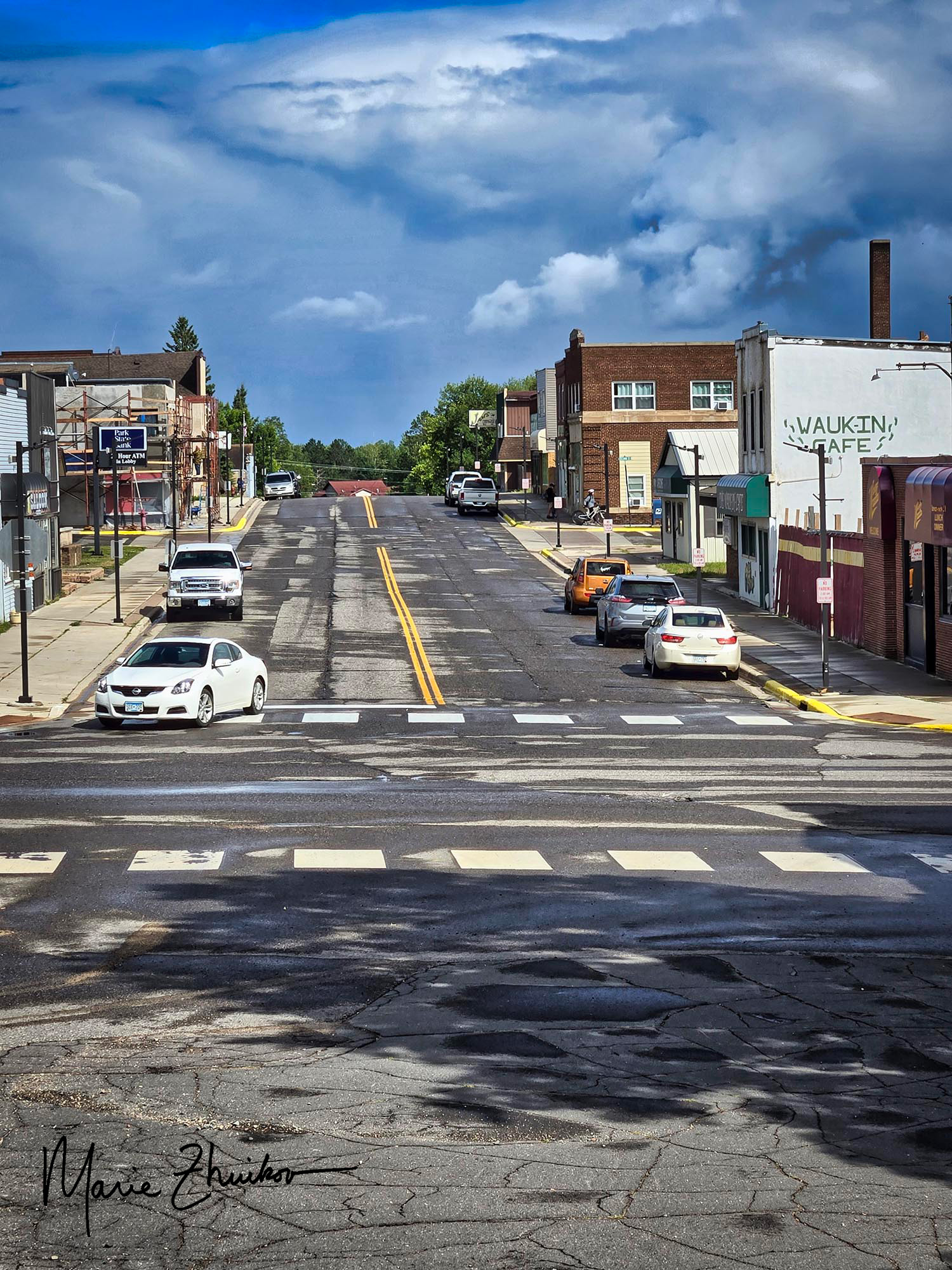
Downtown Nashwauk, MN
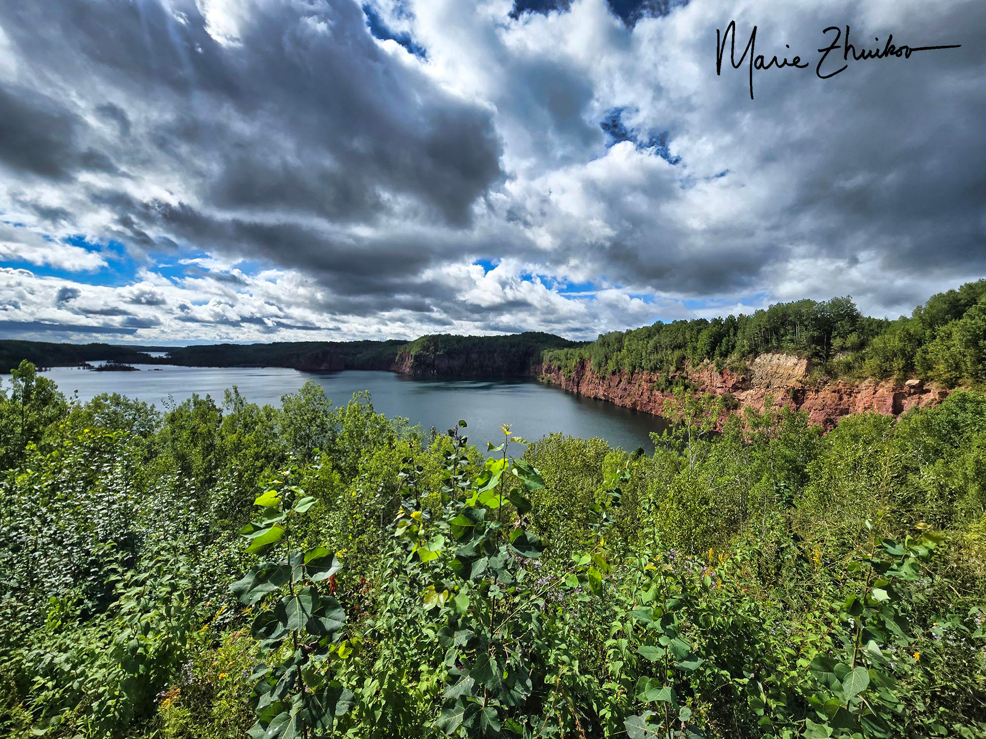
When we reached Nashwauk, we stopped at an overlook at the Hawkins Mine Pit. It used to be an open pit iron ore mine but is now unused and filled with water. Steep red and tan cliffs topped with green trees line the “lake.” As we admired the view, we heard some squawking that sounded suspiciously like peregrine falcons. I’ve heard that they sometimes nest on the mine pit ledges, so perhaps there was a nest at the Hawkins Pit?
It’s believed that Nashwauk was named after a river in New Brunswick, Canada. The word is said to be from the Algonquin language and means “land between.”
As we turned around and headed back to Keewatin, we noticed a spur trail with a sign about the LaRue Pit Lake. The sign said the area features a boat landing, fishing pier, and is a tourist attraction. We decided to check it out.
Our bikes needed a rest at the LaRue Pit lake. We were fine, of course.
The spur trail came out on a paved road. Unsure which way to go, we chose to turn right, which ended up being the correct direction. The road took us down a steep hill to a picturesque lake. It looked like the “tourist attraction” was still under construction – no grass, just bare dirt that was being graded. An angler floated offshore in his boat, trying his luck with the fish. The LaRue Pit began as an underground mine in 1903-1905. The park looks like it will be a nice place, once finished.
The LaRue Pit lake near Nashwauk.
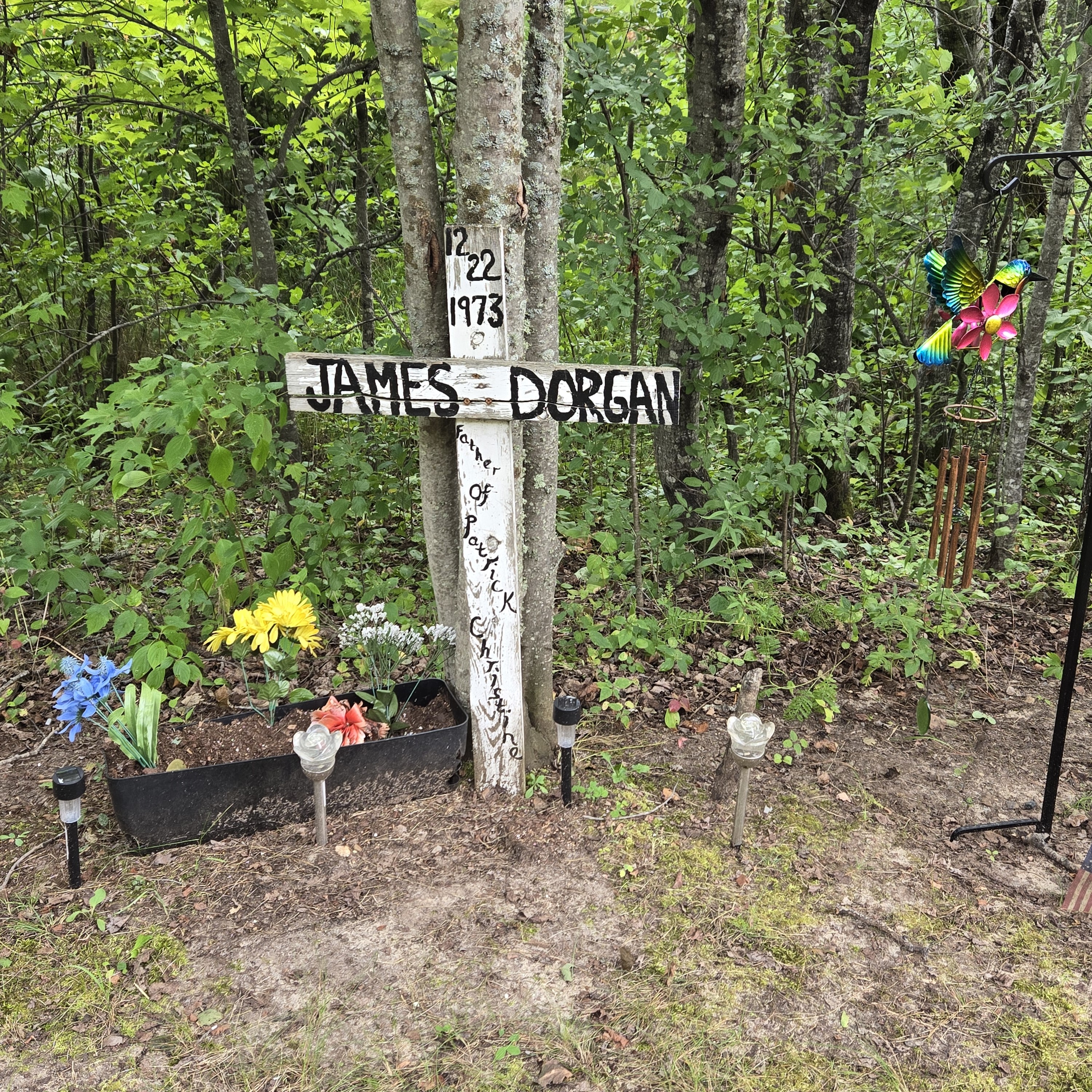
Then we biked back UP the road and rejoined the trail. Not far from the spur, we stopped at a memorial we had passed earlier. The name on the weathered white wooden cross was James Dorgan and it was dated 12/22/1973. The memorial looked in such good shape, we weren’t sure if that was the day he died or the day he was born. Once back home, I did a bit of sleuthing and discovered that it was his death date. James was a former Keewatin resident living in St. Paul who died in a car accident when he stopped to help his ex-wife, whose car was stalled. Another driver apparently hit him.
We were impressed by how well the memorial has been kept up for fifty-two years. Colorful plastic flowers decorated a flower box, and a wind chime hung from a post nearby. Solar lights illuminate the memorial at night.
We mostly had the trail to ourselves. Saw a few squirrels hightailing it across the pavement. Saw a few walkers. We passed a couple of other cyclists in town. Heard some ATVs but didn’t see any.
From rainstorms to pit lakes to falcons to ghosts, this is a good stretch to ride to get a feel for how important mining is to this part of the country.
Wishing everyone a good Labor Day Weekend!
For more information on other sections of the Mesabi Trail, check out my previous posts:
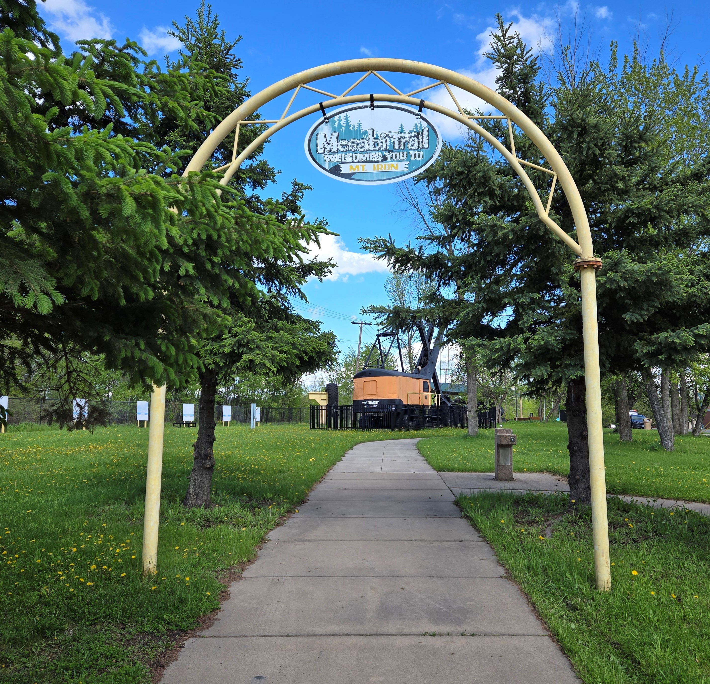
The beginning of the Mesabi Trail in Mountain Iron.
In our continuing quest to bike different sections of the Mesabi Trail in northern Minnesota, Russ and I meandered over to the small mining town of Mountain Iron last weekend. We planned to pedal a 6.5-mile stretch between there and the neighboring town of Kinney. (Round-trip, the distance is a little over 13 miles.)
Mountain Iron is known as “The Taconite Capitol of the World.” It’s the site where iron ore was first discovered on Minnesota’s Iron Range. The mine is no longer in operation, but during the 30 years it was open, 52 million tons of iron ore were shipped to various steel mills in places like Michigan and Illinois.
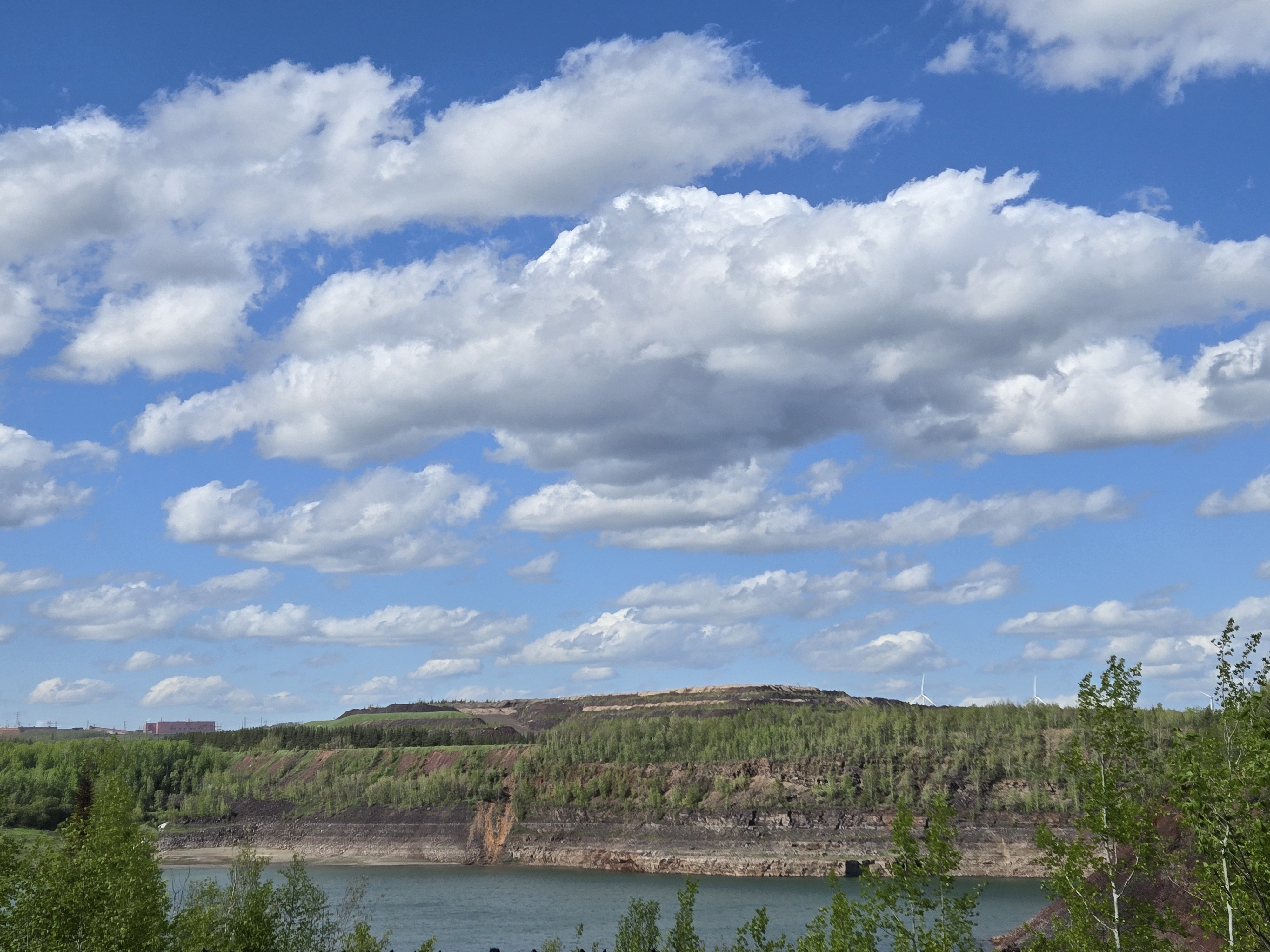
The landscape and town bear the scars of this industry. A huge mine pit filled with turquoise water is visible from the small city park where the trail begins. As we biked toward Kinney, we passed ghostly remnants of homes and businesses that had been moved to make room for mining operations. Cement house pads and neglected lilacs provided testament to the abandoned homesteads.
The open pit mine in Mountain Iron. You can almost make out the wind turbines on the hill to the right.
These days, instead of iron ore, Mountain Iron is known for wind energy. Several turbines spin on far hills. They are part of the Taconite Ridge Wind Energy Center – the first commercial wind center in northeastern Minnesota. An interpretive sign in the park says, “In ideal wind conditions, 10 turbines can collectively capture the wind and convert it into 25 megawatts of electricity – enough to power 8,000 homes on an annual basis.”
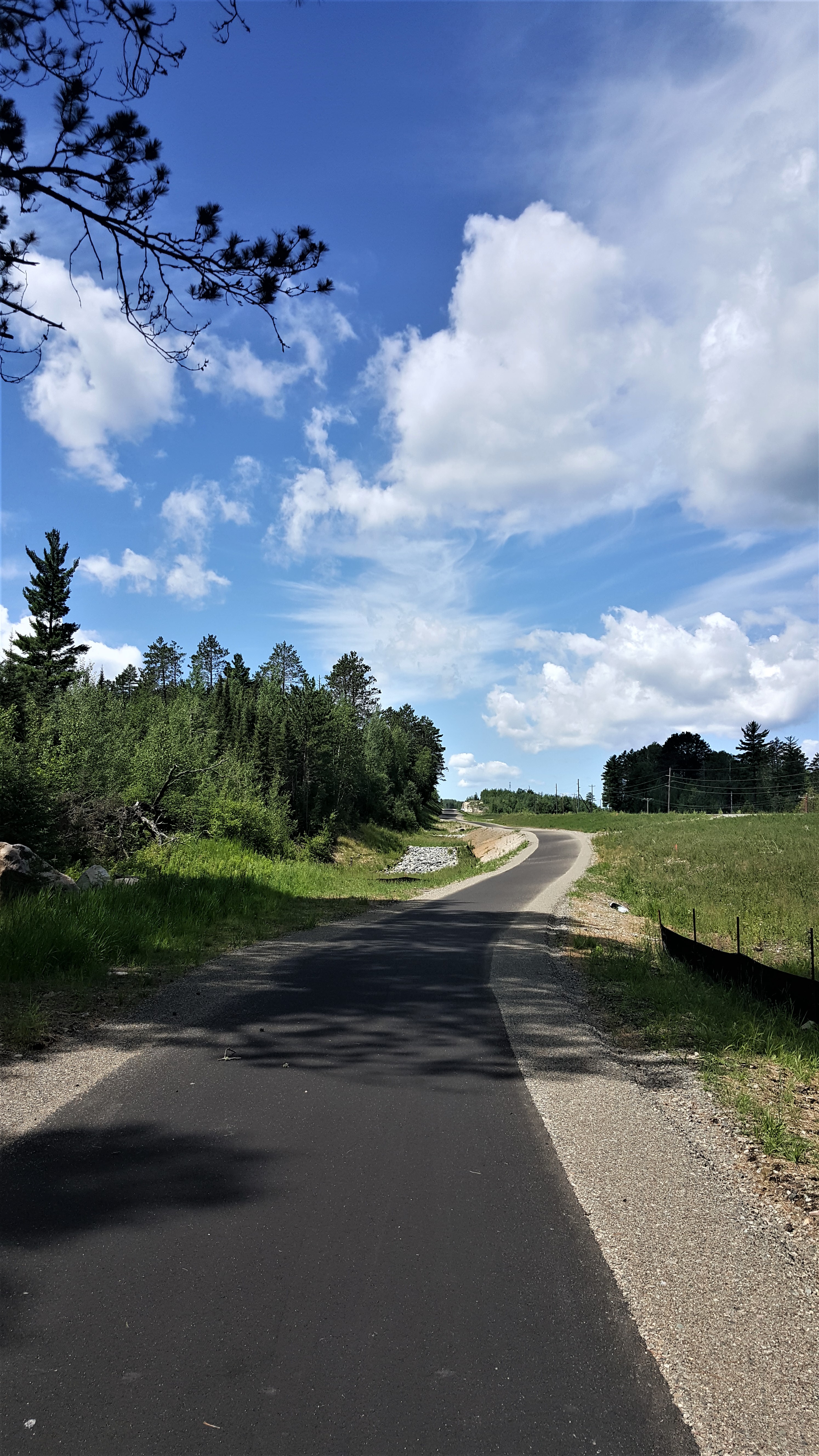
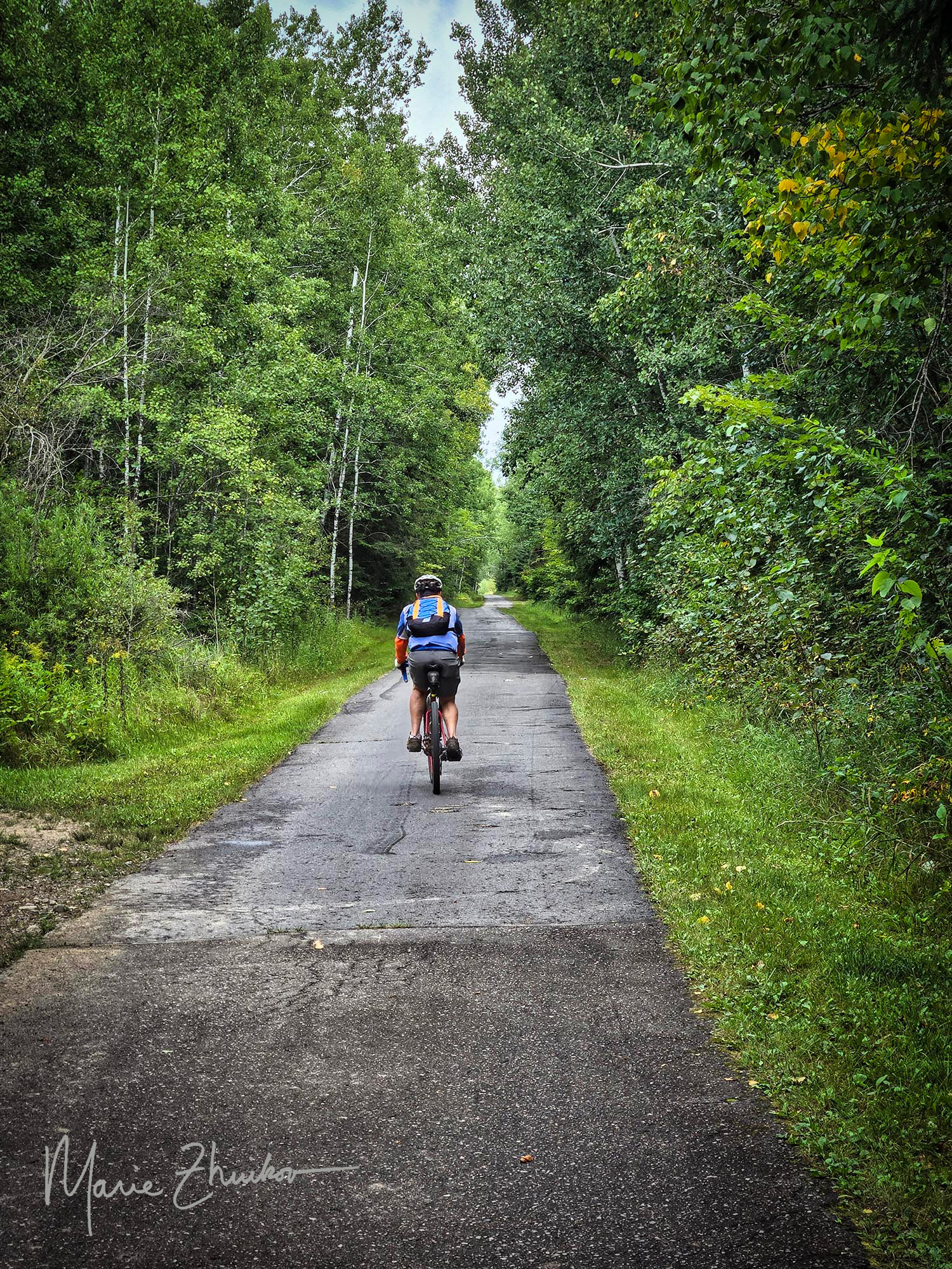
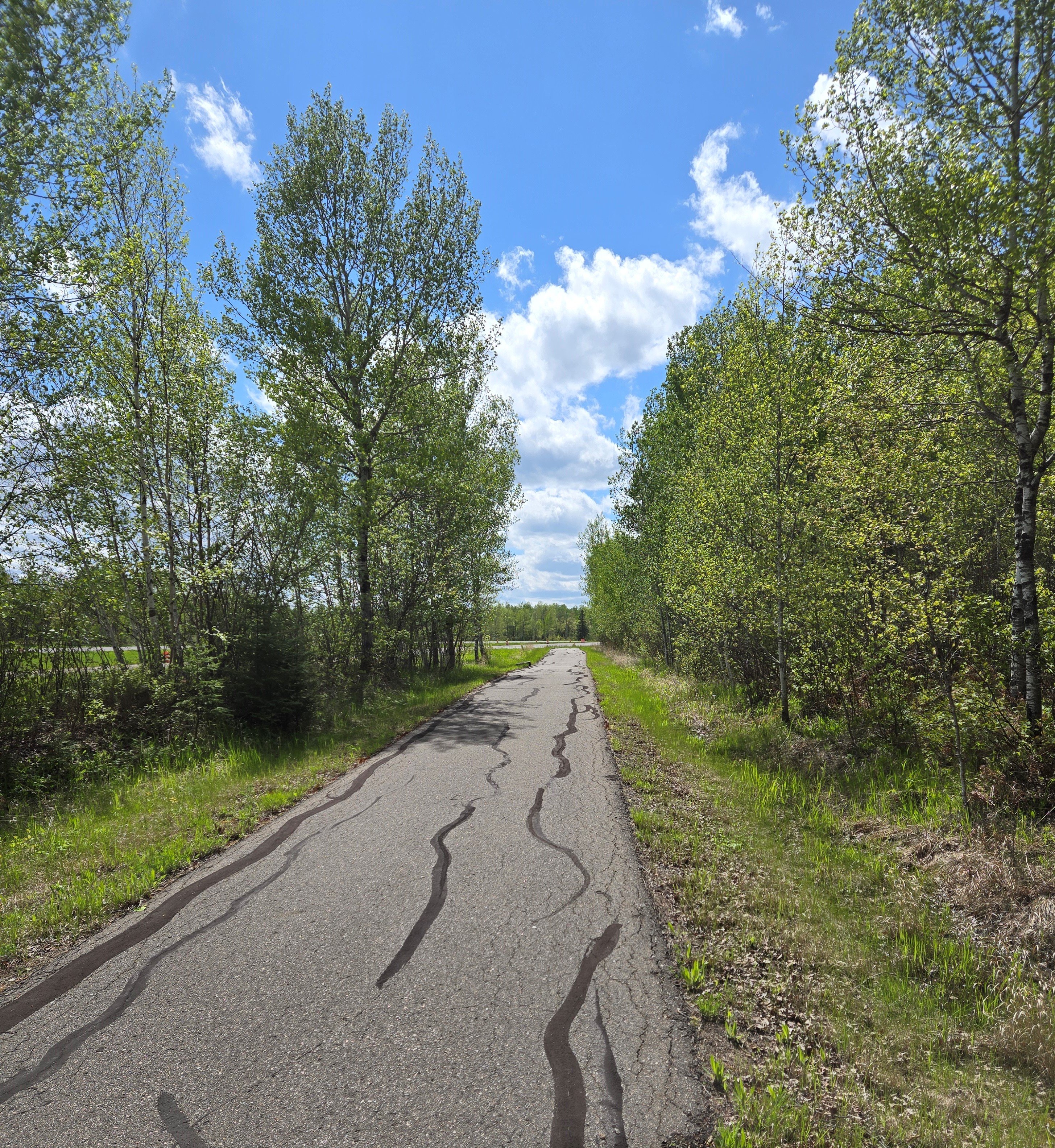
A typical section of the Mesabi Trail.
Compared to other sections of the trail we’ve biked, this was more civilized. Once we passed the abandoned neighborhood, a few occupied homes lay along the trail. Huge grassy piles of mining tailings lined the horizon. Although a sign along the way says that tailings are not a health hazard, I don’t believe it! We saw a lined basin where it seemed like water was being pumped from the base of the piles. I couldn’t find any info about that online, but I am hoping it’s so the water can be collected and treated before being released into the environment. For much of the way, the trail parallels a highway, although it’s often hidden from view by trees.
A couple of hills dot this section of trail, but nothing too onerous. When you first near the highway, there is a hill with a curve at the bottom. Bikers coming the other way also have a downhill before the curve, so beware of that. Two downhills lead over small bridges with culverts underneath them. The culverts each form a bump. I almost caught air on one of them!
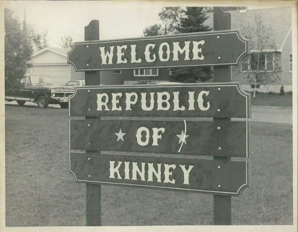
We saw one bicycling family and a few other small groups. When we reached the turn off to Kinney, we did not feel the need to explore. But now, after reading more about the town, I wish we would have. Kinney once voted to secede from the United States and become a foreign country. This bold yet tongue-in-cheek action was taken to draw attention to the small city’s dire water system situation.
According to an account on the Mesabi Trail website (linked above via “Kinney”), the system was “failing so badly that the fire department had to watch buildings burn to the ground due to lack of water pressure. That year the term ‘The Kinney Brown Shirts’ was coined because all clothing washed with detergent that included bleach turned brown because of mineral deposits in the water.
“Replacing the water system far exceeded the budget of the small town, so the city exhaustively searched locally and nationally for assistance. The resulting volume of paperwork led to the city’s motto of ‘File in Triplicate.’ The city attorney commented that it would be easier to get money if the city seceded, waged war with the union, quickly lost, and then asked for foreign aid. The joke took root, and the council voted unanimously to secede on July 13, 1977, and a certified letter was sent to U.S. Secretary of State Cyrus Vance.”
A sign with the new name of the town of Kinney after it seceded from the USA and declared itself a foreign republic. Image courtesy of the Mesabi Trail website.
The secession gained international publicity and from that, the city eventually received grants to replace their water system.
Our way back to Mountain Iron seemed easier than the ride out. I’m not sure if that was from the tailwind or the topography, but biking back was a breeze. Ride over, we spent time exploring the various pieces of mining equipment in the park. This included an old locomotive, which, no doubt, used to haul taconite to ships waiting for it on Lake Superior’s shore. Another group of bikers that we passed on the trail arrived and we chatted a bit. They were from St. Paul and were biking the entire trail, staying in hotels overnight.
Downtown Mountain Iron.
That’s it for our experience with this section of the Mesabi Trail. Maybe next time, we’ll start from Kinney to experience this plucky little burg.
The locomotive engine in the Mountain Iron city park where the bike trail begins.
Update: 8/31/25
Well, it took a while, but we did start cycling from Kinney. This hardscrabble town is composed mostly of trailer homes. Not that there’s anything wrong with trailer homes. I’m just not used to seeing so many of them near the center of town.
We biked from Kinney to Buhl, which is only 4K. From there we rode toward Chisholm, a section we’ve ridden in the past, but I don’t think I blogged about it. The most scenic spot was the Stubler Mine Pit Beach, which looked like a good spot for swimming. A bunch of folks were doing just that during our Labor Day Weekend ride.
The beginning of the trail was wooded, but then much of it follows an abandoned roadway. The most scenic part of the section past Buhl was the City of Chisholm sewage plant. Thus, this addendum and not an entire blog post.
In our continuing quest to familiarize ourselves with the Mesabi Trail in northern Minnesota, Russ and I recently biked an 8.5-mile section right in the middle between the towns of Hibbing and Chisholm. This section runs by iron ore mine pits and a spur that leads to the Discovery Center, a cultural museum about the Iron Range.
The trail offers a good mix of ups and downs, shade and sun. In Hibbing, the trailhead parking lot is the same one that serves the Greyhound Bus Museum. We had time to visit the museum, which I’ll feature in my next post.
We rode out and back for a total of 17 miles. Not every bike trail offers sights like the Bruce Mine Headframe (pictured). A nearby sign said this structure was originally underground and it hoisted low-grade iron ore 300 feet to the surface. It’s the last standing headframe on the Mesabi Range.
The Bruce Mine Headframe — one of the sights along the Mesabi Trail between Hibbing and Chisholm.
The sign also goes onto to relate an incident that happened in the Bruce Mine. “In July 1927, Nick Bosanich was reported to have died in a rockslide in the mine. Forty-six hours later, he was found alive in a 10-foot-square room. His first request was for a cigarette.”
Ironic that upon his “resurrection” he probably shortened his life by resuming smoking!
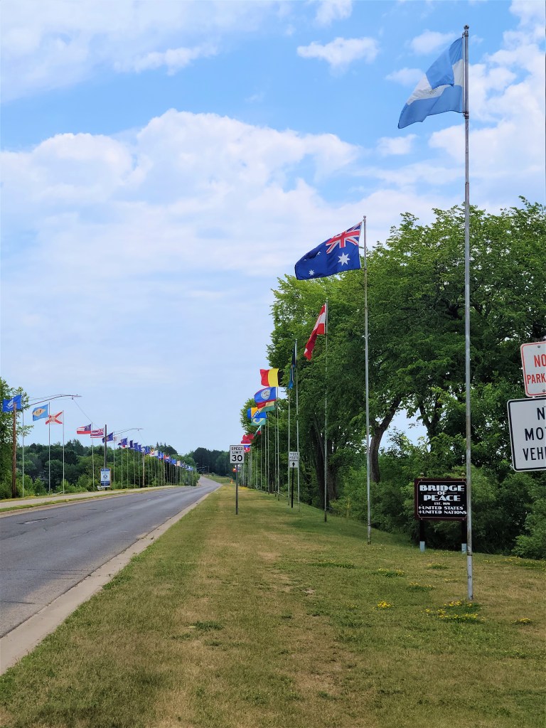
On the way into Chisholm, the trail follows a city park along a lake. At our turnaround point, we could view downtown one way and in the other direction, the “Bridge of Peace” causeway across the lake. The bridge showcases flags from all 50 states as well as flags from around the world, which gives this small town a touch of the cosmopolitan.
Ever watch “Field of Dreams?” (One of my faves.) Chisholm’s other claim to fame is as the home of the legendary baseball player, Doc “Moonlight” Graham, who is featured in the movie.
So, this section of the trail offers mines, museums, and movie heroes. If you want a good introduction to the Iron Range, this is the right section of trail for you!
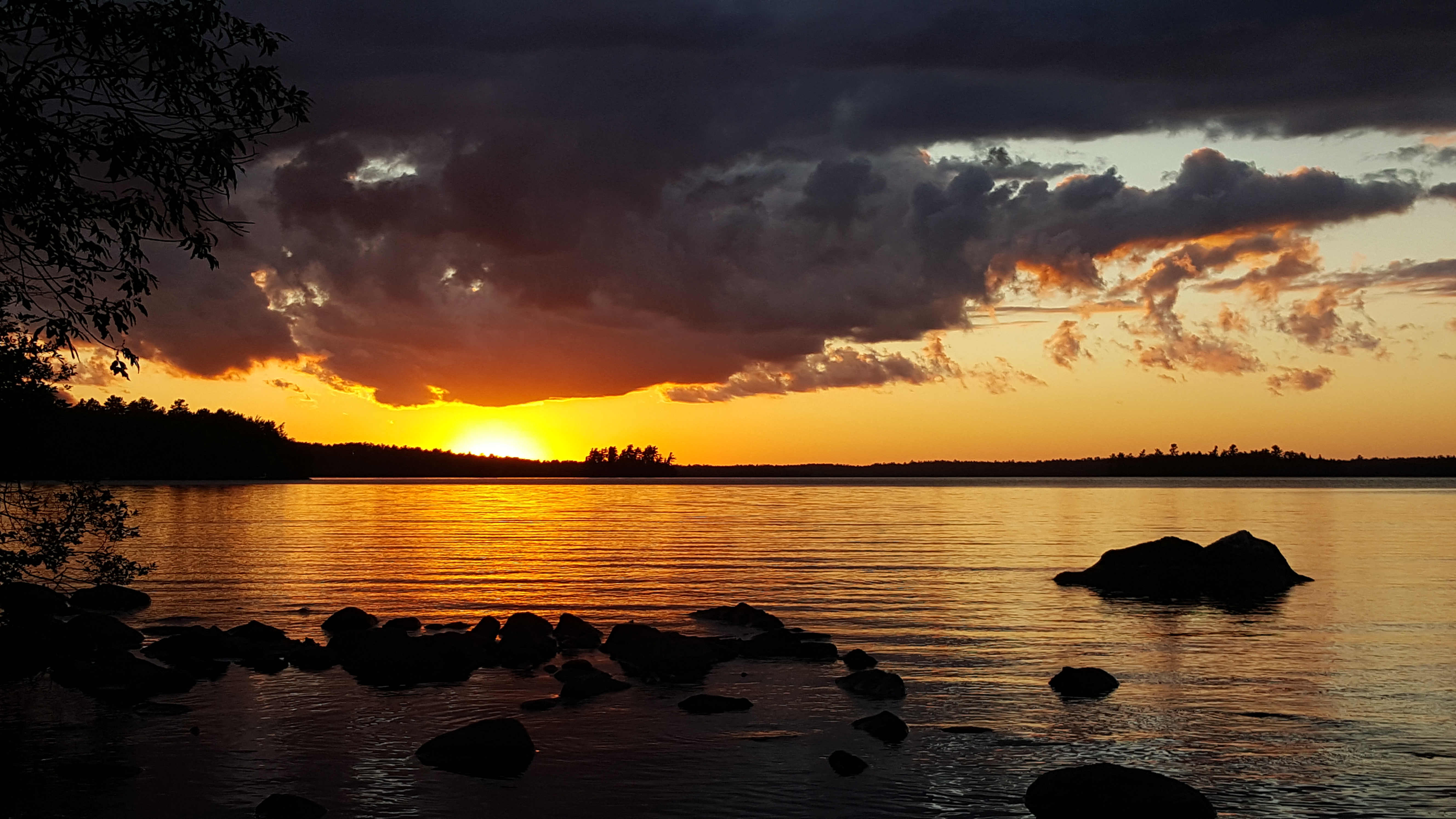
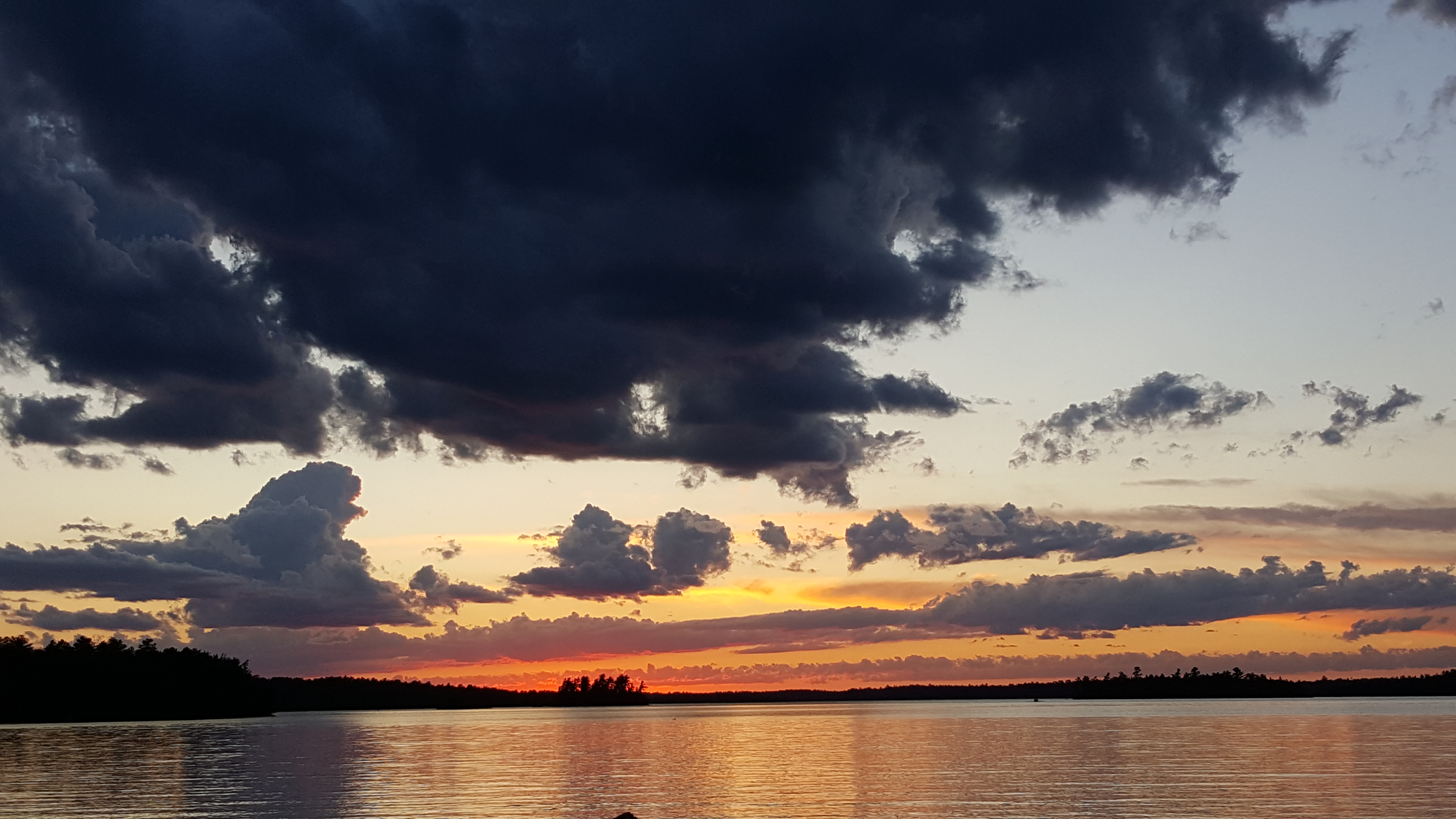
A vermilion sunset on Lake Vermilion. Night One of our stay.
Since nobody wants Americans in their countries right now, Russ and I decided to take several local camping trips. For mini-vacation #1, we trailered our thirteen-foot Scamp to Lake Vermilion State Park, a newish development in northern Minnesota.
I’ve spent some time on Vermilion Lake before but had not been to the park yet. This large lake is reminiscent of the Boundary Waters Canoe Area Wilderness – same rocky shorelines, scraggy spruces and towering pines – but development is permitted (outside of the park) so lots of cabins and lake homes line the shore.
There’s also an historic iron ore mine located in the park. When viruses aren’t running rampant, underground tours are offered, which are an interesting way to learn about the importance of Minnesota’s Iron Range.
We spent two nights in the Vermilion Ridge Campground. We brought our kayak, paddleboard, and bikes, and used them all, even though the weather wasn’t that good. We went during the week because all of the weekends for the summer were booked already – apparently, everyone else had the same idea to travel locally.
Here are some pros and cons we discovered.
PROs
A nice boat launch. You can use it if you have a state park sticker, otherwise, I think there’s a daily fee. (Staying at the campground requires a state park sticker, which you can apply for at a self-service kiosk when you enter the park.) We found that the boat launch dock was a good place to watch the sun set. That’s where I took some of the photos that accompany this post.
Close to the Mesabi Trail. This is a bike trail that spans 135 miles across the north. It’s not all completed yet. The section near the campground seems new. We were able to bike to it from our site and ride 4-5 miles toward Ely before the pavement stopped. Someday, the trail will reach Ely.
There’s wifi! If you need to keep in touch with friends, family, or social media while you’re in the woods, you can.
Quiet. The campground was quiet at night and there’s a good screen of trees between sites, which affords some privacy.
New pavement. The campground was constructed about ten years ago and work is still being done on the roads. All the pavement (including the bike trails) is smooth and new – a dream for longboarders, bikers and inline skaters.
Sunset on Lake Vermilion, Night Two.
CONS
No swimming beach. There’s no good place to swim in the park. A drive is required to reach local beaches on the lake.
Hard to get a reservation. Like I mentioned, we had to go in the middle of the week because summer weekends were filled already. Plan ahead to get the dates you desire.
The campsites aren’t on the lake. They are farther inland. I suppose this is better for the health of the lake, but it would’ve been more scenic to be near the water.
A building at the Tower-Soudan iron ore mine.
Another thing to know before you go is that you can’t bring your own firewood or gather it in the park. You’ll need to pay a fee to use wood the park provides. I think this has to do with not spreading the emerald ash borer beetle.
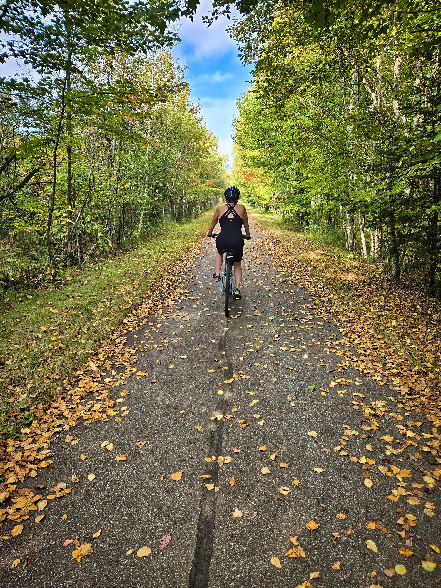
An idyllic scene from the Mesabi Trail.
If you go, we hope you enjoy the park as much as we did. Buddy liked it, too!
Buddy, a goldendoodle naturally highlighted by a golden sunset.


 I’ve spent some time on Vermilion Lake before but had not been to the park yet. This large lake is reminiscent of the Boundary Waters Canoe Area Wilderness – same rocky shorelines, scraggy spruces and towering pines – but development is permitted (outside of the park) so lots of cabins and lake homes line the shore.