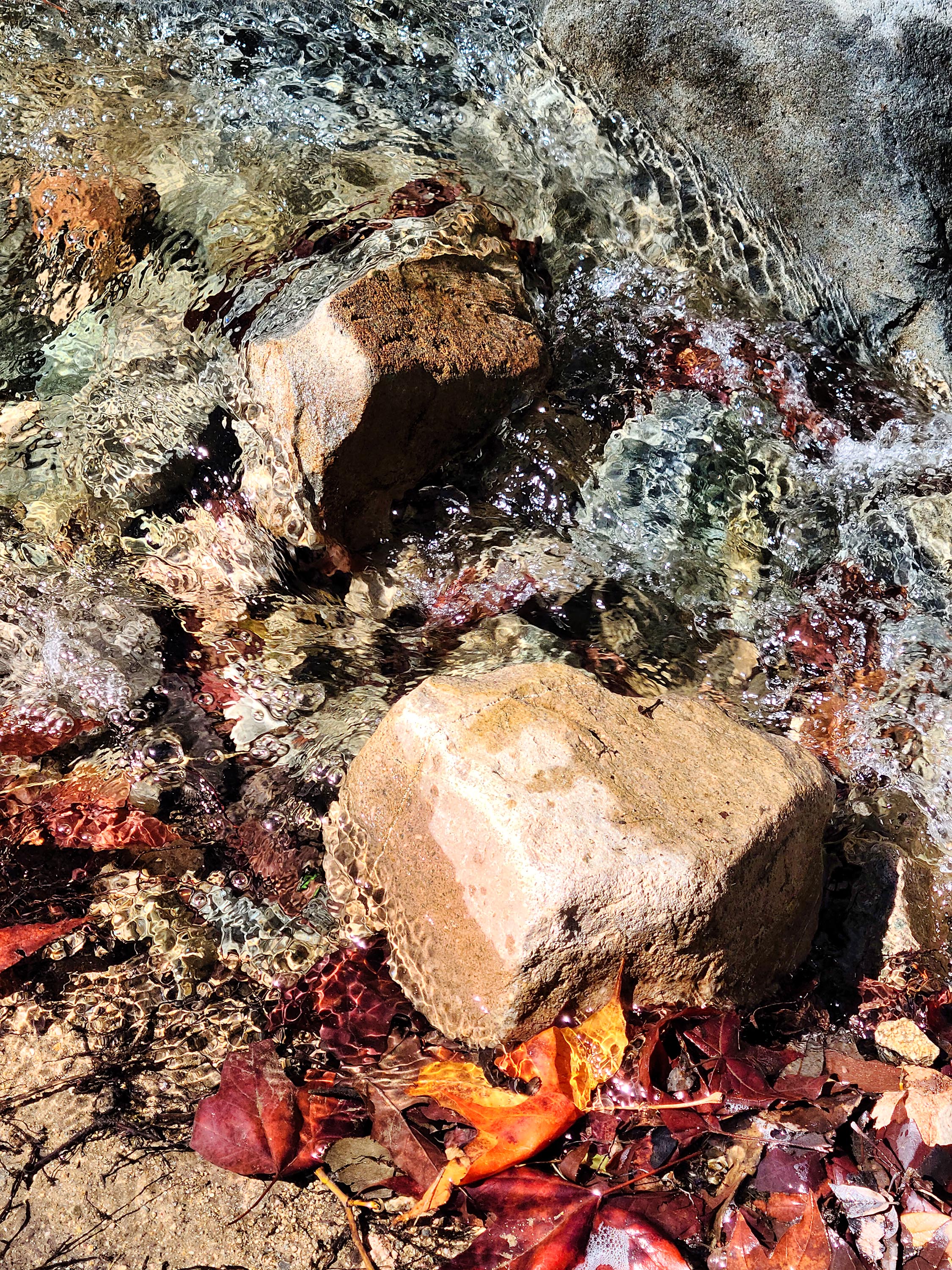
I have two images leftover from my previous blog post about a visit to a park in northern Minnesota. The images want to be seen! So, here they are.

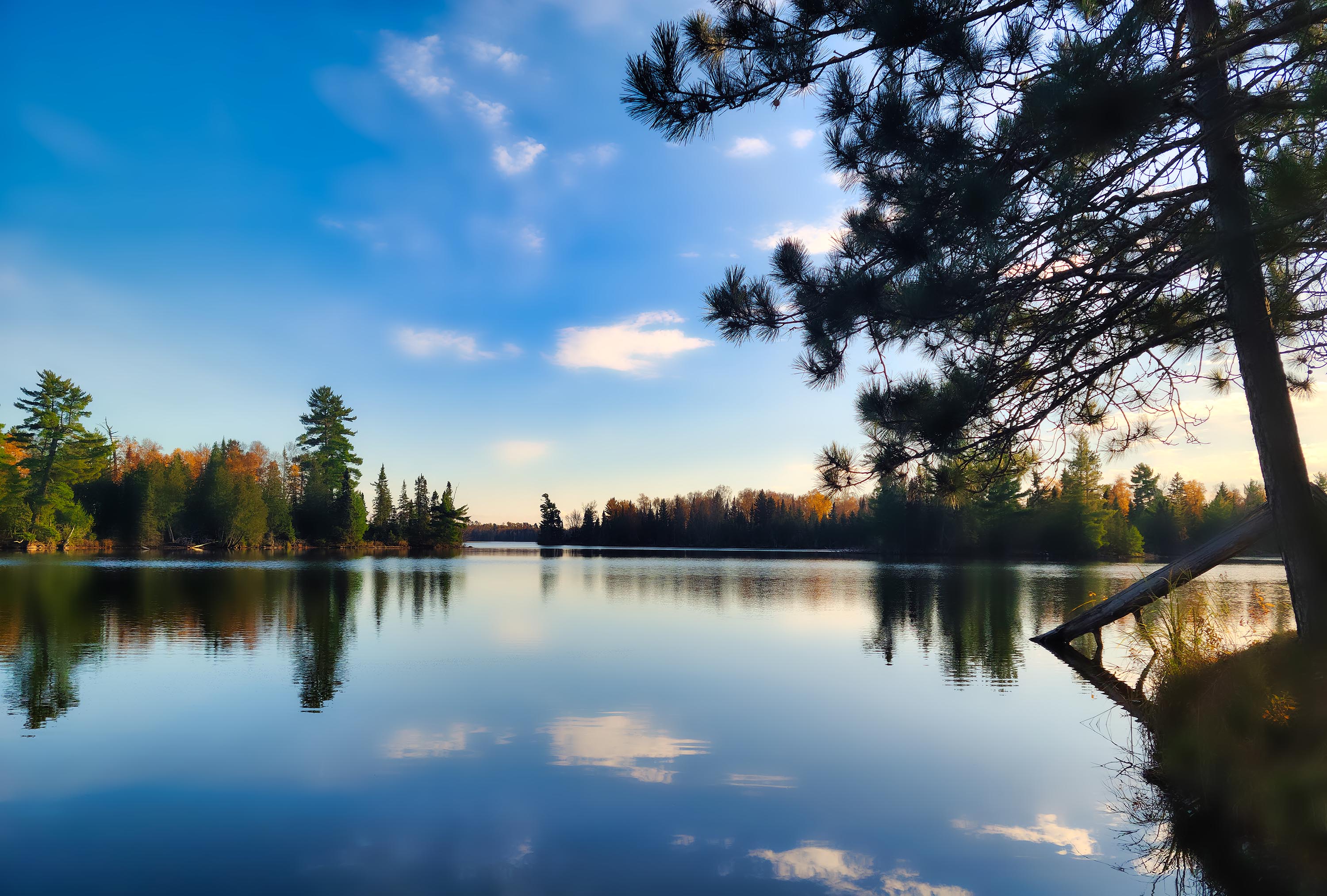
I have two images leftover from my previous blog post about a visit to a park in northern Minnesota. The images want to be seen! So, here they are.

Russ and I had only used our Scamp trailer once this summer (to Pictured Rocks National Lakeshore), so, we decided to get one more trip in before the snow began to fly. We chose Bear Head Lake State Park in northern Minnesota for several reasons: it was nearby, and we had passed the turnoff for it several times and wondered what it would be like to stay there. We were also intrigued because we’d heard that in 2010, it won the America’s Favorite Park contest. It must have something going for it!
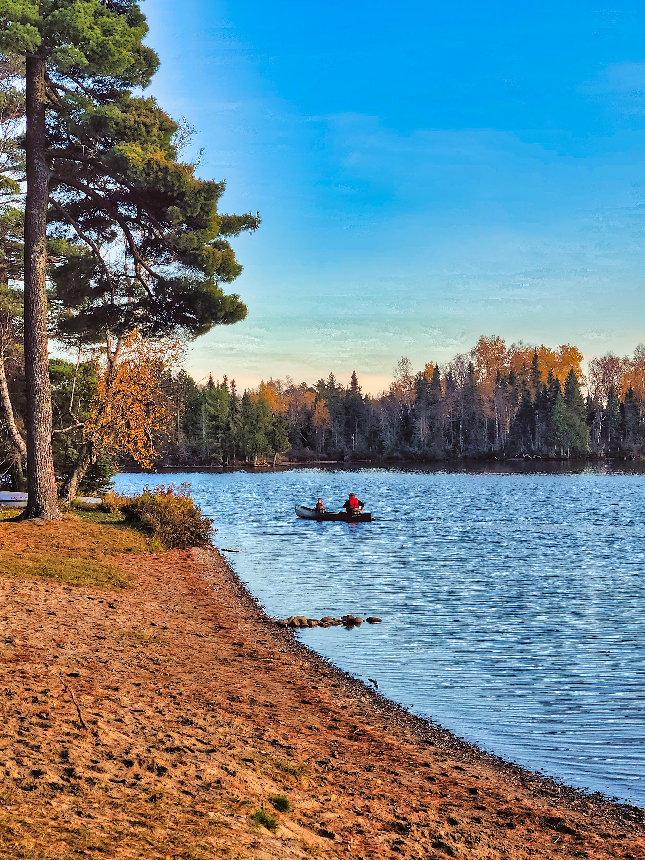
We pulled into our site on a Friday evening. We chose a site on a loop that bordered the lakeshore. One thing that impressed us was that all campers have equal access to the shore. No sites are directly on the lake (they’re across the road from it), but there are several trails off the road that lead down to small docks that are perfect for fishing or lake-gazing.
The air was warm for mid-October and the wind was calm. After our Spam and eggs supper, we took a walk on trails along the lake. The tamarack trees and aspens were still clothed in their splendid yellows. The trail ended at a beach surrounded by tall red pines. We’d find out later that these pines were spared during logging times because they were too small to be of interest. Good thing the place is a state park because they’d certainly be of interest to loggers now!
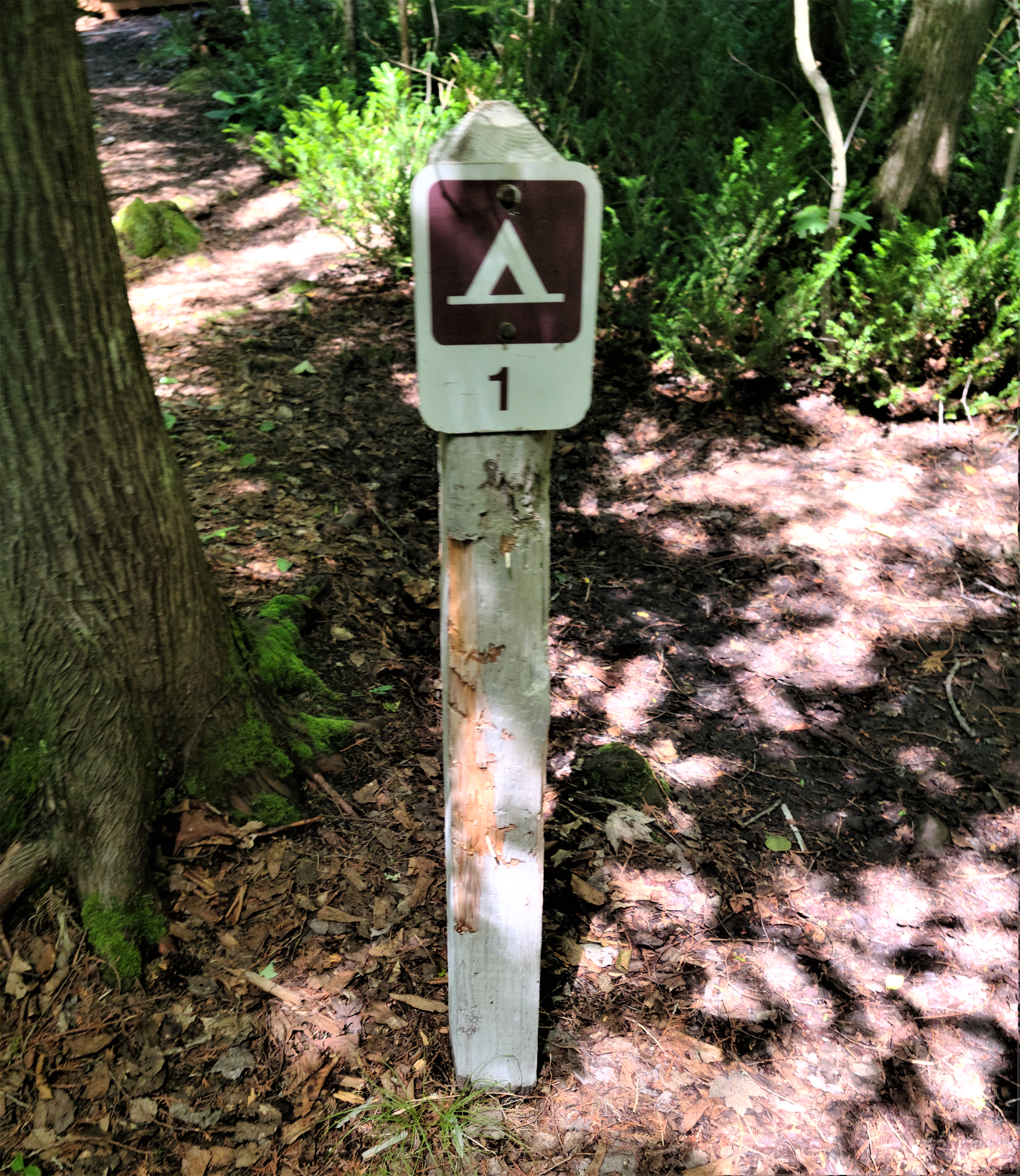
A Trail Center building nearby offered bathrooms and a warm place for hikers to gather before heading out on any one of the park’s 13 miles of paths. I discovered later that the impressive center was built thanks to the park’s standing in the 2010 contest, which was sponsored by Coca Cola. The park won $100,000, which they spent to build the center.
At the time, the park staff credited their win to Facebook and the power of social media because a popular bear frequented the park and people wanted to help draw attention to the bear’s home. The bear is no doubt long gone, but the Trail Center stands as a testament to the good will of social media strangers.
After our hike we enjoyed a fire (firewood is for sale at the park office). Our plans to hike the next day were disrupted by a steady drizzle. We opted to drive to Ely, Minnesota, instead. One of our stops was the Dorothy Molter Museum, which I described in my previous post. We also ended up getting a private tour of the Pioneer Mine Museum. Like the Dorothy Molter Museum, it was also open past Labor Day, contrary to its publicized operating season.

We didn’t intend to visit the Mine Museum. We began walking on a paved trail around Miner’s Lake but the steady drizzle and my failing health (I was catching the flu or something from Russ) made us turn around after a short jaunt.
As we neared our car in the parking lot of the Mine Museum, a man called to us from a building atop a nearby hill. He said the museum was open and he’d gladly give us a tour. Having nothing else better to do on a rainy day, we took him up on his offer.
The Pioneer Mine closed in 1967 and its payload was iron ore. The museum featured a plethora of artifacts and photos from its hey day. Our guide was Seraphine Rolando whose grandfather and other relatives had worked in the mine. Seraphine was a great storyteller and regaled us with tales of memorable rescues and descriptions of what it was like to work in the mine. Unlike the nearby Tower-Soudan Mine, the Pioneer Mine was wet, dirty, and much more hazardous.
Seraphine is a legend in his own right. I found this profile of him in the local Ely paper after I returned home. I easily remembered his name because one of my ancestors was named Seraphina, which must be the female version of his name.

After our tour, we stopped at the Evergreen Restaurant in the Ely Grand Lodge for lunch. Interestingly, the lodge is built on a pile of mine tailings. The restaurant featured a beautiful view of Shagawa Lake and more golden trees.
Rain featured heavily on our next camping day, too. We ended up leaving for home a few hours early because I was now fully engulfed by the flu. But I recovered and am now ready for more meanderings.
Staying at Bear Head Lake State Park is like staying on a lake in the Boundary Waters Canoe Area Wilderness, but with more conveniences. Electric sites are available but not water hookups. A pump well is in the park and civilized toilet facilities are also available. They were closed during our visit, however, so we had to make do with an outhouse.
A final thing I wanted to mention was that one of our camping neighbors employed was using a leaf blower as they were packing up to leave. I suppose they were cleaning leaves off their outdoor carpet, or something. That was a new one on us – hearing a leaf blower at a campground. It’s bad enough hearing them at home, much less in a natural space. I sure hope this doesn’t become a trend!

Rain moved in on our last full day at Pictured Rocks. It foiled our morning plans to hike from our campground (Hurricane River, Lower Loop) to the Au Sable Lighthouse, a 3-mile round trip. But after Russ and I read and were generally slothful, the rain stopped in the afternoon and we were able to hike.
The “trail” to the lighthouse is more like a gravel road. In fact, the park employees who staff it drive on it with their car. It’s mostly level and easy walking along the shore of Lake Superior. Several shipwrecks lie on the beach near the lighthouse, but we couldn’t access them because of the rough waves.

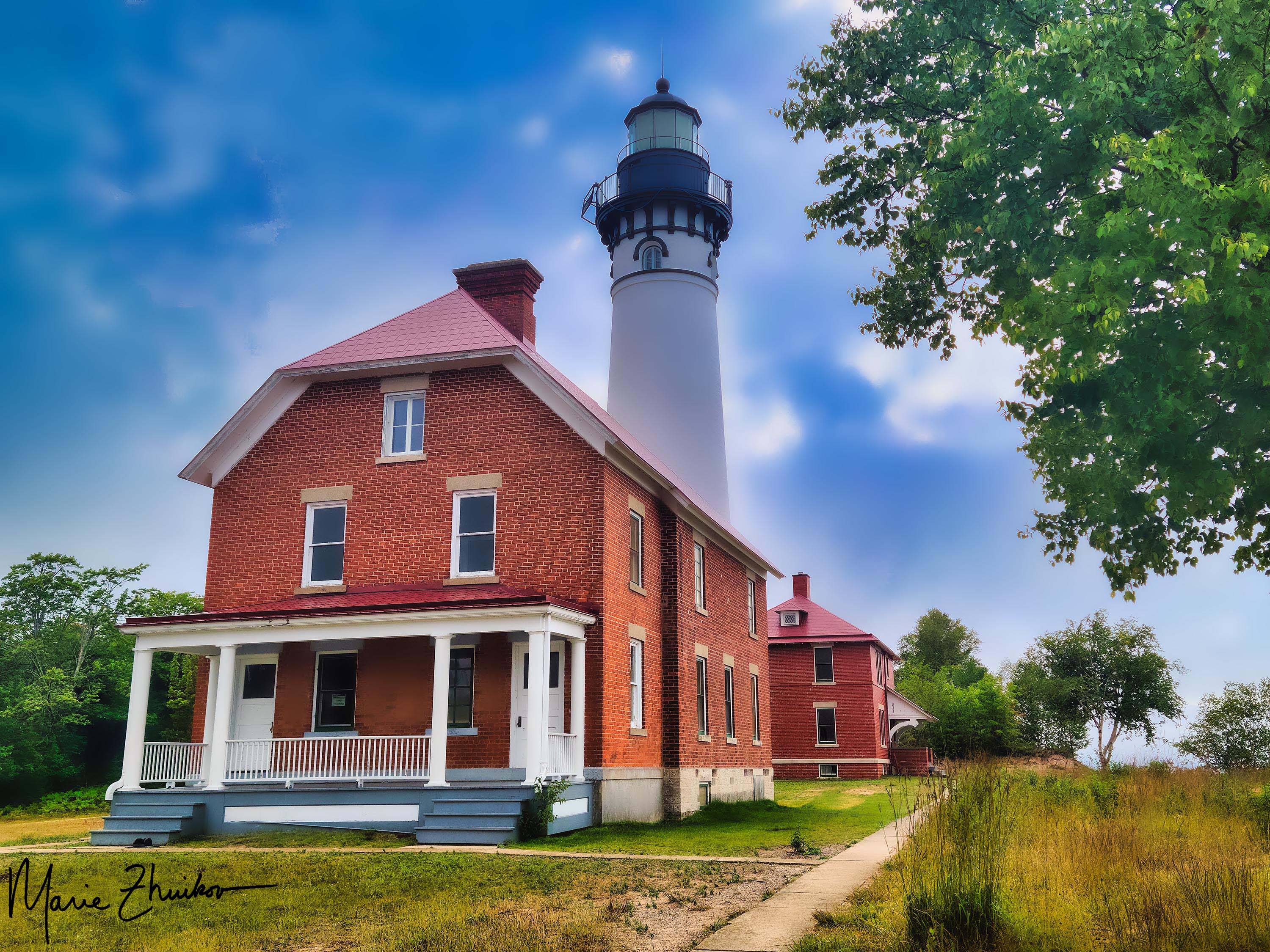
The light station is comprised of a small museum, the lighthouse and keeper’s quarters, a foghorn signal building, two historic outhouses (plus one the public can use), and a small brick oil building.
I’d wanted to visit this particular lighthouse for several years – ever since I discovered it’s the twin of the lighthouse on Outer Island in the Apostle Islands National Lakeshore. I would like to set a novel in the Outer Island lighthouse but was unable to tour inside it, so the Au Sable Light was the next best thing! Tours are offered during the summer for $5.
With its underwater reefs and thick fogs, Au Sable Point is a hazard to Lake Superior mariners. The lighthouse was built in 1874, the same year as the Outer Island Lighthouse. The light tower is 86 feet high. In 1945, the U.S. Coast Guard took over operation, replacing civilian keepers. In 1958, the Coast Guard converted the light station to an automatic, unattended light and discontinued the fog signal. The station became the property of the park service in 1968. The Coast Guard maintains the small LED beacon and solar panel that charges its battery. The park has completed several restoration projects over the years.

The furnishings inside the lighthouse are not original, but they are of the appropriate time period. The keeper’s quarters consist of a kitchen, dining room, living room, bedroom, work room and several closets. The lighthouse tower can be accessed directly from the living quarters.
The second floor of the keeper’s quarters is much like the first and was built for the assistant keeper’s family. Tours include a trip up the 90 steps to the top of the tower, with its impressive view of Lake Superior and the surrounding forest.
After the tour, Russ and I wandered the grounds (with me taking photos). As we prepared to leave for the hike back to the campground, a fog rolled in, completing the ambiance.
Our evening plans included a drive to Munising to trade in our Spam camping food for more elegant fare. We made reservations at Tracey’s at Roam Inn. It was pricey, but the food was worth it! I had the Lakeshore Pan Roast – a seafood stew made with lobster, whitefish and scallops in reposado cream (made with tequila). Russ had the Grass-Fed Bison Filet Mignon. You can choose three different ways for your meat to be prepared. He chose the “House” method, which involves covering the meat in pepper and serving it with mashed potatoes, birch syrup asparagus, and morel mead cream. If you like pepper, this is the dish for you.

Both of our meals were luscious and provided the perfect end to a wonderful trip. For dessert, Russ had the chocolate cake (served with raspberry sauce and whipped cream), and I had the crème brulee served with lingonberry sauce and a stroopwafel (a Dutch waffle cookie with caramel filling). This put our meals over the top!

As we dined, we reflected on our experience. I was tickled by how excited people became from seeing “rocks.” On our sunset cruise, they were taking selfies with the various rock formations as well as cell phone videos to share with friends. Calling the Pictured Rocks National Lakeshore “just a bunch of rocks” (like our church friend did) was like calling the Grand Canyon “just a big hole in the ground.”
The next day, we would drive home with our Scamp. But we would do so filled with a new appreciation for an area we had driven past many times but never had time to visit.

Pictured Rocks National Lakeshore in Michigan has plenty of wonderful overlooks across Lake Superior with great views (for some, see my previous post here).
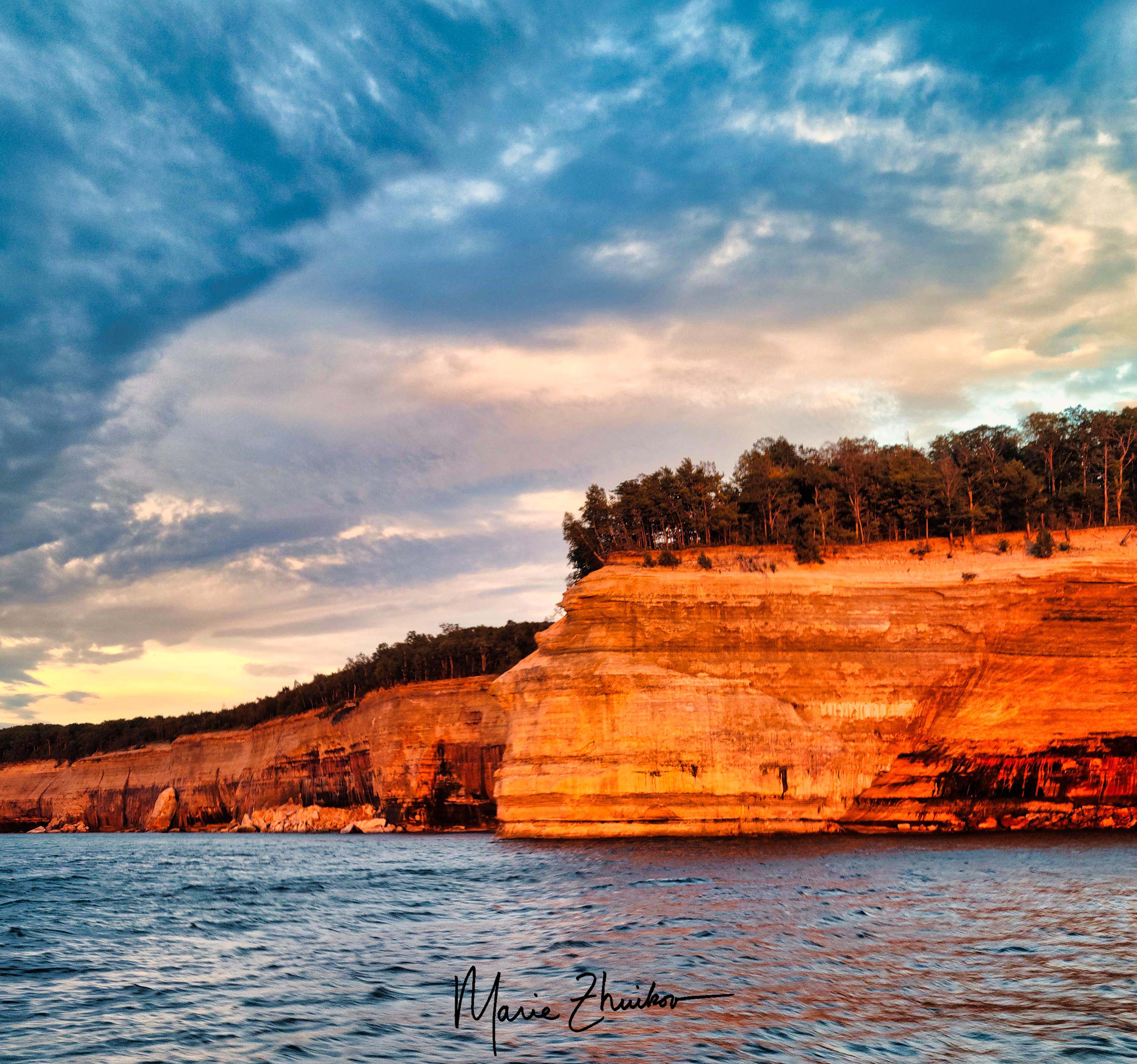
But the best way to see the sandstone rock formations is via boat. Russ and I took a sunset cruise the first full day of our trip. We knew the weather would be changing to rain the next day, so we didn’t want to miss the opportunity for good photos.
Our particular cruise left from the town of Munising. Although we arrived at the cruise dock early, apparently, we weren’t quite early enough. A huge line had already formed.

Pro tips:
There were so many passengers, the cruise line ended up fitting us onto two boats. Russ and I nabbed seats in the middle of the top deck. Not ideal, but not that bad, either.
The captain wouldn’t let people stand up to take photos, so when we neared interesting rock formations, I had to go downstairs to the viewing platform on the back of the boat where photography was allowed.
The sunset was colorful, but even more impressive was how it reflected off the rock formations. Although the sunset cruise costs a bit more, it’s worth it for the added colors.
If there’s some way you can get out on the water in a canoe or kayak, that would be even better for taking photos, but we didn’t have time for that.
Next up: a lighthouse tour and a sumptuous meal in Munising.


When I mentioned to someone at church that Russ and I were planning on camping at Pictured Rocks National Lakeshore in Michigan, the fellow said he thought the place was overrated.
Shocked by his unusual opinion, Russ and I talked about other things with him for a bit until I had to ask why he thought it was overrated. “It’s just a bunch of rocks,” he said.
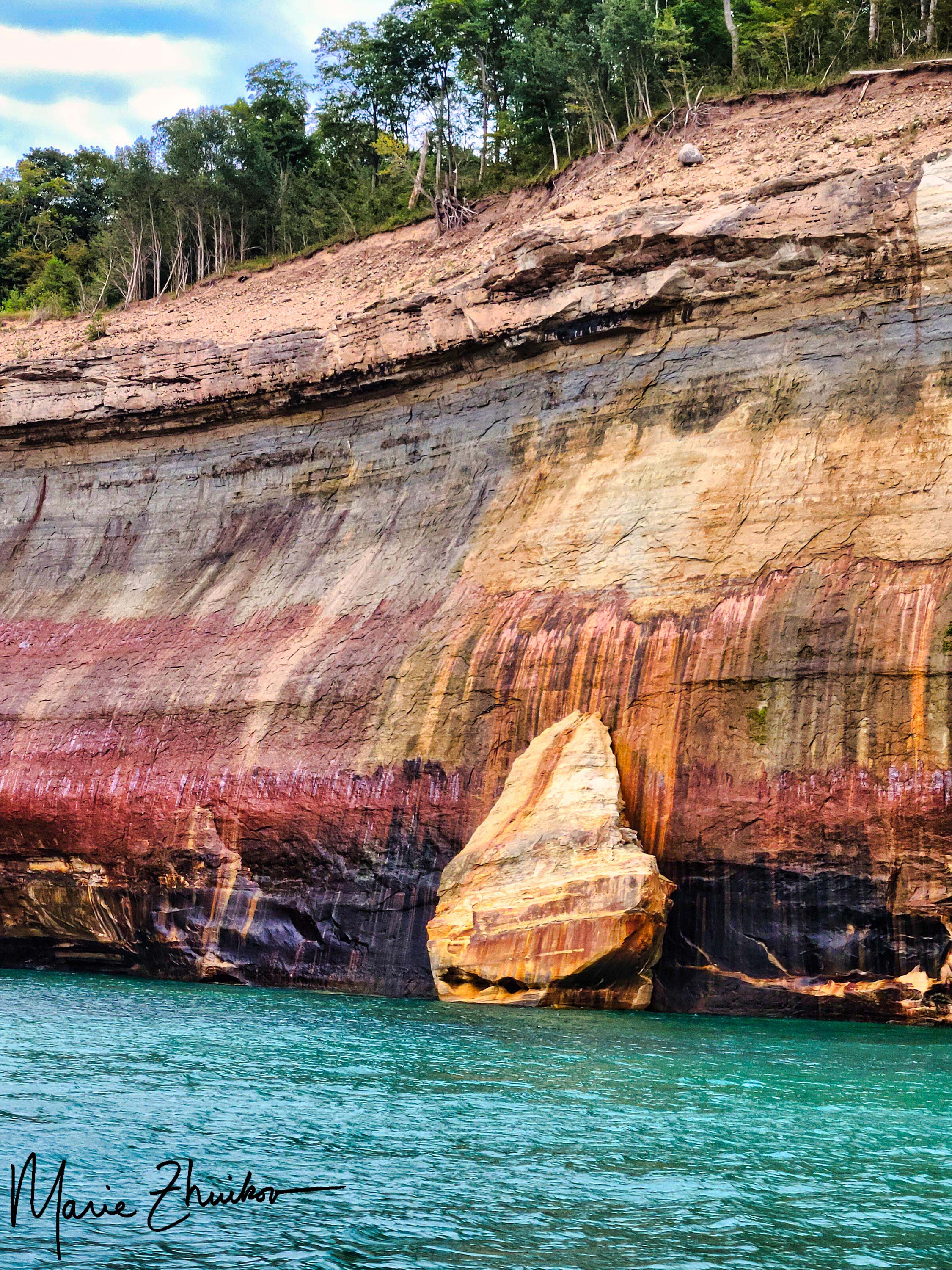
We managed to keep straight faces for the rest of the conversation, but during our Scamping trip a couple of weeks ago, it was our favorite thing to say whenever Russ and I saw one of the spectacular Jacobsville Sandstone formations in this park along Lake Superior.

We camped for three nights at the Hurricane River Campground (Lower Loop). We chose that from several other options because of its close proximity to Lake Superior plus a trail that leads to a lighthouse I’ve wanted to see ever since I learned that it’s the twin of the lighthouse in the Apostle Islands where I want to set a novel.
After a 6-hour drive from Duluth, we set up camp just in time to catch the sunset over Lake Superior. We were driving around the campground, looking for drinking water, when we caught a glorious orange glow coming through the trees. I made Russ stop the car and let me out. I ran with my camera to the rocky beach. By that time, the orange had muted to a purple-blue-orange, but I still managed to get one worthy shot.

The next morning, we headed out early on our bicycles. We pedaled 5 miles on the scenic, twisty-turny highway and a gravel road into Twelvemile Beach Campground. (Warning: if you do this, be prepared for hills!) Although we were perfectly happy with our campground, this one had gorgeous sites strung out along a sandy lakeshore with huge pines. If we end up returning, we’ll try this one next.
Once we biked back to our campground, we spent some time wading in Lake Superior to quiet our strained calf muscles. After lunch, we drove 12 miles to Grand Marais to resupply our ice and firewood. This quaint town reminded me of Grand Marais, Minnesota, on the lake’s North Shore in many ways, except that the beach is sandy instead of rocky.
Russ was eating cherries and spitting out the pits as we drove along. I hereby apologize to the citizens of Grand Marais for his littering. If cherry trees someday spring up in town, you’ll know who to blame. 😊
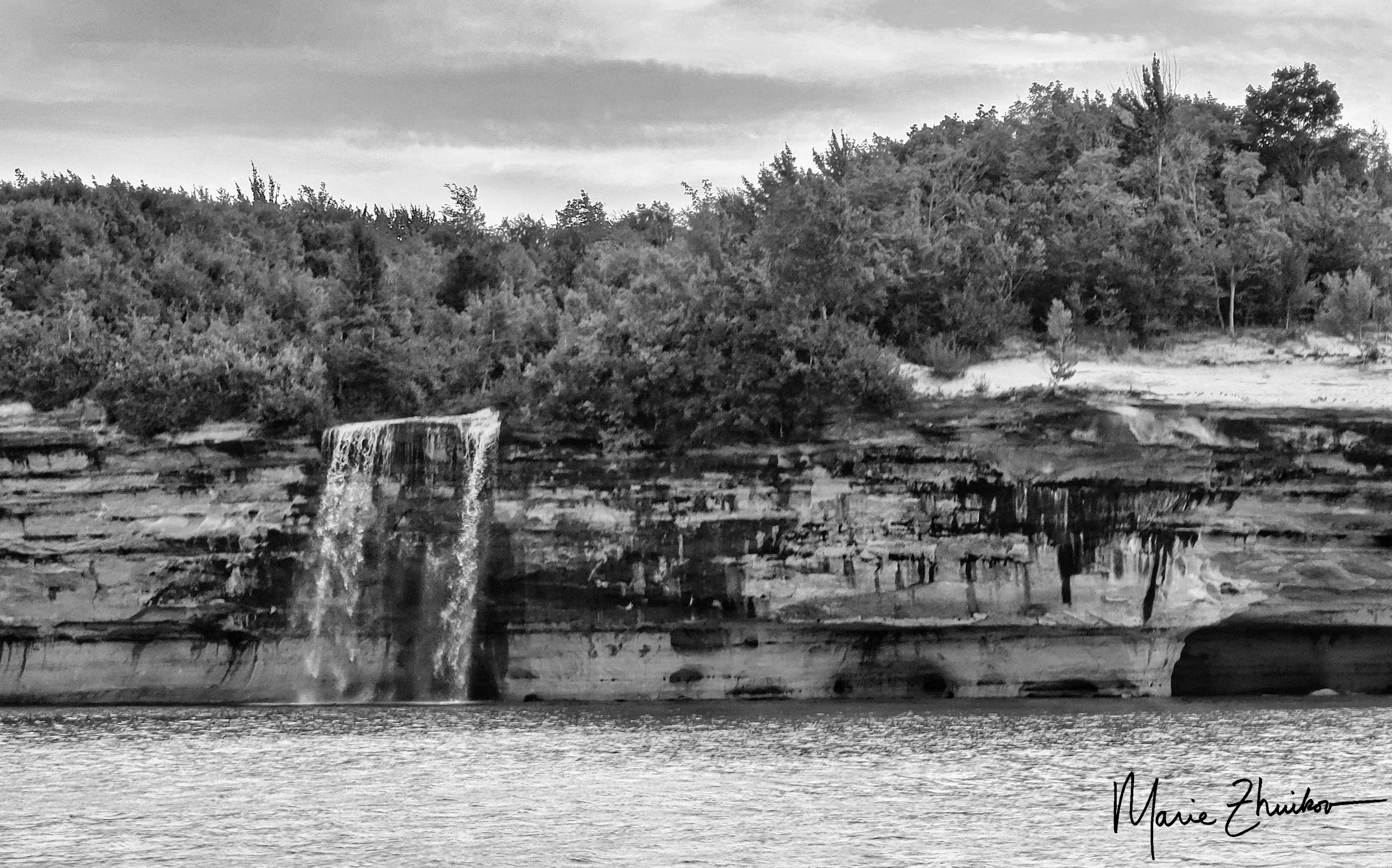
On our way back, we stopped at Sable Falls, which requires 168 steps down a stairway and another 168 on the return trip. The sight was worth it – the falls are beautiful! They come from the outflow of Grand Sable Lake. (Sable is the French word for sand.) A short way down the road from the falls there’s an overlook for the lake. We stopped and were impressed by the lake’s size and by a heavily laden apple tree rustling in the breeze.


Our next stop was the Log Slide Scenic Overlook. Back in the 1880s, lumbermen built a wooden chute that plunged down the steep sand dunes. Logs were sent down the chute to waiting ships for transport. The wooden chute is no longer there but the impressive dunes are. It’s said that sometimes the logs would catch fire on the chute due to the friction from the sand and wood, as well as the heat of the sun.
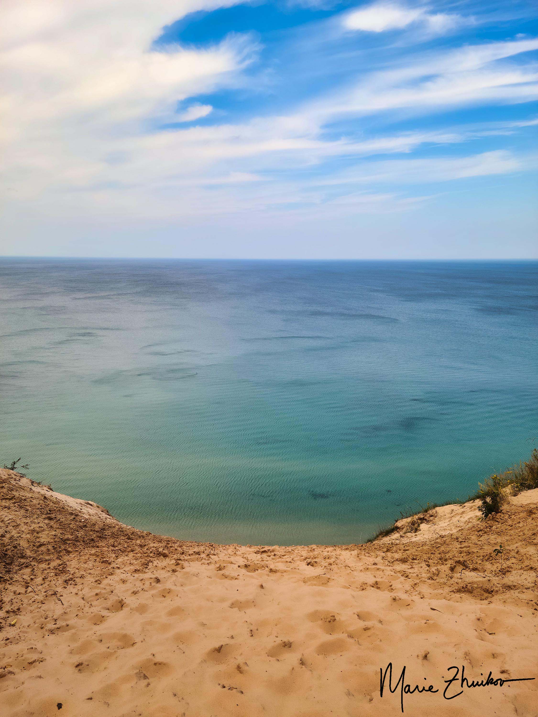
Although it’s possible to walk down the path of the chute, it’s a LONG way back up, and we decided our legs had had enough exercise between biking and stair climbing. Besides, the view from the top was impressive enough.
We continued our sightseeing, driving toward Munising. We stopped at Miners Castle Scenic Overlook, which features viewing platforms for an eroded rock that looks like a castle turret. The shallows of Lake Superior around the formation were a breathtaking turquoise green, making us feel like we were in the Caribbean instead of the Upper Peninsula.
Despite this, Russ and I turned to each other and said, “Eh, it’s just a bunch of rocks.” 😊
Our final stop on this busy day was a sunset cruise out of Munising, where we saw yet more rocks. More on that in my next post.


When the Rainy Lake Visitor Center was dedicated in Voyageurs National Park in northern Minnesota, I was there. That was maybe about thirty-five years ago. My mother wanted to attend, and she asked me to go with her. I’m not sure why she wanted to attend except that she liked national parks and perhaps this was her way of feeling connected to a local one.

The ceremony was interesting and came complete with a man dressed up as a French voyageur – one of the intrepid fur traders who plied the waters by birch bark canoe in the 16th to 19th centuries. I know I have photos of the ceremony – I’ll peruse my old albums to see if I can find any to include with this post.
This is just a long way of saying that, although I was part of the park’s beginnings, I had not visited it much, if any, since.
Russ and I had a desire for an overseas vacation this summer, but I, as the major trip planner, just couldn’t muster much enthusiasm for the effort it would require. I think I’m still recovering from all the travel we did last year in the “post-COVID” frenzy.
So, we thought of trips closer to home. Houseboating on Rainy Lake in Voyageurs popped into my head. There used to be billboards advertising the houseboat companies on a local major highway and I always thought it would be fun to try.
The idea appealed to us because it would be like being in the wilderness, except with comfortable beds, a refrigerator, and no need to paddle (except for fun) due to the houseboat’s motor. We have some experience driving boats. It sounded perfect! Plus, we’d get to know the park better.
With enthusiasm, we began planning and invited Russ’s grown son Garrett along on the four-night, five-plus-day trip.
After we arrived at the houseboat base just outside International Falls, Minnesota, we loaded our gear onto the watercraft, a 42-foot Minnitaki, which sleeps two to six people. From the dark paneled interior, it looked like the boat was built in the mid-1980s. Some of the houseboats feature hot tubs, but we did not feel the need for one of those. We were being decadent, but not THAT decadent.
We were required to rent a small motorboat to tow along behind us in case of emergencies. The motorboat is also useful for exploring or fishing. We also bought 3 bundles of firewood. We brought our own paddleboards and a kayak, which easily fit on the top level of the houseboat.
We were oriented to its somewhat complicated workings by one of the staff, who also piloted it out of the harbor and made sure we were comfortable driving it before he was picked up by another staff person in a motorboat and we were left alone.
It felt rather like when I was cast adrift on a paddleboard for the first time. However, this was a 42-foot, a much more expensive craft! I was glad we opted to pay the hull insurance the company offered.
The weather was sunny with a wind at about 6 mph. That might not seem like much wind, but in a boat shaped rather like a huge bathtub, it was a lot. We all took turns driving and were surprised by how hard it was to keep a straight course. The boat comes equipped with computer navigation and the lake comes equipped with red and green buoys. We just needed to keep the red buoys on our right and the green ones on our left so that we did not run aground. Easier said than done.
After zigzagging across the lake for about 8 miles, we were ready to moor for the night. Rainy Lake features designated houseboat sites on land where the boats need to be tied up for the night by 6 p.m. No driving boats in the dark is allowed, nor is anchoring.

The first designated site we wanted was already occupied so we chose a “traditional” site on a nearby island. We weren’t sure of the island’s name because it wasn’t listed on our chart, but we figured out later it was Oveson Island. Traditional sites don’t have houseboat signs and they are a bit more primitive than the designated sites.
We tied the houseboat to three trees as instructed and walked down the skinny wooden gangplank to explore the small site, which came with a fire grate. It looked much like any wilderness campsite with rocks and pine trees.
After a scrumptious steak dinner thanks to the houseboat’s gas grill, I explored the island. A well-worn trail led away from our campsite. I was surprised when it ended at a well-built privy. I was like, “What the heck?!”
A trail from the privy led to a boardwalk and a small picnic area. Next to that were several buildings painted a light green. Interpretive signs along the way informed me this was the Oveson Fish Camp, built by Harry Oveson and occupied during summers from 1959 to 1985. Harry fished for whitefish and walleye.

An icehouse, a fish processing shed, and Harry’s house make up the camp. There’s also a large dock so boaters can visit.
Besides being a fisherman, Harry was a jack-of-all trades. He was an inventor, ham radio operator, mink farmer, home flipper, and an avid reader and bird watcher. I figured out later that I am acquainted with his nephew, Tony, who still lives near the park. Harry’s descendants operate a lodge on Pelican Lake, about an hour’s drive away.
Excited by my discovery, I scampered back to the houseboat. When I arrived, I told the guys that I found something, but I didn’t tell them what. They followed me down the trail, curiosity piqued.
I stopped proudly at the privy and said, “I found a privy!!”
They looked unimpressed until I laughed and pointed down the boardwalk where they could see the rest of the fish camp buildings. They were more impressed by this. (It’s the wilderness. Sometimes, you need to make your own entertainment.)
We spent the rest of the evening exploring the camp and later had a campfire at our site. At sunset, a single loon stationed itself off our stern in the small bay. It wailed a few times, making the wilderness ambiance complete.

We also heard noises nearby that sounded like people having a party. Garrett thought it might be geese. Later, it began to sound more like geese to me, but not Canada geese. I wasn’t sure what they were.
The night sky was filled with gobs of stars – Voyageurs National Park was just recently certified as an official Dark Sky Park, so it’s protected from light pollution.
Our sleep on the boat was restful except for the thumping of the motorboat against the stern. We hadn’t read the part in the boat manual yet about tying the motorboat up on shore for the night, but you can be sure we did that the following night. That turned out to be a very good thing!
In the morning, I enjoyed my mug of hot chocolate outdoors on the back porch of the boat while wearing my fluffy light blue bathrobe. I have never worn a bathrobe in the wilderness, and this felt especially luxurious.
The weather forecast called for sun, heat, and twice as much wind as the day before. Given the difficulty we had steering the boat, we decided to stay put. The wind was expected to die down the next day.
We spent our time paddling around the island in our kayak and paddleboards. Garrett and I saw a bald eagle, a single loon that I was pretty sure was the same one from the previous evening, and a regal pair of trumpeter swans. These must have been making the mysterious geese-like sounds we heard the night before.
The day was restful – full of reading, games, conversation, and eating. I watched a red squirrel drink from a puddle. I investigated the otter scat – full of crayfish parts – that littered the shoreline rocks. The sunsets both nights were beautiful – the sun made into an orange and then huge red ball in the sky from haze from wildfires in Canada. The loon parked itself off our stern again, giving its mournful wail. It sounded lonely. I called back to it a few times to give it some semblance of company.

However, the night was not restful. Around midnight, the wind switched so that it was directly behind us, causing our houseboat to bang into the shoreline rocks. Russ got up and retied our lines, but it was too late; our boat was wedged sideways on a rock ledge. After his effort, much of the bumping sounds stopped, but we had visions of a hull breach and our trip possibly being over. Once again, I was thankful we bought that hull insurance.
We’d have to radio the houseboat base the next morning and let them know the bad news. I mulled this over while listening to the loon, who had begun calling again.
Was our trip over? If not, how did we get out of this fix? Read the next installment, coming soon!
I had the chance to meander to Stockton Island, one of several islands in the Apostle Islands National Lakeshore in Lake Superior a couple of weeks ago. I was there to cover what the National Park Service is doing to make their facilities on the island more accessible to disabled people. I’ll be writing a story about that for work, but I also got a tour of the island by former park ranger, Neil Howk, who gave us (there were about 8 of us) the skinny on the history of black bears on the island.
Neil worked for many years in the Lakeshore and is now on the board of the Friends of the Apostle Islands, which organized the tour on a sunny, breezy Friday. Neil took us on a short hike on the trail that leads through the campground on Stockton Island to the signpost for campsite number 4. We took a sharp right and began bushwhacking into the woods. Neil knew there was a bear den nearby.
After not too much whacking or getting whacked by tree branches, we came to a deadfall – a tree that had been blown over by wind. Neil said the bear had made its den among the tree roots, which provided a fairly snug place to spend the winter.
He felt okay taking us to this location because: 1) It’s not winter, so no bear will be actively hibernating there, and 2) Bears usually only use a hibernation site once, so disclosing its location should not endanger the privacy of any bears (except if another one ends up using it!)
Besides overwintering in dens in rocks or tree roots, black bears have also been known to hibernate inside hollow trees and even in eagle’s nests. I did not know the eagle’s nest thing. I also learned many other new bear trivia, such as: bears don’t poop all winter. Neil said they eat grass in spring to get their bowels going again.
Also, cannibalism is normal for bears. Males will sometimes eat cubs – presumably ones that aren’t related to them, in order to bring females into estrus sooner so that they can procreate with them. And bears will also eat meat (besides the berries, ants, and other things that bears are known to consume). Neil said that deer fawns and chipmunks are among their favored meaty fare.
Another fact that Neil conveyed is that when bears were first counted on Stockton Island – sorry, I’m not sure when that began – there were only a couple. But now there are 20 known to live there. I can attest to their presence. On my several trips there, I’ve seen many bear tracks on the island’s beaches. (I’ll try to dig up some of my photos of those for this post.)
One memory that emerged during the tour came from a trip I made to Russia many years ago. One of my former husband’s relatives bragged about a bear he had shot. Granted, this relative liked his vodka and ended up chasing one of my young sons around the picnic table where we were eating – he was a rather scary, imposing figure, somewhat bearish. At some point, he showed us photos of his triumphant hunt. From the snow in the photo and the location, it became obvious that he had shot a hibernating bear. So much for sportsmanship, but I guess maybe they do things differently in Russia!
Anyway, I learned some things I didn’t know about bears from this tour, and I hope you did, too.
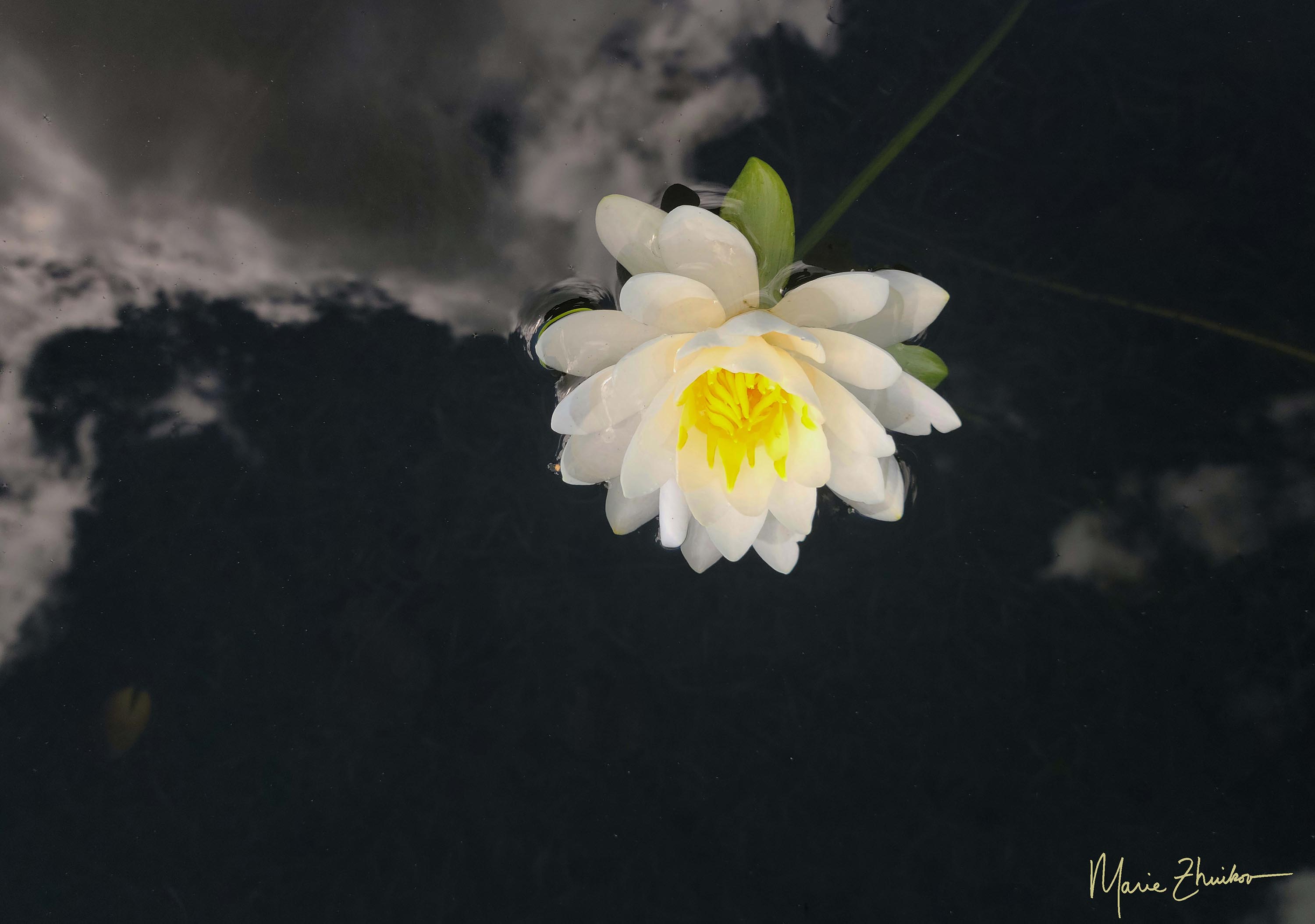
I was paddle boarding at our cabin recently and had my phone along. I don’t always take it because it could fall into the lake. It’s the height of summer here in the northland and the water lilies were blooming. I decided to try and get a good photo of one.
I maneuvered my board next to a lily and ended up sinking it. Argh! But it popped back up. As the water drained from its petals, I began taking photos. After about the third one, I noticed that the clouds were reflected in the water. Cool!
My board drifted away from the lily and my friends, who were in a canoe nearby, requested my presence, so I had to leave the lily.
Once back on land, I excitedly viewed my photos. One turned out just as I had hoped. Although the plant stem and a leaf are discernable underwater, it looks like the lily is floating on a dark sky with white clouds. I hereby dub it, “Sky Lily.”
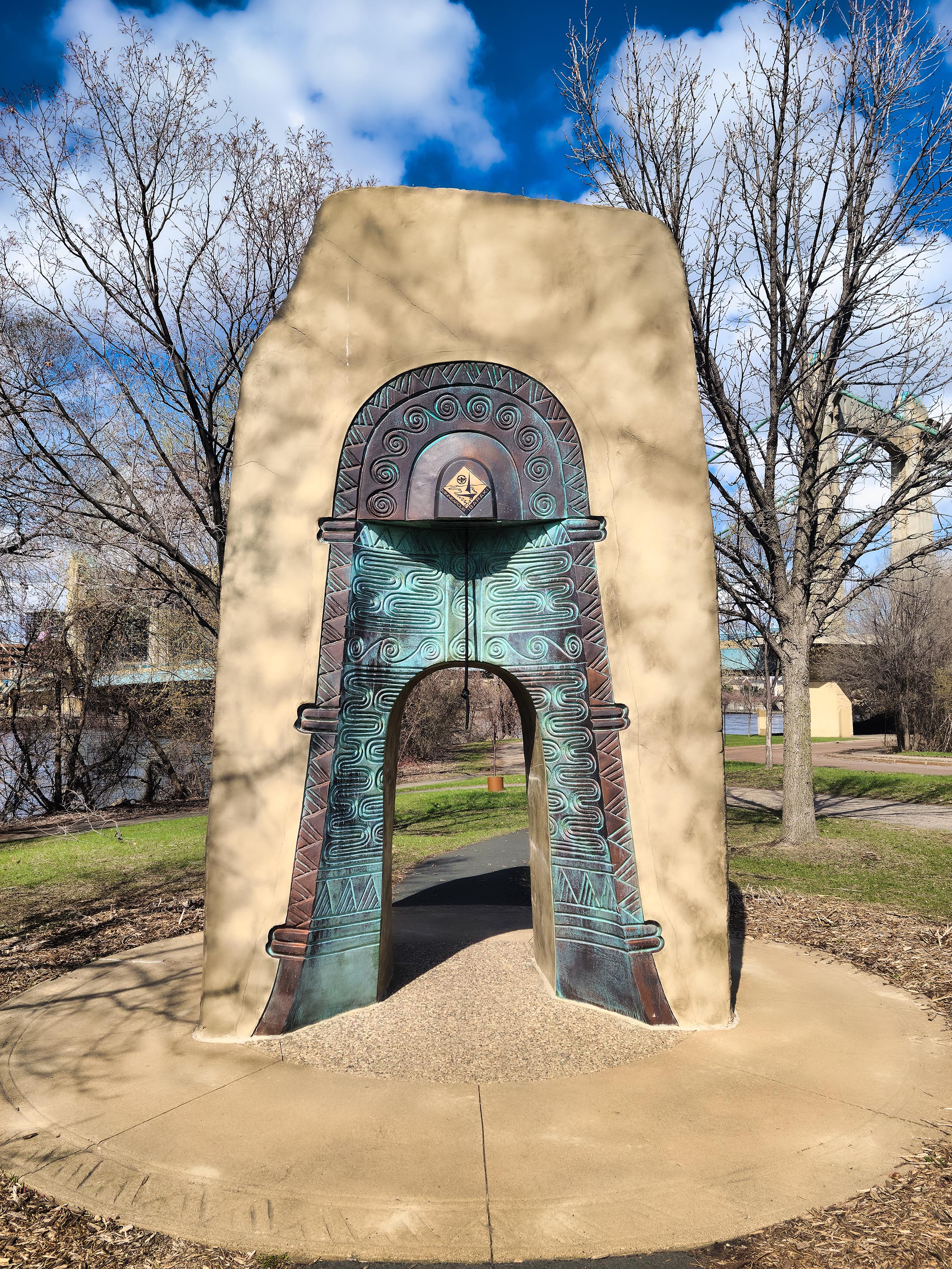
This is the Bell of Two Friends on Nicollet Island in Minneapolis. We came across it during an impromptu walk around the park pavilion. See the rope hanging down over the archway? Ringing the bell it’s attached to signifies a prayer for world peace and continued friendship between the people of Minneapolis and their sister city, Ibaraki, Japan.
The sculpture was inspired by a 2,000-year-old terra cotta mold of a bronze bell, discovered in Ibaraki. We didn’t know all this when we rang the bell, but we could feel the friendship somehow.
Nicollet Island is supposedly the only inhabited island in the Mississippi River. I’ve had the chance to visit it on several occasions. Each time, I come away thinking that if I was forced to move from Duluth (probably at gunpoint, which is what it would take) and reside in the Twin Cities, I might be able to be happy on this island.
I love the historic feel of it, the energy of the river that runs on both sides, the roar of St. Anthony Falls, the green spaces, and old homes. My latest visit prompted me to read a book about the island (“Nicollet Island” by Christopher and Rushika February Hage). I learned that there used to be five other islands near it but once settlers arrived, two were filled in so that they joined the riverbank, two were destroyed when a lock and dam was built, and one eroded.

Before it was named for explorer Joseph Nicollet, the Dakota people called it “wita waste,” meaning beautiful island. They fished from its banks and tapped maple trees that covered it. Rites of transition from childhood to manhood were carried out there and the island was considered as a safe place for women to give birth. Plus, it had the added benefit of the sound of the falls to drown out the screaming. 😊
Waterpower from the falls proved irresistible to the settlers, who used it to run sawmills and flour mills. Once the home of the most fashionable and prominent Minneapolitans, the island changed drastically after a fire in 1893 that began by boys smoking at a Wagon Works. Eventually, rebuilding occurred in the form of a Catholic high school and a monastery. Once-elegant apartments were subdivided and occupied by pensioners and veterans. As the economy tanked during the Depression, the island became home to the homeless.

In the 1950s, the city razed many buildings in the nearby Gateway District, forcing even more homeless people to the island. Then the razing eyes of city government turned toward the island, but the residents resisted.
In the 1960s and 70s, the island was a favorite with the counterculture. Musicians, artists, (dare I say writers?), and drug-users coexisted with the poor island residents. They did not want to be “improved” upon by city planners.
In 1971, St. Anthony Falls and the island were designated in the National Registry of Historic Places. A city preservation commission helped with a movement to preserve the island’s historic homes. Eventually, a city park was established on the site of vacant industrial land.
Now, people like Russ and I enjoy walking, biking, and running on the island. And we ring a bell in world friendship.
When last you heard about us, Russ and I were having past life regression sessions in Prescott. That done, we left Prescott a day early under the impending threat of ten inches of snow. We drove across the mountains to the funky mining town of Jerome. Russ had not been there before and we were so close, it seemed a must-see.
Like on my previous trip, we ate lunch at Bobby D’s BBQ. This time, it was Russ’s turn to sit in the “haunted booth” where a former restaurant owner died. Despite this unappetizing tale, we heartily enjoyed our lunch of BBQ chicken, ribs, onion rings, and zucchini fries. They make the BBQ sauce on-site. Our favorite of the four was the jalapeno, molasses and brown sugar one. Zippy but not too spicy, even for us Minnesotans.


Sated, we searched for Nellie Bly’s kaleidoscope shop, which I’d visited last time. Then, I did not purchase any of these tubular wonders. Now, I had some relatives’ birthdays as an excuse. I even bought a small polished wooden one for us. Sometimes, you just need to look at the world in multiple triangles.

After some more browsing, we decided it was best to hightail it to lower elevations before the snowstorm came. We drove to Phoenix where we stayed overnight. The next day we visited the Heard Museum, which specializes in Native American art. From the sculptures outdoors to the paintings indoors, it was all marvelous. But my favorite exhibit was “Stories Outside the Lines: American Indian Ledger Art.” Hidden in several upper floor hallways, the drawings show events and past achievements that Native artists recorded in ledger books.
According to the museum, this art form began in the late 19th century when several Great Plains tribes were relocated to reservations by the U.S. Government. Many of their cultures had traditions of recording events on animal hides using natural pigments. Faced with imprisonment for practicing their cultural traditions, the Natives turned to the materials they had at hand, which were ledger books and colored pencils, provided by traders and government agents.
What struck me was their two-dimensionality. They looked like something a school child would draw except for the subtle sophistication of the topics they depict.
Russ and I are both big “Outlander” book and TV series fans, so our next stop was in the suburb of Phoenix at the Poisoned Pen Bookstore. The bookstore is near Outlander author Diana Gabaldon’s home and she sometimes does events there. We found that we missed Diana by a mere day – she was going to be speaking the next evening. Although tempted to stay, we had relatives waiting for us in Tucson, so we had to content ourselves with buying a few books instead. (After I got home, I discovered that one was autographed by Diana!)

Later, we drove south to Tucson and stayed at a relative’s home. We awoke the next morning to, you guessed it, a few inches of snow. It was the first snow the city had experienced in several decades. It seems we just could not escape it. However, the white stuff quickly melted.

We saw my son in Tucson and toured the Sonoran Desert Museum. Both Russ and I had been there before, but my son hadn’t. It had been years since we’d been there – the exhibits seemed more numerous and larger than I recall, but I suppose some had been added since the 1980s!
Our trip capped off with a hike in Madera Canyon, which to me seemed more like a valley than a canyon in the national forest nearby. The area is known for its birds, so we made sure to take in the bird-feeding station at the Santa Rita Lodge after our hike. We saw a lot of turkeys and Mexican jays.
Thus, ended our trip to Arizona to escape the snow. We failed in that regard, but the experience was successful in so many other ways.