Free Stuff and Boring Place Names: A Road Trip Through America’s Heartland

We recently returned from an epic road trip straight south. Our mission? To take my youngest son to college in Arizona. He wanted to have his car with him at school, so thus the necessity of driving it 1,700+ miles.

It’s been a while since I’ve taken a long road trip and I was looking forward to it. I’d also never driven across Kansas or Oklahoma before, so was itching to cross those states off my driving list.

20190820_170403

Photo taken by Hunter Zhuikov, somewhere along the Kansas Turnpike.

Two themes soon emerged: free stuff and boring geographic names.

The free stuff started with our first lunch while we were still in Minnesota. We stopped at a Perkins Restaurant. Unbeknownst to us, Mondays are free pie days at the chain. Our waitress thought that everybody knew this and that’s why we stopped there. When she announced our free pie choices, we just stared at her in dumbstruck wonder. Afterward, we continued our drive, fortified by a few hundred extra free calories.

Our luck continued that night in Kansas City where we ate at a Red Lobster for supper. Due to a computer glitch, our food order did not make it to the cooks in a timely manner, so, even though we weren’t upset by the wait, the manager offered us a free dinner and two desserts. More free food, yippee!

The next day our luck changed from food to transportation. We were at a tollbooth on the end of the Kansas Turnpike when the machine malfunctioned. The toll operator let us pass through without paying because it was going to take too long to reboot the machine. Yeehaw!

We thought our luck was over when no free stuff appeared for the next 24 hours, but we were wrong. On our third and final day of the trip, we decided to stop at White Sands National Monument in New Mexico because it was right next to the highway and it looked picturesque. We could only spend about a half-hour there, however, because relatives were waiting for us in Arizona. As we drove up to the entrance fee booth, we noticed it was empty. Yay! Free scenery!

20190821_143021

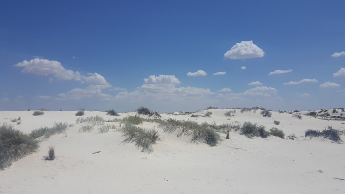
White Sands National Monument

If you ever get the chance to visit White Sands, be sure to do so. The piles of white gypsum flow in spectacular dunes, which you can access right off the park road. We had enough time to drive to a boardwalk trail and hike to the end of it, taking photos along the way.

Now for boring geographic names. C’mon Kansas, you can do better. Examples: there’s a town named Rock, another named Urbandale. How generic can you get? A river called Whitewater. Another town named Grove.

Ugh. As if driving through farmland isn’t already mind-numbing, the place names in Kansas, at least those before Witchita, were totally uninspiring.

After Witchita, things changed. We ran into town called Smoots. Another called Pretty Prairie. That’s better, Kansas. Keep it up! We crossed the Ninnescah River about three times. I probably liked this name because it sounded Minnesotan. Thank goodness the place names got better or I might have fallen asleep behind the wheel.

Other things of note: We passed the world’s largest hand-dug well in Greensburg, Kansas. We did not stop, but maybe we should have. I mean, the thing has its own visitor center, it’s so huge! We also passed the world’s largest pistachio. This was in New Mexico. It’s not a real pistachio, but a “mammoth outdoor sculpture” to advertise a pistachio tree ranch. We didn’t stop there, either, having already used all our spare time at the White Sands.

We were also impressed by all the wind turbines in Kansas and Oklahoma. It seems as if wind power is alive and well in those states.

I am happy to report that my son’s car survived the journey, and so did we! My son is ensconced in his dorm room and starting his classes now. Once we flew back home, the house was eerily silent without his presence. We are still adjusting.

20190822_103411

Moving into the dorm.

A Hidden Seafood Restaurant Gem in Orlando

20190814_183626

Arroz marinero at Casa del Marisco.

We meandered down to Orlando, Florida, last week for a work conference. We stayed at a huge hotel with almost 3,000 people just for our conference, plus thousands of others who were attending other conferences held there.

The hotel housed half a dozen restaurants, but they were incredibly noisy. After a couple of days of hoarse voices from talking over other people, we decided to venture off-site for dinner. After a quick Google search for nearby places, we decided on Casa del Marisco, a seafood restaurant that features Peruvian and Ecuadorian seafood.

The worry began when we arrived. The restaurant seemed to be in the basement of a repurposed hotel. By repurposed, I mean there were tattoo parlors, fast biz cash loan offerings, and other questionable business ventures.

Our sense of dread did not abate when we opened the restaurant doors and found ourselves the only customers. The restaurant was white and clean, yes, but with its mirrored walls and tiled floors, the ambiance harkened back to the 1980s.

We were quickly greeted and seated, however. After perusing the menu, I looked up and could see through a window into the kitchen. The cooks looked like they could be Mexican or Edcuadorian. I suspected that this dining experience could be either very good or very bad.

Our waiter was friendly, and it was obvious that English was a second language to him.

I chose the arroz marinero, a paella rice and seafood mixture served with fried plantains. It arrived as pictured above, with healthy doses of mussels, shrimp, squid and scallops. As my dining companions enjoyed their dinners, it didn’t take long for my taste buds to realize that this was going to be a great dining experience!

The rice was zesty, but not too spicy for my Minnesota palette, the seafood was not overcooked, and the plantains were tender and sweet.

Only one other person entered the restaurant during our dinner, and that was to wait for a to-go order. But the kitchen staff was busy, presumably making other to-go orders. An “uber pick-up” sign made us think the place must do a good take-out business.

When the check arrived, the numbers were in Spanish, with a comma where the decimal point should be. It all seemed thrillingly ethnic to us northerners.

So I am here to say, don’t let the appearance of this place put you off. The food is worth the retro ambiance. In fact, some people might even like the ambiance, since the 1980s are hip once again.

Two of the Coolest Spots on Madeline Island

IMG_6082

The bridge across Big Bay Town Park lagoon. Look at that beautiful water!

My friend Sharon and I meandered onto this island in Lake Superior a couple of weeks ago. We’d both been there before, but found two cool new places to explore this time. And I mean “cool” as in awesome and interesting.

20190713_141046

The lagoon.

The first was Big Bay Town Park, which friend recommended to us. Unlike with the state park on the island, the town park has a free-will donation fee. A short walk down a stairway from the parking lot leads you to a bridge across a stunning lagoon that enters Lake Superior. On the other side of the lagoon is a public beach studded with white pines. The water is crystal clear and inviting, although as always with Lake Superior, temperatures may be a bit cool.

Canoes are available to rent via self-service onsite, or you can rent watercraft, including paddleboards from a place in town. The kayaks, canoes, and paddleboard are all onsite, and the businesses will give you a key to unlock them.

I brought my own blow-up paddleboard and Sharon rented one for two hours. We cruised the lagoon, watching painted turtles walk across the sandy bottom and startling a fish here and there. The water is so clear, it felt like we were flying through it.

IMG_6099The second place is Tom’s Burned Down Café. I’d seen it from afar before and heard about its, shall we say, counterculture reputation. Maybe it once was a café (before it burned down?) but now it is a bar. No food is available.

The place is a hodgepodge of homegrown-construction seating areas held together with signs with sayings like “It’s not premaritial sex if you don’t plan on getting married,” and “Be the rainbow in a world full of rain.” The top is covered by several tents.

20190714_132120Filter

Tom’s Burned-Down Cafe

Sharon and I sat down, thirsty after our paddleboard, and ordered margaritas. The friendly bartender asked us if we’d like to try beet-infused tequila in our margaritas, pointing to a large glass container of mysterious red liquid behind him.

20190714_133432

My beet-infused margarita with the hand-written menu behind it.

We hesitated for a few beats, and then agreed. We were already brave enough to come into the bar, why not be even braver and try something new? The beet margarita was definitely drinkable, but it didn’t have as much lime in it as we were craving.

Also of note is that the place is cash-only. If you don’t have any, an ATM is available (under its own small tent) in the bar.

Tom’s was named the Number 2 Best Beach Bar in America in 2013 by Maxim Magazine, no doubt, for its unusual ambiance. If you go there with a sense of adventure, you won’t be disappointed!

Exploring Prophyry Island Lighthouse

DSC05399

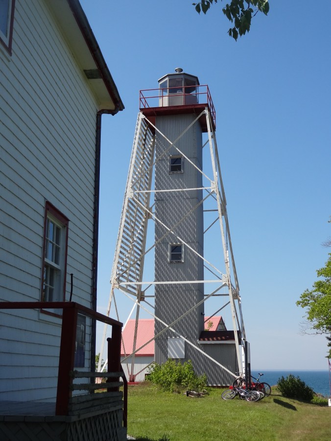
Porphyry Island Lighthouse

Porphyry is a wilderness island in Lake Superior on the east side of the Black Bay Peninsula near Thunder Bay in Ontario, Canada. Most arrive by motorboat, sailboat, kayak or canoe, docking in a secluded cove about a mile away from the lighthouse. Some arrive by helicopter, alighting on the helipad adjacent to the lighthouse.

Us? We arrived by dinghy, rowing from our anchorage farther down the island. When we landed, we were met by a native Canadian lad – a volunteer for the Canadian Lighthouses of Lake Superior organization.

DSC05388

Did you know there’s a universal symbol for taking a sauna? We didn’t until now, either!

When he asked where we traveled from, Captain Dave told him we rowed from Isle Royale — a preposterous 29 miles away. The lad did not take the bait, and instead, graciously offered us a tour of new structures in the cove. A boathouse features a mini-gift shop, and the sauna offers promises of warmth to be dashed by a splash in Lake Superior afterward.

Although bikes were available, we chose to stretch our sailboat- and dinghy-cramped legs by walking the flat trail to the lighthouse. Lined with Canada dogwoods, forget-me-nots, and the mysterious devil’s club plant (readers of my novel “Eye of the Wolf’ will know what this is!), the trail passed two points of interest along the way.

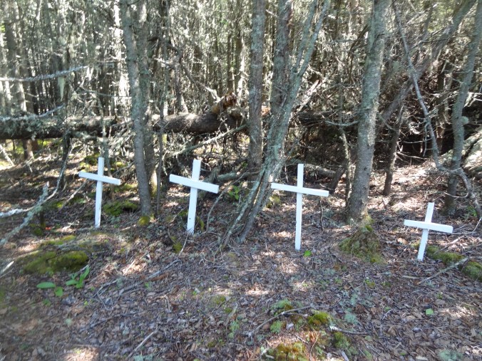
One was a small graveyard. Four white crosses mark where members of a former lighthouse keeper’s family are buried. The second is an area where a couple of junker cars lie moldering, relics from when the trail used to be a road.

DSC05393Upon reaching the lighthouse, we were greeted by several more volunteers, plus Eve, a former assistant lighthouse keeper. Her husband, Graham, was the last to keep the light before it became automated. He died a couple of years ago, and a photo gallery has been set up near the lighthouse to showcase his award-winning photos.

DSC05398Volunteer Kaitlyn showed us the gallery and a small museum. She was walking us toward the lighthouse for a tour when the door of the structure groaned and burst open. A man ran out, cell phone plastered to his ear, talking intently.

After all the wilderness silence we’d experienced, this was shocking. Not only for the noise but for the technology. (We hadn’t had cell phone service in a while.) We all put our hands on our hearts, and stopped on our tracks.

The man continued walking away from us, talking on his phone. After recovering, Kaitlyn and Eve told us the man was Paul, who ran the place. Once he got off his phone, we were able to meet him. He explained his office is in a room in the base of the lighthouse. He did not explain why he had to suddenly run out of it, but one would assume it was because he was in an important conversation and needed better reception. It made me wonder if his heart-attack-inducing bursting forth happened often, and also made us feel a bit sorry that running the place has him so stressed that he can’t meld into the peacefulness of it.

DSC05401

The helipad at the lighthouse.

As we were speaking with Paul, an older woman laden with painting supplies walked by. She was the latest artist-in-residence at the lighthouse, a painter from Jerusalem. The lighthouse organization sponsors several artists each summer. There’s also a guest house that people can rent, which used to be the lighthouse keeper’s quarters.

After we promised to donate to the lighthouse organization, Paul deemed us worthy of a tour of the lighthouse. Eve and Kaitlyn guided us up the six steep sets of stairs, which were more like ladders. Once at the top, we admired the view of Thunder Bay’s Sleeping Giant through the windows.

After a bit, Eve asked us if we’d like to go outside on the railing. Without hesitation, we said yes. We ducked through a small opening, out into the freedom of the summer breeze. The view was stunning. Eve pointed out the other islands we could see where she had worked with her husband, and where her sons were born. She told us that when they worked at Prophyry, her sons used to enjoy dropping water balloons down the inner corridor. I could totally see how that would appeal to them.

DSC05404

The view looking down from the top of the lighthouse.

After drinking in the view, we carefully descended the steps back to the ground. Eve, at 70, navigated them like a much younger woman. Then again, she must have had a lot of practice when she worked here.

We walked back to the cove and socialized with a Canadian sailor who was anchored there. As we rowed back to our boat, a fog started to roll in, relegating the lighthouse and its inhabitants back into the mists of time.

DSC05403

Eve and Kaitlyn

Wilderness Sailing in Canada, Eh?

DSC05356Russ and I had the privilege of crewing on the sailboat Neverland on a Lake Superior cruise during the 4th of July week. We sailed from Grand Marais, Minnesota, to Red Rock, Canada, which is as far north as you can go on the lake.

I learned more, not only about sailing, but about my feelings for my country. Before we left Duluth for Grand Marais, we happened to see a beat-up pickup truck driving around town with two American flags stuck behind its cab. Instead of inspiring feelings of patriotism, the sight of the flags struck me as aggressive, pugnacious, and a little redneck.

I have never felt that way before about the flag, and suspect it has something to do with our current president and the political/cultural climate in which we find ourselves. Suddenly, missing Independence Day fireworks because we’d be in Canada didn’t seem so bad. But I brought along several old packages of sparklers I had just so we’d be able to celebrate a little bit on the boat.

The Neverland left Grand Marais on a calm, cool morning. Although the air temperature was in the 60s, the Lake Superior water temperature was around 40 degrees. Brrr! Plunk yourself down in a boat in the middle of it, and it feels like fall in July.

Calm weather means poor sailing, so we motored for most of the day across the Canadian Border. You may be wondering how one can cross the border if there are no customs stations in the lake. Well, you need to fill out a remote border crossing permit beforehand. The permits cost around $30 and you have to provide copies of your passport along with it. Allow a month for processing.

If all goes well, your permit will arrive in the mail a few days before your trip. You need to bring the permit along with you just in case your craft gets stopped once you’re over the border. Thankfully, we never got stopped, but it was good to know we had the proper permissions with us, just in case.

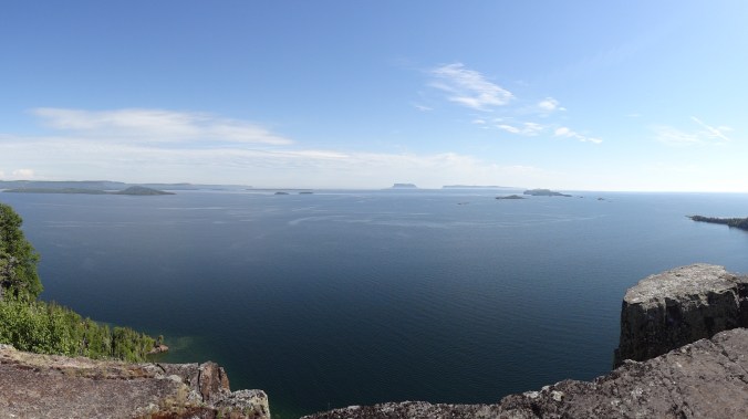
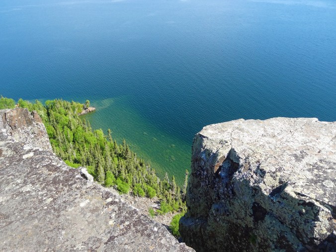
Our first anchorage was at Spar Island, near the entrance to Thunder Bay. This craggy, piney island has a protected cove, which provided for tranquil waters all night. In the morning, we rowed Tinkerbell, the dinghy, to a campsite on shore and found a trail that leads to the “top of the world,” which is a tall bluff that offers stunning views of the lake and nearby islands.
DSC05366

View from the “top of the world” on Spar Island.

Ever observant, Russ found a metal mailbox nestled in a pine tree. It held a logbook and we added our names to it. After enjoying the view, we hiked back down.
DSC05369

Looking down from the top of the world.

After another cold, calm crossing (we could see our breath!), we anchored at Porphyry Island. We began the Fourth of July with a breakfast of luscious banana walnut pancakes courtesy of Captain Dave. Then we rowed Tinkerbell over to Prophyry Island Cove. We were met by a volunteer who gave us a tour of the new sauna and boat house at the cove. The island also features a lighthouse. I’ll describe our tour of that in a separate posting later.

Our afternoon sail took us to Chapleau Island, which is off the Black Bay Peninsula. Cell phone service is nonexistent here, and would be until the end of our trip. We shared our cove with a bunch of kayaker boys who were using the campsite and sauna opposite our anchorage. It was fun to see them whooping and hollering as they ran from the sauna and jumped into the frigid waters.

We celebrated our successful arrival with gin and tonics below decks, enjoying the music of hermit thrushes, winter wrens, white-throated sparrows and loons from the surrounding forest.
DSC05428

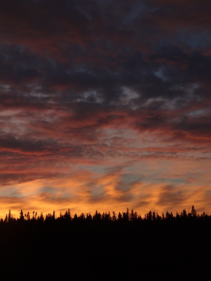
Fourth of July sunset.

Russ cooked us THE BEST maple butter chicken I have had in memory. Maybe it was so good because of the holiday, but maybe it was because we were so hungry from a long day of activity.

DSC05435After dinner, Russ and I went on deck and took out the sparklers. We were heartened to see they still worked. We had our own little private fourth of July celebration as the sparklers quietly hissed and threw their light into the Canadian evening.

The next morning, I practiced rowing Tinkerbell by myself in the quiet cove. I will admit I did it perfectly backwards, but was soon corrected by my sail mates and got myself turned around in the right direction.

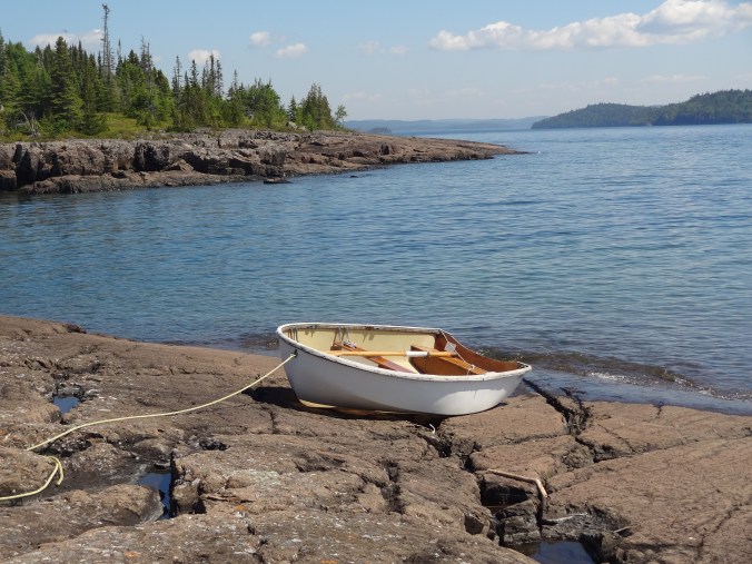
We rowed quite far to explore an unnamed island that Russ and Capn Dave had seen on their last trip here. The island was half rock and half trees, sloping down into the lake gently on one side, with a steep cliff on the other. Pools of fresh water collected in depressions on the shore, featuring tadpoles and mysterious shrimp-like creatures. On the way back to the boat, I even rowed. I can’t say that I am proficient, but at least nobody drowned.

In the afternoon, we finally had good sailing weather. We reached 6 knots on the way to Moss Island, which is at the beginning of the Nipigon Straits. However, good wind means a lot of cold – I had to wear four layers on top and two on the bottom, but at least I didn’t need to use hand and feet warmers like last year. The air was beginning to smell like wildfire smoke and the sky was getting hazy.

A flock of half a dozen white pelicans greeted us and flew by several times during our stay. The weather warmed enough that I could wear shorts, finally – as one should during July!

The next morning, we motored up the straits to Nipigon Bay. In the bay, the wind picked up enough to sail. We made it to Red Rock Marina, our final destination, in time for supper and most-welcome showers.

This is my third trip aboard the Neverland. I am finally getting the hang of what “port” and “starboard” mean. I can steer the boat well while it’s motoring, but not so well with sails. That will take more practice. I am learning the boat’s quirks and how everything works. I would not call myself a sailor, though. I still have a long way to go before that happens.

As we drove home the next day, we saw plenty of Canadian flags, since Canada Day was July 1. I marveled at the different emotions that flag elicited within me: happiness, friendliness, and peace – similar to the feelings the wilderness islands and lake stirred within.

Now, I realize that Canada is not perfect (for instance, their treatment of native peoples is deplorable) but on the whole, their displays of the flag seemed glaringly different compared to the displays in my home town.

I can hear the haters now: If you hate America so much, just move to Canada! I don’t hate America. I’m just pointing out that the 4th of July doesn’t feel the same as it used to, but it took time away on a sailboat for me to realize that.

I hope this time next year our culture will have changed enough that I can be proud of our flag again.
DSC05448

Tinkerbell on the unnamed island near Chapleau Island.

How we almost saw Biosphere2

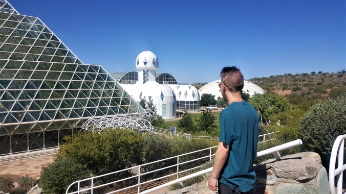
20190619_091811I meandered down to Tucson, Arizona, with one of my sons last week. On the last day of our trip, before we caught our plane back home, we had a few extra hours. We decided to go see Biosphere2, the world-renowned self-enclosed science station run by the University of Arizona that’s about a 45-minute drive outside of town.
Because we would be time-limited, I checked the station’s website to see when their tours run. The text said tours were offered throughout the day on a first-come, first-served basis. Great! We would have time for a tour if we arrived right when their doors opened at 9 a.m.

However, when we got there, the docent said the tours wouldn’t be starting until 10 a.m., which was when we needed to leave to catch our flight. We were disappointed, but decided to pay the entry fee anyway and take a self-guided tour of the grounds.

I remembered hearing about the facility while I was growing up when a team of “terranauts” closed themselves into this giant terrarium for two years to see if humans could live in a man-made environment, with the thought that something similar could be done on some other planet, like mars.

What I didn’t realize from the news stories about the experiment is that Biosphere2 has different enclosures for different environments. There’s a rainforest, an ocean, a desert, and a coastal fog desert. To ensure adequate air exchange, there are event two “lung” buildings that control air volume.

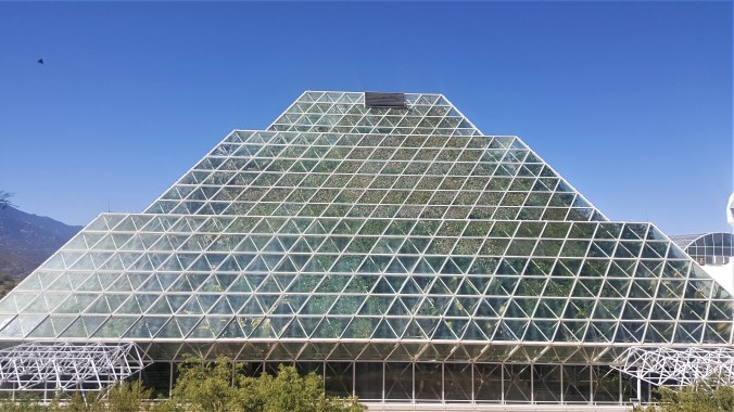
On our self-guided tour, we were able to see the outside of the rainforest building, which is covered in glass panels. Leaves were plastered against the windows, making it look like the plants were just about to burst out of their man-made enclosure.

We were also able to go into the living area that the team used when they were enclosed in the facility. Unfortunately, construction was going on, so we really weren’t able to see much of anything. But there was a cool globe where we could see graphic representations of world populations, Facebook friend links and the like.

The last place we visited was the ocean building. We were able to go inside it and see the exhibits. Unfortunately, the ocean itself is experiencing an algae overgrowth. The water was green, which made it hard to see any fish.

Although we hardly got to see anything, it was still cool. I would like to go back there again under better circumstances and try to get the official tour.

20190619_091800

The huge rainforest pavilion, with plants plastered against the glass.

Five Things to do in Freeport, Bahamas

DSC05128

Taino Beach, Grand Bahama Island

I meandered away from the white snow of Minnesota to the white sands of the Bahamas for a week in February. My friend Russ and I stayed at a resort on Taino Beach in Freeport. Here are 5 things we did that you might want to do too, if you’re ever on the island.

Port Lucaya Marketplace

This shopping and dining center is named after the native people who used to live in the Bahamas, the Lucayan. Since the International Bazaar is defunct in Freeport after several hurricanes, this is your best bet for retail therapy and live music. High-end shops (Columbian emeralds, anyone?) mix with tourist stalls that sell T-shirts.

DSC05112

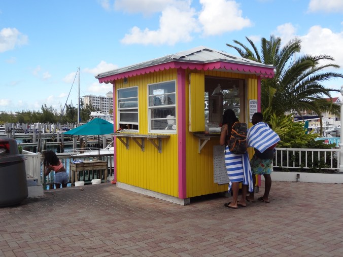
The conch stand at Port Lucaya Marketplace

We had drinks at the Corner Bar (best pina colada I’ve ever had!) and another day ate a wonderful lunch at Zorba’s Greek Restaurant (which serves the second-best pina colada I’ve ever had). The conch stand always had a line of people waiting to taste this sluggy wonder of the Caribbean. If we’d had time, we would have eaten at Cappuccino’s, an Italian place known for its dinners.

DSC05182

The second-best pina colada I had during our trip (at Zorba’s).

Rand Nature Center

Take a walk on the wild side in this 100-acre natural area. It’s named after the Rand Family, who were early Freeport settlers and philanthropists. For a $5 entrance fee, you’ll get a short talk and orientation to the visitor center and then free run of the place. Grand Bahama Island is very flat, so the walking is all easy.

DSC05147

The pond at Rand Nature Center

You’ll walk through Bahamian pines and past a pond full of turtles. Besides wild lizards and birds, the trail takes you past cages with a captive red-tailed hawk, Bahama parrot, and a couple of boa constrictors.

Once back in the visitor center, take a look at the gallery, which features work of local artists. Our visit was very peaceful and restorative.

Wave Running

A WaveRunner tour of the island is on the opposite end of the excitement spectrum from the nature center. Our resort offered an exhilarating ninety-minute tour along the shore to Peterson Cay National Park, known for its healthy reefs and tern habitat.

This trip was Russ’s idea, so I let him do the driving. I hung on for dear life as we bounced on the turquoise waves. Our guide, Ricardo, showed us where dolphin shows take place, and we got to look through the fence and see a dolphin or two. We also motored along Millionaire Row, a canal lined with expensive homes.

DSC05161Then Ricardo took us back out to the sea to the cay, stopping once to point out a $20 million home along the beach. A couple from Massachusetts was with us on the adventure. Denise and Michael were able to keep up with Ricardo better than we were, but paid for it with two impressive falls off their machine.
As we neared Peterson Cay, Ricardo stopped and took a chum bucket out of his machine to feed the sea turtles that frequent the area. Unfortunately, they weren’t around, but he left some offerings for them anyway.

Once on the beach he dropped six tiny hermit crabs in my palm and seemed disappointed when I didn’t freak out. We only spent enough time at the cay to take some photos, then we went back to the waves. Normally, the tour stops at a beach bar on the way back for drinks, but we were so putzy, we didn’t have time.

Once we were back to the resort, Denise said, “I feel like we survived something!” Russ and I had to agree, but it was a fun adventure.

The Perfume Factory

At least one business is still in operation in the defunct International Bazaar in Freeport. It’s the Perfume Factory, where they make colognes for women and men. They produce an impressive variety of fragrances all onsite by hand.

DSC05155

The Perfume Factory in Freeport

During our short tour of the “factory,” we saw their mixing room and production line. After the tour, our guide gave us samples to smell. My favorite was “Island Promises” for ladies, which is a mix of jasmine, lilies and patchouli. Russ liked the “Lucyan Bay Rum,” which features cloves and bay leaves.

If you don’t like any of their pre-mixed colognes, you can make your own and give it your own name. They will keep the info on file and you can order it again in the future.

Garden of the Groves

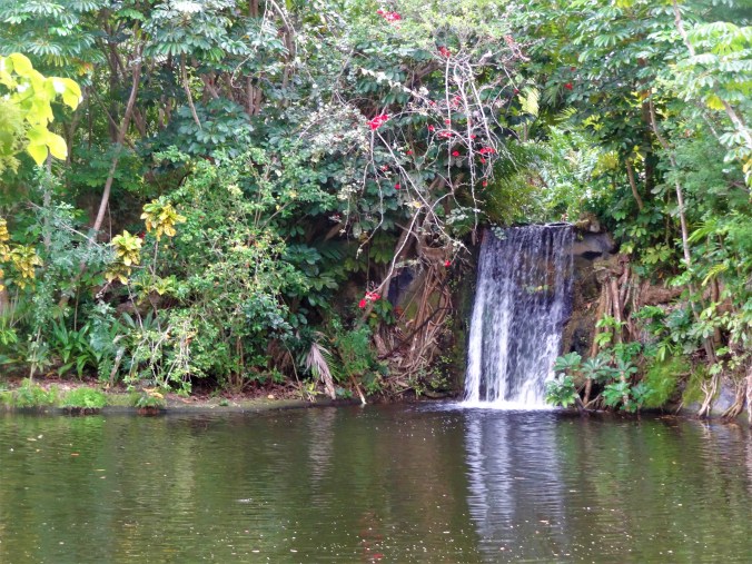
On a day when it was too stormy to snorkel, we took a bus tour that included a stop at the Garden of the Groves, which is a manmade natural attraction. It features a café with a view of a waterfall. If you feel like getting married, there’s even a chapel onsite.

We got a half-hour tour with a talkative guide who gave us the lowdown not only on the garden, but on local culture as well. If you feel like meditating, there’s a labyrinth for that, plus winding trails through lush vegetation.

DSC05170

Garden of the Groves

The Perfect Duluthy Fall Hike

20181021_145814

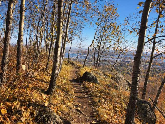
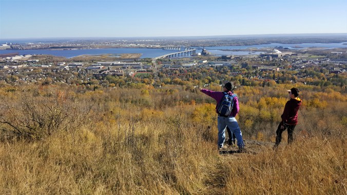
The panoramic view from the Brewer’s Park Loop on the Superior Hiking Trail.

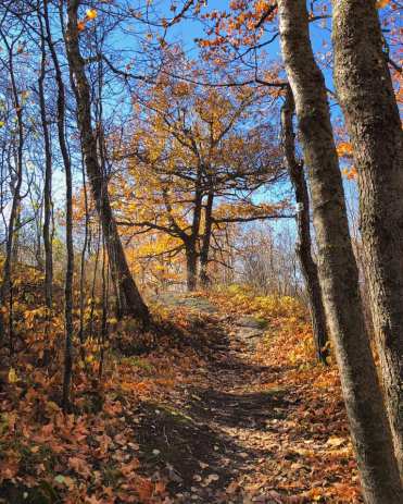
I meandered onto a newish section of the Superior Hiking Trail in Duluth recently. My friends and I hiked the Brewer’s Park Loop, which was completed in 2016. The trail takes walkers through an oak/maple forest and offers unparalleled views of the western part of the city and the St. Louis River – making it a perfect hike for fall.

Amanda image2

Photo by Amanda Jo Dahl-Sales

Some web pages rate the hike as moderate, others as easy. I would say both are true. Some of the climbs are rather steep and would rate a “moderate” in my book, but the majority of the hike is on an unobstructed path that’s fairly level, which rates an “easy.”

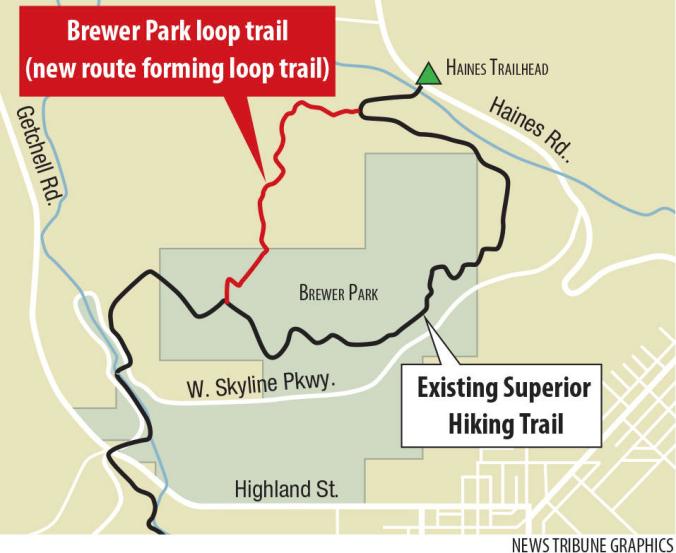
It took us 1-1/2 hours to go about 3-1/2 miles, but we were gawking and talking most of the way so I’m sure other people could do it more quickly. Access to the trail off Haines Road (see map).

Bring some water and your dog. For a near-perfect Duluth experience, visit Bent Paddle Brewery afterward for a drink. Urban hiking doesn’t get much better than this!

Brewer Park loop trail

Duluth News Tribune map

20181021_145751Enhanced

Amanda image

Image by Amanda Jo Dahl-Sales

End of Season Sail

DSC05076

Basswood Island dock, Apostle Islands National Lakeshore in Wisconsin.

I had the privilege of another sailing trip on Lake Superior this year. The season is ending — the wind cold, the sky gray, and the leaves turning.

We sailed from a marina outside of Bayfield, Wisconsin, and went to Oak Island in the Apostle Islands National Lakeshore. We anchored off its shore and hiked a long loop on the island among giant hemlocks and oaks, and then spent the night offshore. The next day we traveled to Basswood Island for a hike to the quarry there before sailing back to the mainland.

The sailing season is short, but oh so worth it!

DSC05070

Oak Island sandspit, Apostle Islands National Lakeshore

DSC05063

Guess which island we found these on?

DSC05081

Basswood Island brownstone quarry pond.

Boundary Waters Nostalgia

DSC04959

Tuscarora Lake in the Boundary Waters Canoe Area Wilderness of Minnesota.

Like Saganaga Lake in the Boundary Waters Canoe Area was author Sigurd Olson’s quintessential wilderness lake, Tuscarora Lake is mine. The only problem is, I hadn’t been there in over thirty years.

I wanted to get back to it while I still could, so this fall Russ and I headed out on what the guidebooks say is one of the most rugged routes in the boundary waters.

For those not familiar, the boundary waters is a place in northern Minnesota without roads or any conveniences other than pit toilets and fire grates. A land of interconnected lakes — the only way around is by canoe and by foot.

DSC04971I might write a magazine story about the trip, so I can’t describe it much here. Suffice it to say, the canoe portages were much harder than when I did them in college with six other people.

Tuscarora was much as I remembered and I thoroughly enjoyed spending more time there. The weather cooperated with the first part of the trip, the second part, not so much.

The experience was a good test of our relationship. I am happy to say that we survived both physically and emotionally. We worked together well under difficult circumstances and nobody got hurt.

I hope these photos give you a good feel for the place. If you ever want to match our adventurousness, enter at either at Entry Point #51 or #52 off the Gunflint Trail.

Happy fall everyone!

DSC04991

Brandt Lake in the moonlight.