We are experiencing a blizzard right now in Minnesota. This seems like a good time to wrap up my posts about our wonderful, warm St. Martin Island trip. (To see previous ones about Loterie Farm, Fort Amsterdam, or Topper’s Rhum Distillery, please click on the embedded links.)

Cooling off in the ocean at the end of a trail ride at Seaside Nature Park in St. Martin.
Another memorable outing we did was a visit to the Seaside Nature Park for a horseback ride. Although this former plantation is a nature park, ironically, you have to pass through one of the islands power plants to get there — a rather disconcerting experience. Plus, Google Maps will misdirect you to a road that is not finished yet. We found our way by asking a guy along the road who happened to know. I would suggest calling the park for directions beforehand.
Once we arrived at the rustic reserve, we were introduced to our horses, who were all named after musicians. My horse was named Prince, then there was Electra, Madonna, and Freddie (Mercury). The park offers sunset champagne rides (2 hours) and just regular daytime trail rides (1 hour). After a butt-wrenching experience years ago in Puerto Rico riding a horse for two hours, I decided it was wiser for us to just do the one-hour ride for our inexperienced butts. It was just the right amount of time.
Our horses plodded along steep cliff faces with spectacular ocean views. Some of the horses were not too fond of each other, but we quickly learned which ones needed to avoid each other. A highlight was the end, where we rode our horses into the ocean to cool off after the ride. They enjoyed the saltwater dip so much, they groaned with each step! That was something to hear.
The water rose higher than we were expecting during this part of the ride. I thought maybe our calves would get wet, but we went deep enough that our butts (and saddles) got wet. I almost floated off my horse at one point, so a tip would be to bring towels along in the car so that you can use them to sit on for your car ride back to wherever you are staying.
Our guide took photos of us with my phone. I was glad my phone did not fall into the ocean! It was a memorable experience. We all walked sort of funny for a few steps after we got off our horses, but no lasting damage was done to our physiques.
I’ll share the last of my “good” images below and some other tips to help you navigate St. Martin that we learned along the way.
Pro Tips:
If you’re driving and someone blinks their headlights at you, that means “go ahead.” They are either letting you turn in front of them or some other friendly move.
If you happen to stay at the Divi Resort in Little Bay, a great place to snorkel is near the pelican nesting area. Currently, there’s a houseboat there and some buoys that mark a place where people (used to? Currently?) do those Sea Trek dive helmet excursions. The fish there are used to getting fed and will swarm around you near that site, even if you have nothing to feed them. We also saw a sea turtle and an octopus on our way from the resort to the buoys.
Iguanas will bite if they think your toe is food. Beware!
An ignuana at Great Bay. Or is it Godzilla’s baby?
The infinity pool at Divi Little Bay Resort
Marie makes a rare appearance (twice) in her own blog. This is at Fort Amsterdam.
The view from Chewbaca Point on Loterie Farm, St. Martin.
Continuing my posts about the isle of St. Martin, I offer this one about Loterie Farm, a private nature reserve on the French side of the island. This was my second time at the farm, but a first for my traveling companions.
The Jungle Room
The other time I was there, I was initiated into ziplining. The farm has a course that takes you through the surrounding trees and hillsides. If you’re lucky, you’ll see the resident monkeys as you glide along. But since I’d already been there, done that, I and two others from our group decided to explore the farm’s hiking trails.
I admit to not doing much research on the trails beforehand. But I should have clued into the strenuousness of the hike from the switchbacks on the map, which we paid $10 for. (I advise just accessing the map on your phone from the farm’s website if you have coverage). The receptionist’s questions about whether we were wearing adequate footwear also should have been a big hint.
We each grabbed a cane stalk hiking stick from a box near the trailhead, which we were thankful for later. We took the short (60-minute) hike to a spring and then up to Chewbaca View Point.
The hike to the spring was easy, although the spring was not flowing when we were there in November. Then the trail headed up a mountain. There were parts where we Elders were scrambling over boulders, clinging to handholds as best we could. This is where we were very thankful for the hiking sticks.
But, the view from Chewbaca Point was worth it. We could see all the way to the ocean and many of the towns in between. We rested there and rehydrated. (Bring water!) The temps were about 85 degrees (F) and my tank top was totally soaked in sweat from the climb.
From the point, the trail descends back to the farm whence we came. Erosion caused gullies and tricky footing, but we went slow, and everyone made it back to the trailhead without mishap. Along the way, numerous green moths fluttered around us, making us feel like we were in a Disney movie or something.

The best mojito ever!

I should also mention that before our hike, we ate lunch at the farm’s Jungle Room Restaurant. It’s up among the treetops and features cozy couches for large groups and an area for sit-down dinners. The food was exquisite the first time I was there, and we certainly had a repeat performance. I had one of their poke bowls and Russ had the cajun Mahi Mahi salad (see image). Both were delectable, plus my mojito with fresh mint was the best I’ve ever had.
After our hike, we contemplated a plunge in the farm’s Jungle Pool, but we would have only had an hour to enjoy it, and the price tag didn’t seem worth it. So, we hung out at the bar while waiting for the rest of our crew to return from their activities. I ended up having one of their nonalcoholic mixed drinks – I think it had mango in it. So refreshing!
I find it ironic that I was able to complete our hike intact because when I returned home, I ended up breaking my ankle doing a simple side-shuffle exercise during a kickboxing workout. So, I sit here in my ankle boot, envious of my past flexibility and prowess on this adventure. Oh well. Go figure!
Russ and I took a long-awaited and several times cancelled trip to warmer climes earlier this month. We orginally planned to meander to Grand Cayman Island, but our timing was unfortunate. Twice our reservations coincided with times the island was closed due to COVID restrictions. We gave up on trying to go to a U.K. territory and opted for a Dutch/French one instead, the island of St. Martin.
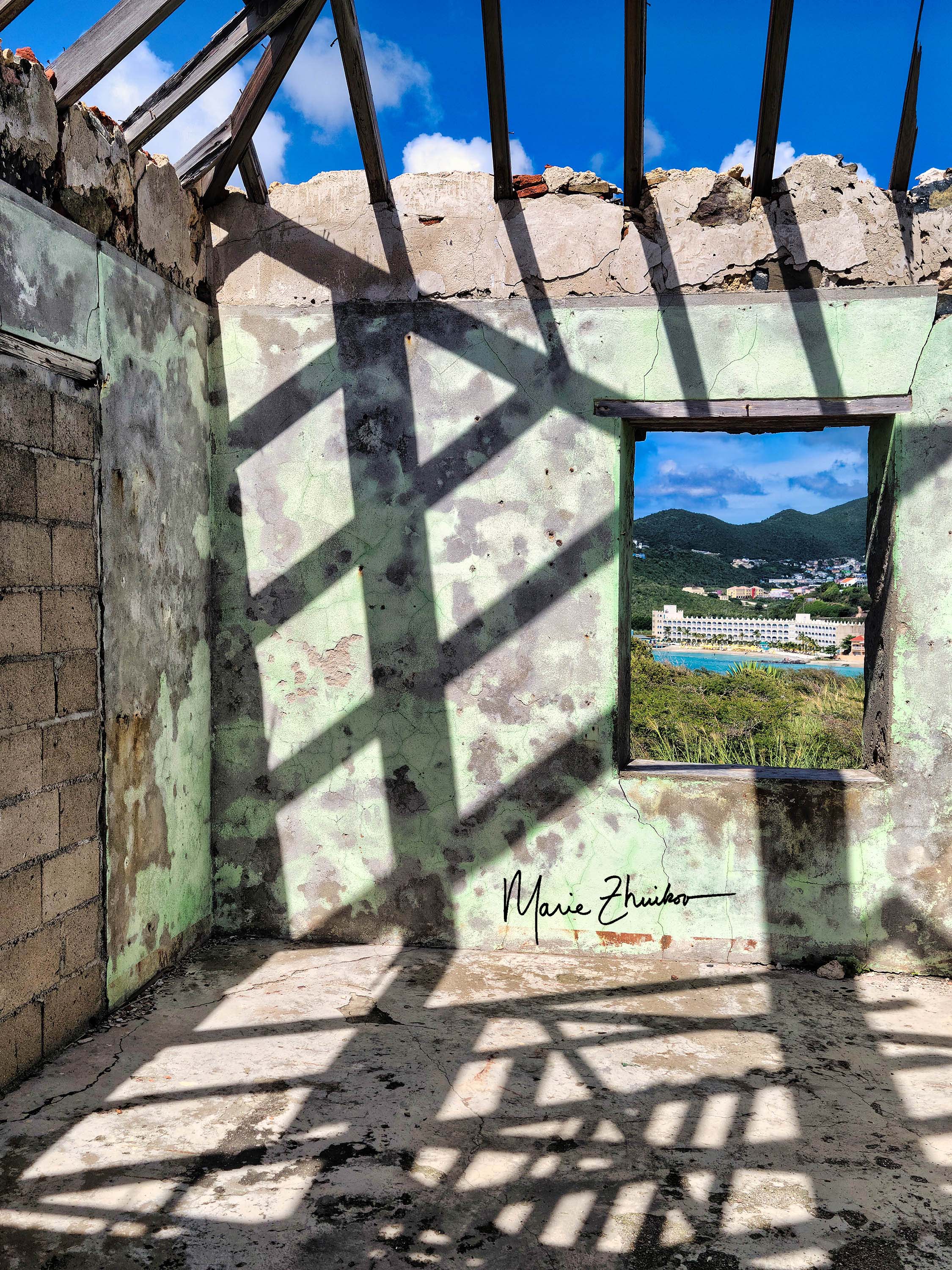
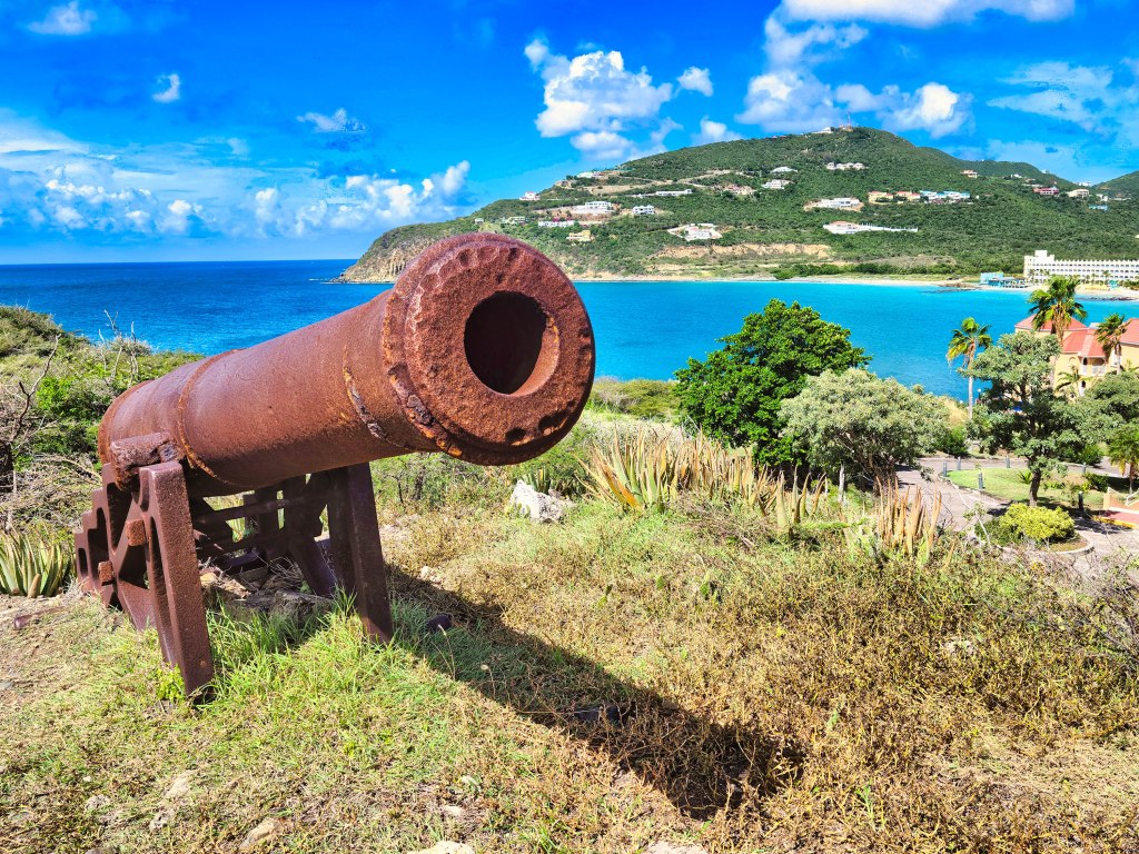
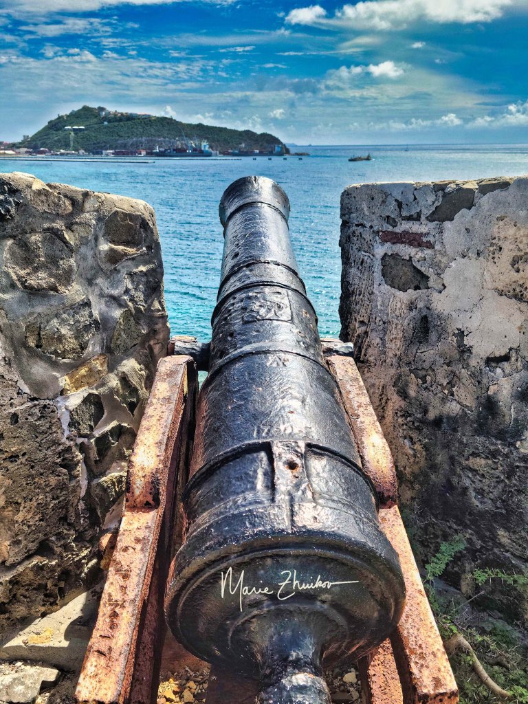
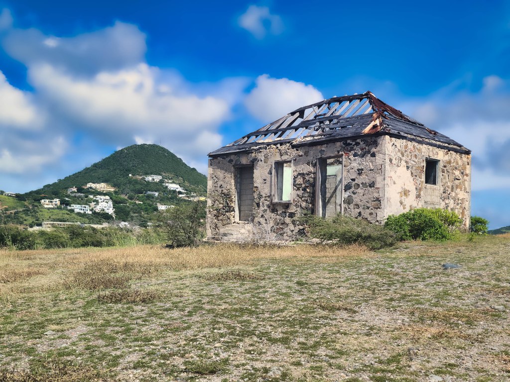
This was my second time there (for photos from the first time, see St. Martin Island – Where Nothing is Better). Sitting here in the snow of Minnesota, I am dreaming of the 85-degree (F) temps and warm turquoise ocean. In my next few posts, I plan to share images from our trip. The image above is from a fort that was near our resort. Fort Amsterdam was built by the Dutch and later the Spanish to protect the salt trade on the island. Several buildings and bastions comprise the fort, which is located on a dramatic point. My favorite was the signal house. It was built in the late 19th century for signal tower communications and was later used to house a radio station.
Its roof is missing, from Hurricane Irma, I suspect. The inside tells the tale of many layers of paint. Several windows look to the ocean or to our resort. Here are some of my favorite images.
A gallery of images from the rest of the area around the fort. Pelicans nest nearby and I caught one resting on rocks below the fort.
I sit with snow lightly falling outside and a cold wind blowing. I sip my rhum infused with a tang of tea and lemon, and my mind meanders back to the balmy beaches and warm salty breezes of the island of St. Martin in the Lesser Antilles.
You may wonder why I’m using the spelling of rum with an h. I admit to being a bit confused on this point. Our Toppers Distillery tour guide, Cristina, on St. Martin, said that “rhum” was how it used to be spelled back in the early days. An internet search tells me that rum is made from molasses, while rhum is made directly from fresh-pressed sugar cane juice. However, Cristina tells me that Topper’s rhum is made from molasses.
In any event, this rhum is exquisite – sinfully smooth and way too easy to drink. It needs no other ingredients to cushion the tongue.

Cristina introduces us to the many varieties of Topper’s rhum.
We toured the Toppers Distillery on St. Martin a few weeks ago. After plying us with a rhum punch, Cristina described the history of rum to us and how the distillery makes its beverages. She invited us to taste many samples of the handcrafted rhums that are mixed on-site. These include white chocolate-raspberry, mocha, banana-vanilla-cinnamon, coconut, a white rhum, and a spiced rhum. All were delicious, even to one member of our tour who had a past bad experience with a rum and coke drink.
The first rhum we tasted was my favorite, and it’s what I am drinking now. It has the unappetizing name of Nelson’s Blood. It also has an unappetizing story behind it, but it tastes so good! Cristina told us that it’s named after British Vice-Admiral Horatio Nelson, who was regarded as one of the greatest naval commanders in history. He was killed at age 47 by a French sharpshooter during the Battle of Trafalgar off the coast of Spain. Too important to be buried at sea, his body was transported back to England for a state funeral.
To preserve Nelson’s body for the trip, it was put into one of the casks of rum (I’ve also heard that it could have been brandy) that the crew habitually drank as part of their daily rations. Cristina told us that once Nelson’s body reached England and the cask was opened, those doing the opening were surprised to find that the rum had disappeared. Apparently, the sailors had drunk the rum. Ewwwww!
Rest assured, Topper’s Nelson’s Blood rhum does not taste like a dead body. I assume the tea and lemon flavors were added to it as a nod to the Admiral’s British heritage. We only brought one bottle of rhum home with us, and this one was it. That’s how good it is.
As we listened to this fascinating tale, blue-eyed, dark-skinned “Topper” himself poked his head inside the room and Cristina introduced him. Meeting one of the owners was cool. He and his wife moved to St. Martin from Boston. They made mixed rum drinks for guests at their restaurant. Their guests liked the drinks so much that the couple decided to produce a supply for local restaurants and stores. In 2008, they commercialized the brand and won many awards. They moved to their current facility in 2012.
Mandarin chicken with a banana vanilla cinnamon rhum sauce.
Back on our tour, Cristina explained how the inside of the rum storage barrels are charred and treated in various ways to elicit different flavors. Then we moved onto the distillery’s small lab, where they create the tasty fruit and spice mixes that are added to the rhum. These natural flavors are hand-mixed in five-gallon buckets. It was also in this room where Russ got drafted into cooking us a mandarin chicken dish with a rhum sauce. With Cristina’s coaching, he created a delicious tropical dish that we all got to taste. By this time, we were all a bit tipsy, so it was good to have a few bites of solid food in our stomachs.
After that, we meandered over to the bottling room, which was surprisingly small for such a large operation. Russ’s daughter had the honor of pushing the “start” button on the assembly line. It can fill six bottles at a time. The colorful bottle sizes vary a bit, so Cristina showed us how they use syringes of rhum to equalize the liquid levels in the bottles.
Then it was my turn to participate in the tour. After the swing top closures are in place atop the bottles, a clear plastic safety seal is applied. This is done with a small heat-sensitive shrink-wrap piece of plastic using high-tech equipment like your hands and hair blow dryer. I volunteered to seal a bottle and it was a piece of cake. (Or, a bottle of rhum, if you prefer.)
Our tour over, we perused their gift shop and ate lunch in the attached restaurant and bar, which features a wonderful view of Simpson Bay. We topped it off with a dessert of gelato from the distillery’s gelateria.
If you’re ever in St. Martin, Topper’s Rhum Distillery tour is a must! It’s a way of bringing a bit of the island home with you.
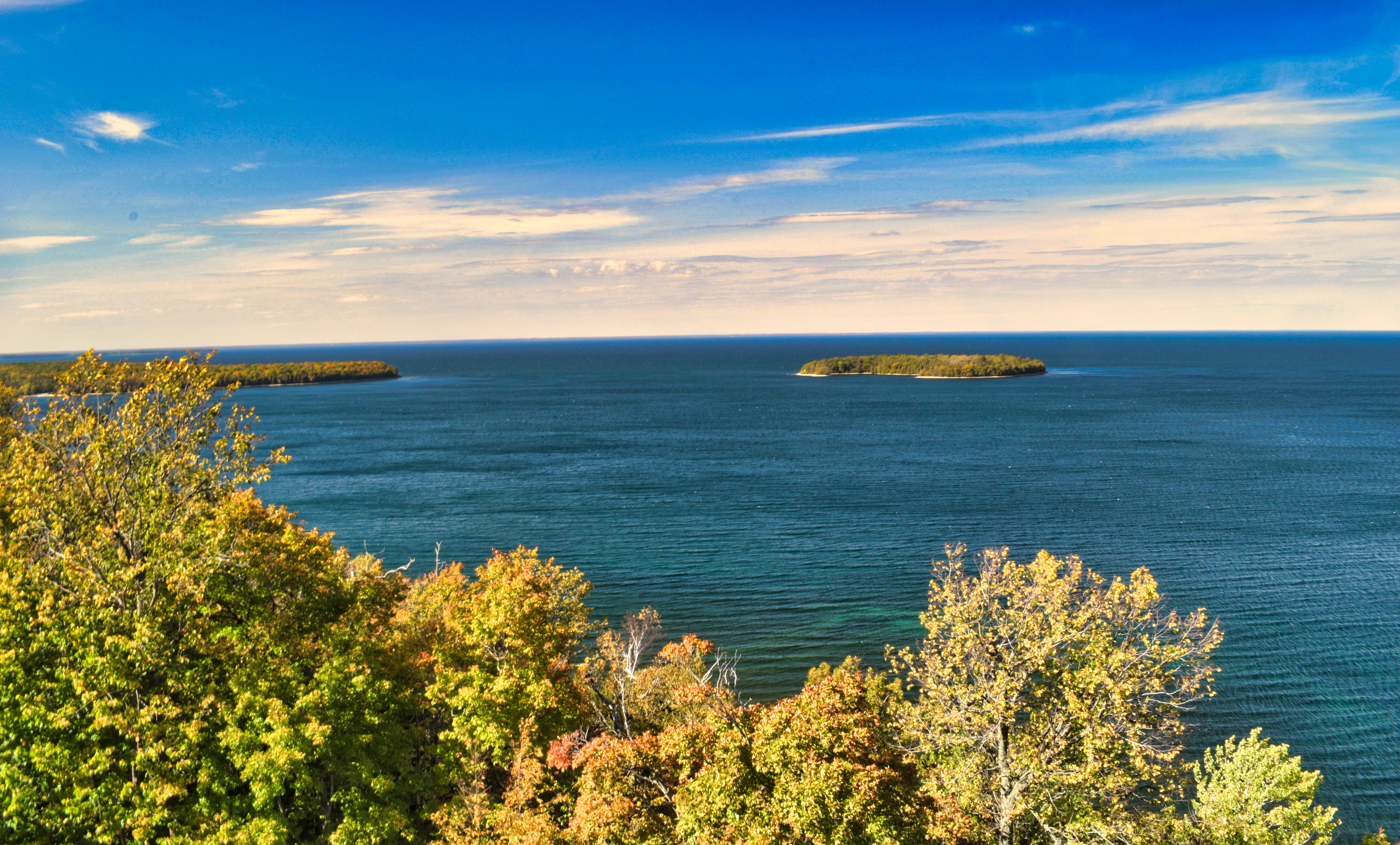
A view of Lake Michigan along the Eagle Trail in Door County’s Peninsula State Park.
Russ and I have been meandering around a lot. I am so far behind with my blog! Where to start?
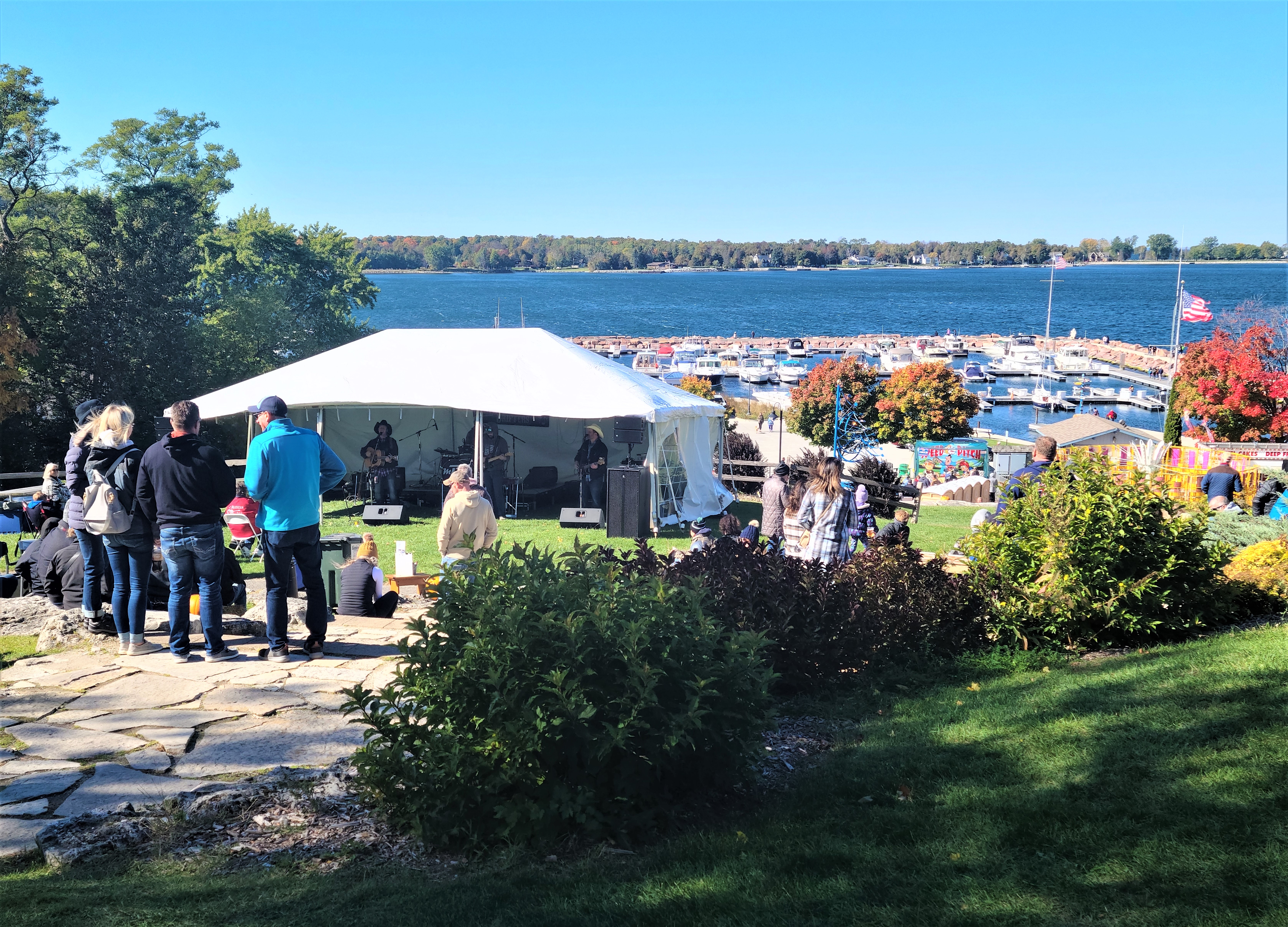
I will start in Door County, Wisconsin, where I needed to spend a weekend for a work event. This necessitated a stay in Egg Harbor on the shores of Lake Michigan. My event coincided with the town’s annual Pumpkin Patch Festival.
As a comparison for northern Wisconsin and Minnesota people, this festival rivals Bayfield’s Apple Festival. It lasts the weekend and gobs of people converge on the small town from all over. But instead of apple-everything (apple pies, apple jam, etc.) there’s pumpkin-everything.
Pumpkin Patch Festival-goers near the Egg Harbor Marina.
I had time to kill before work, so Russ and I were able to go on a little adventure. We drove about 10 miles away from Egg Harbor to Peninsula State Park. This park has a lot to offer and is very popular. It encompasses eight miles of Green Bay shoreline, northern hardwood forests, wetlands, meadows, and 150-foot high dolostone cliffs.
The view from atop Eagle Tower, Peninsula State Park.
We meandered over there on the advice of the guest book in our Airbnb. Some other Minnesotans had stayed there a few days before us and highly recommended the park and a trip to Eagle Tower within it. They were right! Eagle Tower is a newly rebuilt impressive structure that provides views of Lake Michigan and nearby islands. Visitors can either climb several stories of stairs or take an impressive ramp, which offers a more gradual ascent. Interpretive signs along the way offer insights into the views.
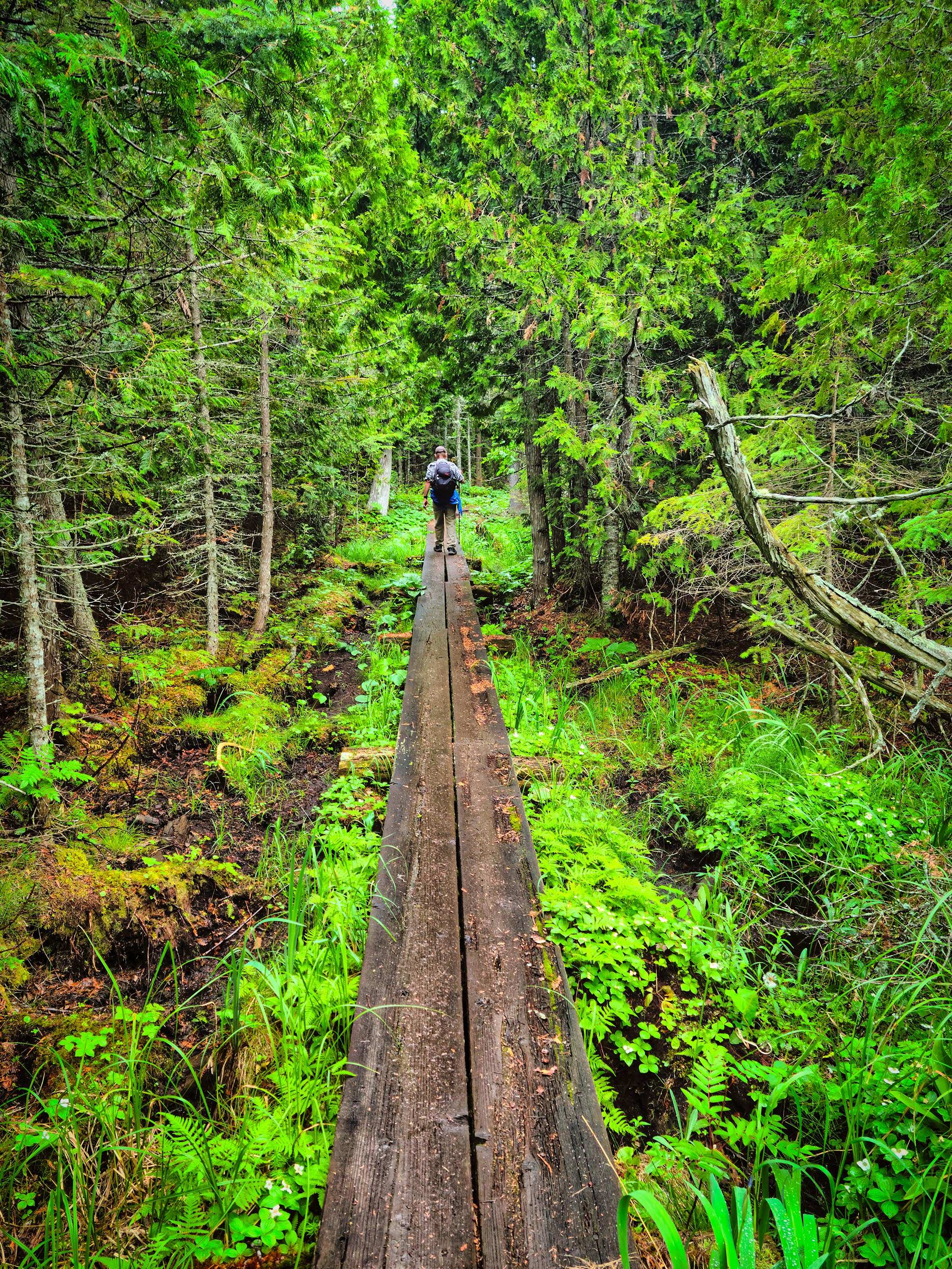
We were also hankering for a hike, so we chose Eagle Trail. It’s not far from the tower and parallels the shoreline for about two miles. The trail was rated “difficult,” but we scoffed a bit at this. Surely Wisconsin’s version of difficult couldn’t be that bad.
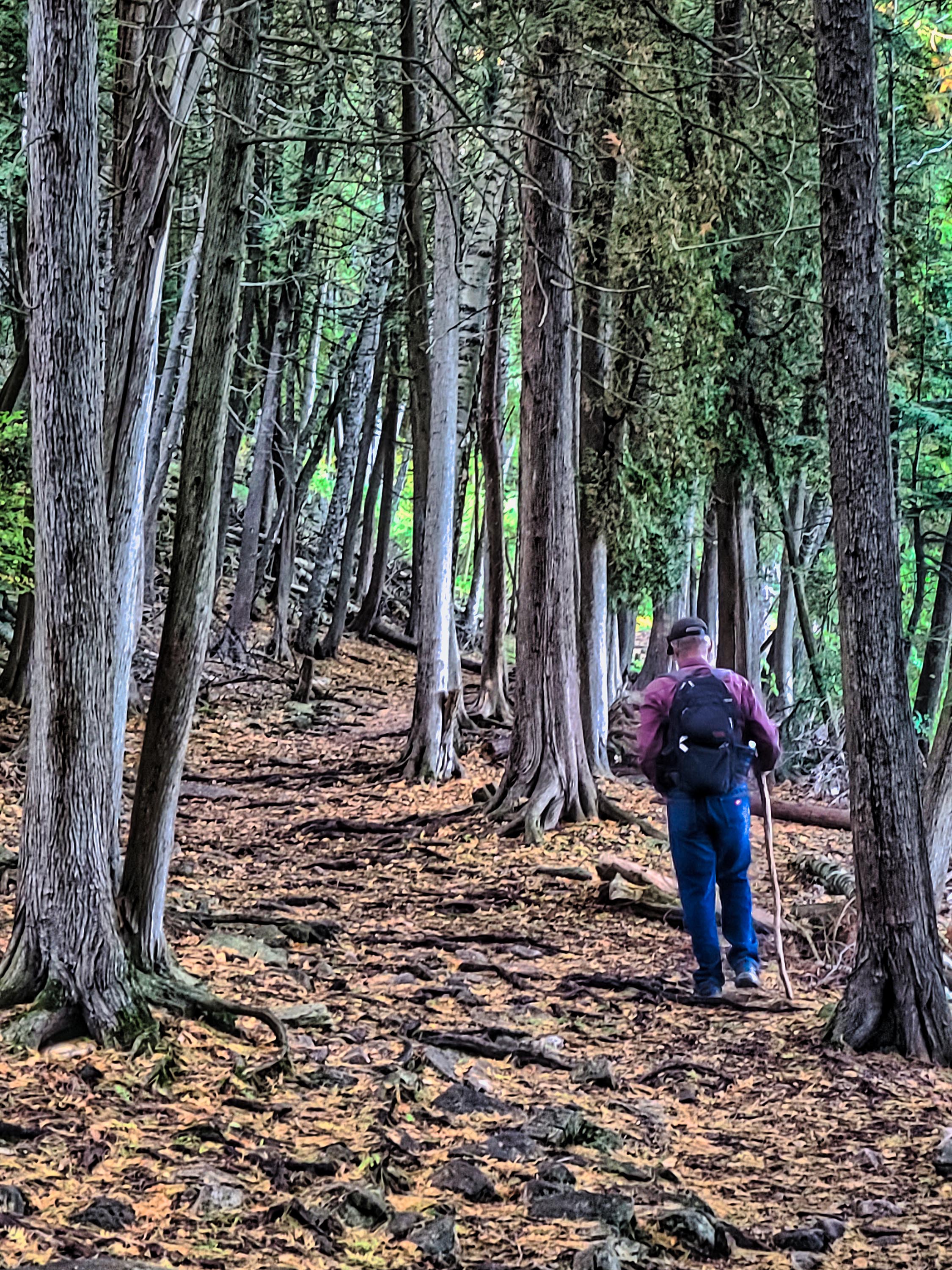
Russ hiking on Eagle Trail among the cedars.
Will we never learn? Apparently not. Eagle Trail was indeed “difficult.” Not all of it, but there were parts right along the shore that were eroded, which required scrambling over rocks and downed trees. Then there were the steep descent and ascents. The trail even has several “emergency access” locations. These are spots where it’s easy for emergency crews to evacuate hikers who have turned their ankles or worse. But we managed to avoid the need for a medical evacuation. Russ found the use of a hiking stick helpful. Although the trail was challenging, the views of the lake, cliffs, and cedar forests were worth it.
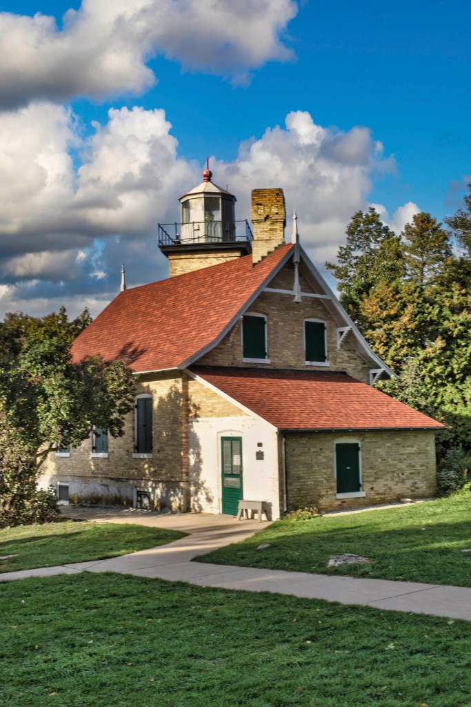
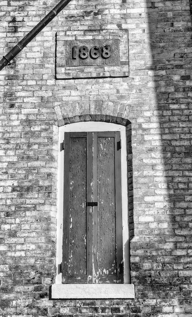
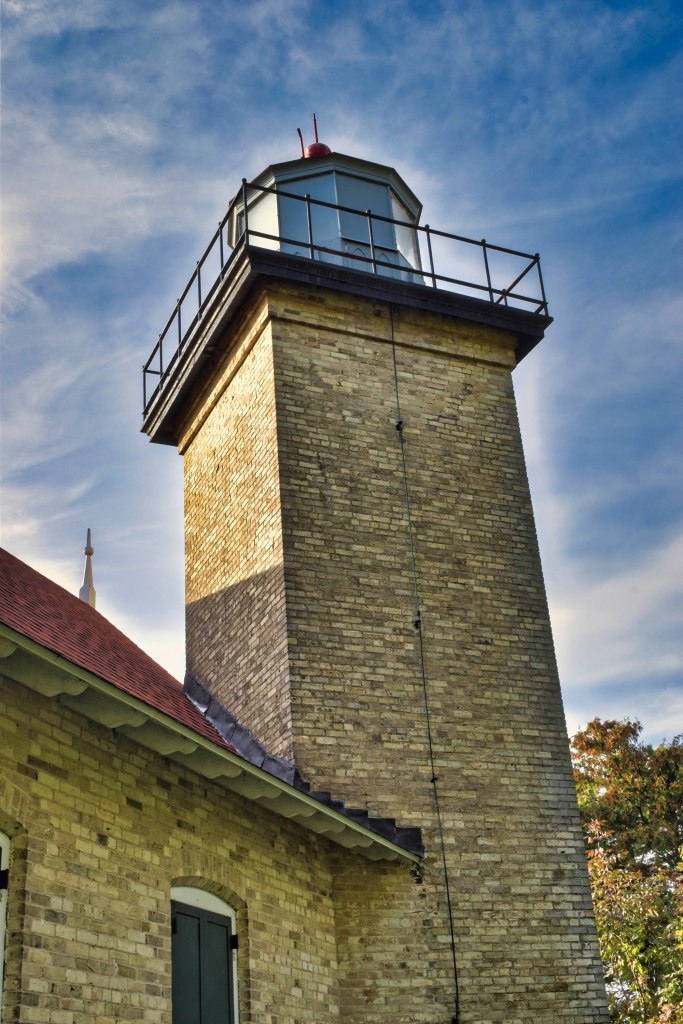
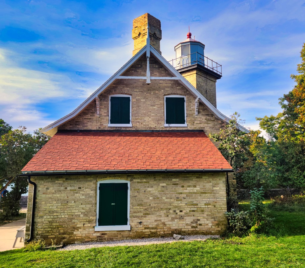
After our hike we drove a short way to visit the Eagle Bluff Lighthouse. Built in 1868, the lighthouse is perched on a cliff above Lake Michigan. A museum is inside it, but this was closed by the time we arrived.
The park also offers several campgrounds, a golf course, a nature center, amphitheater and twenty miles of bicycle trails. If we return someday, we hope to bring our bikes along.
When last we met, Russ, Captain Dave and I were on our way from Stockton Island in the Apostle Islands National Lakeshore in Wisconsin on our way to Madeline Island. This particular island isn’t part of the national lakeshore because it is inhabited. But the island is near the Lakeshore and offers many opportunities for natural fun.
Our trip to Madeline Island was not as speedy as our trip to Stockton. The wind was slight, and we only made a top speed of 2 knots, far from the 9 knots we made on our way previously. We had to tack several times (zigzag) to reach our destination, but at least the sun was out.
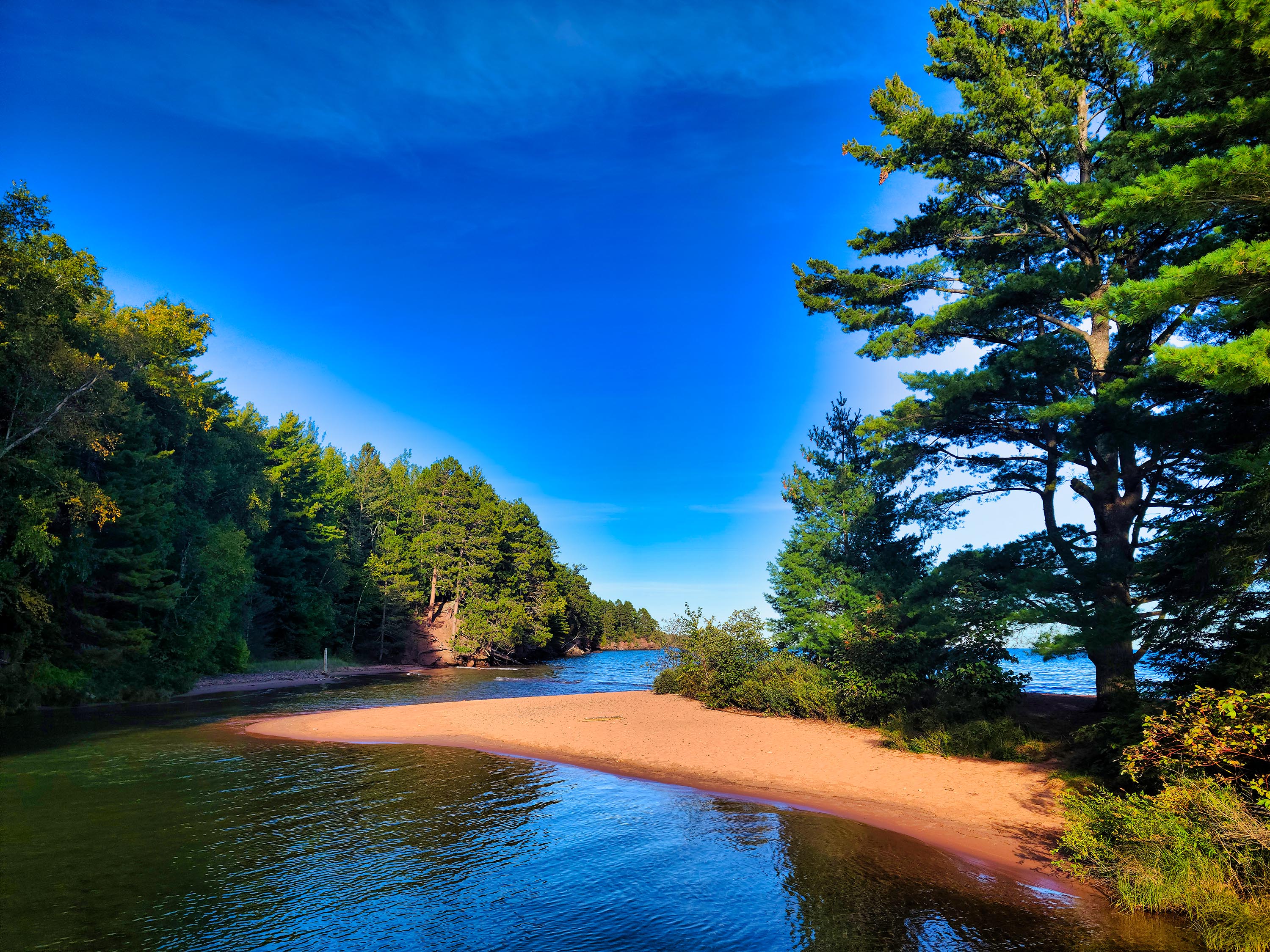
We anchored in Big Bay, which is home to both a town park and a Wisconsin State Park. Many impressive homes lined the shoreline. Seeing how they had protected their shoreline against erosion was interesting. Lake Superior’s water levels have been at record highs the past few years, and the toll that’s taken is obvious along the island’s edges.
A few homeowners have cleared all the trees and vegetation down the water line on their properties, leaving just an expanse of green lawn. This does not seem like a very wise idea in terms of erosion control. For my work with Wisconsin Sea Grant, I write stories about this issue, so I know a bit of whereof I speak.
After we reached Big Bay in the afternoon, we clambered aboard Tinkerbell the dinghy and rowed ashore. The state park offers a boardwalk that parallels the beach and it morphs into the town park, which also sports a boardwalk to a lagoon. We hiked 3-1/2 miles along the shore, visited several times by a buck who also was taking an evening stroll.

A beach teepee on Big Bay, Madeline Island.
Some enterprising person or persons had built a structure out of driftwood on the beach. What are these things called – beach teepees? Enlighten me, please, if you will.
That night we were rocked to sleep on Lake Superior’s swells. It reminded me of slumbering in the cradle as a child. I kept thinking that someone should market a rocking bed for adults – there could be money to be made!
When we weighed anchor the next day, we saw a large vessel with strange implements sticking out of it coming our way. Later, we were able to discern with binoculars that it was the U.S. Environmental Protection Agency’s Lake Explorer research ship. They steamed into the bay, pushing a huge bow wave, and then stopped abruptly. We were too far away at this point to see what they were doing, but I would guess they were either checking some fishing nets that were in the bay or taking water samples for research.
I’ve written about the Lake Explorer for work several times, but this was the first time I’d seen it out on the water in action – an impressive sight!
Remember when I said (in the previous post) that Russ and I had forgotten much of our sailing skills during the pandemic? Russ has a background in sailing so remembered much more than I did. He usually handled the anchor and navigated while we were under sail. I was good at steering the Neverland when it was motoring. Capn Dave had been very patient with us the first two days of our trip, but not so much this third day.
I felt like we made up for it on our fourth (and last) day of the trip when we successfully navigated the Neverland into the Port Superior Marina without mishap. Capn Dave seemed rather pleased with that. Maybe he’ll invite us back sometime? At least we didn’t run the boat aground. He doesn’t invite those people back. 😊
There’s a saying that it pays to be “brave enough to totally suck at something new.” Sailing is like that for me. It takes a certain amount of hutzpah to try something for which you have no background. Once we docked the boat and Capn Dave took time to show me how to secure the line to a dock cleat, I felt a bit more worthy.
Once we returned home, I kept feeling like I was still on the boat, especially when I was in the shower (an enclosed space complete with the sound of water). I just learned today that the term for that is “landsickness” or “disembarkment syndrome.” It’s where you still feel the rocking of the boat even after you’ve been off it for several days. According to the Wiktionary, it most often afflicts women between the ages of 30 and 60 (which I fit). It’s the reverse of sea sickness, and is something that sailors and passengers experience when going ashore after a long voyage. I’ve felt the same thing since my 20s, so it must just be part of my makeup. Or maybe it means I’m supposed to be at sea most of the time.
Does a case of landsickness mean I’m a real sailor? I don’t think so. I don’t feel like a real sailor yet. I don’t think I could handle a sailboat all by myself. I still don’t know the names of all the lines and sails on the boat. But I’m getting there, slowly.
Let this trip be a lesson in not being afraid to try something relatively new. If there’s something you want to try, go for it! Life is too short to sit on shore, wishing you could be at sea.
The “Neverland” anchored in Presque Isle Bay, Stockton Island.
Russ and I meandered east a few hours to the Bayfield Peninsula in Wisconsin last week. We met our sailing friend, Captain Dave, at the Port Superior Marina for a trip to the Apostle Islands National Lakeshore on Lake Superior.
We hadn’t been sailing since before the pandemic. We were apprehensive because we were sure we’d forgotten what skills we had gained, but we were more than ready for an adventure. Our plan was to sail around Stockton Island and Madeline Island over the course of four days.
Although I’d been to both places many times, this would be the first time I’d be doing it by sail, and the first time in the off-season: appealing prospects.
We met in the evening at the marina. After loading our gear onto the “Neverland” (a 32-foot Westsail), we headed down the long pier dock to our car in the parking lot so we could go into Bayfield and find an open restaurant – not an easy task on a Sunday evening after tourist season is over.
Ominous clouds had filled the sky. They chose the “perfect” time to unload their watery burden once we were too far down the pier to seek shelter back on the Neverland. We did not have our rain gear on and got soaked before we reached the car. We were immersed in nature immediately, whether we wanted to be or not.
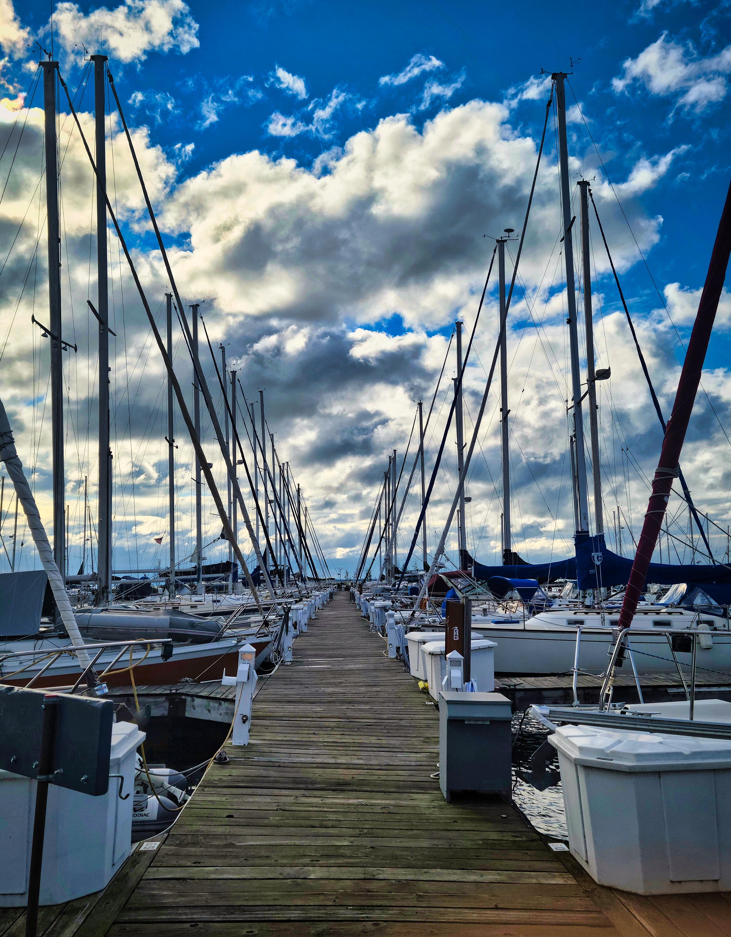
The Port of Superior Marina near Bayfield, WI.
The squall passed by the time we reached Bayfield. Our goal was to eat at the Pickled Herring. We heard they made an awesome whitefish liver appetizer. Captain Dave had eaten there and raved about it. Alas, they were closed, so we chose to eat at Greunke’s Restaurant instead. This would also be a new experience.
We were seated at a table that featured John F. Kennedy Junior memorabilia on the wall. I was not aware that he had visited Bayfield, much less dined at Greunke’s. The restaurant had saved his receipt; he spent $104 on his meal. I hope he didn’t eat all that food by himself!
We noticed that they also offered whitefish livers on the menu. We decided to order them so that Capn Dave could tell us if they measured up to the Pickled Herring’s dish. They come either fried or sautéed with green peppers and onions. We ordered the latter version.
I thought they were passable fare, but Dave said they weren’t as good as their competitor’s. He said the Pickled Herring put some sort of extra spice on theirs that made all the difference. The rest of our food was excellent. In keeping with the theme, I ordered broiled whitefish, which was prepared just right – not too dry/overdone.
Our whitefish liver appetizer. Yum!
We, on the other hand, were not quite dry by the time we returned to the marina. We changed out of our rain-soaked clothes and spent the night in the belly of Neverland, lulled asleep by the creak of dock lines. In the morning, we awoke to the xylophone of sail lines banging on masts in the stiff wind. It was gusting to 25 knots and the sky was overcast — an exciting day to sail!
It only took us a few hours to get to Stockton Island. The Neverland reached its top speed, which is a little over 9 knots. That isn’t as fast as most sailboats go – Capn Dave explained that Westsails are considered “Wet Snails” when it comes to speed, but they are a very safe, heavy boat.
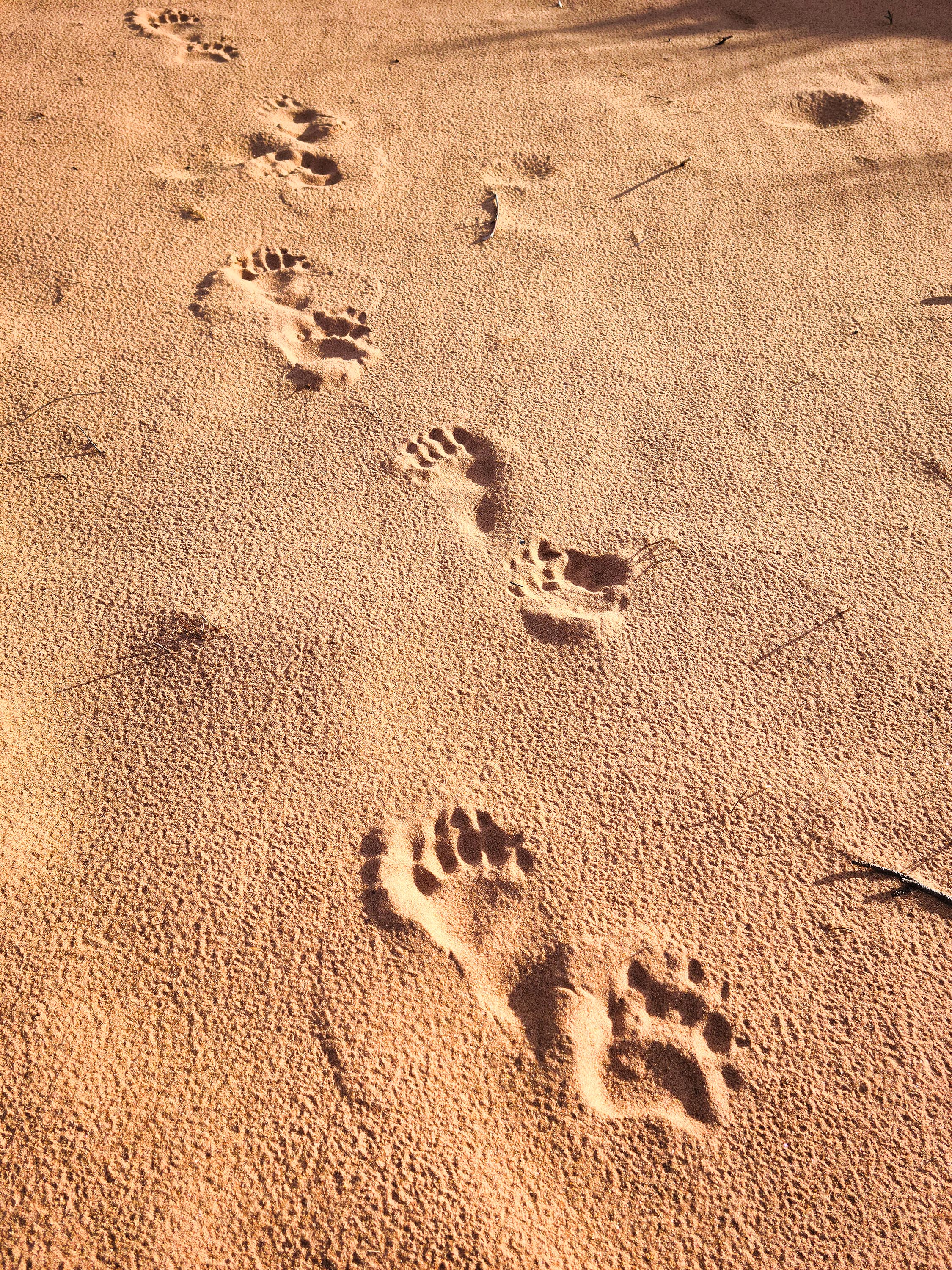
Black bear tracks on Julian Bay Beach, Stockton Island.
We anchored in Presque Isle Bay on the island and rowed ashore in the dinghy, appropriately named “Tinkerbell.” We beached at the end of the park service campground. I was used to seeing people in the campground, so walking past the deserted sites was strange, a little unnerving. We continued onto Julian Bay where we hiked down the beach of the singing sands to the lagoon. We saw a long trail of black bear tracks on that beach as well as the one where we landed Tinkerbell. The island bears were probably roaming far and wide to find enough food to fatten up for winter. A bald eagle flew overhead. A partial rainbow seemed to end over the neighboring island across the lake.
The rainbow ends on Michigan Island.
Back on the Neverland that night, the sky was painfully clear and cold. The Milky Way was easy to see, split by the occasional falling star. Capn Dave fired up the small wood stove inside Neverland, which kept us cozy for an evening of gin rummy and reading.
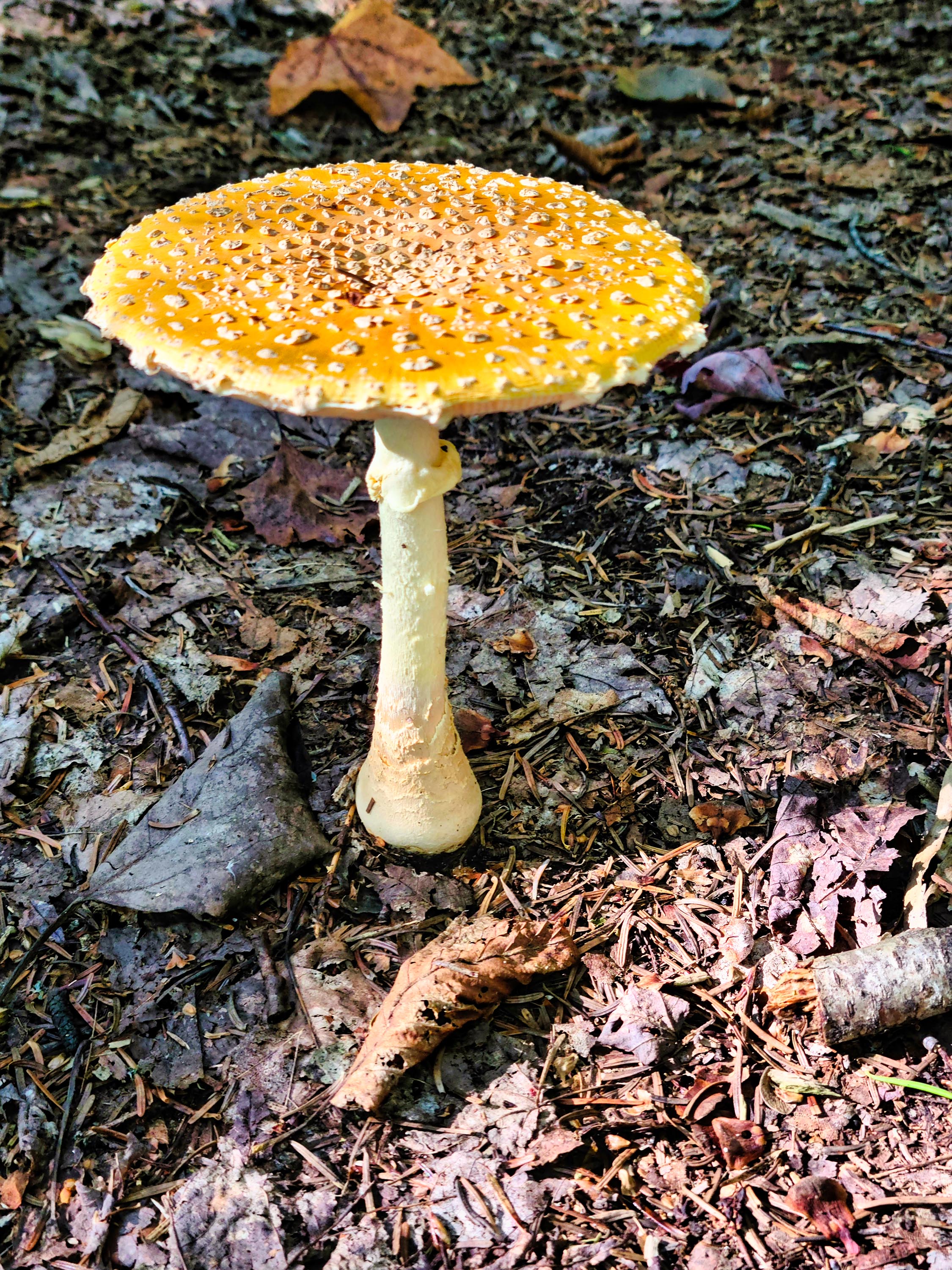
Fortified in the morning by a breakfast of haggis and eggs, we rowed back ashore and hiked the Quarry Trail, which eventually leads to an old brownstone quarry (no longer in service). We stopped before the quarry and spent and pleasant time on a sandstone ledge, enjoying sun on the lakeshore. Hundreds of colorful mushrooms piqued our interest during the 6-1/2-mile stroll – purples, oranges, reds, yellows, browns. It’s a good fall for mushrooms around here.
A fly agaric mushroom, toxic but not lethal if ingested. Found along the Quarry Trail, Stockton Island.
After another chilly night, we left the following day for Madeline Island. More on that in my next post.
The Neverland anchored in Presque Isle Bay, Stockton Island.
Hidden Lake with a low fog, Isle Royale National Park.
When we last checked in, Russ and I were on Isle Royale, a wilderness national park in Lake Superior. It was our final day. Before we had to catch our boat back to the mainland in the afternoon, we had plans to canoe across Tobin Harbor to a rugged trail that leads to Hidden Lake, Monument Rock, and an overlook high on the backbone of the island with the prosaic name of Lookout Louise.
A boardwalk over a wetlands near Hidden Lake.
The weather had other ideas for us, however. A gray sky and drizzle greeted us as we carried our friends’ canoe down to the harbor. To me, it didn’t feel like we were in for a downpour, just a steady drip, so we decided not to let a little rain keep us from my old haunt and one of the most spectacular overlooks on the island. On a clear day, a person can see the other side of the island and all the way to Canada.
After about a half-hour paddle from the sea plane dock on the crystal-clear waters of Tobin Harbor, we reached the Hidden Lake dock. We hauled our canoe ashore and began the mile-long hike to the lookout. While the beginning part of the trail at Hidden Lake is flat, the grade gradually rises until it reaches a steep pitch on the way to Monument Rock and the lookout. Because of this, the difficulty is considered moderate to difficult.
Fog shrouded part of Hidden Lake, adding to its mystery. We found a pile of super-fresh wolf scat next to the trail along with lady slipper orchids.
For entertainment one evening earlier on our trip, we attended a park ranger talk at Rock Harbor. The topic was the fire that occurred on this part of the island last year (2021). Named the Horne Fire, it began as a lightning strike and ended up burning 335 acres and threatening cabins on Tobin Harbor. People were evacuated, tourism was disrupted, and a fire crew was brought in to fight the blaze.
Russ by Monument Rock, which was in the path of the Horne Fire in 2021.
From attending the talk, we knew that the Lookout Louise Trail would take us right through the burned area, so we were ready for the black chaos when we found it. Huge trees were uprooted, soil was blackened. Dead trees, denuded of branches, reached toward the gray sky like iron spikes. But some greenery was returning in scattered patches.
One unexpected benefit of the Horne Fire was that the view of Monument Rock – a large sea stack that sticks up from the hillside – was easily visible. Usually, it’s shrouded by trees. Reaching the landmark means you’re over halfway to the lookout. Once past the rock, the trail becomes a bit less steep.
We didn’t have much time to enjoy the view at the lookout for fear we would miss our boat home, but our gazes drank in what they could of Duncan Bay and Lake Superior. On a clear day, Pie Island, the Sibley Peninsula and Edward Island in Canada are visible.
I heard two days ago that Isle Royale is on fire again. Visitors were evacuated from Three Mile and Lane Cove campgrounds. Those campgrounds are currently closed as are some trails in that area. For more details, please see news article(s) about the fire. Of course, fires are natural on the island, but it is distressing to see the destruction they leave behind and how they impact the lives of the people who live and work on the island in summer.
The view from Lookout Louise.
According to the park service, the lookout was named for Louise Savage of St. Paul, Minnesota. Her family owned one of the cabins on Tobin Harbor before the area became a park.
As we hiked back to the dock, the drizzle grew into a light shower. But we didn’t mind. We had accomplished our goal and were feeling good. The fresh rain seeped into our jeans and into our bones, a reminder of our closeness to nature. We were able to return to Rock Harbor in plenty of time to catch our ride home.
Hidden Lake, Isle Royale. You can see evidence of the Horne Fire on the hillside in the upper right.
I left the island feeling peaceful. I was glad to see that lodge employees still gather on the sea plane dock to watch the sun set every evening like I used to back when I worked there decades ago. It’s obvious that the island still works its magic on employees and visitors alike.
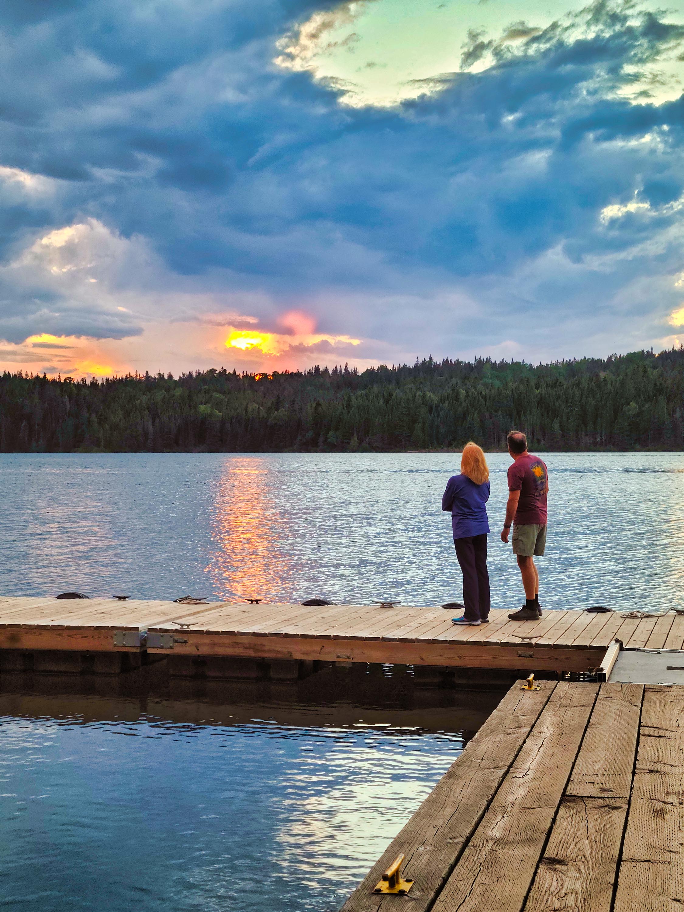
I was taking sunset pictures on the dock during the final island evening of our trip. As oranges and pinks filled the sky, we could hear the rattling trumpet calls of distant sandhills cranes. These birds were not on the island when I worked there in the 1980s, but I guess they are more common now.
Then, right when the sun dipped behind the island’s Greenstone Ridge, a lone wolf howled somewhere near Lookout Louise (was it his/her scat we found the next day?) The small group gathered on the dock all looked at each other in wonderment, as if asking, was that a wolf we just heard? The wolf’s mournful, long howl was followed by a second. No other wolves replied.
As I stepped off the dock onto the land with my camera gear, a man sitting on a bench said, “I’ve been coming here for thirty years and that’s the first wolf I heard. That’s pretty special.”
Darn right it is! I told him the howls were also a first for me. That’s one of those mystical Isle Royale moments I won’t forget.
Isle Royale visitors take time to watch the sunset on the sea plane dock in Tobin Harbor.
This meander was two summers in the making. I tried to reserve a house keeping cabin at Rock Harbor Lodge on Isle Royale in early 2021, but they were booked already!
I longed to return to this national park in Lake Superior because I worked there as a waitress at the lodge for two summers in the 1980s. I hadn’t been back in over 25 years and decided it was time. I needed my Isle Royale wilderness fix.
I didn’t want to primitive camp, however. Been there, done that. During my college waitress days, I had dreamed of someday staying in one of the quaint cabins that line a protected harbor on the island – sleeping in a real bed, bringing my own food, and cooking in a kitchen complete with stovetop and mini-fridge. (Beats a camp stove and no fridge, any time.)
Now was that time. But the only openings were in the summer of 2022. I sighed and made the reservation for this distant date. I was also able to talk Russ and a couple of my friends into accompanying me.
I consider Isle Royale my spiritual home. I’ve had some of my most meaningful experiences there and it’s where I’ve met lifelong friends. My two novels are set on the island. I wasn’t sure how so much time passed off-island, but it probably had something to do with life, responsibilities, and distractions.
Lake Superior is cold this summer! Image courtesy of KBJR-TV, Duluth, MN.
As our departure date neared, my heart sank as I looked at the weather forecast for the four days we’d be spending in the park. The water temperature for Lake Superior has been at record lows this summer – its coldest in 25 years! (Lower-to-middle-40s.) It has to do with prevailing westerly winds, which caused colder waters to upwell from the depths.
As such, we were resigned to the yucky weather forecast for our stay, which predicted highs in the 60s and overcast skies. This magical and mercurial island had other things in mind for us, however; treating us to highs in the mid-70s, sunny skies, and sporadic fog.
One of my fellow travelers was prone to seasickness, so we took the shortest boat route possible, aboard the Queen from Copper Harbor in Michigan’s Upper Peninsula. The passage couldn’t have been better, and we spent our 3.75-hour unusually calm ride in pleasant conversation and card games.
Our house keeping cabin.
After we arrived at Rock Harbor, we had a few hours before our cabins were ready. We spent the time getting reacquainted with my old haunts: the snack bar (now named the Greenstone Grill after semi-precious stones only found on the island) and the America Dock – named after a ship that used to service the island but sunk. I was distressed to see the dock in ruins from ice damage. The employee dorm looked much the same, as did Tobin Harbor and the sea plane dock, next to where our lodgings would be.
The lodge is run by Kim Bob Alexander, who worked on the island when I did. He was a charter captain then and has been managing the lodge concession for many years. It was good to see a familiar face since all the rest are gone. He seemed to remember me, and we discovered that his daughter Marina would be our charter captain the next day for our lake trout fishing trip onto Lake Superior.
I was worried about how the loon population was doing on the island. I fondly remembered falling asleep to the mournful sound of their calls at night and hoped that hadn’t changed. I needn’t have worried. The moment Russ and I checked into our cabin, a pair of loons called from Tobin Harbor, as if in welcome.
The next morning, we rose early and headed to the docks for our charter fishing excursion. Marina and her co-captain Cole greeted us, giving us the rundown of where we would travel and how things would work. I had never been charter fishing before, so I was especially intrigued. (This was yet another former-Isle-Royale waitress’s dream experience.)
We headed out in the fog along the eastern side of the island toward Passage Island, which lies about three miles off its tip. We fished for a couple of hours, unsuccessfully. Or, I should say that Marina fished for us and we just lollygagged around, trying to stay out of her way.
Our lake trout catch.
As the fog began to lift, we hoped our luck would change. To hedge our bets, we decided to offer a little sacrifice to Lake Superior. My friend Sharon poured a little bit of leftover coffee into the lake, saying a few words.
Soon after, she was reeling in her line according to Marina’s instructions, with a four-pound lake trout on the end of it. Not long after, I caught a five-pounder. I was especially impressed by how cold my fish was when I held it, pulled from Lake Superior’s icy depths.
There was another lull during which Russ lost a fish or two. We decided it was time to offer another sacrifice. Sharon and I eyed our men, as if deciding which one to throw overboard, but then opted for a pinch of tobacco that one of them carried.
It worked again! Sharon’s partner Mike caught a trout and Russ finally did, too.
That night we dined on our trout, pan-seared by the lodge chef, along with all the fixings. We felt truly fortunate to eat these fresh gifts from the lake, much to the envy of our fellow diners, who also wanted fish, but it was not on the grill’s menu.
Our lake trout dinner.
Passage Island Lighthouse.
The next day, fog scuttled Russ’s and my plans to canoe in Tobin Harbor, so we opted to hike to Scoville Point instead. The point is about a four-mile round-trip from Rock Harbor. Along the way, we saw a snowshoe hare, which I had never seen before on the island, and an eagle’s nest, complete with eaglets. A mother merganser carried several of her brood on her back along the shore, followed by at least half a dozen other babies.
Our final full day on the island, Russ and I took a half-day trip aboard the lodge’s tour boat, the M.V. Sandy, to Passage Island. The weather cooperated. The park ranger who was supposed to interpret the rugged hike to the island’s lighthouse contracted COVID, so I ended up acting as an impromptu guide for part of the trip, pointing out plants not found on the main island (due to moose browsing) like the devil’s club and huge yew shrubs. We were also treated to views of peregrine falcons flying from their cliff face nest. The lighthouse has aged and decayed since I last saw it, but it still stood as a stalwart presence on the end of the island.
Our final morning dawned foggy and drizzly. Russ and I spent our time canoeing and hiking to Monument Rock and Lookout Louise. More on that in my next post…..
Mystical Scoville Point, Isle Royale National Park.

Our tour guide points out some fossils inside the wedding chapel in Niagara Cave.
I have been neglecting this beloved blog – been meandering around too much. But that means I have plenty to write about when time allows.
When last we met, Russ and I were “Lingering in Lanesboro,” a picturesque town in southern Minnesota. As you may recall, our camping trip was HOT with temps in the 90s. On one of these sweltering days, we opted for the natural air conditioning provided by a cave.
Niagara Cave is in Harmony, Minnesota, about 15 miles south of Lanesboro. I’d been there before but this was a first for Russ. The limestone cavern is a cool 48 degrees and it offers a half-mile of passageways sculpted by water. The one-hour group tour goes out and back, so visitors hike a full mile, 120 feet below the surface. There are a lot of stairs (550 total) to ascend and descend, so if you have trouble with those, you might want to take that into consideration.
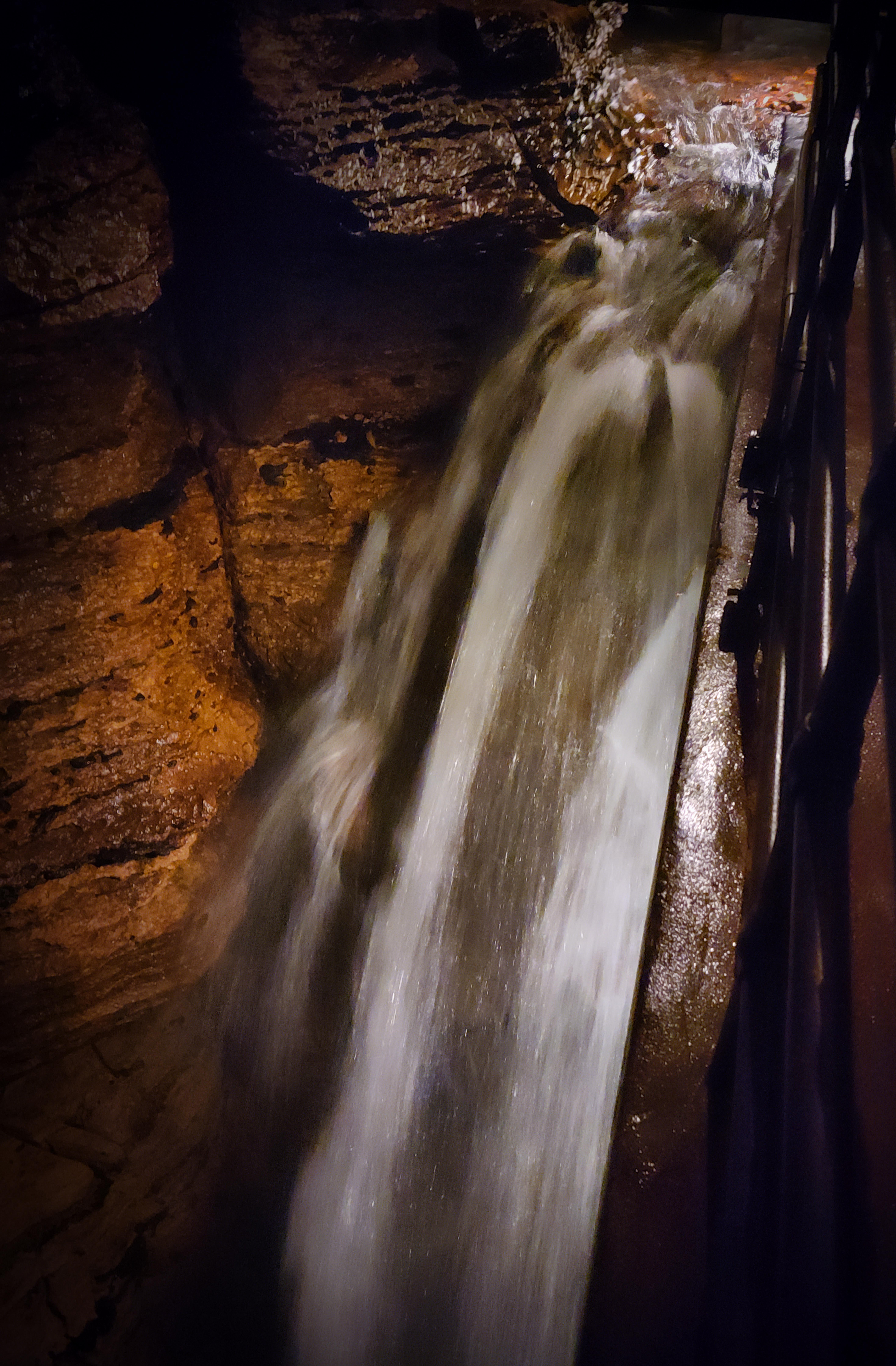
The underground stream that carved the cave is (thankfully) only running through part of the cave these days. It forms a subterranean waterfall that drops an impressive 60 feet; kind of like the Niagara Falls of caves – thus the cave’s name. As if that wasn’t enough, there’s even a tiny wedding chapel where you could tie the knot, if so inclined.
Fossils from prehistoric plants and animals dot the walls and geologic features like stalactites, stalagmites, and flow stone are on view.
The waterfall is my favorite feature. I’d never seen a cave with one before I came here, although there are other caves with waterfalls in the U.S.